|
|
 krichard2011|2014-4-9 15:04
|
顯示全部樓層
krichard2011|2014-4-9 15:04
|
顯示全部樓層
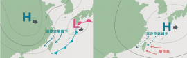
預測巔峰強度稍調降
依據BOM的報文指出
今天由於很接近巴布亞紐幾內亞
受到地形的干擾 發展上有受到阻礙
不過當這系統移到了昆士蘭外海
諸多條件相當符合她的發展
預期星期四、五將有一波快速增強的階段
也是她能增強到多強的重要關鍵。。。
IDQ20018
TROPICAL CYCLONE TECHNICAL BULLETIN: AUSTRALIA - EASTERN REGION
Issued by BRISBANE TROPICAL CYCLONE WARNING CENTRE
at: 0646 UTC 09/04/2014
Name: Severe Tropical Cyclone Ita
Identifier: 15U
Data At: 0600 UTC
Latitude: 11.3S
Longitude: 150.2E
Location Accuracy: within 10 nm [20 km]
Movement Towards: west [281 deg]
Speed of Movement: 8 knots [15 km/h]
Maximum 10-Minute Wind: 80 knots [150 km/h]
Maximum 3-Second Wind Gust: 110 knots [205 km/h]
Central Pressure: 963 hPa
Radius of 34-knot winds NE quadrant: 90 nm [165 km]
Radius of 34-knot winds SE quadrant: 120 nm [220 km]
Radius of 34-knot winds SW quadrant: 120 nm [220 km]
Radius of 34-knot winds NW quadrant: 90 nm [165 km]
Radius of 48-knot winds NE quadrant: 50 nm [95 km]
Radius of 48-knot winds SE quadrant: 50 nm [95 km]
Radius of 48-knot winds SW quadrant: 50 nm [95 km]
Radius of 48-knot winds NW quadrant: 50 nm [95 km]
Radius of 64-knot winds: 30 nm [55 km]
Radius of Maximum Winds: 10 nm [20 km]
Dvorak Intensity Code: T5.0/5.0/D0.5/24HRS
Pressure of outermost isobar: 1002 hPa
Radius of outermost closed isobar: 120 nm [220 km]
FORECAST DATA
Date/Time : Location : Loc. Accuracy: Max Wind : Central Pressure
[UTC] : degrees : nm [km]: knots[km/h]: hPa
+06: 09/1200: 11.4S 149.3E: 025 [045]: 085 [155]: 962
+12: 09/1800: 11.7S 148.3E: 035 [065]: 090 [165]: 960
+18: 10/0000: 12.0S 147.5E: 050 [090]: 095 [170]: 955
+24: 10/0600: 12.3S 146.9E: 060 [115]: 100 [180]: 950
+36: 10/1800: 12.9S 145.8E: 080 [150]: 105 [190]: 944
+48: 11/0600: 13.7S 144.9E: 100 [185]: 105 [195]: 941
+60: 11/1800: 14.6S 144.3E: 120 [220]: 095 [175]: 951
+72: 12/0600: 15.6S 144.2E: 140 [255]: 055 [100]: 982
+96: 13/0600: 17.8S 145.0E: 185 [340]: 030 [050]: 1002
+120: 14/0600: 20.0S 148.1E: 270 [500]: 030 [055]: 1002
REMARKS:
The Dvorak analysis of Severe Tropical Cyclone Ita was based on an embedded
centre pattern with a LG surround, giving a DT of 4.5. MET and PAT give 5.0 and
4.5 respectively. FT weighted towards MET due to the pattern type used for the
analysis.
Severe Tropical Cyclone Ita is situated in a low vertical wind shear environment
with sea surface temperatures greater than 28 degrees. These atmospheric and
oceanographic conditions are expected to remain fairly constant along Ita's
current forecast track towards the far north Queensland coast and should allow
the system to intensify during Thursday and Friday. In the short term,
intensification may be difficult for Ita today due to the systems proximity to
Papua New Guinea.
Severe Tropical Cyclone Ita is currently moving in a general westwards direction
under the influence of a mid-level ridge extending from Queensland into the
central Coral Sea. Ita is expected to continue moving in this general direction
over the next couple of days and at this stage it is expected to cross the far
north Queensland coast between Lockhart River and Cape Flattery late Friday.
There is a fair degree of uncertainty in the exact track Ita will take closer to
the coast with the computer model guidance varying depending on the strength and
orientation of the mid-level ridge that extends across the central Coral Sea by
Friday. |
|


 照妖鏡
照妖鏡