簽到天數: 1650 天 [LV.Master]伴壇終老
|
 老農民版夜神月|2020-11-14 04:51
|
顯示全部樓層
本帖最後由 老農民版夜神月 於 2020-11-14 16:55 編輯
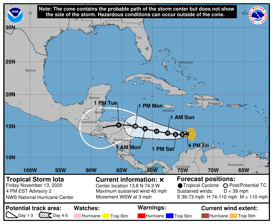
NHC21Z正式命名lota,並上調上望至MH,105節
000
WTNT41 KNHC 132044
TCDAT1
Tropical Storm Iota Discussion Number 2
NWS National Hurricane Center Miami FL AL312020
400 PM EST Fri Nov 13 2020
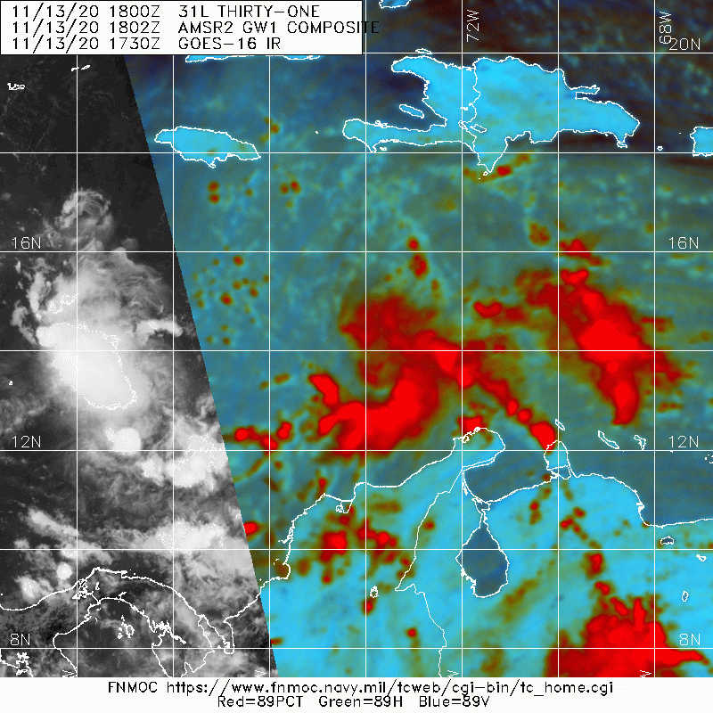
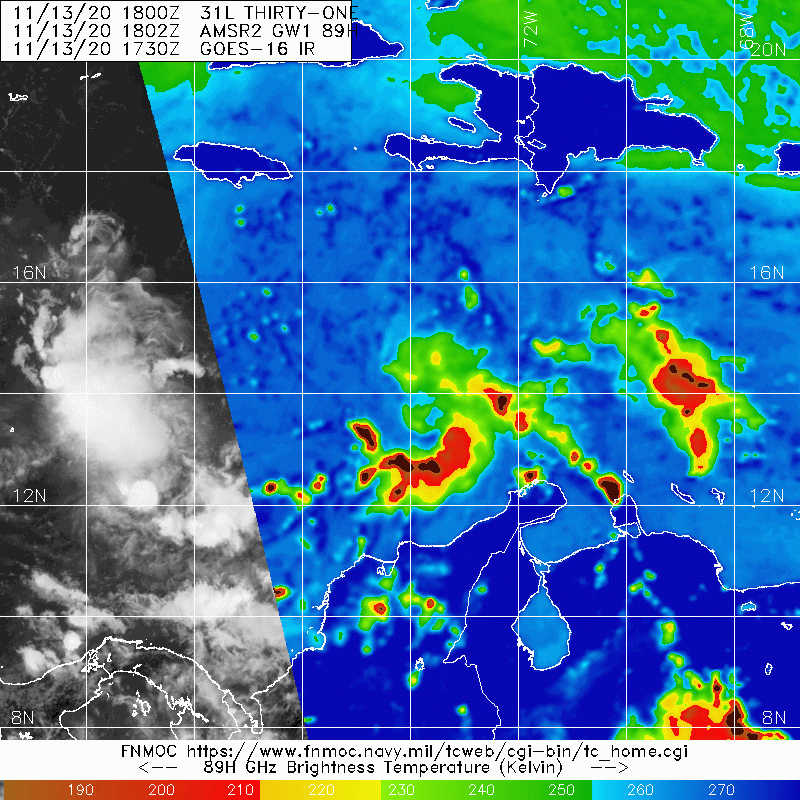
Banding features over the eastern and southeastern portions of the
cyclone's circulation have increased since this morning, and the
overall organization of the system continues to quickly improve.
Earlier ASCAT data indicated that there was a fairly large area of
light winds near the center, and that the low-level center was
displaced to the northwest of the mid-level center seen in visible
satellite imagery. Since the system is still in its formative
stage, the low-level center may reform closer to the mid-level
feature, and the advisory position is a compromise between the
low- and mid-level circulations. The earlier ASCAT data indicated
peak winds of around 30 kt with several higher rain-inflated
vectors. Based on the continued increase in organization,
and Dvorak T-numbers of T2.5 from both TAFB and SAB, the initial
intensity is raised to 35 kt. Iota becomes the 30th named storm of
the recording-breaking 2020 hurricane season.
The environment ahead of Iota appears to be quite conducive
for intensification. The system will be moving over warm waters,
in a moist atmosphere, and within an area of very low vertical
wind shear. As a result, steady to rapid strengthening appears
likely over the next few days. The NHC intensity forecast calls
for Iota to reach hurricane status within 36 h, and now calls for
the system to be a major hurricane when it approaches the coast of
Central America. The NHC intensity foreast is in good agreement
with the HFIP corrected consensus model, and the 70-kt increase in
intensity over the next 72 hours is supported by the SHIPS Rapid
Intensification Index that shows a nearly 60 percent chance of a 65
kt increase in intensity during that time period.
The tropical storm has not moved very much today, and the initial
motion estimate is a somewhat uncertain 255/3 kt. A strong
mid-level ridge that extends across Florida and the western
Atlantic is forecast to slide eastward over the next few days
causing the cyclone to move faster toward the west or
west-northwestward. The track guidance has come into a bit better
agreement this afternoon, with only the HWRF showing a track
farther north over the northwestern Caribbean Sea. The latest
consensus aids were very close to the previous official forecast,
and no significant adjustments to the earlier track forecast were
required.
Key Messages:
1. Iota is expected to strengthen and be a major hurricane when it
approaches the coast of Central America. There is a risk of
dangerous wind, storm surge, and rainfall impacts across portions of
Nicaragua and Honduras beginning Sunday night or early Monday.
Hurricane Watches will likely be issued for a portion of this area
tonight or early Saturday.
2. Through Wednesday morning, heavy rainfall from Iota may lead to
life-threatening flash flooding and river flooding across portions
of Haiti, Jamaica and Central America. Flooding and landslides
from heavy rainfall could be significant across Central America
given recovery efforts underway after Hurricane Eta.
FORECAST POSITIONS AND MAX WINDS
INIT 13/2100Z 13.8N 74.3W 35 KT 40 MPH
12H 14/0600Z 13.7N 75.1W 45 KT 50 MPH
24H 14/1800Z 13.7N 76.2W 55 KT 65 MPH
36H 15/0600Z 13.9N 77.5W 70 KT 80 MPH
48H 15/1800Z 14.2N 79.3W 85 KT 100 MPH
60H 16/0600Z 14.6N 81.2W 95 KT 110 MPH
72H 16/1800Z 15.0N 82.8W 105 KT 120 MPH
96H 17/1800Z 15.2N 85.5W 50 KT 60 MPH...INLAND
120H 18/1800Z 14.7N 88.5W 25 KT 30 MPH...POST-TROP/REMNT LOW
$$
Forecaster Brown


|
|