簽到天數: 1650 天 [LV.Master]伴壇終老
|
 老農民版夜神月|2020-8-26 17:00
|
顯示全部樓層
本帖最後由 老農民版夜神月 於 2020-8-26 17:05 編輯
NHC09Z升格C2,定強95KT,上望登陸前達115KT
855
WTNT43 KNHC 260858
TCDAT3
Hurricane Laura Discussion Number 26
NWS National Hurricane Center Miami FL AL132020
400 AM CDT Wed Aug 26 2020
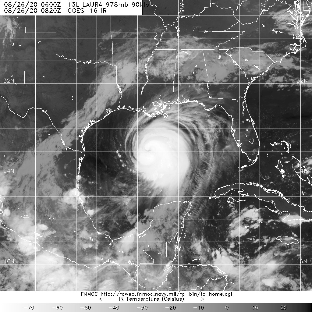
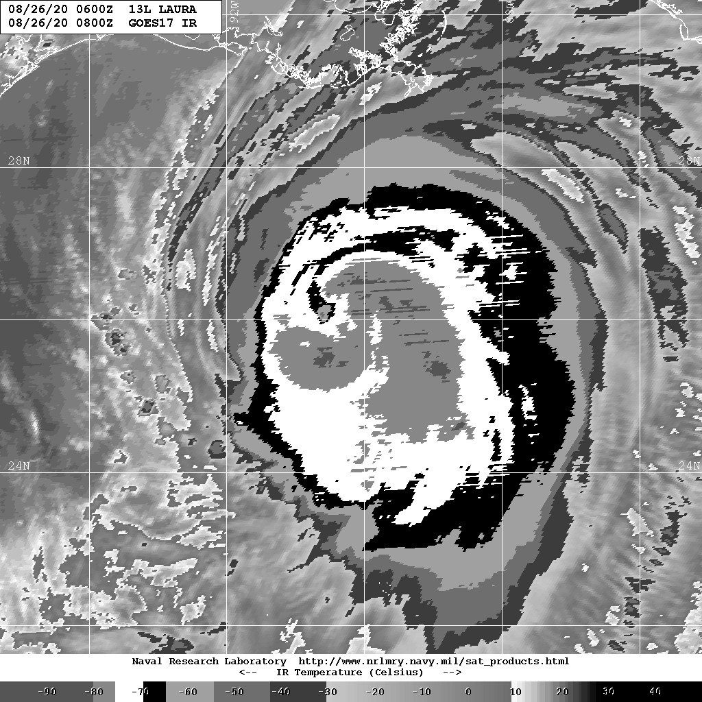
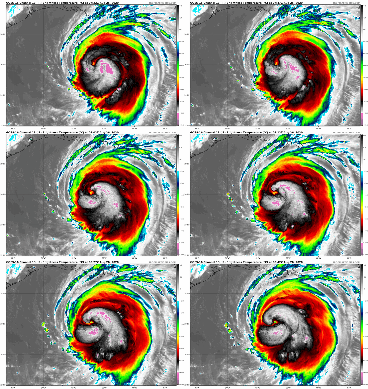
Satellite images indicate that Laura has become a formidable
hurricane since yesterday evening. Deep convection has intensified
and become more symmetric, with an eye now trying to clear out. An
earlier Air Force Hurricane Hunter mission found flight-level winds
of 104 kt, along with peak SFMR values of 86 kt, which supported the
90-kt intensity on the intermediate advisory. Since that time,
however, the cloud pattern has only continued to improve, so the
initial wind speed is set to 95 kt for this advisory. Notably, the
aircraft also recorded that the extent of the hurricane-force winds
have increased substantially northeast of the center. A pair of
Hurricane Hunter planes should be in the area within a couple of
hours.
The hurricane has intensified a remarkable 40 kt during the past 24
hours, and there are no signs it will stop soon, with shear
remaining low-to-moderate over the deep warm waters of the central
Gulf of Mexico. Guidance is noticeably higher than before, so the
new peak intensity will be raised to 115 kt, and some models are
even a little higher. Increasing shear is expected to slightly
weaken the hurricane close to landfall, so the new forecast keeps
the previous 105-kt intensity near the coast. Laura will
weaken rapidly after landfall, but it will likely bring
hurricane-force winds well inland over western Louisiana and
eastern Texas. In the extended range, there is some chance that
Laura re-intensifies as a tropical cyclone off the Mid-Atlantic
coast, instead of becoming part of a frontal system, but for now
the forecast will stay extratropical at 96 hours and beyond.
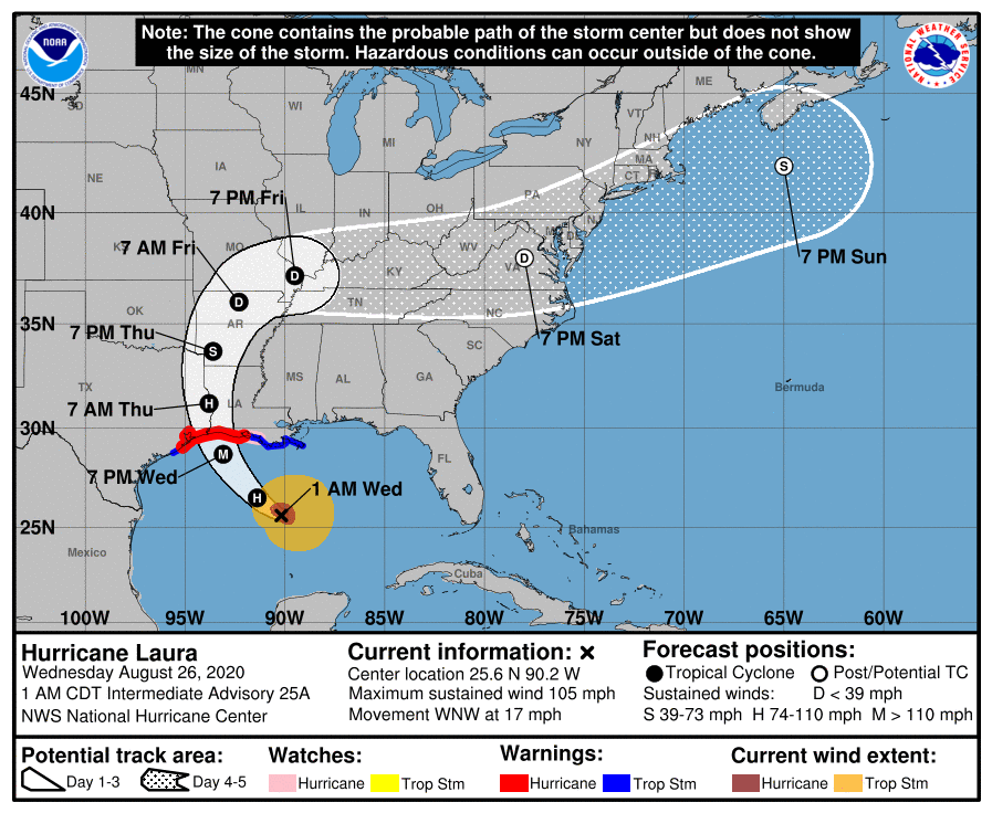
Recent satellite shows that Laura has turned northwestward, now
estimated at 13 kt. There are no substantial changes to the track
forecast to report. The hurricane should gradually turn toward the
northwest and north over the next day or two as it moves around the
western periphery of a mid-level high. The models are in very good
agreement on the center of Laura moving into extreme southwestern
Louisiana or southeastern Texas in about 24 hours, so no changes
were made to the previous NHC forecast. Later in the forecast period
the weakened cyclone should turn toward the east-northeast and move
with increasing forward speed while embedded within the mid-latitude
westerlies. The official track forecast is shifted southward at
longer range, not too far from the latest consensus track model
predictions.
It should be mentioned Laura is now a large hurricane, and wind,
storm surge, and rainfall hazards will extend far from the center.
Do not use the cone graphic for any representation of these hazards,
it is just for the center uncertainty.
Key Messages:
1. Life-threatening storm surge with large and dangerous waves is
expected to produce potentially catastrophic damage from San Luis
Pass, Texas, to the Mouth of the Mississippi River, including areas
inside the Port Arthur Hurricane Flood Protection system. This surge
could penetrate up to 30 miles inland from the immediate coastline
in southwestern Louisiana and southeastern Texas. Actions to protect
life and property should be rushed to completion as water levels
will begin to rise later today.
2. Hurricane-force winds are expected tonight in the warning area
from San Luis Pass, Texas, to west of Morgan City, Louisiana, and
the strongest winds associated with Laura's eyewall will occur
somewhere within this area. Hurricane-force winds and widespread
damaging wind gusts are also expected to spread well inland into
portions of eastern Texas and western Louisiana early Thursday.
3. Widespread flash flooding along small streams, urban areas, and
roadways is expected to begin this afternoon into Thursday from far
eastern Texas, across Louisiana and Arkansas. This will also lead
to minor to isolated moderate freshwater river flooding. The heavy
rainfall threat and localized flash and urban flooding potential
will spread northeastward into the middle-Mississippi, lower Ohio
and Tennessee Valleys Friday night and Saturday.
FORECAST POSITIONS AND MAX WINDS
INIT 26/0900Z 26.1N 90.7W 95 KT 110 MPH
12H 26/1800Z 27.4N 92.4W 115 KT 130 MPH
24H 27/0600Z 29.7N 93.5W 105 KT 120 MPH...NEAR COAST
36H 27/1800Z 32.4N 93.7W 50 KT 60 MPH...INLAND
48H 28/0600Z 34.8N 92.9W 30 KT 35 MPH...INLAND
60H 28/1800Z 36.4N 91.0W 25 KT 30 MPH...INLAND
72H 29/0600Z 37.3N 87.3W 30 KT 35 MPH...INLAND
96H 30/0600Z 38.0N 74.5W 35 KT 40 MPH...POST-TROP/EXTRATROP
120H 31/0600Z 44.0N 60.0W 45 KT 50 MPH...POST-TROP/EXTRATROP
$$
Forecaster Blake 


|
|