簽到天數: 3291 天 [LV.Master]伴壇終老
|
 t02436|2017-9-27 12:01
|
顯示全部樓層
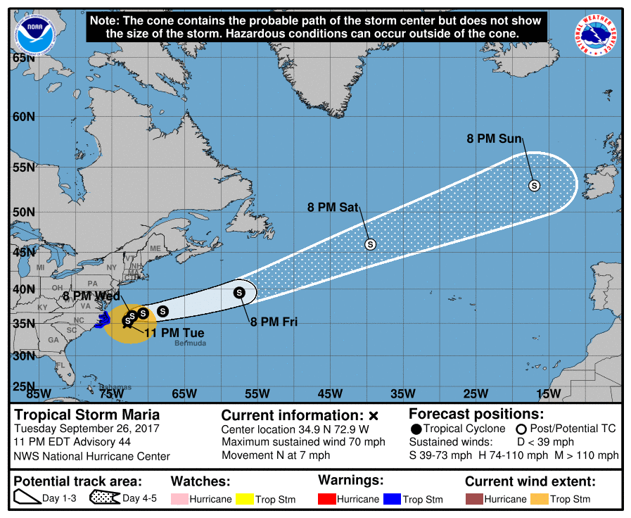
中心在北卡東方外海,準備再轉向衝向愛爾蘭。
ZCZC MIATCDAT5 ALL
TTAA00 KNHC DDHHMM
Tropical Storm Maria Discussion Number 44
NWS National Hurricane Center Miami FL AL152017
1100 PM EDT Tue Sep 26 2017
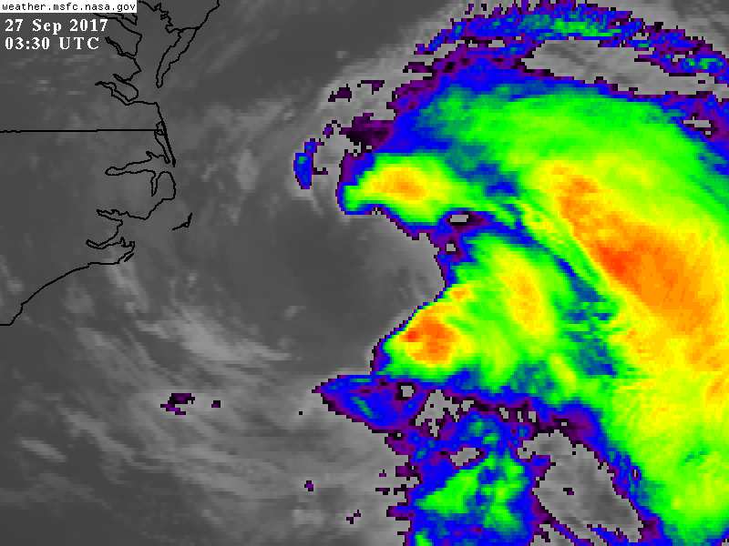
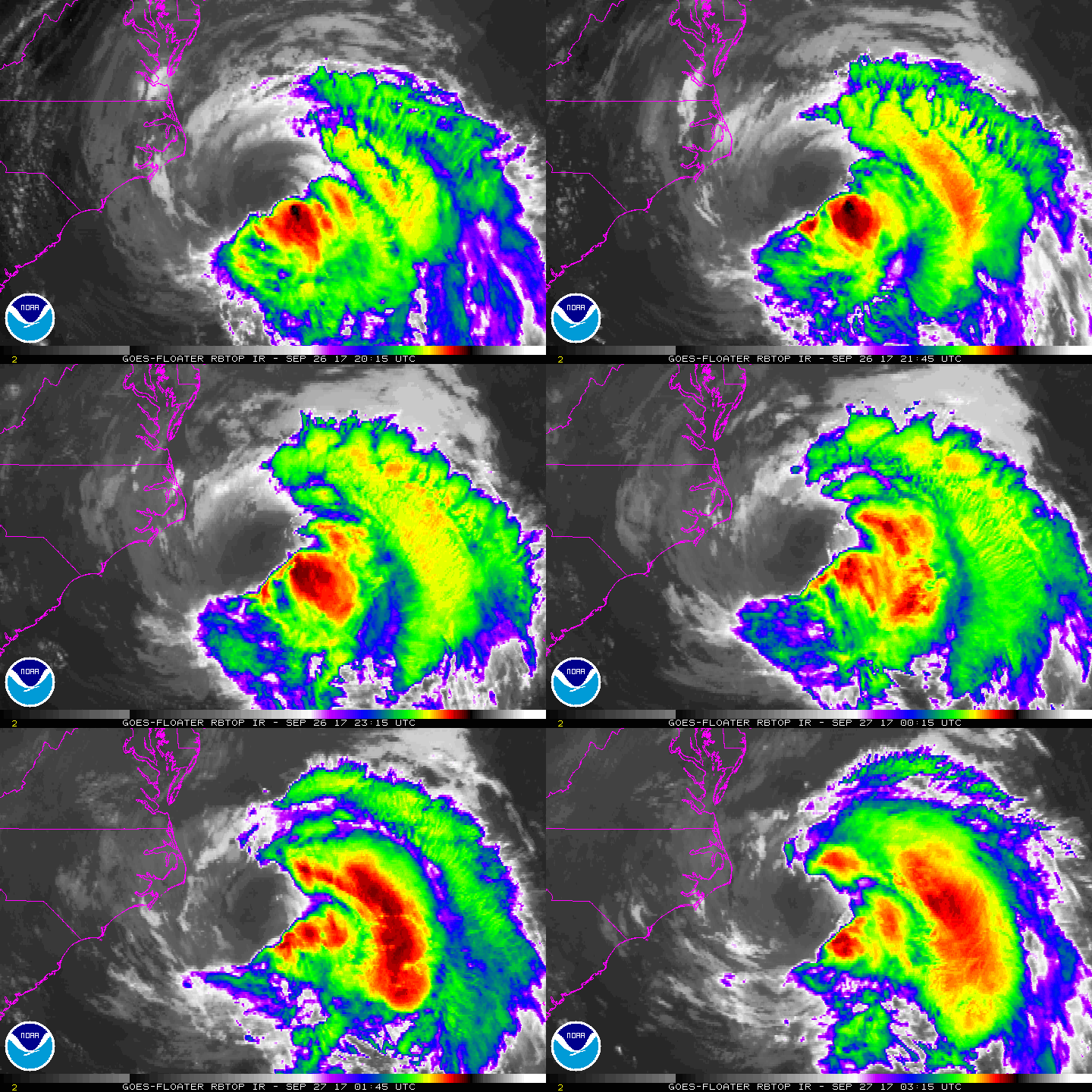
Practically all of the deep convection associated with Maria is
over the eastern semicircle of the circulation, and the center is
exposed near the edge of the dense overcast due to moderate
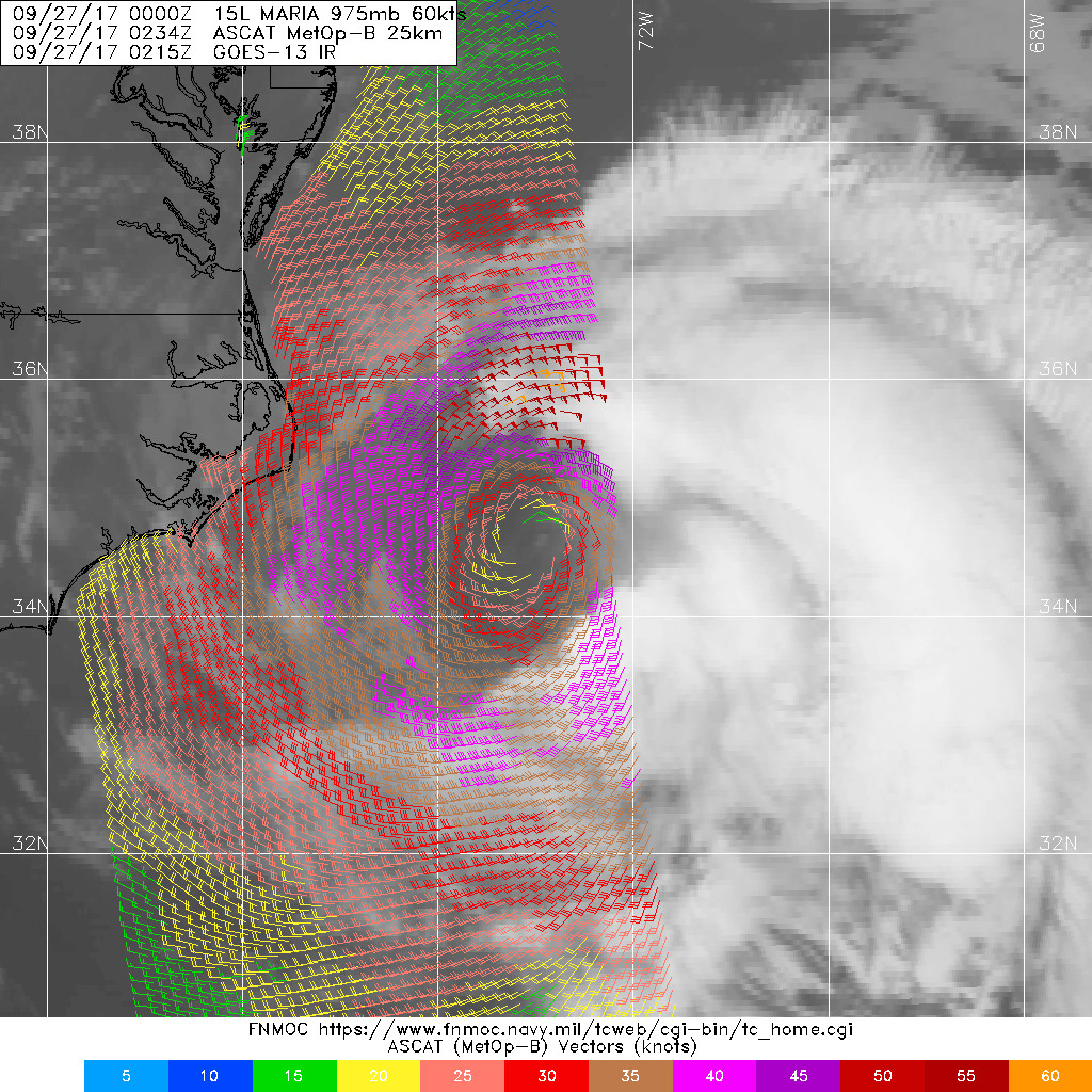
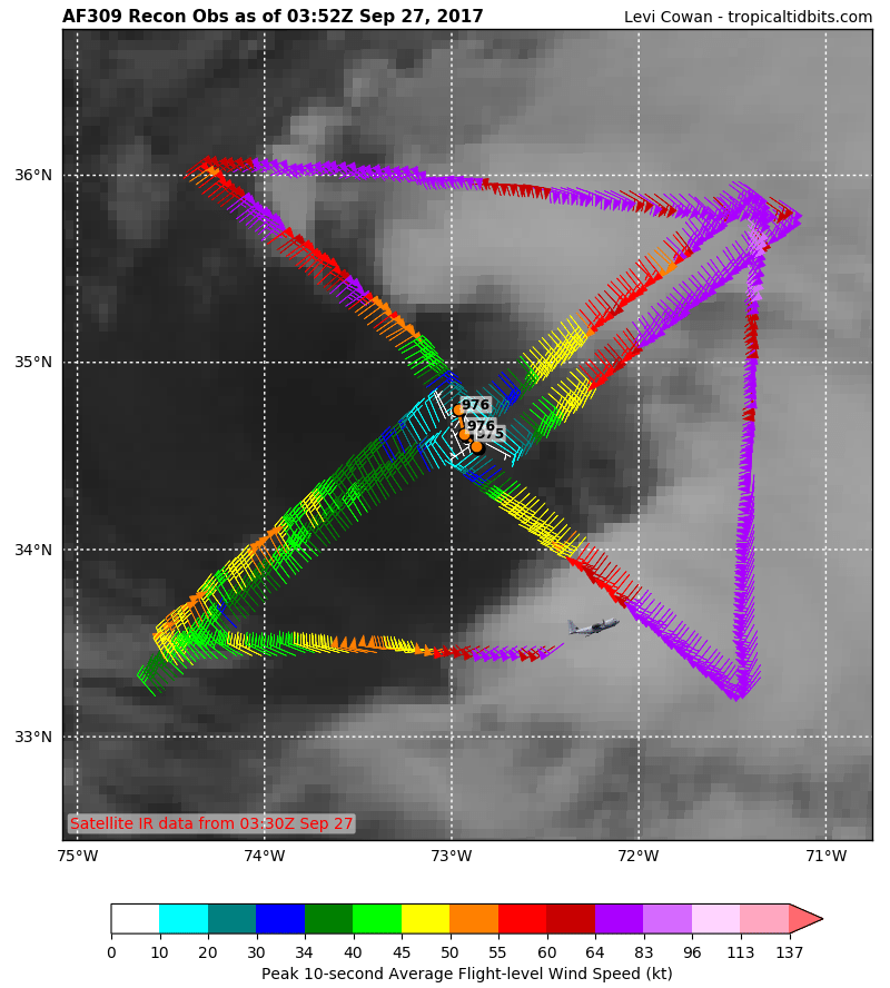
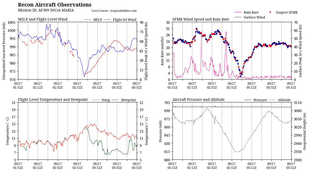
west-northwesterly shear. SFMR-observed surface winds from an Air
Force Hurricane Hunter aircraft support a current intensity of 60
kt, although satellite classifications indicate a much weaker
cyclone. Since SSTs are not expected to cool significantly along
the projected path of Maria over the next couple of days, only
slight weakening is forecast up to 72 hours. Later in the forecast
period, the global models depict the cyclone as embedded in a
frontal zone, so the system is forecast to become extratropical by
day 4.
Maria continues to move slowly northward along the western periphery
of a subtropical ridge. In 24-48 hours, the mid-latitude
westerlies should shift southward in association with a broad
mid-tropospheric trough moving across eastern North America. This
should cause Maria to turn east-northeastward and then accelerate
ahead of the trough by late in the week. The track models are in
general agreement on this scenario, however, the guidance has
become less tightly clustered. This is especially true later
in the forecast period, where the ECMWF is much slower than the GFS
and HWRF models. The official track forecast lies between these
options and is a little to the left of the previous one in the
early part of the period, in deference to the ECMWF solution.
KEY MESSAGES:
1. Maria is forecast to move roughly parallel to the U.S. east coast
for the next day or so, bringing some direct impacts to portions of
the North Carolina coast through Wednesday where a tropical storm
warning is in effect.
2. Storm surge flooding, especially along the sound side of the
North Carolina Outer Banks, is expected, and a storm surge warning
and watch are in effect for portions of eastern North Carolina.
3. Swells generated by Maria are affecting much of the east coast of
the United States. These swells are also affecting Bermuda, the
Turks and Caicos Islands, and the Bahamas. These swells are likely
to cause life-threatening surf and rip current conditions. Please
consult products from your local weather office for more
information.
FORECAST POSITIONS AND MAX WINDS
INIT 27/0300Z 34.9N 72.9W 60 KT 70 MPH
12H 27/1200Z 35.4N 72.8W 60 KT 70 MPH
24H 28/0000Z 36.1N 72.2W 55 KT 65 MPH
36H 28/1200Z 36.5N 70.7W 55 KT 65 MPH
48H 29/0000Z 36.8N 68.0W 55 KT 65 MPH
72H 30/0000Z 39.5N 57.5W 55 KT 65 MPH
96H 01/0000Z 46.0N 39.5W 50 KT 60 MPH...POST-TROP/EXTRATROP
120H 02/0000Z 53.0N 17.0W 45 KT 50 MPH...POST-TROP/EXTRATROP
$$
Forecaster Pasch
NNNN
|
|