|
|
 霧峰追風者|2017-9-18 07:46
|
顯示全部樓層
飛機時測升一級颶風,巔峰上看三級颶風上限。
ZCZC MIATCDAT5 ALL
TTAA00 KNHC DDHHMM
Hurricane Maria Discussion Number 6
NWS National Hurricane Center Miami FL AL152017
500 PM AST Sun Sep 17 2017
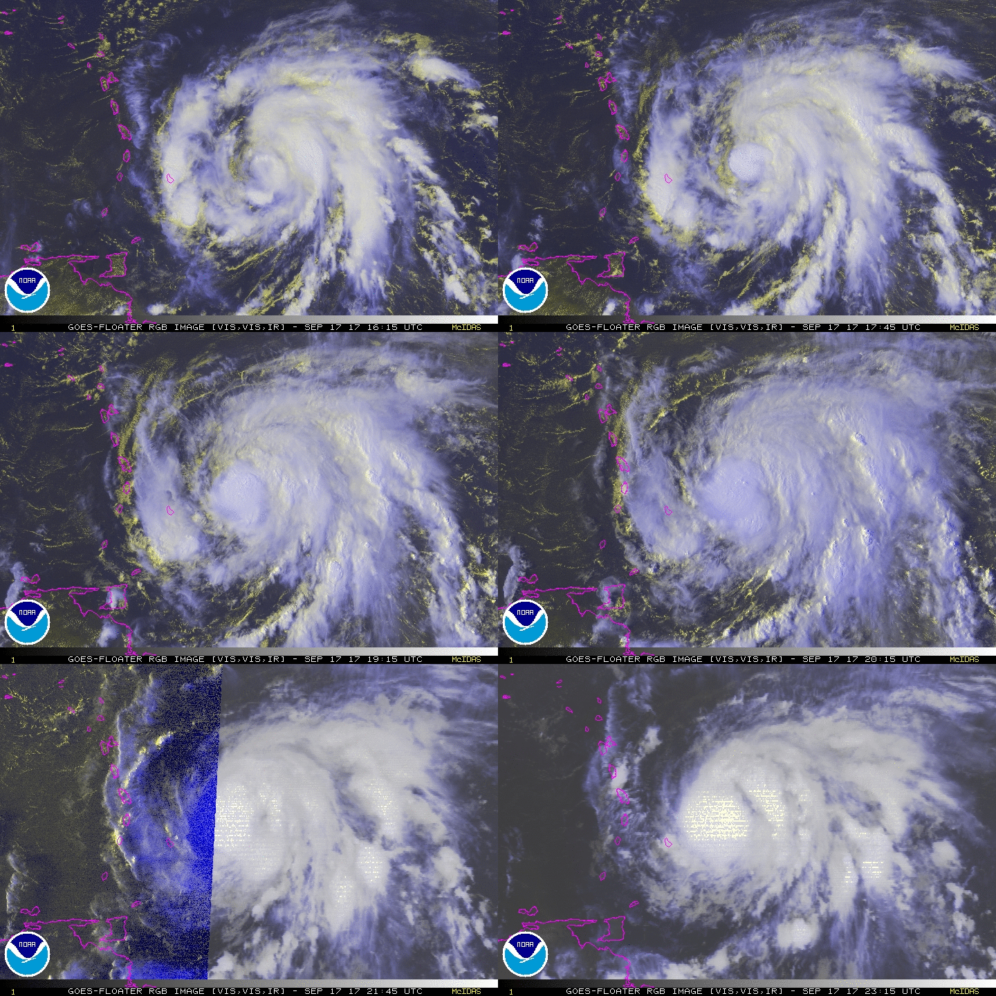
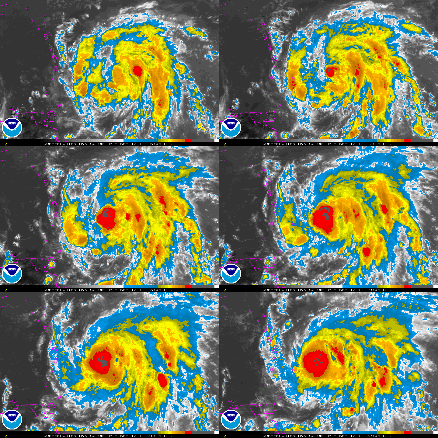
A burst of deep convection developed over Maria's center since the
last advisory and has continued to expand in size. The Air Force
Hurricane Hunter aircraft investigating the cyclone found maximum
flight-level winds of 63 kt and SFMR surface winds of 64 kt. The
crew also noted the formation of an open eyewall. Based on these
data and observations, Maria is upgraded to a 65-kt hurricane.
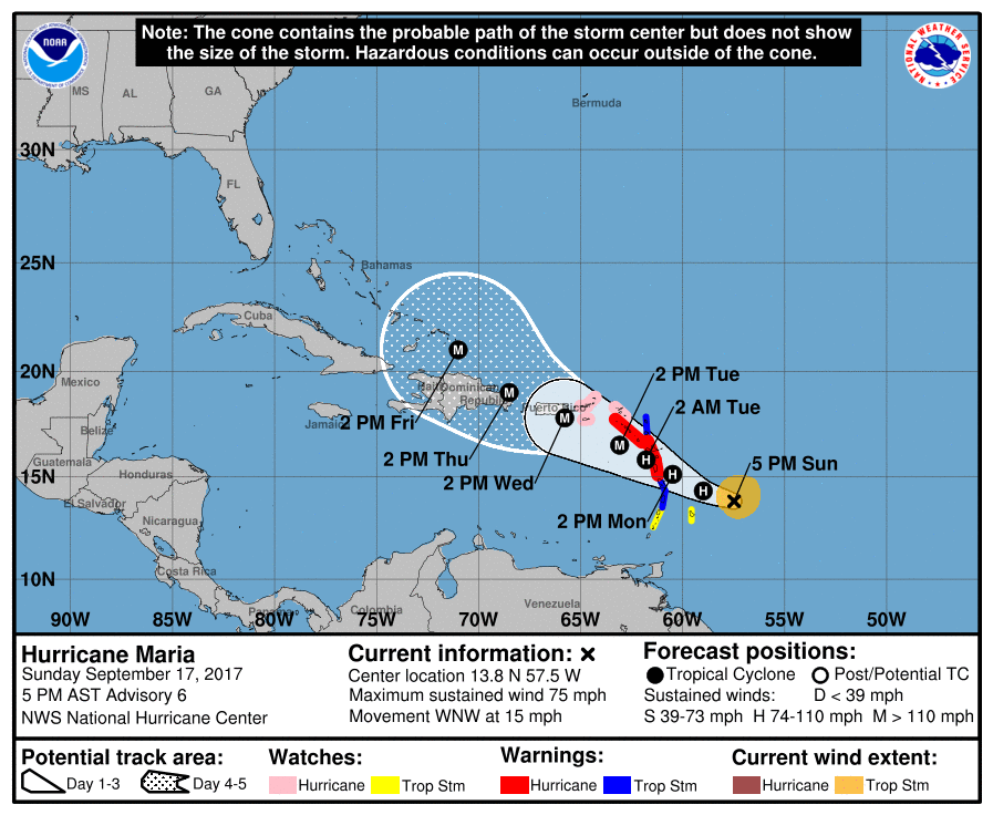
The initial motion remains west-northwestward, or 283/13 kt. Maria
is expected to maintain this trajectory for quite some time, but it
will likely slow down during the next 36 hours as it approaches the
Lesser Antilles. Overall, the track guidance is tightly clustered
for the entire 5-day forecast period, which increases confidence in
the NHC track forecast. The updated official forecast is slightly
south of the previous one for the first 36 hours, mainly due to the
update of the initial position found by the aircraft, but it is
right along the previous track after 36 hours. This solution is
between the GFS and ECMWF models and very close to the HCCA
solution.
The aircraft data indicate that Maria has a compact circulation,
which could make it a prime candidate for significant
intensification in an environment of low shear and warm SSTs.
Rapid intensification indices are not especially high, but
nonetheless, Maria is forecast to continue strengthening and
potentially reach major hurricane by 48 hours. If that occurs,
some fluctuations in intensity could occur due to eyewall
replacements and land interaction, but Maria will likely remain as
a major hurricane on days 3 through 5. Because of Maria's small
size the chance of significant strengthening is higher, and the NHC
intensity forecast is near the high end of the guidance, closest to
the HWRF and HCCA models.
KEY MESSAGES:
1. Maria has strengthened to a hurricane and could be near major
hurricane intensity when it affects portions of the Leeward Islands
over the next few days, bringing dangerous wind, storm surge and
rainfall hazards. Hurricane and tropical storm warnings have been
issued for portions of the Leeward Islands, and these warnings will
likely be extended northward and westward tonight or on Monday.
2. Maria is likely to affect the British and U.S. Virgin Islands and
Puerto Rico by mid week as a dangerous major hurricane. Hurricane
watches have been issued for the U.S. and British Virgin Islands and
could be extended to Puerto Rico tonight or early Monday. Interests
in these areas should monitor the progress of Maria and follow any
advice given by local officials.
FORECAST POSITIONS AND MAX WINDS
INIT 17/2100Z 13.8N 57.5W 65 KT 75 MPH
12H 18/0600Z 14.3N 59.0W 75 KT 85 MPH
24H 18/1800Z 15.1N 60.5W 85 KT 100 MPH
36H 19/0600Z 15.8N 61.8W 95 KT 110 MPH
48H 19/1800Z 16.5N 63.1W 105 KT 120 MPH
72H 20/1800Z 17.8N 65.8W 110 KT 125 MPH
96H 21/1800Z 19.0N 68.5W 110 KT 125 MPH
120H 22/1800Z 21.0N 71.0W 105 KT 120 MPH
$$
Forecaster Berg
NNNN 


|
|