|
|
 霧峰追風者|2017-9-19 05:10
|
顯示全部樓層
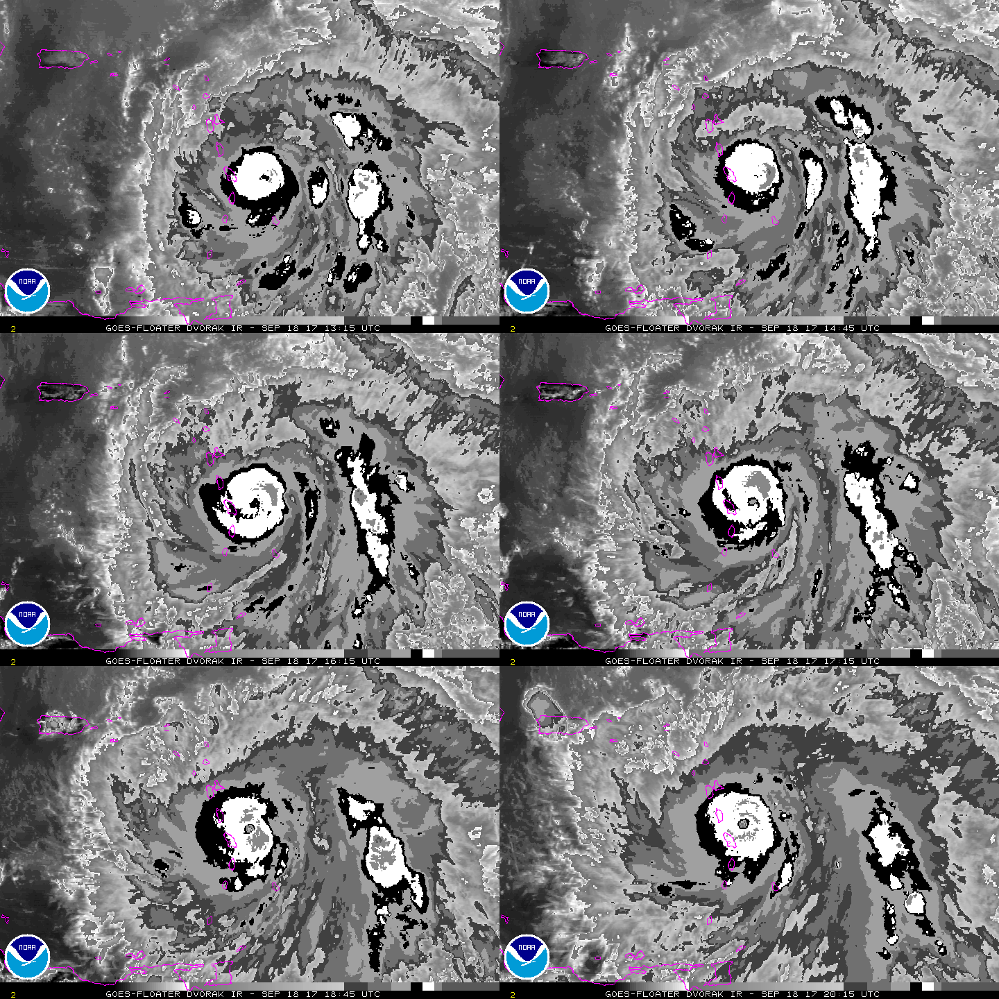
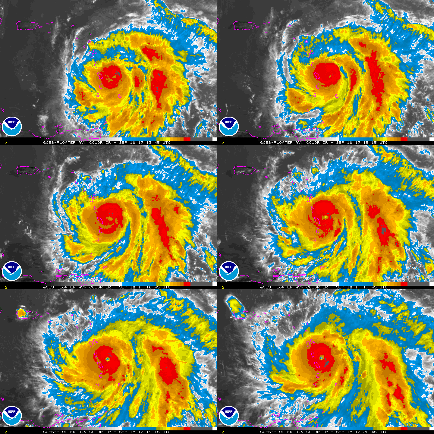
風眼開啟升四級颶風,巔峰上看135kts.逐漸影響群島。000
WTNT45 KNHC 182048
TCDAT5
Hurricane Maria Discussion Number 10
NWS National Hurricane Center Miami FL AL152017
500 PM AST Mon Sep 18 2017
Maria is developing the dreaded pinhole eye. The last reports from
an Air Force Reserve Hurricane Hunter aircraft and radar data from
Martinique indicated an eye with a diameter of about 8-10 n mi, and
this featured has recently become better defined in visible and
infrared satellite imagery. The aircraft data supported an
intensity of 105-110 kt back at 18Z, and all indications are that
rapid intensification is continuing. Thus, the initial intensity
is increased to 115 kt. Another Hurricane Hunter aircraft is
schedule to arrive in Maria about 2330Z, and it is distinctly
possible that it will find a higher intensity than 115 kt.
After an excursion to the left overnight, Maria has resumed a
motion of 290-295 degrees at about 8 kt, and the short-term motion
may be even farther to the right. A weak subtropical ridge to the
north of the hurricane should steer it generally west-northwestward
for the next three days, with the center crossing the Leeward
Islands near Dominica during the next few hours. This is expected
to be followed by a track across the northeastern Caribbean to near
the Virgin Islands, then followed by a passage over or near Puerto
Rico around the 48 h point. Once north of Puerto Rico, the
hurricane should gradually turn toward the northwest and
north-northwest as it approaches a weakness in the ridge. The track
guidance is tightly clustered through 120 h, and the new forecast
track is an update of the previous forecast that lies a little to
the south of the various consensus models.
Atmospheric and oceanic conditions appear favorable for additional
rapid strengthening for the next 24 h and possibly longer. The
intensity forecast, which is at or above the upper edge of the
guidance, now calls for Maria to reach a peak intensity of 135 kt
in about 24 h, and it is possible that the hurricane could reach
category 5 status. Later in the forecast period, land interaction
and less favorable upper-level winds are expected to cause some
weakening. On top of these general trends, there is also the
possibility that eyewall replacement cycles could occur that would
affect the intensity. However, Maria is likely to remain an
extremely dangerous major hurricane through the forecast period.
It should be noted that the despite the great intensity of Maria,
the hurricane force winds are currently confined to a small area
near the eye. The radii forecast assumes that the 64-kt radii will
not expand significantly during the next 36 h. However, if an
eyewall replacement cycle occurs, the hurricane-force winds could
expand to an area larger than forecast.
If radar data from the eastern Caribbean is regularly available,
Tropical Cyclone Updates may be issued this evening.
KEY MESSAGES:
1. Maria will affect portions of the Leeward Islands and the British
and U.S. Virgin Islands as an extremely dangerous major hurricane
during the next couple of days, and hurricane warnings are in effect
for many of these islands.
2. Maria is likely to affect Puerto Rico as an extremely dangerous
major hurricane, and a hurricane warning has been issued for that
island.
3. The potential for a life-threatening storm surge, accompanied by
large and destructive waves, has increased for the Leeward Islands,
the Virgin Islands, and Puerto Rico.
4. Life-threatening flash floods and mudslides from heavy rainfall
are expected across the Leeward Islands, including Puerto Rico and
the U.S. and British Virgin Islands.
FORECAST POSITIONS AND MAX WINDS
INIT 18/2100Z 15.1N 60.7W 115 KT 130 MPH
12H 19/0600Z 15.7N 61.9W 125 KT 145 MPH
24H 19/1800Z 16.5N 63.3W 135 KT 155 MPH
36H 20/0600Z 17.3N 64.7W 135 KT 155 MPH
48H 20/1800Z 18.2N 66.2W 130 KT 150 MPH...OVER PUERTO RICO
72H 21/1800Z 20.0N 69.0W 125 KT 145 MPH...OVER WATER
96H 22/1800Z 22.0N 71.5W 120 KT 140 MPH
120H 23/1800Z 25.0N 73.0W 105 KT 120 MPH
$$
Forecaster Beven


|
|