簽到天數: 3308 天 [LV.Master]伴壇終老
|
 king111807|2025-10-28 02:17
|
顯示全部樓層
king111807|2025-10-28 02:17
|
顯示全部樓層
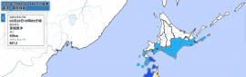
NHC最新一報,評價150節
000
WTNT43 KNHC 272042
TCDAT3
Hurricane Melissa Discussion Number 26
NWS National Hurricane Center Miami FL AL132025
500 PM EDT Mon Oct 27 2025
A few hours ago, data from an Air Force Reserve Hurricane Hunter
aircraft showed that the central pressure in Melissa had fallen to
near 906 mb. The aircraft measured maximum 700-mb flight-level
winds of 161 kt, which supports surface winds of near 145 kt. In
addition, low-level winds measured by a dropwindsonde in the
northeastern eyewall support surface winds of 155 kt. During the
time since the aircraft departed the hurricane, there has been
little change in organization and no obvious signs that Melissa has
weakened. Thus, the initial intensity is set at 150 kt as a blend
of the surface wind estimates mentioned above. NOAA and Air Force
Reserve Hurricane Hunter aircraft will again investigate Melissa
during the next few hours.
Melissa is starting its northward turn, and the initial motion is
now northwestward or 315/3 kt. The mid-level ridge north of Melissa
continues to weaken as a deep-layer mid-latitude trough moves
eastward through the southeastern United States into the
southwestern Atlantic. This should cause the hurricane to turn
northward during the next 6-12 h or so at a continued slow forward
speed. After 18 h or so, Melissa should turn northeastward with
a slight increase in forward speed as the mid-latitude westerly
flow becomes the dominant steering mechanism. A continued
northeastward motion with a significant increase in forward speed
is expected from 36 h through the end of the forecast period. On
the forecast track, the center of Melissa will be near or over
Jamaica late tonight and on Tuesday, cross eastern Cuba Tuesday
night or early Wednesday, and then move near or over the Bahamas
and the Turks and Caicos on Wednesday. After that, the cyclone
could reach the vicinity of Bermuda on Thursday night. The track
guidance envelope has nudged a little to the west and north since
the previous advisory, and the new forecast track is also a little
to the west and north of the previous track.
Some fluctuations in intensity are likely during the next 12-24 h
due to the possibility that Melissa will start an eyewall
replacement cycle (ERC). However, the previous aircraft data showed
no evidence that an ERC had started, and it is possible that the
upcoming aircraft may find Melissa is stronger than 150 kt.
Regardless, even with an ERC it is unlikely that Melissa will
weaken significantly before reaching Jamaica, and there is no
practical difference in Melissa making landfall at category 4 or 5
intensity, since both categories produce catastrophic wind damage.
After reaching Jamaica, a combination of land interaction and
increasing southwesterly shear should cause weakening, although
Melissa is still forecast to be a major hurricane when it reaches
Cuba. Once over the Atlantic, stronger shear should cause more
substantial weakening, and Melissa is expected to become
extratropical by the end of the forecast period as it interacts
with a large baroclinic low over the north Atlantic. The new
intensity forecast has minor adjustments from the previous and
again follows the trend of the intensity consensus.
Key Messages:
1. Jamaica: Remain in your safe shelter and do not venture
outside. Catastrophic, life-threatening flash flooding and numerous
landslides are expected through Tuesday. The eyewall’s destructive
winds may cause total structural failure, particularly in higher
elevations, leading to widespread infrastructural damage, prolonged
power and communication outages, and isolated communities. Along the
southern coast, life-threatening storm surge and damaging waves are
anticipated through Tuesday.
2. Haiti and the Dominican Republic: Catastrophic and
life-threatening flash flooding and landslides are expected across
southwestern Haiti and southern portions of the Dominican Republic
through midweek. In Haiti, extensive infrastructural damage and
isolation of communities is likely. Tropical storm conditions are
expected late Tuesday and Wednesday.
3. Eastern Cuba: Heavy rainfall with life-threatening and
potentially catastrophic flash flooding and landslides is expected
to begin tonight. Life-threatening storm surge and damaging winds
are expected late Tuesday and Tuesday night. Preparations should
be rushed to completion.
4. Southeast and Central Bahamas and the Turks and Caicos: Hurricane
conditions, life-threatening storm surge, and heavy rainfall are
expected across portions of the southeast and central Bahamas on
Wednesday. Residents should follow advice given by local officials
and be sure to have preparations complete by Tuesday night.
Tropical storm conditions, heavy rains, and a significant storm
surge is expected in the Turks and Caicos Islands on Wednesday.
FORECAST POSITIONS AND MAX WINDS
INIT 27/2100Z 16.7N 78.4W 150 KT 175 MPH
12H 28/0600Z 17.1N 78.3W 145 KT 165 MPH
24H 28/1800Z 18.2N 77.8W 125 KT 145 MPH...INLAND
36H 29/0600Z 19.8N 76.6W 110 KT 125 MPH...OVER WATER
48H 29/1800Z 21.8N 75.0W 95 KT 110 MPH
60H 30/0600Z 24.3N 72.9W 85 KT 100 MPH
72H 30/1800Z 27.8N 69.9W 80 KT 90 MPH
96H 31/1800Z 37.1N 60.0W 70 KT 80 MPH
120H 01/1800Z 44.7N 45.4W 60 KT 70 MPH...POST-TROP/EXTRATROP
$$
Forecaster Beven


|
|

.png")
.png")
.png")
.gif")

 照妖鏡
照妖鏡


.png")
.png")

.png")
.gif")