簽到天數: 3206 天 [LV.Master]伴壇終老
|
 king111807|2021-9-23 23:53
|
顯示全部樓層
NHC升格TD18L
WTNT43 KNHC 222054
TCDAT3
Tropical Depression Eighteen Discussion Number 1
NWS National Hurricane Center Miami FL AL182021
500 PM AST Wed Sep 22 2021
The tropical wave that NHC has been monitoring over the last several
days has gradually become better organized. The satellite structure
in particular is quite impressive for a tropical depression, with
both the 1800 UTC subjective Dvorak estimates from TAFB and SAB
at T2.5/35 kt. This bigger question, however, was if the system
possessed a well-defined closed earth-relative circulation. An
ASCAT-C pass from earlier this morning hinted that the circulation
was becoming better defined, with the development of westerly
low-level winds to the south of the convective shield. This westerly
low-level flow is also confirmed by atmospheric motion vectors
(AMVs) available from the GOES-16 meso domain over the system. While
the low-level circulation may still be somewhat broad, it now
appears to be well-defined enough to mark the formation of a
tropical cyclone. The initial intensity is set at 30-kt, in
agreement with peak wind retrievals of 28-30 kt by the earlier
scatterometer data.
The initial motion is estimated to be at 270/13 kt, though this is
somewhat uncertain given that the center has only recently formed.
An expansive mid-level ridge is located to the north and west of
the cyclone, which should maintain its heading toward the west,
though with a gradual gain in latitude as the system approaches
the western extent of the ridge by day 5. The track guidance is in
excellent agreement on this track evolution for the first three
days, with just a bit more spread in the guidance thereafter. The
ECMWF and its ensemble mean towards the end of the forecast is on
the left side of the guidance envelope, while the GFS and HWRF
models are currently on the right side. For the first NHC track
forecast, I have elected to stay close to the track consensus aids,
taking a blend of the HCCA and TCVN aids which are near the
middle of the guidance envelope.
The environment ahead of the tropical depression appears quite
favorable for intensification. Vertical wind shear is forecast by
both the ECWMF- and GFS-based SHIPS guidance to stay at or under 10
kt for the next 3-5 days as the storm traverses warm 28-29 C sea
surface temperatures. Most of the guidance responds to this
environment by indicating strengthening, and the NHC intensity
guidance follows suit, showing a steady increase in intensity
throughout the forecast period. While it might take a bit of time
for the formative low-level circulation to become vertically aligned
with the mid-level center, once that occurs, it is possible a period
of rapid intensification could occur during the five day forecast.
The forecast intensity by 120 hours (100 kt) is on the higher end of
the guidance envelope, but not as high as the latest HWRF or HAFS-B
forecasts.
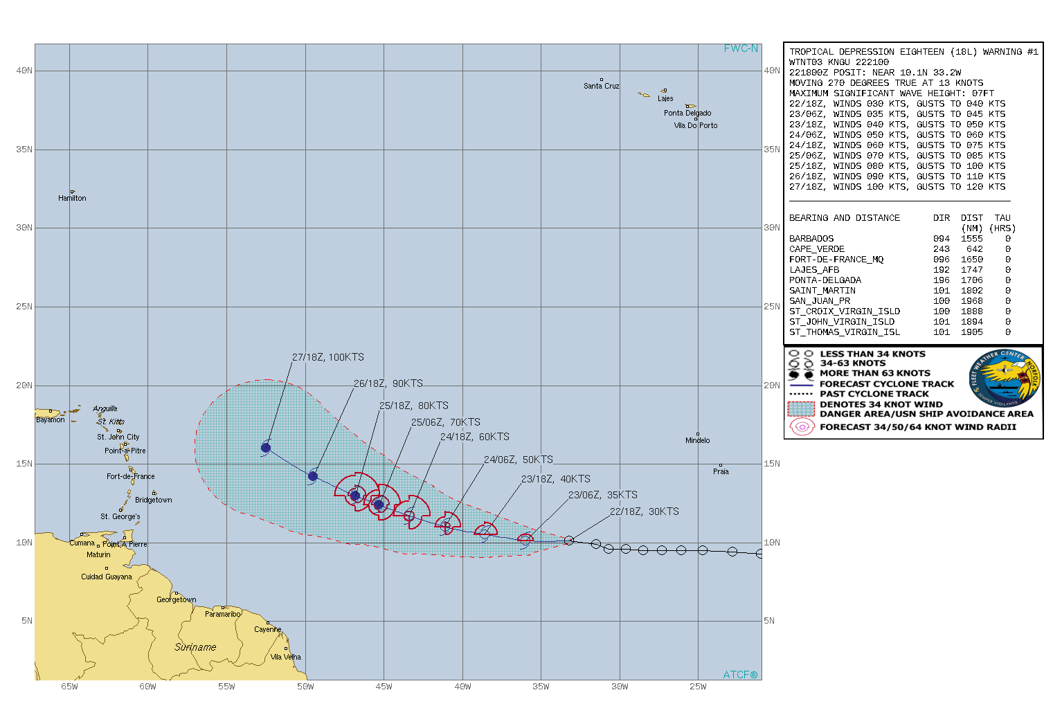
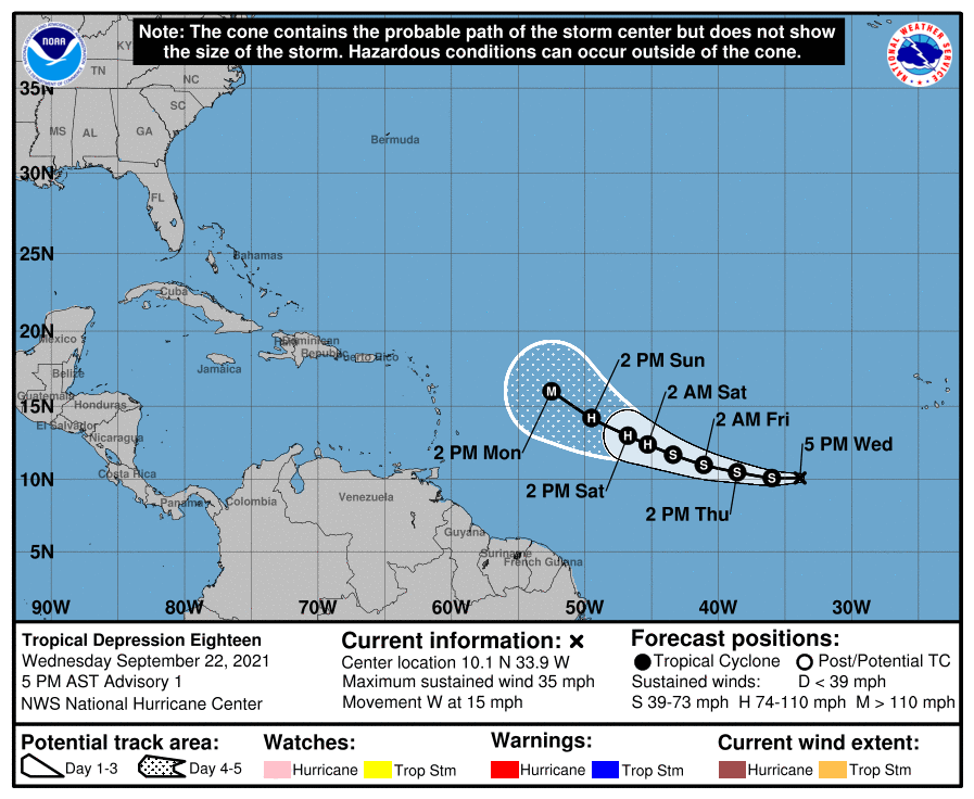
FORECAST POSITIONS AND MAX WINDS
INIT 22/2100Z 10.1N 33.9W 30 KT 35 MPH
12H 23/0600Z 10.1N 36.0W 35 KT 40 MPH
24H 23/1800Z 10.5N 38.6W 40 KT 45 MPH
36H 24/0600Z 11.0N 41.1W 50 KT 60 MPH
48H 24/1800Z 11.7N 43.4W 60 KT 70 MPH
60H 25/0600Z 12.4N 45.3W 70 KT 80 MPH
72H 25/1800Z 13.0N 46.8W 80 KT 90 MPH
96H 26/1800Z 14.2N 49.5W 90 KT 105 MPH
120H 27/1800Z 16.0N 52.5W 100 KT 115 MPH
$$
Forecaster Papin


|
|