簽到天數: 1650 天 [LV.Master]伴壇終老
|
 老農民版夜神月|2021-6-22 00:28
|
顯示全部樓層
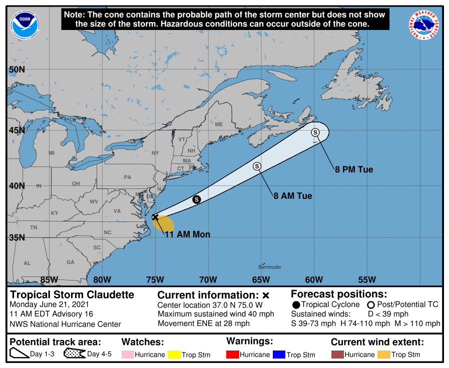
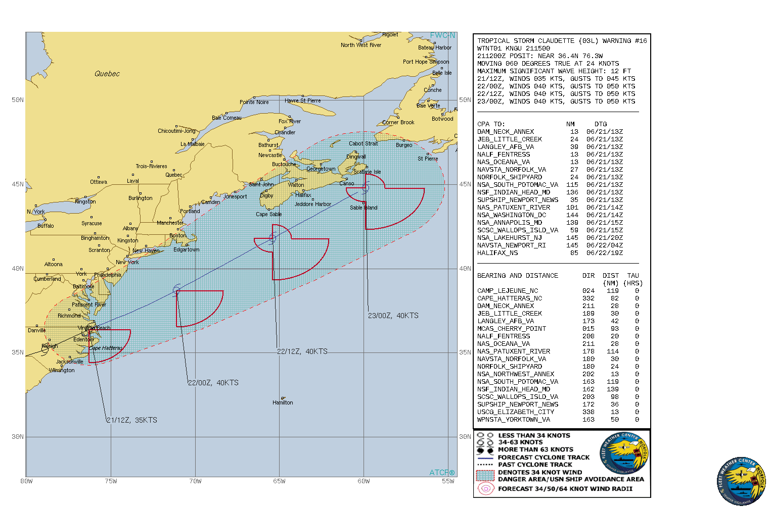
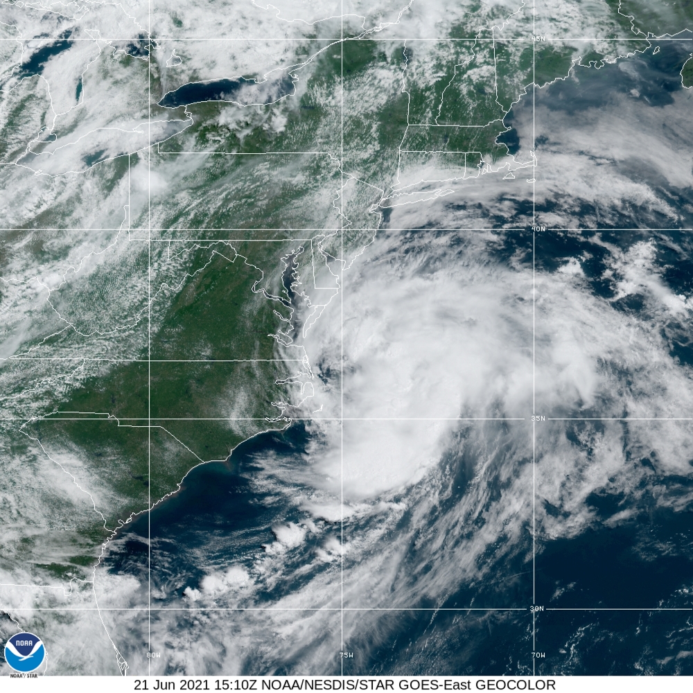
NHC認定已出海,並預測將逐漸轉化000
WTNT43 KNHC 211449
TCDAT3
Tropical Storm Claudette Discussion Number 16
NWS National Hurricane Center Miami FL AL032021
1100 AM EDT Mon Jun 21 2021
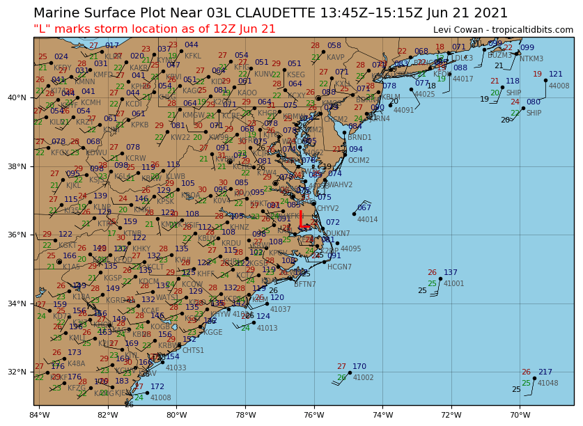
Claudette's low-level center is estimated to be back over water.
However, it is difficult to locate in surface observation data due
to the broad inner-core wind field and elongated pressure envelope
near the NC/VA coasts in which the cyclone is embedded. For now, the
surface center has been placed close to the low- to mid-level
circulation center noted in KAKQ and KMHX Doppler radar data. The
initial intensity is being maintained at 35 kt based on a 1200 UTC
32-kt wind report from ship 3EVZ8 located about 130 nmi southeast of
the center.
Claudette continues to accelerate east-northeastward and the motion
is now 060/24 kt. The track forecast and discussion remain pretty
straightforward. Claudette is now caught up in the deep-layer
west-southwesterly flow on the north side of a broad subtropical
ridge and ahead of a mid-latitude trough currently moving into the
eastern and southeastern United States. The cyclone or its remnants
will gradually lift out toward the northeast ahead of the
approaching mid-latitude trough by tonight, with that motion
continuing through Tuesday. The new NHC track forecast is similar to
the previous advisory track, and lies close to a blend of consensus
track models TVCA, GFEX, and HCCA.
As Claudette continues to accelerate, its increased forward speed
could result in the low-level wind field opening up into a trough,
which would result in the cessation of the system as a tropical
cyclone. For now, however, the assumption is that the cyclone could
strengthen a little more, which would allow for the surface wind
field to remain closed today and into Tuesday until the system
weakens over the cold North Atlantic waters north of the Gulf
Stream, which is located along roughly 38N latitude. As a result,
Claudette is forecast to become a post-tropical remnant low in
about 24 h, follows by dissipation in about 48 h. The official NHC
intensity forecast remains very similar to the previous one, and the
track closely follows the intensity consensus models HCCA and IVCN.
Key Message:
1. Heavy rain from Claudette will continue to diminish this morning
across far southeast Virginia and the Outer Banks of North Carolina.
Isolated flash, urban, and small stream flooding impacts are
possible.
FORECAST POSITIONS AND MAX WINDS
INIT 21/1500Z 37.0N 75.0W 35 KT 40 MPH
12H 22/0000Z 38.7N 71.1W 40 KT 45 MPH
24H 22/1200Z 41.8N 65.4W 40 KT 45 MPH...POST-TROP/EXTRATROP
36H 23/0000Z 44.8N 59.9W 40 KT 45 MPH...POST-TROP/EXTRATROP
48H 23/1200Z...DISSIPATED
$$
Forecaster Stewart 


|
|