|
|
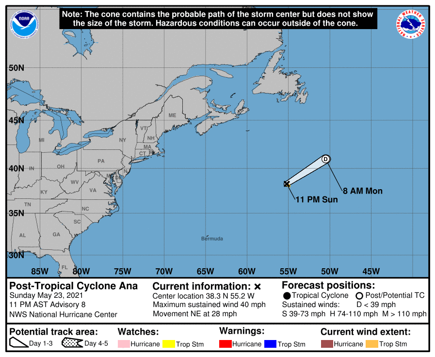
NHC03Z判定成為後熱帶氣旋660
WTNT41 KNHC 240242
TCDAT1
Post-Tropical Cyclone Ana Discussion Number 8
NWS National Hurricane Center Miami FL AL012021
1100 PM AST Sun May 23 2021
Ana has mainly remained devoid of deep and organized convection
today, with only a couple of short-lived bursts noted in satellite
imagery earlier this morning. The cyclone has been an exposed cloud
swirl through the afternoon and evening hours, and Ana continues
moving into a hostile environment characterized by cool sea-surface
temperatures, dry mid-level air, and increasing vertical wind shear.
Thus, Ana has become a post-tropical cyclone, and this will be the
final NHC advisory on the system.
Although a recent ASCAT-B pass missed the center of post-tropical
Ana, it still shows an area of 30-35 kt winds in the southeast
quadrant of the low near the edge of the swath. Therefore, the
initial intensity is set at 35 kt, with the slightly stronger winds
likely just a product of the accelerating forward speed of the
system. The post-tropical cyclone is embedded in deep-layer
southwesterly flow and will continue to accelerate northeastward
until it opens up into a trough and becomes absorbed by a strong
baroclinic zone approaching from the northwest on Monday.
Additional information on post-tropical Ana can be found in High
Seas Forecasts issued by the National Weather Service, under AWIPS
header NFDHSFAT1, WMO header FZNT01 KWBC, and online at
ocean.weather.gov/shtml/NFDHSFAT1.php
FORECAST POSITIONS AND MAX WINDS
INIT 24/0300Z 38.3N 55.2W 35 KT 40 MPH...POST-TROPICAL
12H 24/1200Z 41.0N 50.5W 30 KT 35 MPH...POST-TROP/REMNT LOW
24H 25/0000Z...DISSIPATED
$$
Forecaster Reinhart/Brown 
|
|