|
|
 霧峰追風者|2018-2-27 21:46
|
顯示全部樓層
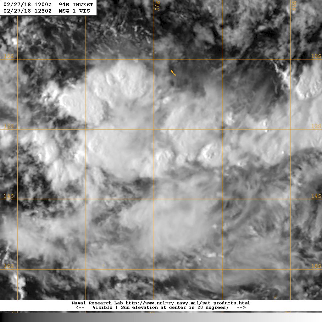
補報文,JTWC 12Z評級提升“Medium”
(1) THE AREA OF CONVECTION (INVEST 94S) PREVIOUSLY LOCATED
NEAR 11.8S 58.5E, IS NOW LOCATED NEAR 12.9S 56.2E, APPROXIMATELY 500
NM NORTH OF LA REUNION. ANIMATED MULTISPECTRAL SATELLITE IMAGERY
DEPICTS CONSOLIDATING, FLARING CONVECTION ABOVE A LOW LEVEL
CIRCULATION (LLC). A 271051Z SSMI 85GHZ MICROWAVE IMAGE SHOWS A
NOTCH FEATURE IN THE CONVECTION ABOVE THE LLC. 94S IS AIDED BY AN
UPPER LEVEL ANTICYCLONE CREATING ADEQUATE DIVERGENCE ALOFT AND LOW
(10-15 KNOT) VERTICAL WIND SHEAR. SEA SURFACE TEMPERATURES ARE WARM
(29-31 CELSIUS) ACROSS A BROAD SWATH OF THE SOUTHERN INDIAN OCEAN.
GLOBAL MODELS INCREASINGLY AGREE THAT 94S WILL CONSOLIDATE AND GAIN
STRENGTH AS IT TRACKS TO THE SOUTHWEST TOWARDS MADAGASCAR. HOWEVER
THERE IS STILL SOME DISAGREEMENT ON HOW FAST IT WILL MOVE AND WHEN
IT COULD GAIN TROPICAL STORM STRENGTH IN THE NEXT SEVERAL DAYS.
MAXIMUM SUSTAINED SURFACE WINDS ARE ESTIMATED AT 15 TO 20 KNOTS.
MINIMUM SEA LEVEL PRESSURE IS ESTIMATED TO BE NEAR 1007 MB. THE
POTENTIAL FOR THE DEVELOPMENT OF A SIGNIFICANT TROPICAL CYCLONE
WITHIN THE NEXT 24 HOURS IS UPGRADED TO MEDIUM. 
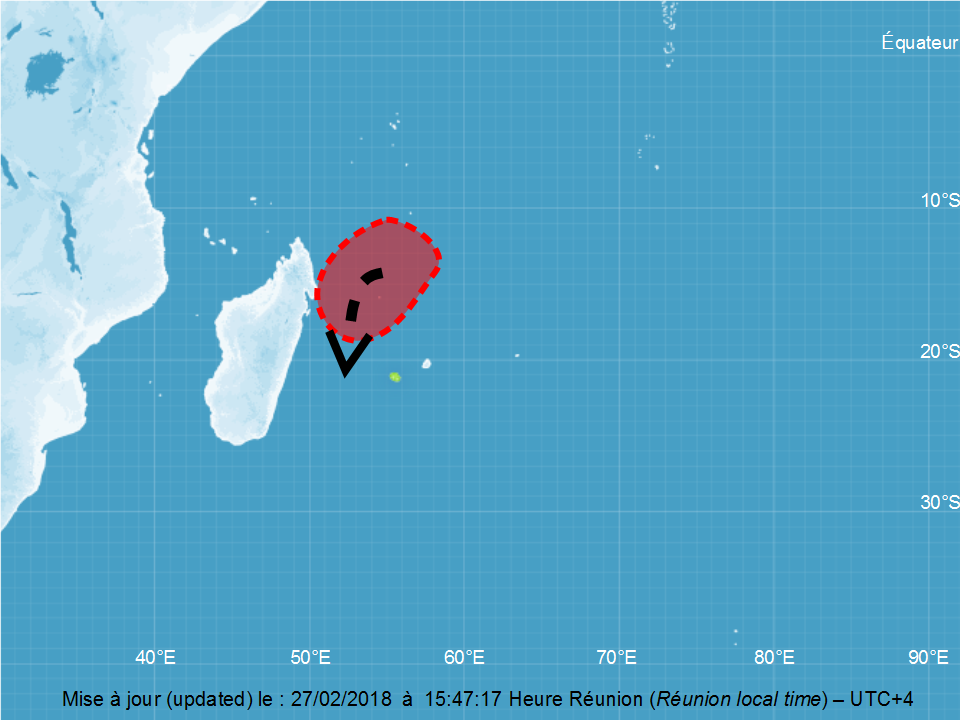
DATE: 2018/02/27 AT 1200 UTC
Potential cyclogenesis North-East of Madagascar :
Last observations show a broad ill defined surface trough, around Agalega. Convective activity is
concentrated in the southern semi-circle, in the slowing down area of the trade wind flow. No closed
circulation is depicted within this area.
Tomorrow, the trade wind flow convergence is expected to increase with the evacuation of the
baroclinic low south of Madagascar. With the persistence of a very good upper divergence, a closed
circulation is forecast to build, South-South-West of Agalega. The lack of equatorial convergence
and a wide structure may at first slow the deepening. But in a very conducive environment this
week-end, the intensification rate is likely to increase. A parabolic meridian track is expected due to
the absence of a mid-tropospheric ridge at south.
Numerical guidance is in a good agreement to forecast a cyclogenesis over the week-end. Yet, they
differ on its exact location and the deepening rate, which induces a lot of uncertainty on a possible
threat to inhabited areas.
For the next 5 days, the risk of development of a moderate tropical storm become low on
Friday, moderate on Saturday and high on Sunday. 
|
|