簽到天數: 3291 天 [LV.Master]伴壇終老
|
 t02436|2017-8-26 11:24
|
顯示全部樓層
以115節強度登陸德克薩斯州。
000
WTNT44 KNHC 260301
TCDAT4
Hurricane Harvey Discussion Number 23
NWS National Hurricane Center Miami FL AL092017
1000 PM CDT Fri Aug 25 2017
Harvey has continued to slowly strengthen since the last advisory.
Air Force Reserve Hurricane Hunter aircraft data earlier indicated
700-mb flight-level winds near 130 kt, and there have been multiple
estimates from the Stepped Frequency Microwave Radiometer of winds
of 110-115 kt. In addition, there have been winds of 135-150 kt
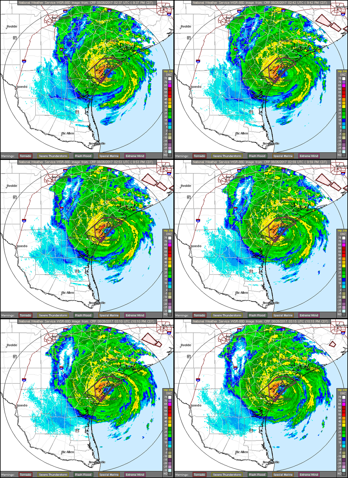
observed at 2500-3000 ft in the north eyewall by the Corpus Christi
WSR-88D. Based on these, Harvey is making landfall at this time as
a category 4 hurricane with winds near 115 kt.
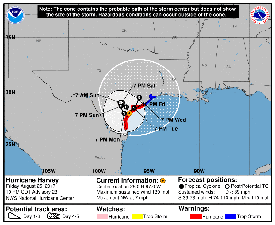
The initial motion is 325/6, a little slower than before. The eye
of Harvey should continue this general motion for the next several
hours, which would bring it inland over southeastern Texas. After
12 h or so, the hurricane should become embedded in an area of weak
steering currents and become nearly stationary. The track guidance
is in good agreement that Harvey will move slowly through at least
72 h, and the new forecast track shows a slow cyclonic loop during
that time. After 72 h, an equally slow motion toward the north or
northeast appears likely. It is unclear at this time whether the
center of Harvey will emerge over the Gulf of Mexico, as the
guidance is in poor agreement on that. It is clear, though, that
Harvey will remain over southeastern Texas or the adjacent waters
through the forecast period, thus producing a major rainfall and
flooding threat.
Gradual weakening is now anticipated as Harvey moves farther
inland. However, a large amount of the circulation should remain
over the Gulf of Mexico, and the weakening is likely to be slower
than normal. The new intensity forecast is slightly changed from
the previous forecast, but it still calls for Harvey to remain a
hurricane through 24 h and remain a tropical storm through the
forecast period. The forecast is based on the premise that the
center will remain over land, and the intensities could be higher if
the center emerges over the Gulf of Mexico.
Key Messages:
1. Harvey is making landfall at this time, bringing life-threatening
storm surge, rainfall, and wind hazards to portions of the Texas
coast. Hurricane conditions have been reported in the landfall
area.
2. A Storm Surge Warning is in effect for much of the Texas coast.
Life-threatening storm surge flooding could reach heights of 9 to
13 feet above ground level at the coast between Port Aransas and
Port O'Connor. For a depiction of areas at risk, see the Storm
Surge Watch/Warning Graphic at hurricanes.gov. Due to the slow
motion of Harvey and a prolonged period of onshore flow, water
levels will remain elevated for several days.
3. Catastrophic and life-threatening flooding is expected across the
middle and upper Texas coast from heavy rainfall of 15 to 30 inches,
with isolated amounts as high as 40 inches, through Wednesday.
Please refer to products from your local National Weather Service
office and the NOAA Weather Prediction Center for more information
on the flooding hazard.
FORECAST POSITIONS AND MAX WINDS
INIT 26/0300Z 28.0N 97.0W 115 KT 130 MPH...ON COAST
12H 26/1200Z 28.6N 97.3W 95 KT 110 MPH...INLAND
24H 27/0000Z 29.0N 97.7W 65 KT 75 MPH...INLAND
36H 27/1200Z 29.0N 97.9W 50 KT 60 MPH...INLAND
48H 28/0000Z 28.7N 97.8W 45 KT 50 MPH...INLAND
72H 29/0000Z 28.0N 97.5W 40 KT 45 MPH...INLAND
96H 30/0000Z 28.5N 96.5W 40 KT 45 MPH...INLAND
120H 31/0000Z 29.5N 96.0W 35 KT 40 MPH...INLAND
$$
Forecaster Beven


|
|