簽到天數: 3291 天 [LV.Master]伴壇終老
|
 t02436|2017-9-8 17:03
|
顯示全部樓層
09Z減弱到135節,將直搗佛州而去
ZCZC MIATCDAT1 ALL
TTAA00 KNHC DDHHMM
Hurricane Irma Discussion Number 37
NWS National Hurricane Center Miami FL AL112017
500 AM EDT Fri Sep 08 2017
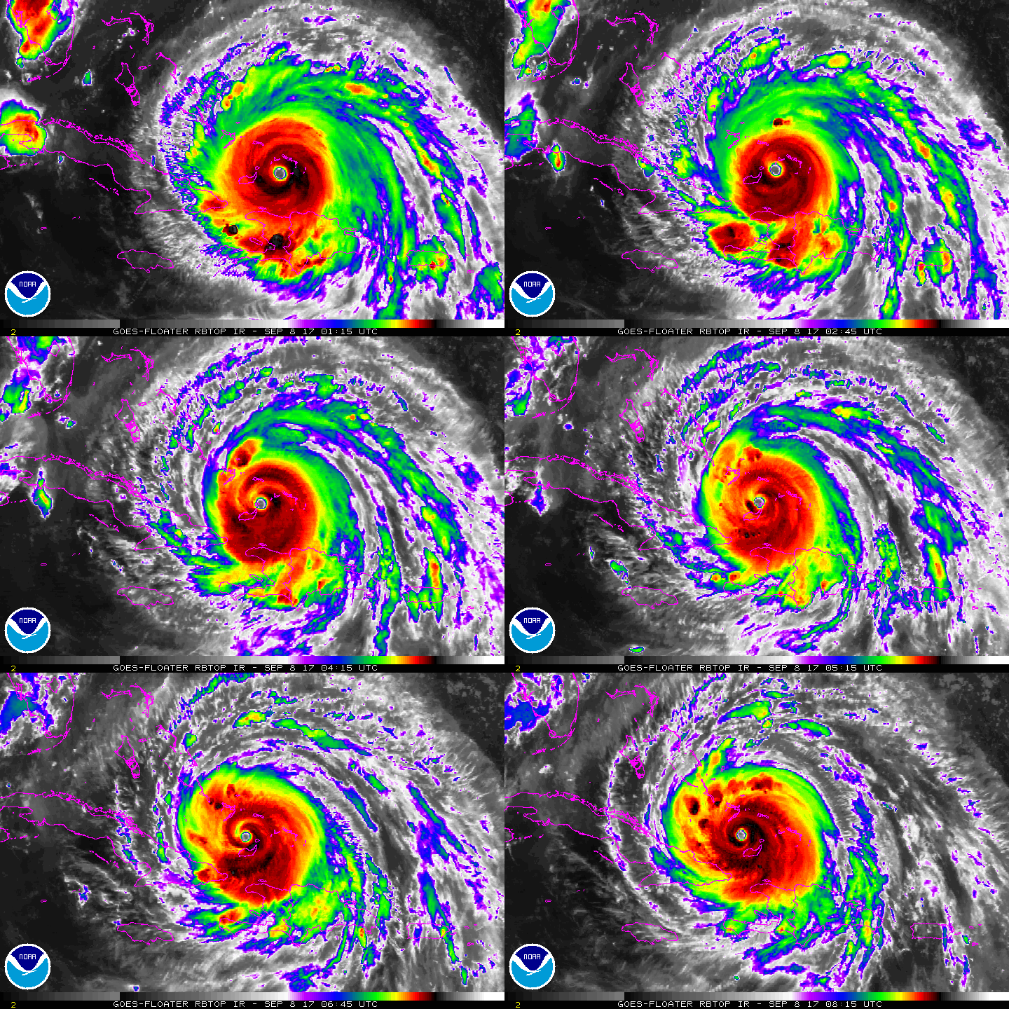
Microwave images and data from an Air Force Reserve Hurricane
Hunter aircraft indicate that Irma is currently undergoing an
eyewall replacement cycle. A recent GMI overpass showed an 50 nmi
wide outer eyewall, with the inner eyewall weakening. The
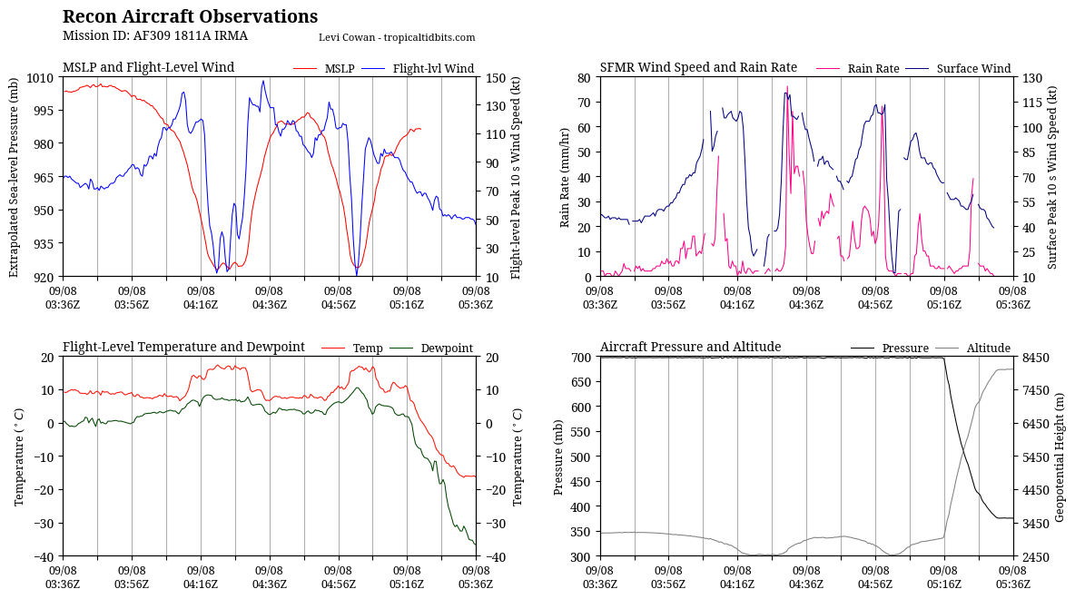
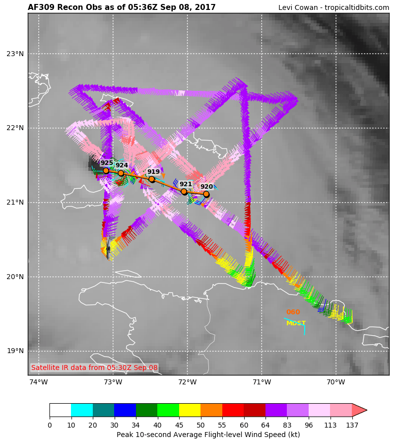
Hurricane Hunter aircraft reported peak 700-mb winds of 147 kt in
the outer eyewall near 0500 UTC, and maximum SFMR winds were in the
125-130 kt range. Based on these data, the initial intensity is
reduced to 135 kt.
Irma is forecast to remain in a favorable warm water, light shear
environment for the next 36-48 h. The intensity guidance shows a
slow weakening during this time, but Irma is expected to remain at
least a Category 4 hurricane until landfall in Florida. After
landfall, a fairly quick decay in maximum winds is expected due to
land interaction and increased shear, although Irma's large wind
field is likely to still produce hurricane-force winds over a large
area. There are two caveats to the intensity forecast. First, some
additional weakening could occur during the eyewall replacement,
followed by re-intensification as the cycle completes. Second, the
ECMWF, UKMET, and NAVGEM forecast a track over or close to the
coast of Cuba that is not currently a part of the track forecast.
If this occurs, Irma could be weaker than currently forecast along
the later parts of the track.
The initial motion is west-northwestward or 285/14. Irma should
maintain this general trajectory for the next 24-36 h as it moves
along the southwestern side of the subtropical ridge. After that
time, the guidance is in good agreement that the ridge should break
and allow Irma to turn north-northwestward to northward. There
remains some spread between the models on when the turn will occur,
with the GFS/Canadian being on the eastern side of the guidance and
the UKMET/NAVGEM on the left side. The ECMWF, Florida State
Superensemble, and the HFIP Corrected consensus are in the middle
of the guidance envelope, and the new track forecast is in best
agreement with those models. Overall, the new forecast track is
similar to the previous forecast, with minor westward adjustments
at 36 and 48 h.
KEY MESSAGES:
1. Irma is an extremely dangerous Category 4 hurricane and will
continue to bring life-threatening wind, storm surge, and rainfall
hazards to the Turks and Caicos Islands and the Bahamas through
Saturday. Heavy rainfall is still possible across portions of
Hispaniola through today. Hurricane conditions will also spread
over portions of the north coast of Cuba, especially over the
adjacent Cuban Keys through Saturday.
2. Severe hurricane conditions are expected over portions of the
Florida peninsula and the Florida Keys beginning Saturday night.
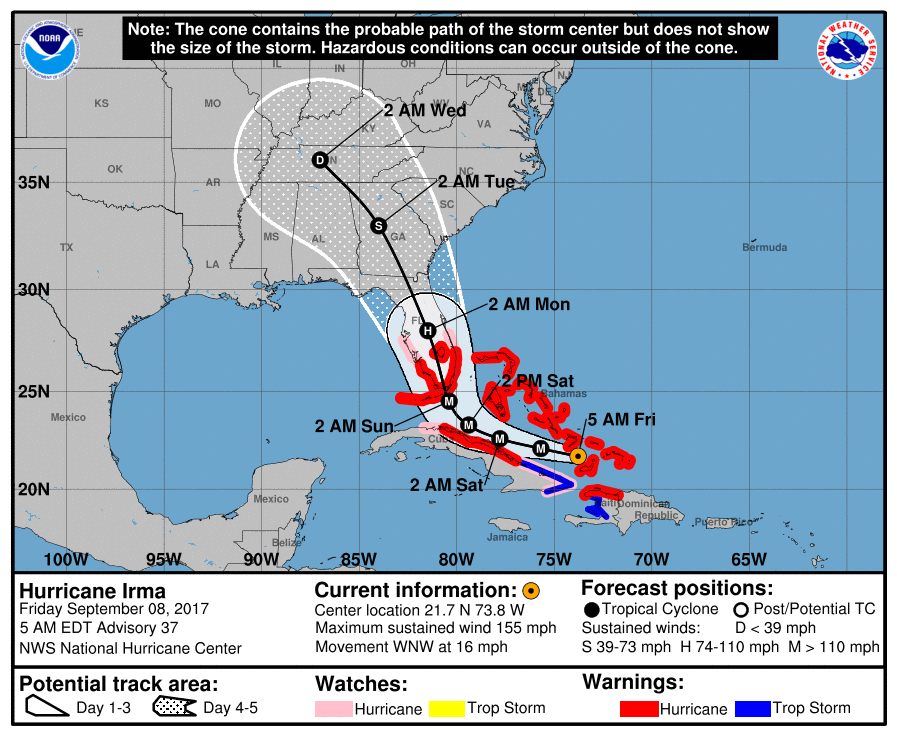
Irma is likely to make landfall in southern Florida as a dangerous
major hurricane, and bring life-threatening storm surge and wind
impacts to much of the state. A Hurricane Warning is in effect for
southern Florida, the Florida Keys, Lake Okeechobee, and Florida
Bay, while Hurricane Watches have been issued northward into central
Florida.
3. A Storm Surge Warning is in effect for southern Florida and the
Florida Keys. A Storm Surge Warning means there is a danger of
life-threatening inundation, from rising water moving inland from
the coastline, during the next 36 hours. This is a life-threatening
situation. Persons located within these areas should take all
necessary actions to protect life and property from rising water and
the potential for other dangerous conditions. Promptly follow
evacuation and other instructions from local officials. A Storm
Surge Watch has been issued north of the Storm Surge Warning area
for portions of the central Florida coast.
4. There is a chance of direct impacts in portions of Georgia,
South Carolina, and North Carolina, but it is too early to specify
the magnitude and location of these impacts.
FORECAST POSITIONS AND MAX WINDS
INIT 08/0900Z 21.7N 73.8W 135 KT 155 MPH
12H 08/1800Z 22.1N 75.7W 135 KT 155 MPH
24H 09/0600Z 22.6N 77.8W 135 KT 155 MPH
36H 09/1800Z 23.3N 79.4W 135 KT 155 MPH
48H 10/0600Z 24.5N 80.4W 130 KT 150 MPH
72H 11/0600Z 28.0N 81.5W 90 KT 105 MPH...INLAND
96H 12/0600Z 33.0N 84.0W 40 KT 45 MPH...INLAND
120H 13/0600Z 36.0N 87.0W 25 KT 30 MPH...INLAND
$$
Forecaster Beven
NNNN


|
|