開啟輔助訪問
 找回密碼
 立即加入

14L.Marco 短暫成為颶風 登陸路易斯安那州

簽到天數: 1650 天

[LV.Master]伴壇終老

2020-8-17 05:27 | 顯示全部樓層
  基本資料  
編號    :14 L
擾動編號日期:2020 08 17 04
撤編日期  :2020 08 00 00

97L INVEST 200816 1800 12.3N 50.6W ATL 25 1009

20200816.2050.goes-16.ir.97L.INVEST.25kts.1009mb.12.3N.50.6W.100pc.jpg

NHC:20%  
1. Shower and thunderstorm activity has increased in association with
a fast-moving tropical wave located about 700 miles east of the
Windward Islands.  This system is expected to move westward at
about 20 mph during the next few days, and that fast speed is
likely to limit significant development while the system approaches
the Windward and southern Leeward Islands Monday, and moves across
the eastern Caribbean Sea on Tuesday.  After that time, the system
is expected to move more slowly westward across the central and
western Caribbean Sea, and upper-level winds could be conducive for
development during the middle to latter part of this week.
* Formation chance through 48 hours...low...20 percent.
* Formation chance through 5 days...medium...40 percent.

two_atl_2d1.png
two_atl_5d1.png

--猶加敦半島

評分

參與人數 1水氣能量 +15 +1 收起 理由
t02436 + 15 + 1

查看全部評分

回復

使用道具 舉報

簽到天數: 1650 天

[LV.Master]伴壇終老

老農民版夜神月|2020-8-25 18:17 | 顯示全部樓層
NHC判定09Z已成為殘餘低氣壓
000
WTNT44 KNHC 250839
TCDAT4

Post-Tropical Cyclone Marco Discussion Number  21
NWS National Hurricane Center Miami FL       AL142020
400 AM CDT Tue Aug 25 2020

Marco has been devoid of any significant convection for at least
12 hours, and ASCAT scatterometer surface wind data around 0239Z
suggested that Marco might have degenerated in a north-to-south
elongated trough. Based on this information, Marco has been
downgraded to post-tropical remnant low.  Brisk southwesterly
vertical wind shear of 30 kt is forecast to increase to near 35 kt
in 24 hours, which should prevent the redevelopment of deep
convection near the center.

Marco's remnants are expected to move generally westward along or
just south of the southern coast of Louisiana for the next 24 hours
or until dissipation occurs.

This is the last forecast/advisory issued by the National Hurricane
Center on Marco. Additional information on this system can be found
in high seas forecasts issued by the national weather
service...under AWIPS header NFDHSFAT1 and WMO header FZNT01 KWBC.

FORECAST POSITIONS AND MAX WINDS

INIT  25/0900Z 28.8N  91.2W   25 KT  30 MPH...POST-TROP/REMNT LOW
12H  25/1800Z 28.8N  92.7W   20 KT  25 MPH...POST-TROP/REMNT LOW
24H  26/0600Z...DISSIPATED

$$
Forecaster Stewart

al142020.20200825092416.gif 20200825.0940.goes-16.ir.14L.MARCO.25kts.1008mb.28.8N.90.7W.100pc.jpg
5b4adf4d-f001-4a90-8d6c-9c739d563701.jpeg

點評

我在樓上講完果真GG  發表於 2020-8-25 18:24
回復

使用道具 舉報

簽到天數: 53 天

[LV.5]常住居民I

天篷大元帥|2020-8-25 14:27 | 顯示全部樓層
裸奔中
離GG不遠了

裸奔中

裸奔中
回復

使用道具 舉報

簽到天數: 3280 天

[LV.Master]伴壇終老

t02436|2020-8-25 12:40 | 顯示全部樓層
23Z判定登陸
ZCZC MIATCUAT4 ALL
TTAA00 KNHC DDHHMM

Tropical Storm Marco Tropical Cyclone Update
NWS National Hurricane Center Miami FL       AL142020
600 PM CDT Mon Aug 24 2020

...MARCO MAKES LANDFALL NEAR THE MOUTH OF THE MISSISSIPPI...
...EXPECTED TO BECOME A TROPICAL DEPRESSION LATER TONIGHT...

Visible satellite imagery and surface observations indicate that
Marco made landfall near the mouth of the Mississippi River around
600 PM CDT. Data from an Air Force Reserve Hurricane Hunter Aircraft
indicate that Marco is producing a small area of
tropical-storm-force winds over water to the northeast of the
center. These winds will likely subside during the next few hours as
Marco moves along the coast of Louisiana. Heavy rain will continue
along portions of the north-central Gulf Coast through tonight.

The estimated minimum pressure at the time of landfall was 1006 mb
(29.71 inches).


SUMMARY OF 600 PM CDT...2300 UTC...INFORMATION
----------------------------------------------
LOCATION...29.0N 89.2W
ABOUT 0 MI...0 KM N OF THE MOUTH OF THE MISSISSIPPI RIVER
MAXIMUM SUSTAINED WINDS...40 MPH...65 KM/H
PRESENT MOVEMENT...WNW OR 290 DEGREES AT 8 MPH...13 KM/H
MINIMUM CENTRAL PRESSURE...1006 MB...29.71 INCHES

$$
Forecaster Zelinsky

NNNN

03Z已減弱為TD
000
WTNT44 KNHC 250231
TCDAT4

Tropical Depression Marco Discussion Number  20
NWS National Hurricane Center Miami FL       AL142020
1000 PM CDT Mon Aug 24 2020

Visible imagery and surface observations indicated that Marco made
landfall around 6 pm CDT near the mouth of the Mississippi River.
Shortly before landfall, reports from an Air Force Reserve Hurricane
Hunter plane indicated that Marco was still producing a small area
of tropical-storm-force winds over water to the northeast of its
center. Since then, the system has moved almost due west along the
southeast coast of Louisiana while its deep convection has become
farther displaced from the low-level center. Between the lack of
central convection and Marco's proximity to land, it is likely that
the winds have decreased since earlier this evening and the
intensity has been lowered to 30 kt.

If deep convection does not redevelop overnight, Marco will become a
remnant low as soon as Tuesday morning. Regardless of its status,
Marco should move generally westward near the coast of Louisiana
while it weakens for the next day or so and could continue to
produce heavy rain for portions of the north-central Gulf Coast
tonight. The system is then forecast to dissipate by early
Wednesday, if not sooner.


FORECAST POSITIONS AND MAX WINDS

INIT  25/0300Z 29.0N  89.8W   30 KT  35 MPH
12H  25/1200Z 29.0N  91.3W   25 KT  30 MPH...POST-TROP/REMNT LOW
24H  26/0000Z 29.0N  93.3W   25 KT  30 MPH...POST-TROP/REMNT LOW
36H  26/1200Z...DISSIPATED

$$
Forecaster Zelinsky

023245_5day_cone_with_line.png

GOES04362020238uhtso1.jpg
回復

使用道具 舉報

簽到天數: 1650 天

[LV.Master]伴壇終老

老農民版夜神月|2020-8-25 01:51 | 顯示全部樓層
Marco於昨(24日)凌晨巔峰並短暫達標C1後便開始逐步減弱
NHC15Z新報定強45KT,將於今日上午登陸路易斯安那州
000
WTNT44 KNHC 241445
TCDAT4

Tropical Storm Marco Discussion Number  17
NWS National Hurricane Center Miami FL       AL142020
1000 AM CDT Mon Aug 24 2020

Strong southwesterly shear is taking its toll on Marco, with the
edge of the nearest deep convection now displaced 50 n mi northeast
of the exposed circulation center. Data from an Air Force Reserve
Hurricane Hunter aircraft that investigated the system this morning
measured 45-kt surface winds with the onboard SFMR instrument in
that convection, but winds of only 20 to 30 kt were measured
between this thunderstorm activity and the cyclone's center.
Sampling by the aircraft has also revealed that winds of tropical
storm force are likely no longer occurring in any portion of the
circulation except in that convection. Based on the SFMR data, the
initial intensity is initialized at 45 kt.

The shear is not forecast to abate in the foreseeable future, and
the simulated satellite imagery in the GFS and ECMWF suggests that
Marco will degenerate into a remnant low on Tuesday. The latest NHC
forecast is near the various consensus aids, which shows the cyclone
weakening to a tropical depression late tonight. Based on the
updated intensity forecast, tropical storm conditions are no longer
expected to be produced by Marco over the central portions of the
Louisiana coast, and the Tropical Storm Warnings for those
locations have been discontinued.

Marco has slowed down and has moved a little to the right of the
forecast track over the past few hours, with an initial motion of
NNW/7 kt. The track guidance for the entire forecast period has
shifted back northward, and is just south of where it was this time
yesterday. The official forecast track was adjusted eastward in the
near term to accommodate the recent right-of-track bias. After 12
h, the track forecast lies between the previous one and most of the
consensus track guidance. On this track, Marco is expected to move
inland tonight, and remain inland when the system turns
west-northwestward in the low-level flow by Tuesday morning.


Key Messages:

1. Gusty winds, dangerous storm surge, and heavy rainfall are
expected from Marco along portions of the Gulf Coast beginning
later today. Interests in these areas should follow any advice given
by local government officials.

2. Tropical Storm Laura could bring additional storm surge,
rainfall, and wind impacts to portions of the U.S. Gulf Coast by the
middle of the week. This could result in a prolonged period of
hazardous weather for areas that may also be affected by Marco.
Interests there should monitor the progress of Marco and Laura and
updates to the forecast during the next few days.


FORECAST POSITIONS AND MAX WINDS

INIT  24/1500Z 28.5N  88.5W   45 KT  50 MPH
12H  25/0000Z 29.2N  89.3W   35 KT  40 MPH...INLAND
24H  25/1200Z 30.0N  91.3W   30 KT  35 MPH...POST-TROP/REMNT LOW
36H  26/0000Z 30.5N  93.6W   30 KT  35 MPH...POST-TROP/REMNT LOW
48H  26/1200Z 30.9N  95.9W   25 KT  30 MPH...POST-TROP/REMNT LOW
60H  27/0000Z...DISSIPATED

$$
Forecaster Latto

al142020.20200824154847.gif 20200824.1700.goes-16.vis.2km.14L.MARCO.45kts.1006mb.28.1N.88.4W.pc.jpg
GOES17362020237SobtCT.jpg LATEST.jpg
回復

使用道具 舉報

簽到天數: 1650 天

[LV.Master]伴壇終老

老農民版夜神月|2020-8-24 01:50 | 顯示全部樓層
本帖最後由 老農民版夜神月 於 2020-8-24 02:25 編輯

NHC特報升格Marco為颶風
並預測Marco將於約+36H後進逼路易斯安那州
000
WTNT64 KNHC 231629
TCUAT4

Hurricane Marco Tropical Cyclone Update
NWS National Hurricane Center Miami FL       AL142020
1130 AM CDT Sun Aug 23 2020

...MARCO BECOMES A HURRICANE...
...LIFE-THREATENING STORM SURGE AND HURRICANE-FORCE WINDS EXPECTED
ALONG PORTIONS OF THE U.S. GULF COAST...

Data from an Air Force Reserve Hurricane Hunter aircraft indicate
that Marco has strengthened into a hurricane with maximum winds of
75 mph (120 km/h) with higher gusts.


SUMMARY OF 1130 AM CDT...1630 UTC...INFORMATION
----------------------------------------------
LOCATION...25.0N 87.4W
ABOUT 300 MI...480 KM SSE OF THE MOUTH OF THE MISSISSIPPI RIVER
ABOUT 460 MI...740 KM SE OF LAFAYETTE LOUISIANA
MAXIMUM SUSTAINED WINDS...75 MPH...120 KM/H
PRESENT MOVEMENT...NNW OR 340 DEGREES AT 14 MPH...22 KM/H
MINIMUM CENTRAL PRESSURE...992 MB...29.29 INCHES

$$
Forecaster Latto

153825_5day_cone_with_line_and_wind.png 20200823.1700.goes-16.vis.2km.14L.MARCO.60kts.993mb.24.3N.87.2W.pc.jpg
GOES17262020236PhYoa3.jpg goes16_ir_14L_202008231627.gif
回復

使用道具 舉報

簽到天數: 1650 天

[LV.Master]伴壇終老

老農民版夜神月|2020-8-23 00:37 | 顯示全部樓層
本帖最後由 老農民版夜神月 於 2020-8-23 00:40 編輯

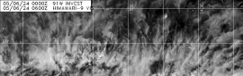
Marco過去24小時稍微東偏剛好閃過陸地,NHC上調上望至1級颶風75KT
000
WTNT44 KNHC 221454
TCDAT4

Tropical Storm Marco Discussion Number   9
NWS National Hurricane Center Miami FL       AL142020
1000 AM CDT Sat Aug 22 2020

Reconnaissance data, geostationary and microwave satellite imagery,
and radar data from Cuba all indicate that Marco is strengthening
quickly this morning.  The Air Force Reserve Hurricane Hunters
measured a peak 850-mb flight-level wind of 69 kt, and there were
several SFMR measurements of 50-55 kt to the northeast of the
center.  These data support raising Marco's initial intensity to 55
kt, and the central pressure based on dropsonde data has fallen to
992 mb.  The crew on the plane reported the formation of a partial
eyewall, which agrees with what we've seen on recent microwave and
radar images.

The track forecast has been complicated by the fact that the plane
has fixed Marco's center to the east of the previous forecast
track, and that makes the current motion north-northwestward, or
340/10 kt.  The subtropical ridge currently located over the
southwestern Atlantic is forecast to build westward along the
northern Gulf Coast during the next few days, and this expanding
ridge is expected to push Marco northwestward and then eventually
westward while the cyclone moves across the Gulf of Mexico.  This
general thinking has not changed, but the adjusted initial position
ended up shifting the track guidance to the north and east on this
cycle.  In response, the new NHC track forecast has been adjusted
eastward and northward during the first 3 days and is generally
between the HCCA and TVCN consensus aids.

Marco has finally tapped into the favorable conditions over the
northwestern Caribbean Sea, and the cyclone's overall small size and
small radius of maximum winds makes it susceptible to quick changes
in intensity. The tropical storm is just beginning to move into a
higher zone of shear to its north, but conditions should remain
conducive enough for Marco to intensity to a hurricane during the
next 24 hours. After that time, southwesterly shear is expected to
increase over 20 kt by day 2 and then over 30 kt by day 3, and those
conditions, along with the cyclone's small size, should cause
weakening as Marco gets closer to the central and northwestern Gulf
coast. The updated NHC intensity forecast has been increased during
the first 2 days and lies above the HCCA/Florida State
Superensemble solutions but below the SHIPS/LGEM scenarios. The
intensity forecast comes back in line with the previous forecast by
day 3 during the expected weakening phase, and Marco is ultimately
expected to dissipate over Texas by the end of the forecast period.

The updated track forecast suggests that watches could be required
for a portion of the central Gulf Coast later today.

Key Messages:

1. Marco is forecast to strengthen to a hurricane as it moves into
the southeastern Gulf of Mexico by tonight, and tropical storm
conditions are expected over the northeastern coast of the Yucatan
Peninsula and in extreme western Cuba.  Heavy rainfall is also
expected in the eastern portions of the Mexican states of Quintana
Roo and Yucatan, and across far western Cuba, which could result in
flash flooding.

2. Marco is expected to move across the central Gulf of Mexico as a
hurricane Sunday and approach the central Gulf Coast on Monday.
There is an increasing risk of impacts from storm surge, winds, and
heavy rainfall from the upper Texas coast to Louisiana early next
week, and interests there should monitor the progress of Marco, as
storm surge, tropical storm, and/or hurricane watches could be
issued later today.


FORECAST POSITIONS AND MAX WINDS

INIT  22/1500Z 20.9N  85.3W   55 KT  65 MPH
12H  23/0000Z 22.1N  86.0W   65 KT  75 MPH
24H  23/1200Z 23.9N  87.1W   75 KT  85 MPH
36H  24/0000Z 25.6N  88.4W   75 KT  85 MPH
48H  24/1200Z 27.2N  89.9W   70 KT  80 MPH
60H  25/0000Z 28.5N  91.6W   60 KT  70 MPH
72H  25/1200Z 29.1N  93.6W   50 KT  60 MPH
96H  26/1200Z 29.3N  96.6W   35 KT  40 MPH...INLAND
120H  27/1200Z...DISSIPATED

$$
Forecaster Berg

145755_5day_cone_no_line_and_wind.png 20200822.1550.goes-16.vis.2km.14L.MARCO.55kts.993mb.20.3N.85.1W.pc.jpg
GOES16102020235vmAKfn.jpg 20200822.1249.f17.composite.14L.MARCO.55kts.996mb.20.3N.85.1W.075pc.jpg


回復

使用道具 舉報

簽到天數: 1650 天

[LV.Master]伴壇終老

老農民版夜神月|2020-8-22 11:17 | 顯示全部樓層
本帖最後由 老農民版夜神月 於 2020-8-22 11:21 編輯

03Z命名Marco,另外NHC於新報略微下修上望,暫不看好Marco能成為颶風
000
WTNT44 KNHC 220254
TCDAT4

Tropical Storm Marco Discussion Number   7
NWS National Hurricane Center Miami FL       AL142020
1100 PM EDT Fri Aug 21 2020

An Air Force Reserve Hurricane Hunter aircraft has investigated the
system over the northwest Caribbean during the past few hours. The
plane reported a number of unflagged SFMR winds between 35 and 40 kt
and max flight level winds of 41 kt. A blend of these data supports
an intensity of 35 kt, and therefore, this system has been
designated as Tropical Storm Marco. Deep convection has increased
near and to the east of Marco's center during the past few hours.
Although there still isn't much evidence of inner-core banding, the
data from the plane does indicate that the center of Marco has
become better defined since the afternoon and that the minimum
pressure has dropped.

Unfortunately the intensity forecast has not become any clearer and
confidence in that aspect of the forecast is quite low. Marco is
embedded within an environment that could support a fast rate of
strengthening. However, recent microwave data does not indicate that
the system has developed an inner-core, and only gradual
strengthening is likely until it does. The intensity guidance spread
is quite high, with the GFS and ECMWF global models both showing
little further strengthening, while the HMON regional model rapidly
makes Marco a hurricane before it reaches the northeast tip of the
Yucatan peninsula. That possibility can not be ruled out, but a
majority of the intensity guidance favors the weaker solution of the
global models. Even with the HMON outlier included, the NHC
intensity forecast is above the model consensus. Once Marco moves
over the central Gulf of Mexico, a rapid increase in wind shear
associated with an upper-level trough should limit the potential for
further strengthening, and weakening is still anticipated before
Marco nears the northern Gulf Coast, as shown in the previous
official forecast.

Confidence in the track forecast is also lower than normal, as the
models spread remains quite high. Only small adjustments were made
to the NHC forecast which heavily favors the GFS and ECMWF solutions
on the left side of the track guidance. It is worth noting that the
NHC track forecast is near middle of the GFS and ECMWF ensembles.
Marco is currently forecast to move northwestward toward a weakness
in the subtropical ridge over the central Gulf of Mexico for the
next day or two, before the ridge builds and turns the tropical
cyclone farther west. Near the end of the period, Marco's track and
intensity could be also influenced by Tropical Storm Laura which is
also forecast to be over the Gulf of Mexico, however the details of
that interaction are highly uncertain at this time. Given the high
uncertainty in the forecast, larger than normal changes could be
required to future advisories.


Key Messages:

1. Marco is forecast to strengthen over the northwestern Caribbean
Sea through Saturday as it approaches the northeast coast of the
Yucatan Peninsula. A Hurricane Watch and a Tropical Storm Warning
are in effect for portions of that region.

2. The system is expected to move into the south-central Gulf of
Mexico as a tropical storm on Sunday. Although some strengthening
is anticipated on Sunday, weakening is forecast as the system
approaches the northwestern Gulf coast on Tuesday. It is still too
soon to know exactly the location and magnitude of impacts the
system will produce along the central or northwestern Gulf Coast,
and interests in that area should continue monitoring the progress
of this system over the next few days.


FORECAST POSITIONS AND MAX WINDS

INIT  22/0300Z 18.7N  84.9W   35 KT  40 MPH
12H  22/1200Z 19.7N  85.7W   45 KT  50 MPH
24H  23/0000Z 21.1N  86.7W   50 KT  60 MPH
36H  23/1200Z 22.7N  88.0W   55 KT  65 MPH
48H  24/0000Z 24.4N  89.5W   60 KT  70 MPH
60H  24/1200Z 25.9N  91.0W   60 KT  70 MPH
72H  25/0000Z 27.5N  92.8W   60 KT  70 MPH
96H  26/0000Z 29.0N  95.4W   45 KT  50 MPH...INLAND
120H  27/0000Z 30.0N  97.4W   30 KT  35 MPH...INLAND

$$
Forecaster Zelinsky

025616_5day_cone_with_line_and_wind.png 20200822.0240.goes-16.ir.14L.MARCO.35kts.1007mb.18.3N.84.7W.100pc.jpg
20200822.0016.f17.91pct91h91v.14L.FOURTEEN.30kts.1008mb.18.3N.84.7W.085pc.jpg goes16_ir_14L_202008220035.gif
回復

使用道具 舉報

123下一頁
快速回覆
您需要登錄後才可以回帖 登錄 | 立即加入

本版積分規則

本平台僅供學術討論之用,預報應以氣象局為準

威普網站虛擬主機贊助公司

臺灣第一個天氣類型社群平台 即時天氣資訊、精準颱風動態

線上客服
FB傳送訊息
廣告行銷
精準行銷 物超所值
官方粉專
發佈 快速回復 返回頂部 返回列表