開啟輔助訪問
 找回密碼
 立即加入

01L.Ana 北大首旋

簽到天數: 483 天

[LV.9]以壇為家II

dom|2021-5-20 20:37 | 顯示全部樓層
本帖最後由 dom 於 2021-5-20 20:38 編輯

展望提升至High
ZCZC MIATWOAT ALL
TTAA00 KNHC DDHHMM

Tropical Weather Outlook
NWS National Hurricane Center Miami FL
800 AM EDT Thu May 20 2021

For the North Atlantic...Caribbean Sea and the Gulf of Mexico:

1. A non-tropical low pressure system is located about 800 miles east
of Bermuda.  The low is expected to develop gale-force winds later
today while it moves generally northward. The low is then forecast
to move westward and southwestward over warmer waters tonight and
Friday, and it will likely become a subtropical cyclone near and to
the northeast of Bermuda on Friday. The system is expected to move
toward the north and northeast into a more hostile environment by
late Sunday into Monday. For more information on this developing low
pressure area, please see High Seas forecasts issued by the NOAA
Ocean Prediction Center and forecast products issued by the Bermuda
Weather Service.
* Formation chance through 48 hours...high...70 percent.
* Formation chance through 5 days...high...90 percent.

High Seas Forecasts for this system can be found under AWIPS header
NFDHSFAT1, WMO header FZNT01 KWBC, and online at
ocean.weather.gov/shtml/NFDHSFAT1.php

Forecaster Beven
5F7F7FE5-EC2B-47CD-8980-DDBA84209A47.png
回復

使用道具 舉報

簽到天數: 483 天

[LV.9]以壇為家II

dom|2021-5-20 14:15 | 顯示全部樓層
展望提升至Medium
ZCZC MIATWOAT ALL
TTAA00 KNHC DDHHMM

Tropical Weather Outlook
NWS National Hurricane Center Miami FL
200 AM EDT Thu May 20 2021

For the North Atlantic...Caribbean Sea and the Gulf of Mexico:

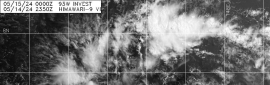
1. A non-tropical low pressure system has developed within a broad area
of cloudiness and thunderstorms about 600 miles east-southeast of
Bermuda. The low is expected to develop gale-force winds later today
while it moves generally northward. The low is forecast to move
westward and southwestward over warmer waters on Friday, and will
likely become a short-lived subtropical cyclone near and to the
northeast of Bermuda on Friday. The system is expected to move
toward the north and northeast into a more hostile environment by
late Sunday into Monday. For more  information on this developing
low pressure area, please see High Seas forecasts issued by the NOAA
Ocean Prediction Center and forecast products issued by the Bermuda
Weather Service.
* Formation chance through 48 hours...medium...50 percent.
* Formation chance through 5 days...high...80 percent.

High Seas Forecasts for this system can be found under AWIPS header
NFDHSFAT1, WMO header FZNT01 KWBC, and online at
ocean.weather.gov/shtml/NFDHSFAT1.php

Forecaster Stewart
192B179F-BE07-475B-8B7D-894AF43FF6D7.png
回復

使用道具 舉報

123
快速回覆
您需要登錄後才可以回帖 登錄 | 立即加入

本版積分規則

本平台僅供學術討論之用,預報應以氣象局為準

威普網站虛擬主機贊助公司

臺灣第一個天氣類型社群平台 即時天氣資訊、精準颱風動態

線上客服
FB傳送訊息
廣告行銷
精準行銷 物超所值
官方粉專
發佈 快速回復 返回頂部 返回列表