|
|
 krichard2011|2014-9-13 11:28
|
顯示全部樓層
本帖最後由 krichard2011 於 2014-9-13 15:50 編輯
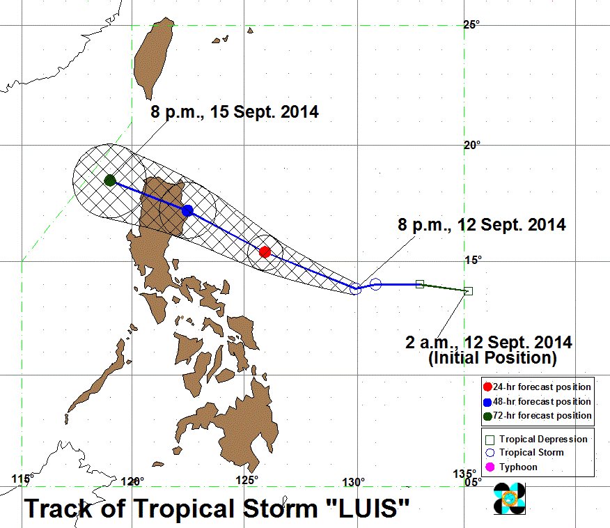
菲律賓PAGASA命名他為 Luis(路易士)路徑方面跟其它機構沒有太大的落差

WEATHER BULLETIN NUMBER FOUR
TROPICAL CYCLONE WARNING: TROPICAL STORM #LuisPH (KALMAEGI)
ISSUED AT 11:00 PM, 12 SEPTEMBER 2014
TROPICAL STORM “LUIS” HAS SLIGHTLY INTENSIFIED AS IT CONTINUES TO MOVE IN A WEST NORTHWEST DIRECTION.
Location of eye/center: At 10:00 PM today, the center of Tropical Storm “LUIS” was estimated based on all available data at 560 km East of Virac, Catanduanes (13.8°N, 129.8°E).
Strength: Maximum sustained winds of 75 kph near the center and gustiness of up to 90 kph.
Movement: Forecast to move West Northwest at 19 kph.
Forecast Positions:
Tropical Storm “LUIS” is expected to be at 270 km Northeast of Virac, Catanduanes by tomorrow evening and at 110 km Southeast of Tuguegarao City by Sunday evening. By Monday evening, it is expected to be at 170 km West of Laoag City.
• PSWS PSW #1 (Winds of 30-60 kph is expected in at least 36 hours): Catanduanes and Isabela
• Residents in low lying and mountainous areas under signal #1 are alerted against possible flashfloods and landslides.
• Estimated rainfall amount is from 5 – 15 mm per hour (moderate - heavy) within the 400 km diameter of the Tropical Storm.
• Luis will enhance the Southwest Monsoon that will bring light to moderate rains and thunderstorms in Visayas and Mindanao.
• Fishing boats and other small seacrafts are advised not to venture out into the Eastern seaboards of Bicol Region, Visayas and Mindanao.
• The public and the Disaster Risk Reduction and Management Council (DRRMC) concerned are advised to take appropriate actions and watch for the next bulletin to be issued at 5AM tomorrow.
|
|