|
|
 krichard2011|2014-7-19 11:36
|
顯示全部樓層
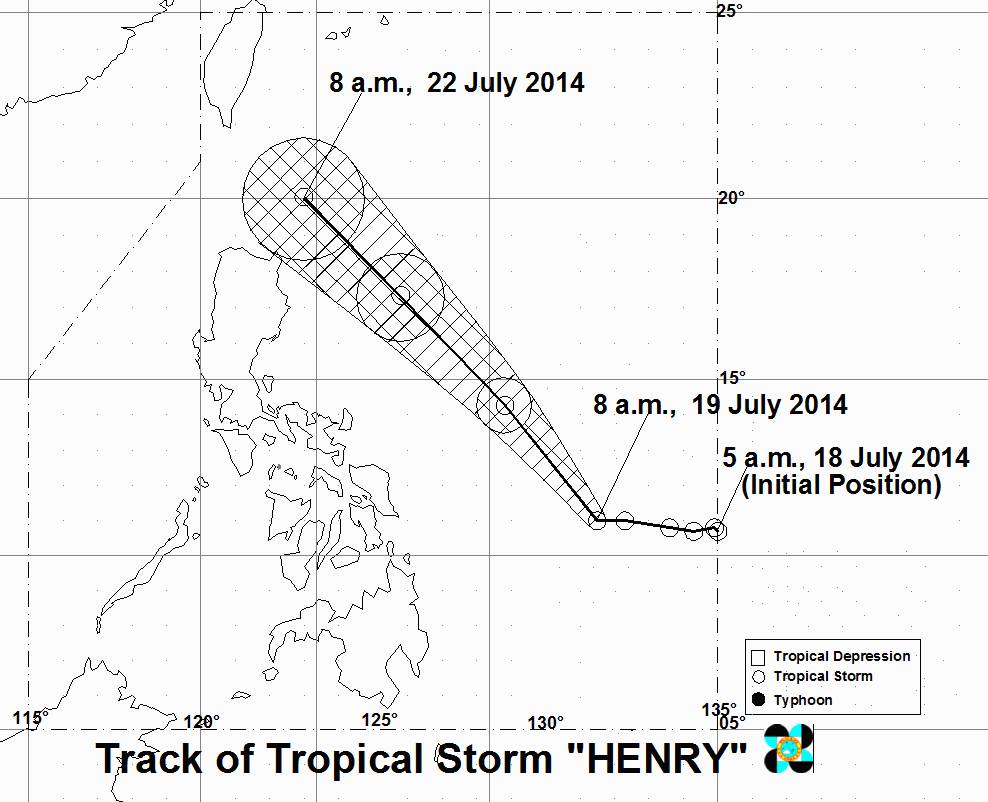
PAGASA 命名HENRY
預測路徑大致跟其它機構差不多

SEVERE WEATHER BULLETIN NUMBER FOUR
TROPICAL CYCLONE ALERT: TROPICAL STORM #HenryPH (MATMO)
ISSUED AT 11:00 AM, 19 JULY 2014
TROPICAL STORM “HENRY” CONTINUES TO MOVE OVER THE PHILIPPINE SEA AS IT INTENSIFIES.
Location of eye/center: At 10:00 AM today, the center of Tropical Storm “HENRY” was estimated based on all available data at 560 km East of Guiuan, Eastern Samar (11.0°N, 131.2°E).
Strength: Maximum sustained winds of 95kph near the center and gustiness of up to 120kph.
Movement: Forecast to move Northwest at 19 kph.
Forecast Positions: Tropical Storm “HENRY” is expected to be at 470 km East of Virac, Cantanduanes by tomorrow morning and at 410 km East of Tuguegarao Cagayan by Monday morning. By Tuesday morning, it is expected to be at 120 km East of Basco, Batanes.
• Estimated rainfall amount is from 7.5 – 15 mm per hour (moderate - heavy) within the 400 km diameter of the Tropical Storm.
• Tropical Storm “HENRY” will not yet affect any part of the country. However, fisherfolks and those with small seacrafts are advised not to venture into the eastern seaboard of Visayas and Mindanao.
• Tropical Storm “HENRY” is expected to enhance Southwest monsoon and may bring moderate to ocassionally heavy rainshowers and thunderstorms over Visayas and Mindanao especially on the western section.
• The public and the disaster risk reduction and management council concerned are advised to take appropriate actions and watch for the next bulletin to be issued at 11 PM tonight. |
|