簽到天數: 2141 天 [LV.Master]伴壇終老
|
 周子堯@FB|2023-9-23 23:52
|
顯示全部樓層
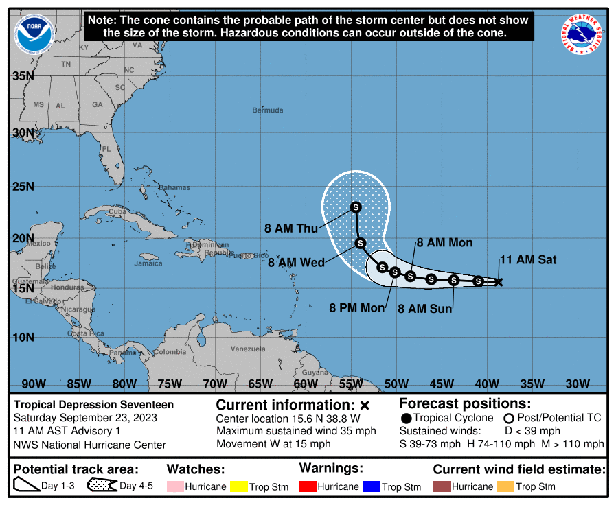
NHC23/12Z升格17L
WTNT42 KNHC 231448
TCDAT2
Tropical Depression Seventeen Discussion Number 1
NWS National Hurricane Center Miami FL AL172023
1100 AM AST Sat Sep 23 2023
Visible imagery since sunrise revealed that a small well-defined
center has formed on the western edge of an area of disturbed
weather located several hundred miles west of the Cabo Verde
Islands. Deep convection associated with the system is also
sufficiently organized to classify it as a tropical cyclone.
Therefore, advisories have been initiated on Tropical Depression
Seventeen.
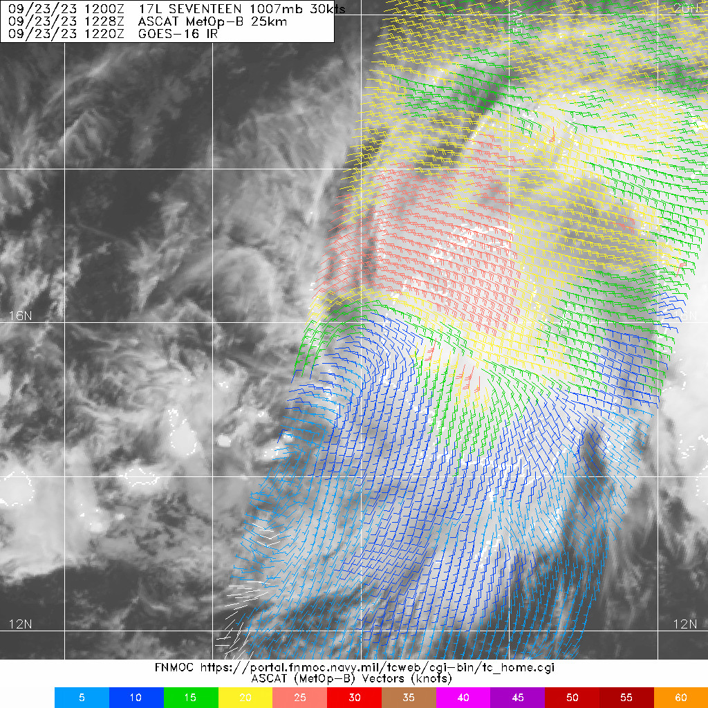
ASCAT data valid around 1200 UTC indicated that maximum winds
associated with the depression are near 30 kt, and that is the basis
for the initial intensity. Since the cyclone's deep convection and
formative mid-level circulation are displaced well east of its
surface center, no significant change in strength is anticipated in
the short term. Deep-layer shear appears to be very weak, but model
soundings suggest some mid-layer shear may be responsible for the
current structure. This shear could lessen by early next week,
allowing for slow intensification to begin in an environment that
should otherwise support strengthening. The NHC forecast is very
near the intensity model consensus, with the statistical-dynamical
models generally showing a faster rate of strengthening than the
dynamical ones.
The depression is moving westward, with an initial forward speed
near 13 kt. The depression should continue westward for the next
several days, slowing down slightly as the subtropical ridge to its
north weakens and moves eastward. After about 3 days, a mid- to
upper-level trough over the central Atlantic should begin to turn
the cyclone northwestward, and then northward by day 5, as long as
Seventeen intensifies as forecasted. The NHC track forecast is
heavily based on HCCA through the full forecast period. Confidence
in the track forecast is somewhat lower than normal based on the
model spread and uncertainty as to when the system will be
vertically deep enough to begin gaining more latitude, but nearly
all available ensemble guidance shows the same general evolution.
FORECAST POSITIONS AND MAX WINDS
INIT 23/1500Z 15.6N 38.8W 30 KT 35 MPH
12H 24/0000Z 15.7N 41.0W 35 KT 40 MPH
24H 24/1200Z 15.8N 43.7W 35 KT 40 MPH
36H 25/0000Z 15.9N 46.2W 35 KT 40 MPH
48H 25/1200Z 16.2N 48.5W 40 KT 45 MPH
60H 26/0000Z 16.6N 50.2W 40 KT 45 MPH
72H 26/1200Z 17.1N 51.6W 45 KT 50 MPH
96H 27/1200Z 19.5N 54.0W 50 KT 60 MPH
120H 28/1200Z 23.0N 54.5W 55 KT 65 MPH
$$
Forecaster D. Zelinsky 

|
|