簽到天數: 3291 天 [LV.Master]伴壇終老
|
 t02436|2022-11-1 23:28
|
顯示全部樓層
15Z直接編號16L並命名Martin
487
WTNT41 KNHC 011500
TCDAT1
Tropical Storm Martin Discussion Number 1
NWS National Hurricane Center Miami FL AL162022
1100 AM AST Tue Nov 01 2022
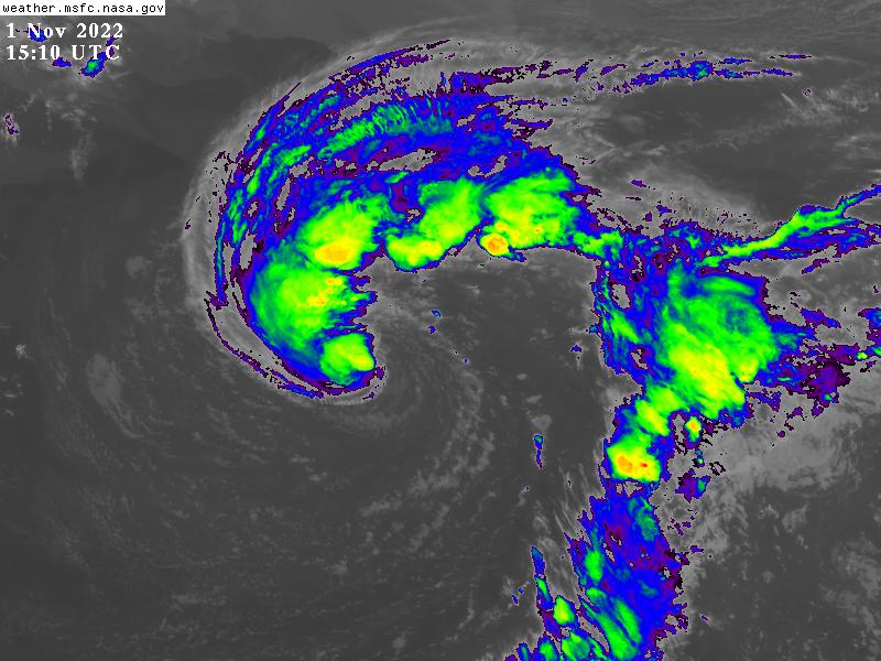
The occluded low over the central North Atlantic has developed deep
convection over its center, while the frontal boundaries have
become displaced a long distance to its east and north. At
the same time, FSU Cyclone Phase Space analyses suggest that the
system has developed a non-frontal warm core. Given these changes,
the system has evolved into a tropical cyclone. The ASCAT
scatterometer just observed the system and indicated that the
intensity is currently at 45 kt with a large area of
35 kt-plus winds. Thus the system is now a tropical storm and given
the name Martin.
The system is moving toward the east-northeast around 8 kt, as it
is embedded in the mid-latitude westerlies in a split in the jet
stream with faster westerlies both poleward and equatorward of the
system. Martin should turn toward the northeast at an increasingly
rapid forward speed during the next two days. The official track
forecast is based upon the consensus (TVCN and HCCA) of the tightly
clustered global and hurricane dynamical models. In about three
days, Martin should decelerate as it merges with a developing
extratropical low to its north.
For the intensity, even though the SSTs are a lukewarm 25C, the
upper-level temperatures are quite cold given that Martin is
embedded within a deep and vertically stacked cyclone. This
vertical temperature structure should enable deep convection
to continue, even while the mid-level moisture is only marginally
ample. The vertical shear is 20-25 kt out of the southwest, but
the effects of this moderate shear are tempered by Martin moving in
the same direction as the shear vector. Bottom line is that
despite the month being November, Martin is expected to develop into
a hurricane at high latitudes. The official intensity prediction
steadily strengthens the system through 48 hr, which matches a
consensus of the statistical, global, and hurricane dynamical
models. Around 48 hr, Martin should transition into a powerful
extratropical low as a cold front reaches near the center of the
system. In about three days, post-tropical Martin should be
merging with an developing extratropical system to its north but
still be containing hurricane-force winds.
FORECAST POSITIONS AND MAX WINDS
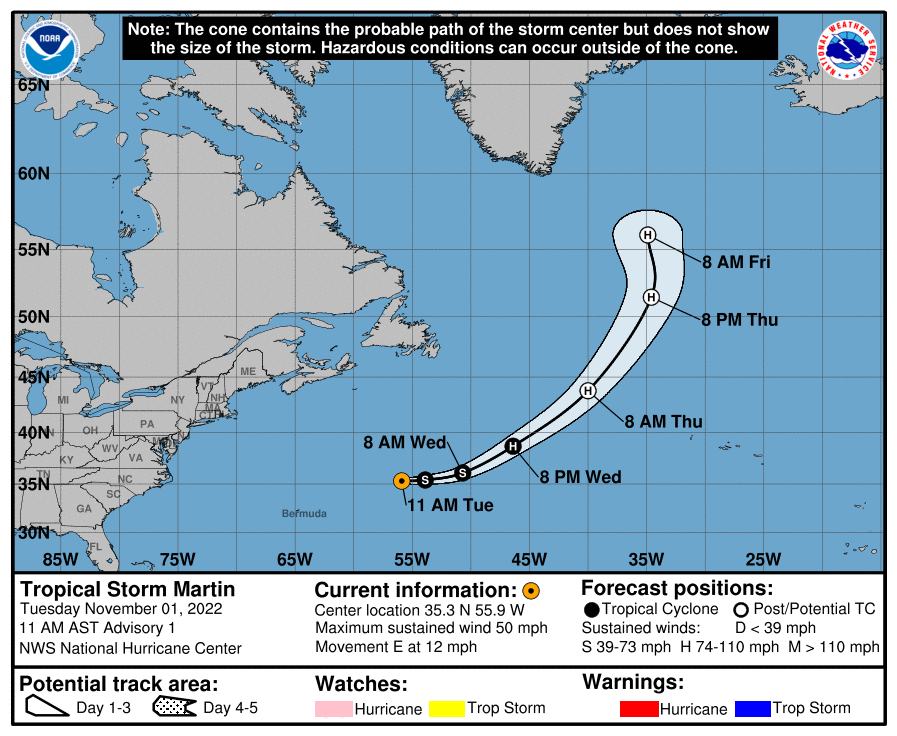
INIT 01/1500Z 35.3N 55.9W 45 KT 50 MPH
12H 02/0000Z 35.4N 53.9W 50 KT 60 MPH
24H 02/1200Z 36.1N 50.7W 60 KT 70 MPH
36H 03/0000Z 38.7N 46.4W 70 KT 80 MPH
48H 03/1200Z 43.8N 40.0W 75 KT 85 MPH...POST-TROP/EXTRATROP
60H 04/0000Z 51.5N 34.6W 75 KT 85 MPH...POST-TROP/EXTRATROP
72H 04/1200Z 56.0N 34.9W 70 KT 80 MPH...POST-TROP/EXTRATROP
96H 05/1200Z...DISSIPATED
$$
Forecaster Landsea


|
|