簽到天數: 1650 天 [LV.Master]伴壇終老
|
 老農民版夜神月|2021-9-4 10:52
|
顯示全部樓層
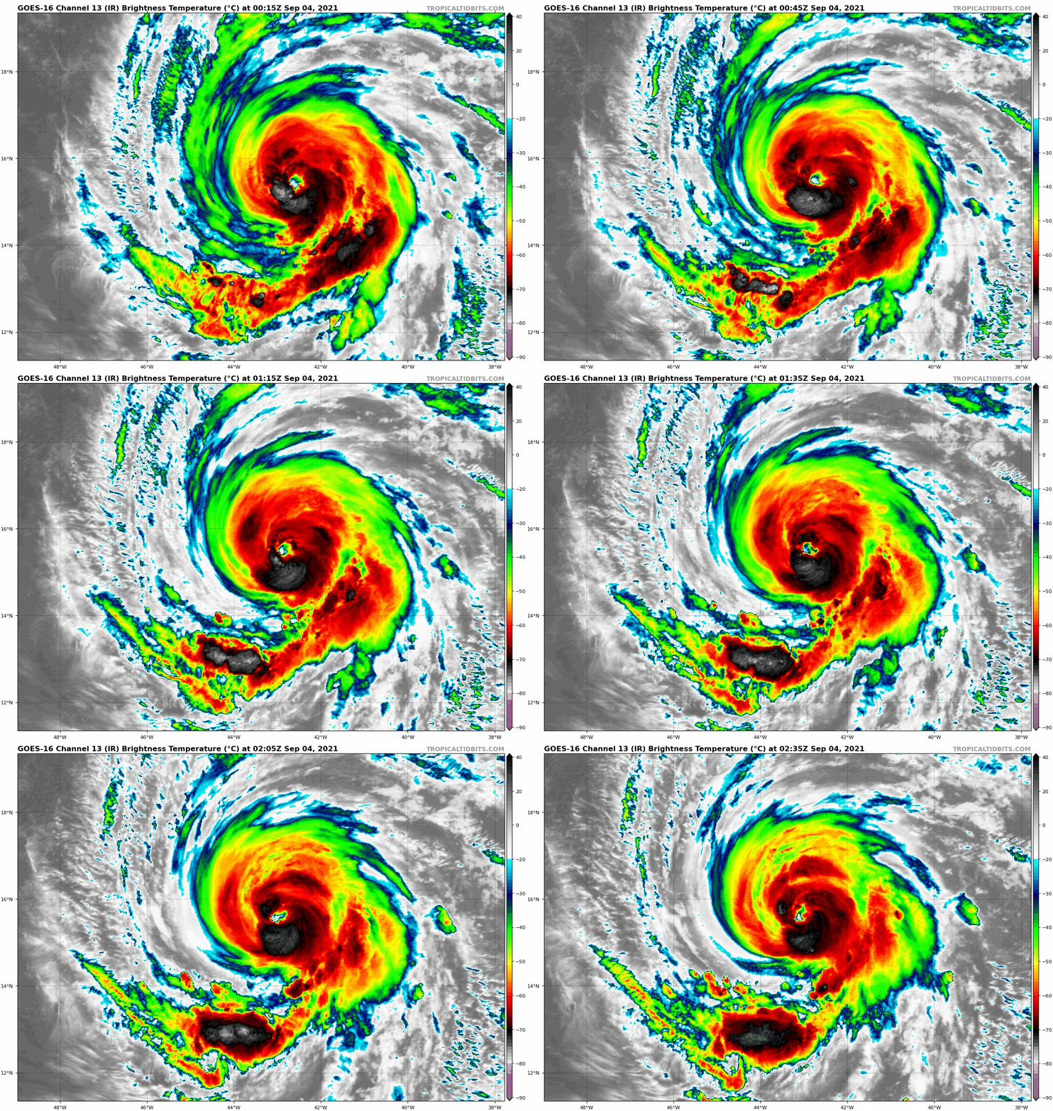
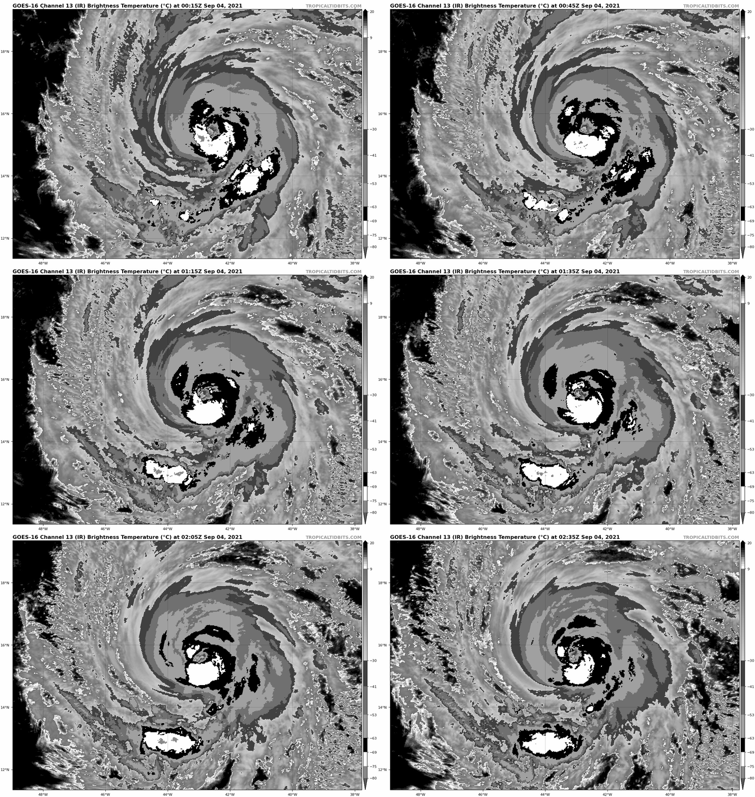
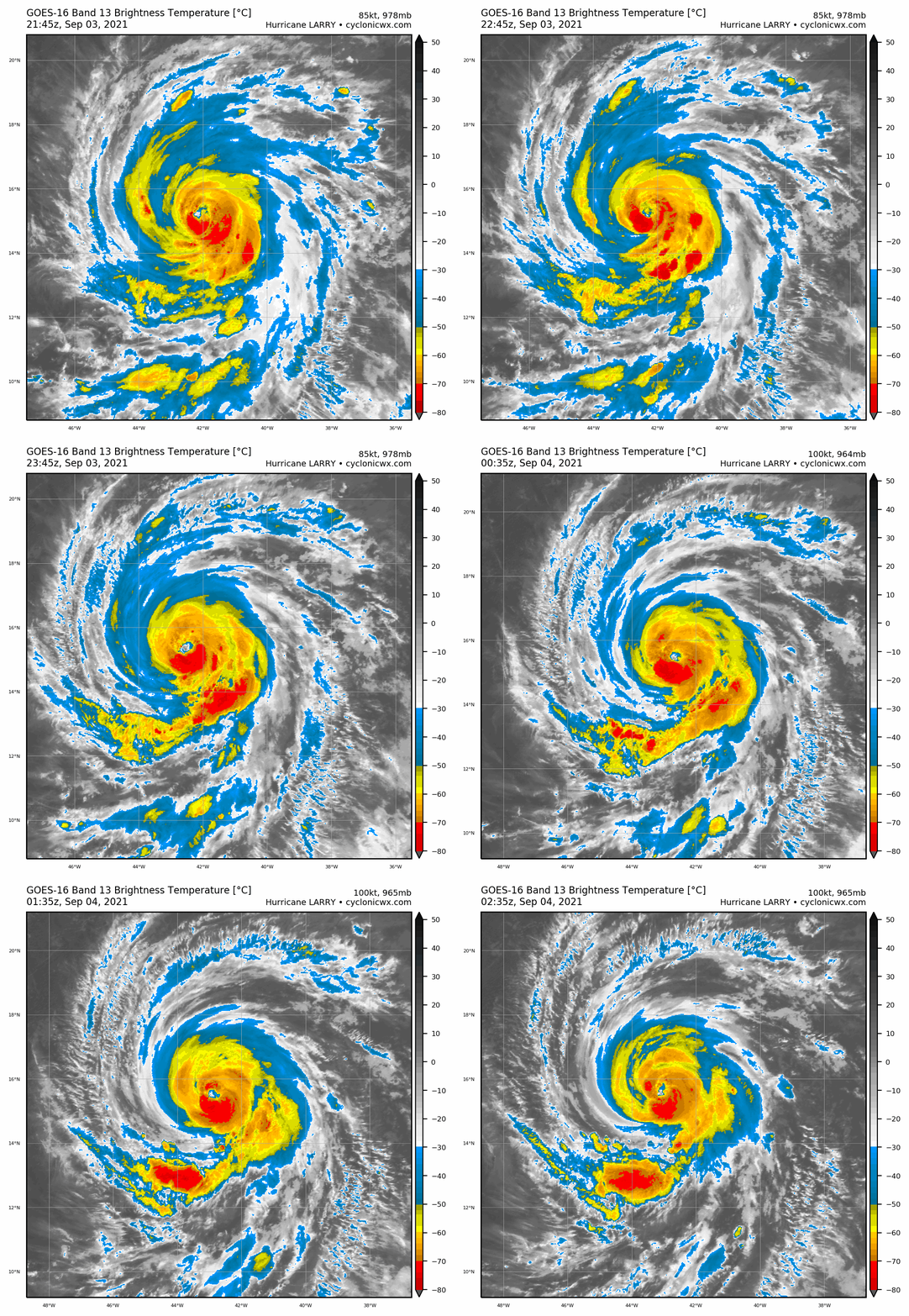
03Z報出爐,定強維持100節,並持續上望120KT


078
WTNT42 KNHC 040237
TCDAT2
Hurricane Larry Discussion Number 14
NWS National Hurricane Center Miami FL AL122021
1100 PM AST Fri Sep 03 2021
Larry has had a distinct but slightly ragged 15 n mi wide eye
during the past few hours, while convective cloud tops within the
eyewall have been gradually cooling. Intensity estimates have
responded, somewhat significantly, to the improved structure, and
TAFB and SAB Dvorak fixes at 0000 UTC were T5.5/102 kt and T5.0/90
kt, respectively. In addition, objective UW-CIMSS ADT and SATCON
estimates are near 105 kt. Larry has become a major hurricane, the
third of the Atlantic season, with estimated 100-kt sustained winds.
The hurricane is located due south of a mid-tropospheric high
centered over the central Atlantic, and continues to move toward
the west-northwest (285/14 kt). Larry is generally expected to move
around the southwestern periphery of the high, turning northwestward
at a slower speed by Sunday and then north-northwestward by
Wednesday as a deep-layer trough moves eastward across the eastern
United States. There is fairly high confidence in the track
forecast, with model guidance showing a below- to near-normal amount
of spread through day 5. The new NHC track forecast is right along
the forecast from the previous advisory through day 3, and then
nudged slightly westward on days 4 and 5. It should be noted that a
few of the consensus aids, including HCCA, are still a little bit
west of the official forecast at day 5, which might portend
additional westward nudges in future advisories.
By strict definition, Larry hasn't quite rapidly intensified since
this time yesterday, but it has still strengthened quickly over
waters that are considered only marginally warm (26-27 degrees
Celsius). For the next couple of days, low shear, higher oceanic
heat content, and a more unstable environment should favor
additional intensification. However, there are still indications
that Larry could run into an environment of higher shear and less
upper-level divergence in 2-3 days as it approaches a
mid-/upper-level trough currently located north and northeast of
the Leeward Islands. In addition, internal processes within the
hurricane's core itself, such as eyewall replacement cycles, could
affect the intensity. In light of all these factors, the NHC
intensity forecast relies on persistence to show additional
strengthening during the next 36 hours, and then holds Larry steady
through 60 hours at an intensity that is near the upper end of the
guidance. Very gradual weakening is anticipated on days 3 through
5 while Larry heads in the direction of higher latitudes, yet the
hurricane is forecast to remain at major hurricane intensity for
the entire 5-day forecast period.
Significant ocean swells generated by Larry's growing wind field
are expected to reach the Lesser Antilles on Sunday, and then
spread westward to portions of the Greater Antilles, the Bahamas,
and Bermuda on Monday and Tuesday. These swells could cause
life-threatening rip currents and high surf conditions. Large
swells are also likely to spread to the east coast of the United
States by midweek.
FORECAST POSITIONS AND MAX WINDS
INIT 04/0300Z 15.5N 43.3W 100 KT 115 MPH
12H 04/1200Z 16.2N 45.3W 110 KT 125 MPH
24H 05/0000Z 17.4N 47.6W 115 KT 130 MPH
36H 05/1200Z 18.7N 49.7W 120 KT 140 MPH
48H 06/0000Z 20.0N 51.7W 120 KT 140 MPH
60H 06/1200Z 21.2N 53.6W 120 KT 140 MPH
72H 07/0000Z 22.4N 55.3W 115 KT 130 MPH
96H 08/0000Z 25.4N 58.5W 115 KT 130 MPH
120H 09/0000Z 29.5N 61.5W 105 KT 120 MPH
$$
Forecaster Berg |
|