簽到天數: 1650 天 [LV.Master]伴壇終老
|
 老農民版夜神月|2020-9-16 17:19
|
顯示全部樓層
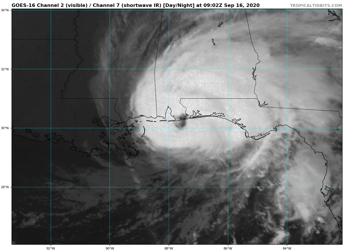
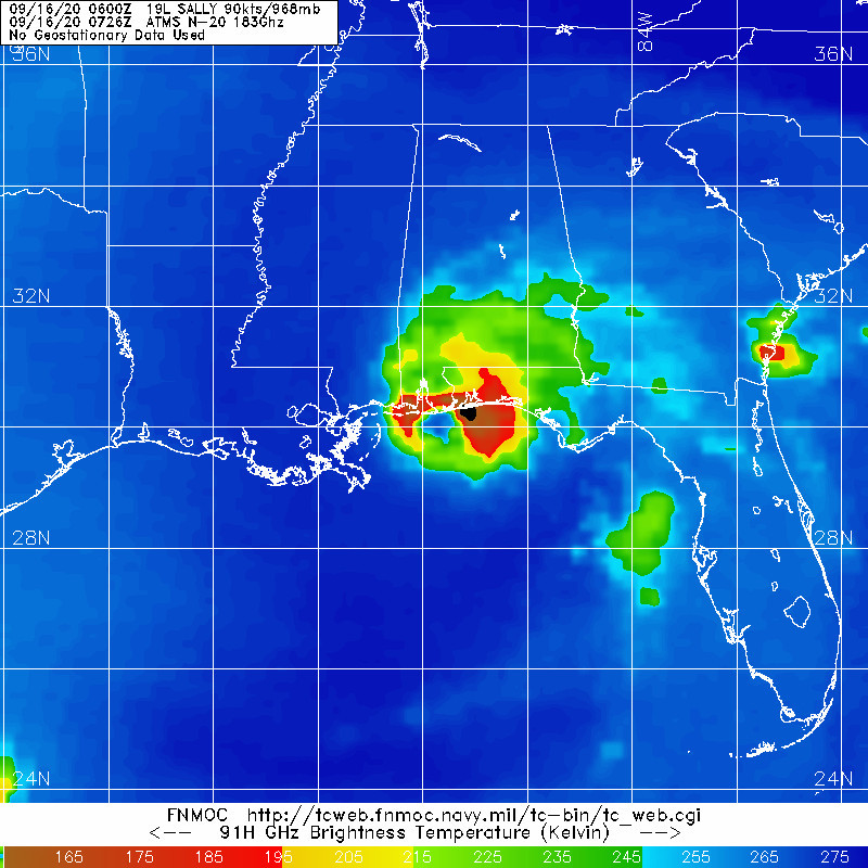
於近岸再度略微增強,風眼亦終於打開,09Z定強90節,中心氣壓965百帕632
WTNT44 KNHC 160858
TCDAT4
Hurricane Sally Discussion Number 21
NWS National Hurricane Center Miami FL AL192020
400 AM CDT Wed Sep 16 2020
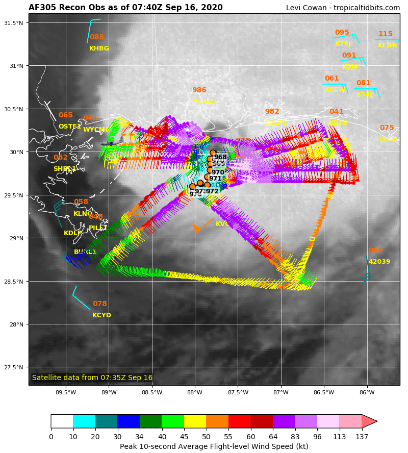
There has been little change in Sally's convective structure during
the past few hours as seen in radar and satellite data. The initial
intensity of 90 kt is based on previous reconnaissance SFMR surface
wind data of 88 kt in the northeastern quadrant, along with average
Doppler radar values of 114 kt between 4500-5000 ft ASL, which
supports an equivalent surface wind speed of about 90 kt. The
reconnaissance aircraft has recently measured peak 700-mb
flight-level winds of 110 kt, but those winds may not be making it
down to the surface based on earlier buoy wind reports underneath
the eyewall. Although the northern eyewall has moved onshore between
Mobile Bay and Pensacola Bay, some slight strengthening is still
possible until the center of Sally's eye makes landfall later this
morning. Rapid weakening is forecast after the center moves inland,
and the system should become a remnant low in a couple of days.
This is consistent with the latest model guidance.
Radar and aircraft center fixes indicate that Sally's motion is
north-northeastward, or 020/03 kt. No significant changes were
required to the previous track forecast. The latest NHC model
guidance continues to show Sally moving slowly north-northeastward
this morning, and then turn northeastward with a gradual increase in
forward speed by tonight. That motion should then continue for the
next day or so. As Sally approaches the mid-latitude westerlies at
higher latitudes, the tropical cyclone should turn toward the
east-northeast with some slight increase in forward speed until it
becomes a dissipating remnant low near the southeastern U.S. coast
in 2-3 days. The official forecast is close to the latest corrected
dynamical model consensus, HCCA, prediction.
KEY MESSAGES:
1. Historic and catastrophic flooding is unfolding along and just
inland of the coast from west of Tallahassee, Florida, to Mobile
Bay, Alabama. In addition, widespread moderate to major river
flooding is forecast. Significant flash and urban flooding, as well
as widespread minor to moderate river flooding, is likely across
inland portions Alabama into central Georgia. Widespread flash and
urban flooding is possible, as well as widespread minor to moderate
river flooding, across western South Carolina into western and
central North Carolina. Scattered flash and urban flooding is
possible, as well as scattered minor river flooding in southeast
Virginia.
2. Life-threatening storm surge is occurring along portions of the
coastline from Alabama to the western Florida Panhandle, including
Pensacola Bay and southern portions of Mobile Bay.
3. Hurricane conditions are expected this morning and then continue
into this afternoon within portions of the Hurricane Warning area
along the Mississippi and Alabama coastlines and the western Florida
Panhandle.
FORECAST POSITIONS AND MAX WINDS
INIT 16/0900Z 30.1N 87.7W 90 KT 105 MPH
12H 16/1800Z 30.7N 87.2W 70 KT 80 MPH...INLAND
24H 17/0600Z 31.5N 86.3W 35 KT 40 MPH...INLAND
36H 17/1800Z 32.6N 84.7W 30 KT 35 MPH...INLAND
48H 18/0600Z 33.5N 82.4W 25 KT 30 MPH...INLAND
60H 18/1800Z 34.1N 79.5W 20 KT 25 MPH...POST-TROP/REMNT LOW
72H 19/0600Z...DISSIPATED
$$
Forecaster Stewart


|
|