開啟輔助訪問
 找回密碼
 立即加入

04L.Dolly 高緯獲名

簽到天數: 1650 天

[LV.Master]伴壇終老

2020-6-21 23:33 | 顯示全部樓層
  基本資料  
編號    :04 L
擾動編號日期:2020 06 21 22
撤編日期  :2020 06 25 22
95L INVEST 200621 1200 36.6N 67.8W ATL 25 1013


未命名.png

  NHC:20%

1. A broad, non-tropical low pressure system has formed a few hundred
miles east of the coast of North Carolina. Although cloudiness and
shower activity are currently disorganized, the system could still
briefly acquire some subtropical characteristics tonight and early
Monday while the low moves northeastward over the warm waters of
the Gulfstream.  By Monday night and Tuesday, however, the system
is expected to weaken when it moves back over the cooler waters of
the North Atlantic.
* Formation chance through 48 hours...low...20 percent.
* Formation chance through 5 days...low...20 percent.

two_atl_2d1.png two_atl_5d1.png

評分

參與人數 1水氣能量 +15 +1 收起 理由
king111807 + 15 + 1 熱帶擾動首帖

查看全部評分

回復

使用道具 舉報

簽到天數: 1650 天

[LV.Master]伴壇終老

老農民版夜神月|2020-6-23 07:01 | 顯示全部樓層
NHC22/21Z升格其為副熱帶低壓04L,上望35KT,有機會獲名
WTNT44 KNHC 222045
TCDAT4

Subtropical Depression Four Discussion Number   1
NWS National Hurricane Center Miami FL       AL042020
500 PM AST Mon Jun 22 2020

The non-tropical low pressure system that the National Hurricane
Center has been following for the past couple of days off of the
U.S. east coast has developed enough organized convection near the
center to be classified as subtropical depression. The subtropical
status is due to the low-level circulation center being co-located
beneath an upper-level cold low as seen in water vapor imagery. The
initial intensity of 30 kt is based on earlier ASCAT wind data
indicating numerous surface wind vectors of 26-28 kt in the
southern semicircle, along with a TAFB subtropical satellite
classification of ST1.5/25-30 kt.

The initial motion estimate is 075/08 kt. Subtropical Depression
Four is located north of a deep-layer ridge and is being influenced
by weak westerly mid- to upper-level flow.  The cyclone is forecast
by all of the global and regional models to move east-northeastward
tonight and then turn northeastward on Tuesday.  A northeastward
motion at a faster forward speed is expected Tuesday night through
Thursday when the system is forecast to be located over the cold
waters of the far north Atlantic.  The cyclone should be absorbed by
a larger extratropical low or dissipate on Thursday. The NHC track
forecast is close to a blend of the simple consensus aids TVCN and
GFEX and the NOAA-HCCA corrected consensus.

The cyclone is beginning to move over a ridge of higher SSTs of
26.0-26.5 deg C in the northern extent of the Gulf Stream. The
forecast track takes the subtropical depression down the length of
the axis of warmer water during the next 12-18 h, so there is the
potential for the cyclone to become a subtropical storm during that
time, especially given the large pool of cold air aloft, with 200-mb
temperatures of near -58 deg C and 500-mb temperatures of about -10
deg C which is creating a lot of instability. After the system moves
off of the warm ridge and into sharply cooler water around 36 hours
or so, gradual weakening is expected, with transition to an
extratropical cyclone forecast by 48 hours. The NHC intensity
forecast closely follows a blend of the consensus models ICON, IVCN,
and HCCA.

FORECAST POSITIONS AND MAX WINDS

INIT  22/2100Z 38.2N  65.7W   30 KT  35 MPH
12H  23/0600Z 38.5N  64.0W   35 KT  40 MPH
24H  23/1800Z 39.0N  62.0W   30 KT  35 MPH
36H  24/0600Z 40.5N  59.3W   30 KT  35 MPH
48H  24/1800Z 42.5N  56.7W   30 KT  35 MPH...POST-TROP/EXTRATROP
60H  25/0600Z 45.0N  53.3W   30 KT  35 MPH...POST-TROP/EXTRATROP
72H  25/1800Z 47.8N  50.4W   30 KT  35 MPH...POST-TROP/EXTRATROP
96H  26/1800Z...DISSIPATED

$$
Forecaster Stewart

204324_5day_cone_no_line_and_wind.png 045509xov8jv3difox83zi.jpeg
04L_gefs_latest.png goes16_ir_04L_202006222137.gif
回復

使用道具 舉報

簽到天數: 1650 天

[LV.Master]伴壇終老

老農民版夜神月|2020-6-24 02:05 | 顯示全部樓層
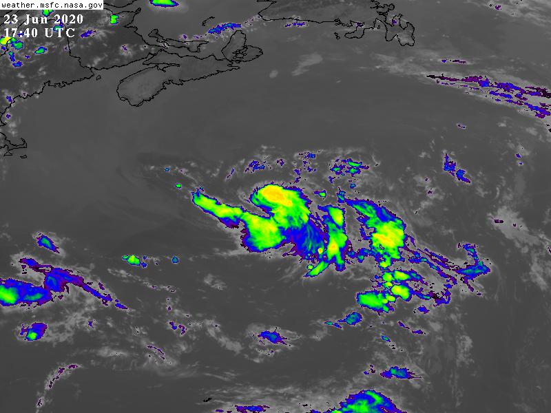
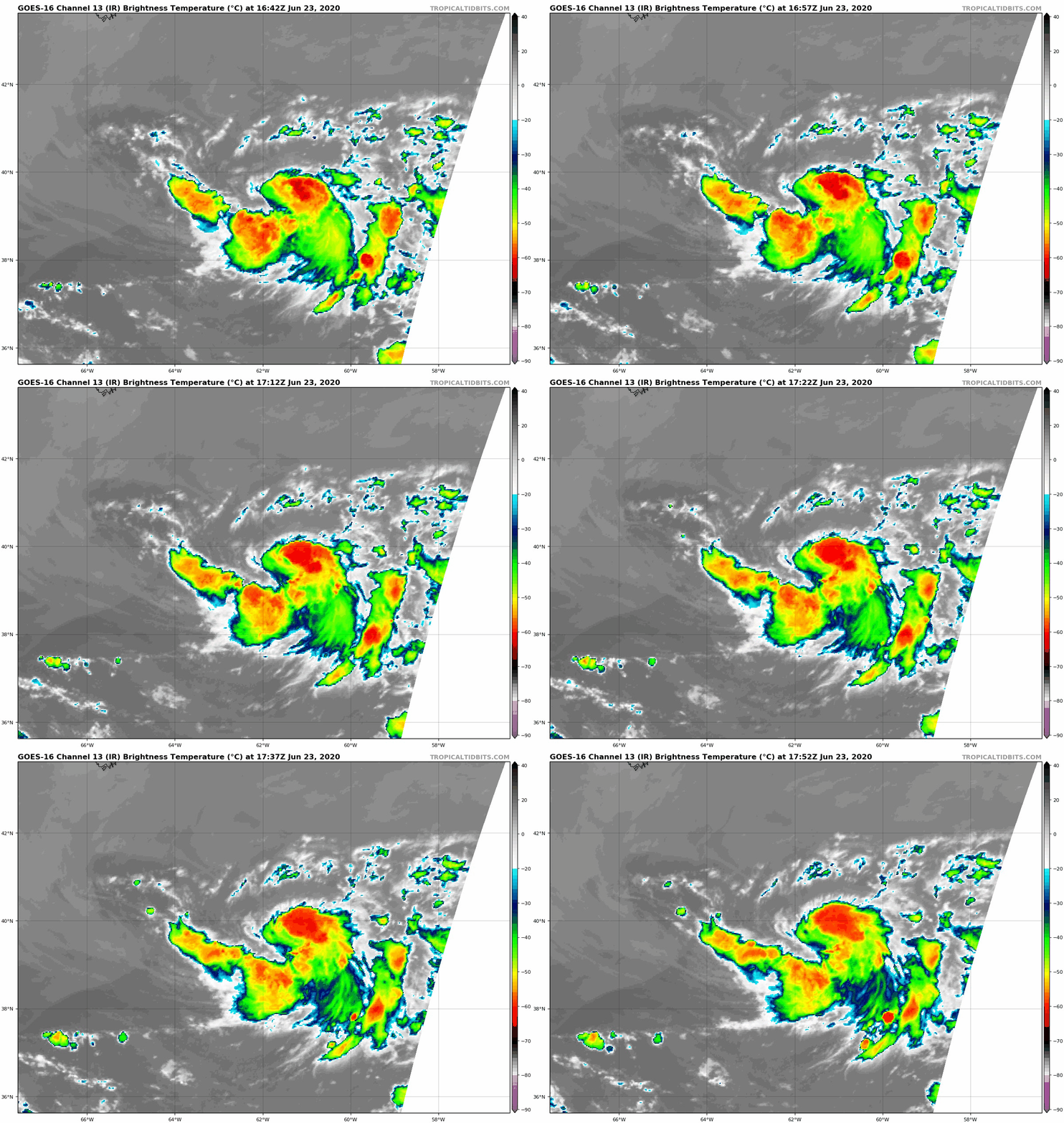
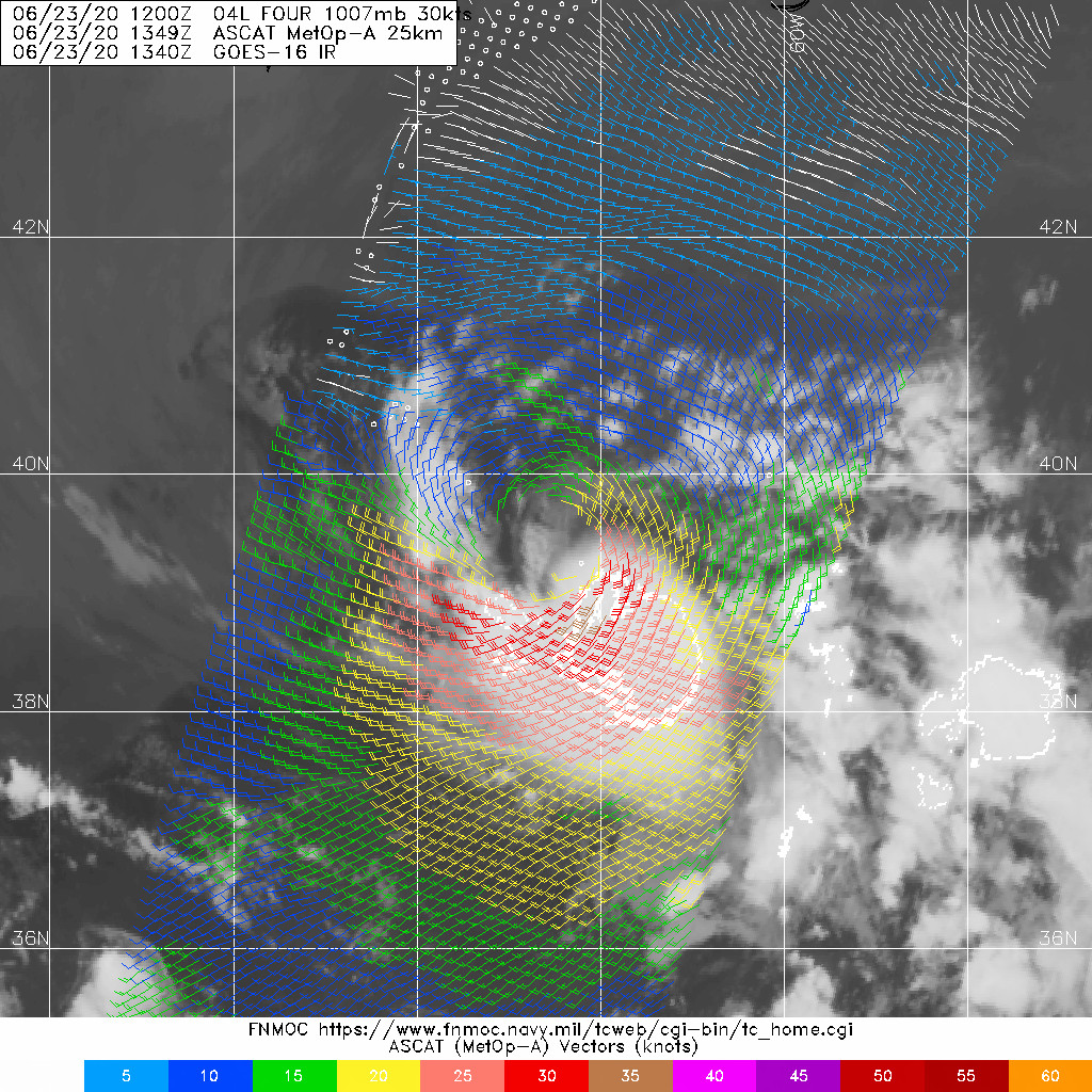
風場掃描達標,NHC23/17Z升格04L為TS,命名Dolly,定強40KT
519
WTNT44 KNHC 231640
TCDAT4

Tropical Storm Dolly Special Discussion Number   5
NWS National Hurricane Center Miami FL       AL042020
100 PM AST Tue Jun 23 2020

A 1348 UTC ASCAT-A scatterometer pass, arriving just after the
previous advisory was issued, indicates that the cyclone is
producing winds of 35-40 kt in its southern semicircle.  In
addition, the radius of maximum winds has contracted to about 40 n
mi.  This, along with the current convective pattern, suggests that
the system has made a transition from a subtropical to a tropical
cyclone, and it has been designated as Tropical Storm Dolly.

This Special Advisory package is being issued to update the
intensity and wind radii forecasts, increasing Dolly's maximum
winds at each forecast time by 5 kt during the next 24 hours. The
forecast track and status changes are the same as in the previous
advisory.

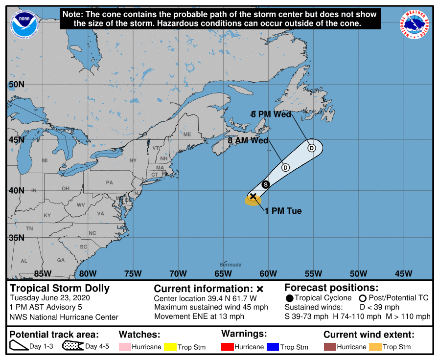
FORECAST POSITIONS AND MAX WINDS

INIT  23/1700Z 39.4N  61.7W   40 KT  45 MPH
12H  24/0000Z 40.6N  60.3W   35 KT  40 MPH
24H  24/1200Z 42.3N  58.1W   30 KT  35 MPH...POST-TROP/REMNT LOW
36H  25/0000Z 44.2N  55.2W   25 KT  30 MPH...POST-TROP/REMNT LOW
48H  25/1200Z...DISSIPATED

$$
Forecaster Berg
164112_5day_cone_no_line_and_wind.png
GOES17402020175hnPZ8o.jpg
goes16_ir_04L_202006231642.gif 235406vzdix3nry3riur99.jpg
回復

使用道具 舉報

快速回覆
您需要登錄後才可以回帖 登錄 | 立即加入

本版積分規則

本平台僅供學術討論之用,預報應以氣象局為準

威普網站虛擬主機贊助公司

臺灣第一個天氣類型社群平台 即時天氣資訊、精準颱風動態

線上客服
FB傳送訊息
廣告行銷
精準行銷 物超所值
官方粉專
發佈 快速回復 返回頂部 返回列表