簽到天數: 868 天 [LV.10]以壇為家III
|
 jrchang5|2020-1-27 18:18
|
顯示全部樓層
本帖最後由 jrchang5 於 2020-1-27 18:33 編輯
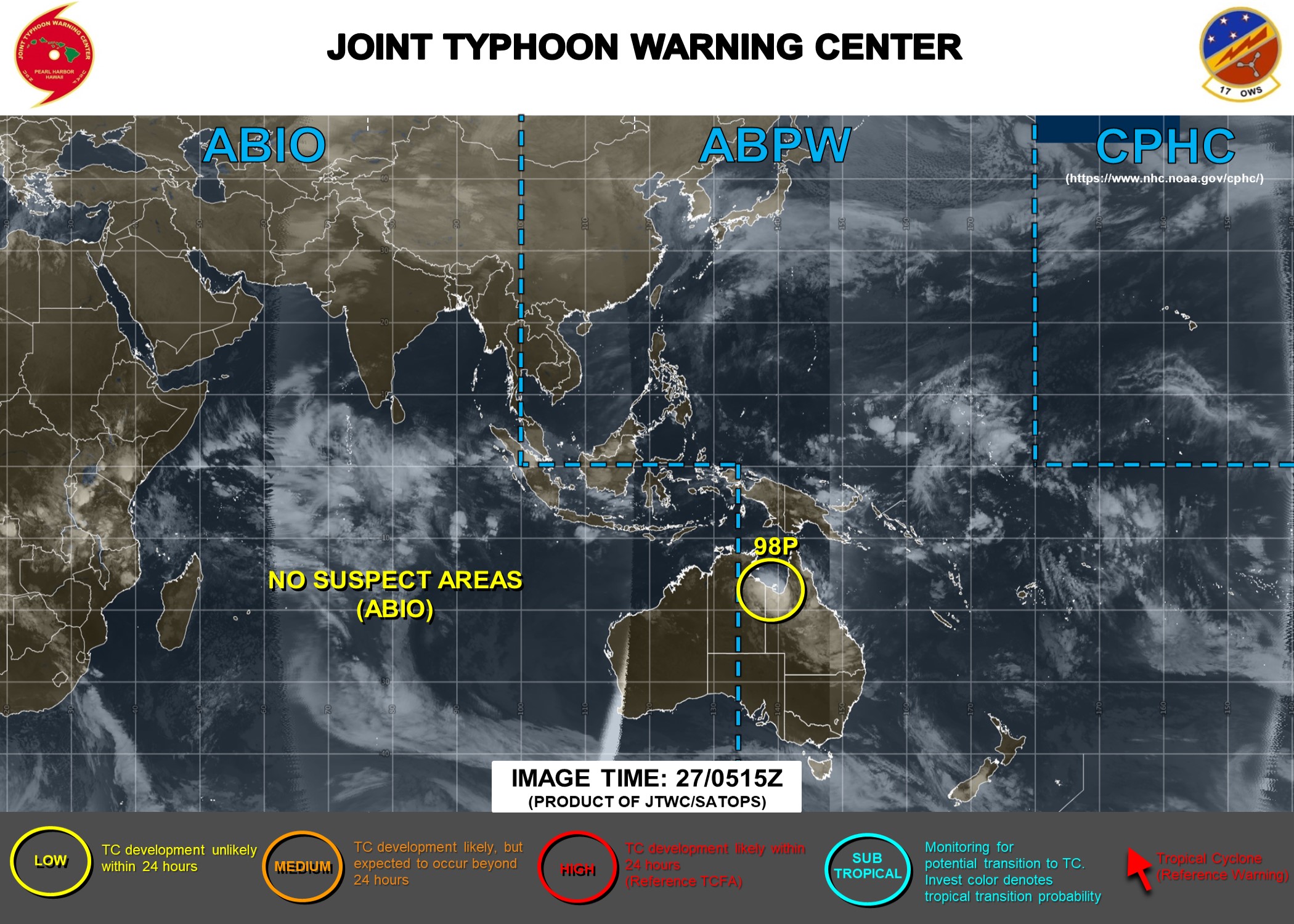
JTWC 27/06Z評級Low。
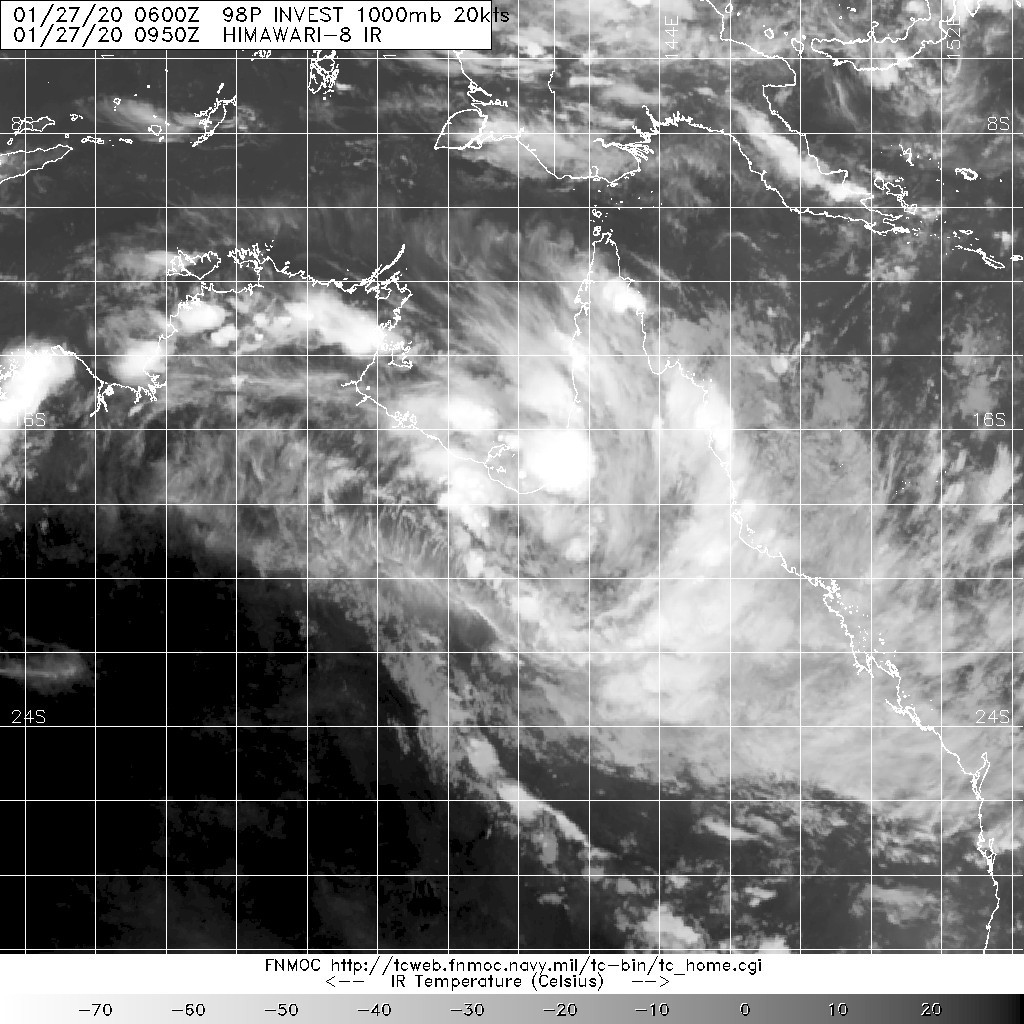
(1) AN AREA OF CONVECTION (INVEST 98P) HAS PERSISTED NEAR
18.4S 139.4E, APPROXIMATELY 102 NM SOUTH OF MORNINGTON ISLAND,
AUSTRALIA. ANIMATED MULTISPECTRAL SATELLITE IMAGERY, ALONG WITH THE
MORNINGTON ISLAND RADAR LOOP, SHOWS A DEVELOPING LOW LEVEL
CIRCULATION (LLC) PARTIALLY OBSCURED BY POCKETS OF DEEP CONVECTION.
A 270412Z AMSR2 GW1 89GHZ MICROWAVE IMAGE REVEALS THE POCKETS OF
DEEP CONVECTION OVERHEAD THE LLC WITH POTENTIAL FRAGMENTED FORMATIVE
BANDING TO THE EAST, OVER CAPE YORK PENINSULA. A RECENT OBSERVATION
AT MORNINGTON ISLAND AIRPORT SHOWS 16 KNOT WEST-NORTHWESTERLY WINDS.
98P IS CURRENTLY EXPERIENCING FAVORABLE UPPER LEVEL SUPPORT WITH LOW
(5 TO 10 KNOT) VERTICAL WIND SHEAR AND GOOD DUAL CHANNEL OUTFLOW.
WHILE 98P IS CURRENTLY OVER LAND, THERE IS A POSSIBILITY THAT IT
WILL MOVE OVER THE VERY WARM (31 TO 32 CELSIUS) SEA SURFACE IN THE
GULF OF CARPENTARIA. GLOBAL MODELS ARE IN GOOD AGREEMENT THAT 98P
WILL MOVE SLIGHTLY NORTHWARD, SKIRTING THE COASTLINE, BEFORE MOVING
BACK SOUTH WITH MINIMAL OVERALL INTENSIFICATION; HOWEVER,
INTENSIFICATION POTENTIAL IS HIGHLY DEPENDENT ON HOW LONG THE SYSTEM
REMAINS OVER THE GULF OF CARPENTARIA. MAXIMUM SUSTAINED SURFACE
WINDS ARE ESTIMATED AT 15 TO 20 KNOTS. MINIMUM SEA LEVEL PRESSURE IS
ESTIMATED TO BE NEAR 1002 MB. THE POTENTIAL FOR THE DEVELOPMENT OF A
SIGNIFICANT TROPICAL CYCLONE WITHIN THE NEXT 24 HOURS IS LOW.


BoM在熱帶氣旋展望報告中亦不看好其未來發展。
Tropical Cyclone Outlook
IDD10610
Tropical Cyclone Outlook for the Northern Region, including the Gulf of Carpentaria
Issued at 2:15 pm CST on Monday 27 January 2020
for the period until midnight CST Thursday 30 January 2020.
Existing Cyclones in the Northern Region:
Nil.
Potential Cyclones:
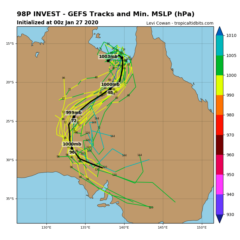
A weak tropical low, 1003 hPa is located over the Gulf Country in Queensland near 18.2S 139.1E, about 340 kilometres east northeast of Brunette Downs at 2.00pm CST on 27 January. This tropical low is slowly moving towards the northeast and may briefly move over the southern Gulf of Carpentaria waters on Tuesday, before moving back over land on Wednesday and track to the southwest towards the Northern Territory/Queensland border.
In the longer term, the tropical low is expected move southwest across the central or southern districts of the Northern Territory.
Likelihood of a tropical cyclone in the Northern Region on:
Tuesday:Very Low.
Wednesday:Low.
Thursday:Very Low.
NOTES: The likelihood is an estimate of the chance of each system being a tropical cyclone in the Region for each day.
Very Low:less than 5%Low:5% to 20%
Moderate:20 to 50%High:Over 50%
The area of coverage for this outlook is the Ocean area south of 9S, between 125E and 142E, including the Gulf of Carpentaria, but excluding the area around Timor (northwest of 11S 125E, 11S 128E, 9S 128E).
|
|