|
|
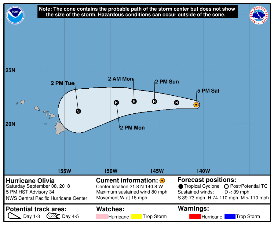
70節強度正式進入中太,CPHC 開始發報。
WTPA45 PHFO 090302
TCDCP5
Hurricane Olivia Discussion Number 34
NWS Central Pacific Hurricane Center Honolulu HI EP172018
500 PM HST Sat Sep 08 2018
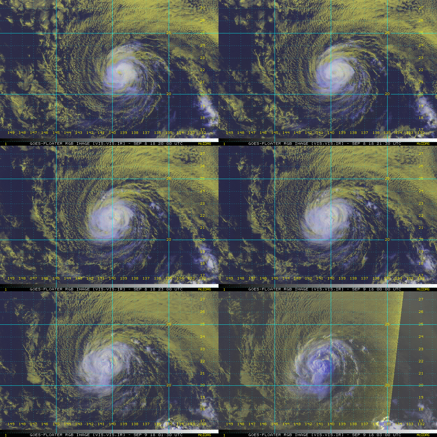
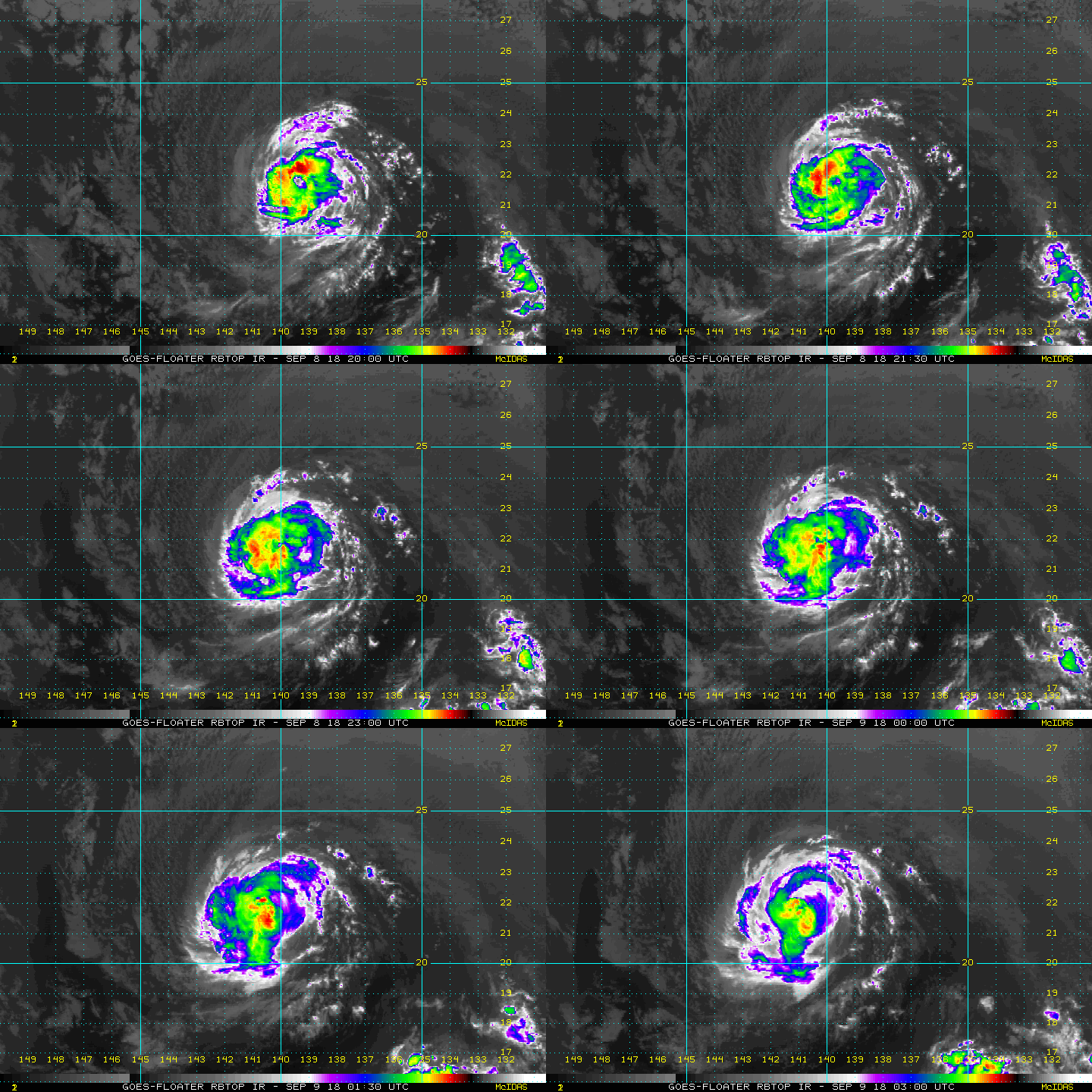
Olivia lost its well-defined center feature in conventional
satellite imagery late this afternoon and now appears as a rather
messy asymmetric blob of deep convection. However, SSMI and GMI
overpasses at 2349 and 2336 UTC, respectively, showed an eyewall
remained, except for a break on the west side, along with a very
well organized low level circulation. The satellite intensity
estimates showed some spread, with 4.5 from PHFO and UW-CIMSS ADT,
4.0 from TAFB and SAB, 3.5 from JTWC. The current intensity was
lowered to 70 kt based on a blend of these estimates, and
considering the degradation seen in the satellite imagery over the
last few hours.
The initial motion estimate is 280/14. Olivia is moving just north
of due west, to the south of strong deep layer ridging to the west
through north of the tropical cyclone. Little change is
anticipitated for the first 48 hours or so as this ridging builds
westward in tandem with Olivia. After 48 hours, the portion of the
ridge to the west of Olivia is forecast to strengthen, shunting the
tropical cyclone on a more west-southwest motion. The track
guidance remains fairly tightly clustered, and this forecast is very
similar to the previous forecast track, which brings the center of
Olivia over the main Hawaiian Islands between 72 and 96 hours. A
more westward motion is expected to resume after Olivia's passage
through the islands, as the upper ridge retreats westward and the
circulation center becomes increasingly steered by the lower level
trades.
Olivia is in a very weak shear environment, but moving over
marginal sea surface temperatures of 25.5C. The hurricane has
already traversed the coolest water it was going to encounter, but
SSTs stay sub-27C until Olivia gets close to the islands. This
should allow Olivia to only very slowly weaken or maintain intensity
through the next 24 to 48 hours. Shear should begin to gradually
increase over Olivia after 48 hours, leading to a slow weakening
trend, but likely not soon enough to prevent some significant
impacts to the main Hawaiian Islands.
KEY MESSAGES:
1. It is important to recognize that errors in both forecast track
and intensity, particularly at longer time ranges, can be large.
While it is too soon to determine the location and magnitude of the
worst impacts, all interests in Hawaii should continue to monitor
the progress of Olivia, and use this time to prepare for the
increasing liklihood of direct impacts from this system.
2. Regardless of the exact track and intensity that Olivia takes
as it approaches the islands, significant effects often do extend
far from the center. In particular, the mountainous terrain of
Hawaii can produce localized areas of strongly enhanced winds and
rainfall, even well away from the tropical cyclone center.
FORECAST POSITIONS AND MAX WINDS
INIT 09/0300Z 21.8N 140.8W 70 KT 80 MPH
12H 09/1200Z 22.0N 142.9W 70 KT 80 MPH
24H 10/0000Z 22.1N 145.3W 70 KT 80 MPH
36H 10/1200Z 22.1N 147.5W 65 KT 75 MPH
48H 11/0000Z 22.0N 149.4W 65 KT 75 MPH
72H 12/0000Z 21.2N 153.5W 55 KT 65 MPH
96H 13/0000Z 20.1N 158.4W 50 KT 60 MPH
120H 14/0000Z 19.5N 163.5W 40 KT 45 MPH
$$
Forecaster R Ballard 


|
|