|
|
 霧峰追風者|2018-8-26 19:07
|
顯示全部樓層
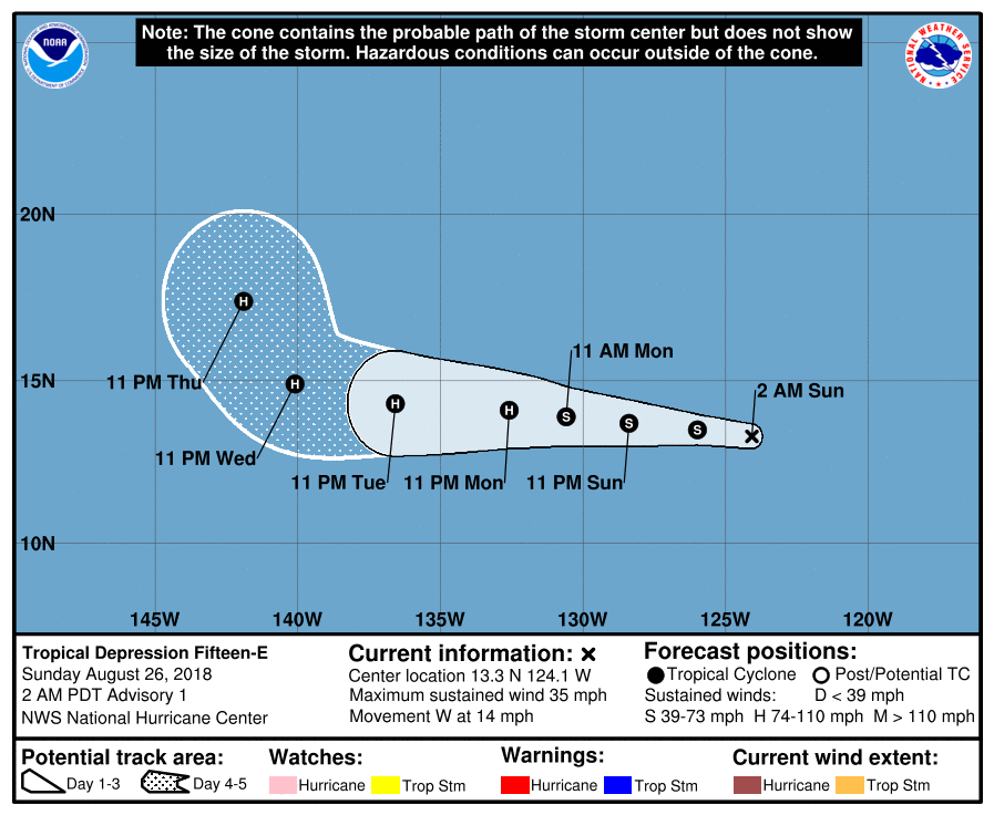
NHC 升格15E,逐漸增強,後期將進入中太。
276
WTPZ45 KNHC 260842
TCDEP5
Tropical Depression Fifteen-E Discussion Number 1
NWS National Hurricane Center Miami FL EP152018
200 AM PDT Sun Aug 26 2018
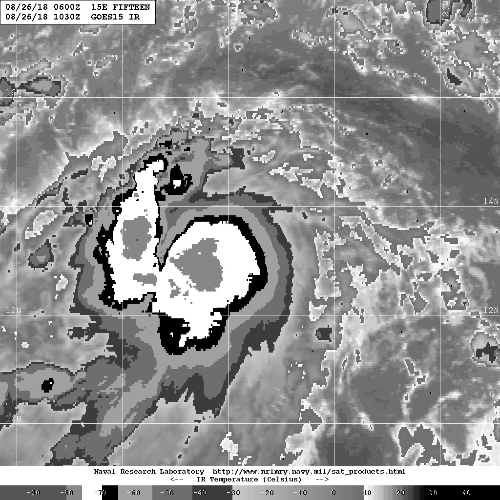
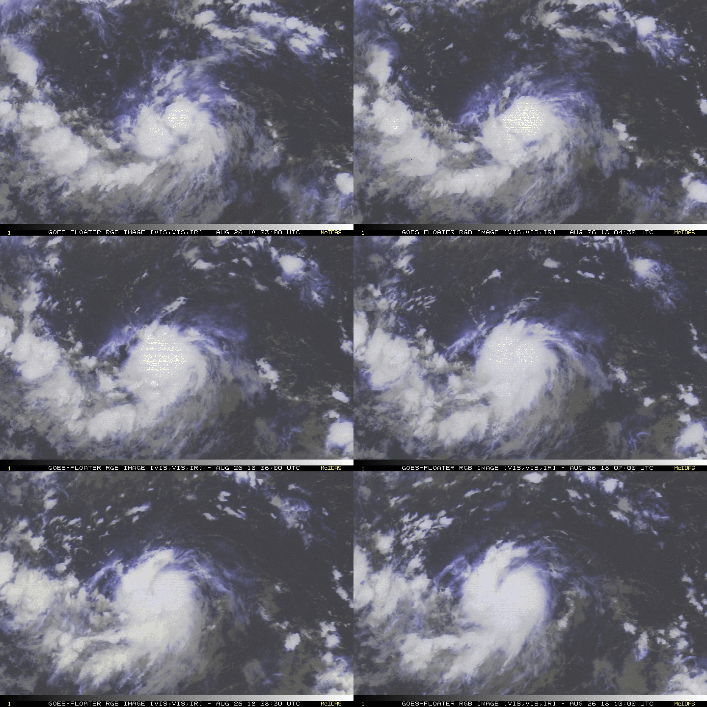
Various satellite data over the past several hours, including recent
ASCAT scatterometer surface-wind data, indicate that the
well-defined low pressure area located about 1000 nmi southwest of
the southern tip of the Baja California peninsula has become much
better organized, and has developed into a tropical depression. A
small CDO-like feature has formed over the well-defined center
depicted in the ASCAT data, and a recent burst of cold cloud tops of
-80C have also developed just west of the center. The initial
intensity of 30 kt is based on 0458Z and 0558Z ASCAT wind data,
which indicated winds of 28-30 kt were located 35-40 nmi west and
southwest of the low-level center.
The initial motion estimate is 280/10 kt. The depression is expected
to remain south of a strong deep-layer subtropical ridge for the
next 96 hours, resulting in a general westward motion at a slightly
faster forward speed. By day 5, the cyclone is forecast to move into
a break in the ridge created by a broad mid-/upper-level trough that
is forecast to dig southward out of the northern Pacific between
140W-145W longitude. The forecast track lies essentially down the
middle of the guidance envelope, which is just north of the
consensus model TVCE and the GFS model, but south of the ECMWF and
UKMET models. The HRWF and HMON models were not being available for
the TVCE consensus on this cycle, so some significant adjustments to
the track in the next advisory may be required.
The cyclone has a radius of maximum winds (RMW) of 35-40 nmi based
on the recent ASCAT data. The combination of the modest RMW, low
vertical wind shear of less than 10 kt, a very moist mid-level
environment, and sea-surface temperatures above 28 deg C, favors
steady intensification and even the possibility of rapid
strengthening. Since this is the first forecast, however, the
intensity forecast is on the conservative side and calls for a
climatological increase of one T-number or 20 kt every 24 h for the
next 48 hours, which is above all of the intensity guidance except
for the Navy COAMPS (CTCI) model. By 96-120 hours, the intensity is
leveled off due to possible entrainment of drier air and an increase
in southwesterly vertical wind shear.
FORECAST POSITIONS AND MAX WINDS
INIT 26/0900Z 13.3N 124.1W 30 KT 35 MPH
12H 26/1800Z 13.5N 126.0W 40 KT 45 MPH
24H 27/0600Z 13.7N 128.4W 50 KT 60 MPH
36H 27/1800Z 13.9N 130.6W 60 KT 70 MPH
48H 28/0600Z 14.1N 132.6W 70 KT 80 MPH
72H 29/0600Z 14.3N 136.6W 80 KT 90 MPH
96H 30/0600Z 14.9N 140.1W 90 KT 105 MPH
120H 31/0600Z 17.4N 141.9W 90 KT 105 MPH
$$
Forecaster Stewart 


|
|