|
|
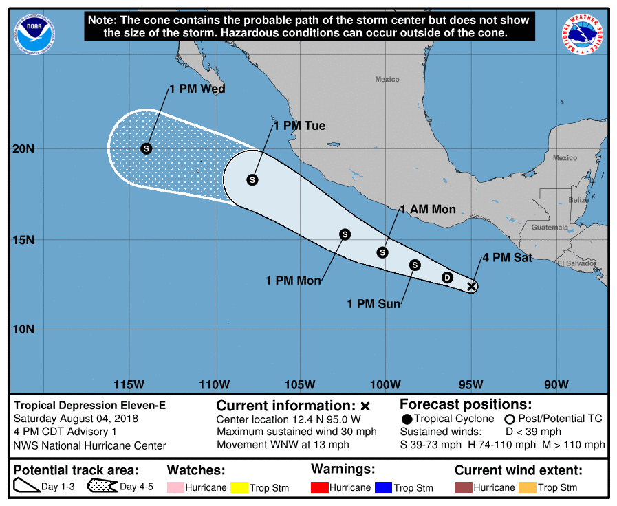
NHC 升格熱帶低壓11E,巔峰上望50KT。
280
WTPZ41 KNHC 042034
TCDEP1
Tropical Depression Eleven-E Discussion Number 1
NWS National Hurricane Center Miami FL EP112018
400 PM CDT Sat Aug 04 2018
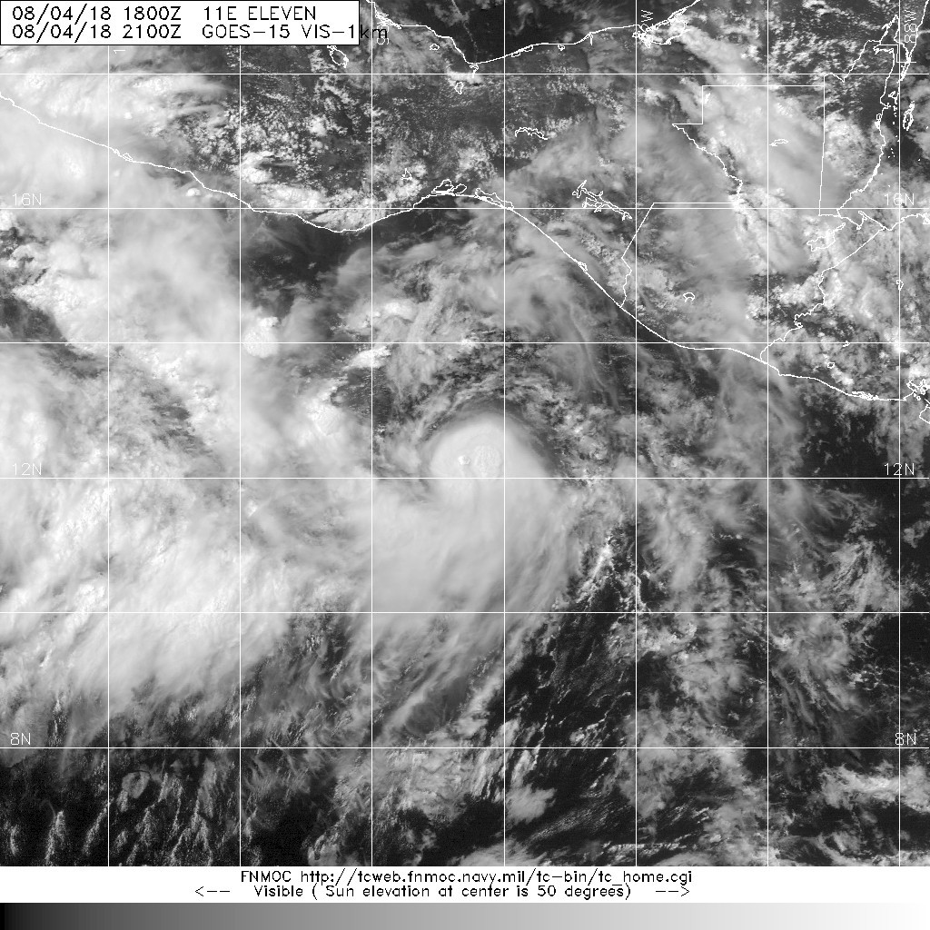
Satellite images indicate that the disturbance located over the far
eastern Pacific has become significantly better organized
throughout the day, with the formation of a well-defined low
pressure center and deep convection organized in a distinct curved
band. Based on these criteria, the system is being designated as a
tropical depression, and the initial intensity is set at 25 kt in
accordance with Dvorak estimates from TAFB and SAB.
Because the system has congealed so quickly, the initial motion is
uncertain but estimated to be 285/11 kt. The cyclone's future
motion will ultimately be dictated by a large mid-tropospheric
ridge to its north and its proximity to another disturbance located
about 450 n mi to the west. A west-northwestward motion at a
nearly constant speed is expected during the next 2-3 days due to
the ridge. After that time, the cyclone could begin to slingshot
around the northern side of the larger weather system to its west.
Many of the track models are not handling the depression very well;
the GFS barely depicts a surface low from the get-go, and the HWRF
does not appear to be accounting sufficiently for the possibility of
binary interaction. As a result, the NHC official track forecast
matches the consensus of the ECMWF and UKMET, the only two models
which appear to have a decent grasp on the situation.
Although the depression will be moving over very warm waters of
29-30 degrees Celsius over the next 2-3 days, the upper-level wind
environment may not be ideal due to possible outflow from the larger
disturbance to the west. As a result, the official intensity
forecast is not too aggressive and is essentially close to the ICON
intensity consensus. Even though the ECMWF and UKMET were used for
the track forecast, the two models disagree on the cyclone's
ultimate demise. The ECMWF has the system absorbed by the other
disturbance by day 4, while the UKMET keeps it distinct and holds it
just beyond the forecast period. As a compromise, the official
forecast shows dissipation or absorption by day 5, but the
confidence in this forecast is low.
Based on the forecast, tropical-storm-force winds are expected to
remain offshore the coast of Mexico. However, only a slight
deviation in the forecast track or an increase in size could bring
those winds closer to the coast, and interests along the southern
and southwestern coast of Mexico should monitor the progress of the
depression.
FORECAST POSITIONS AND MAX WINDS
INIT 04/2100Z 12.4N 95.0W 25 KT 30 MPH
12H 05/0600Z 12.9N 96.4W 30 KT 35 MPH
24H 05/1800Z 13.6N 98.3W 35 KT 40 MPH
36H 06/0600Z 14.3N 100.2W 40 KT 45 MPH
48H 06/1800Z 15.3N 102.4W 45 KT 50 MPH
72H 07/1800Z 18.3N 107.8W 50 KT 60 MPH
96H 08/1800Z 20.0N 114.0W 45 KT 50 MPH
120H 09/1800Z...DISSIPATED
$$
Forecaster Berg 

|
|