開啟輔助訪問
 找回密碼
 立即加入

07E.Fabio 機構看好發展

簽到天數: 2414 天

[LV.Master]伴壇終老

2018-6-28 15:13 | 顯示全部樓層
  基本資料  
編號    :07 E
擾動編號日期:2018 06 28 13
撤編日期  :2018 06 00 00
97E.INVEST.20kts.1004mb.9.5N.94W

20180628.0600.goes-15.ir.97E.INVEST.20kts.1004mb.9.5N.94W.100pc.jpg

NHC : 50%
1. A large area of cloudiness and showers south of the Gulf of
Tehuantepec is associated with a westward-moving tropical wave.
Environmental conditions are forecast to be conducive for
development of this system over the next several days, and a
tropical depression is expected to form well south of the coast of
Mexico by this weekend.
* Formation chance through 48 hours...medium...50 percent.
* Formation chance through 5 days...high...90 percent.

two_pac_2d1.png

評分

參與人數 1水氣能量 +15 +1 收起 理由
king111807 + 15 + 1 熱帶擾動首帖

查看全部評分

回復

使用道具 舉報

簽到天數: 601 天

[LV.9]以壇為家II

霧峰追風者|2018-6-29 21:42 | 顯示全部樓層
NHC 展望提升至70%
1. Showers and thunderstorms associated with a broad area of
low pressure located several hundred miles south of Acapulco,
Mexico, continue to become better organized.  Environmental
conditions are forecast to be conducive for development over the
next several days, and a tropical depression is likely to form
over the weekend, well south of the coast of Mexico.
* Formation chance through 48 hours...high...70 percent.
* Formation chance through 5 days...high...90 percent.
two_pac_2d1.png

回復

使用道具 舉報

簽到天數: 601 天

[LV.9]以壇為家II

霧峰追風者|2018-7-1 17:03 | 顯示全部樓層
本帖最後由 霧峰追風者 於 2018-7-1 17:04 編輯

NHC 命名報,巔峰上望MH。
000
WTPZ42 KNHC 010843
TCDEP2

Tropical Storm Fabio Discussion Number   3
NWS National Hurricane Center Miami FL       EP072018
300 AM MDT Sun Jul 01 2018

Satellite imagery indicates that the convection associated with
Tropical Depression Seven-E has become better organized, with very
cold cloud tops near and west of the center along with a large area
of outer banding.  A recent GMI overpass suggests that the system
has not yet developed a tight inner core.  However, the various
satellite intensity estimates are now 35-45 kt.  Thus, the cyclone
is upgraded to Tropical Storm Fabio with a possibly conservative
initial intensity of 35 kt.

The initial motion is 285/11.  The track guidance is in good
agreement that Fabio should move west-northwestward on the
southwest side of the subtropical ridge for the next several days,
with a turn toward the northwest near the end of the forecast
period.  There has been little change in the guidance since the
previous advisory, so the new forecast track is an update of the
previous forecast that lies near or just north of the model
consensus.

Fabio should be over warm water and in an environment of light
vertical wind shear for the next 72 h or so, and steady to rapid
strengthening is expected during that time.  There remains some
spread in the guidance, with the HWRF model continuing to show less
intensification than the statistical-dynamical SHIPS and LGEM
models.  The new intensity forecast will again trend above that of
the previous forecast, with steady strengthening during the first 24
h followed by rapid strengthening from 24-48 h.  It should be noted
that the forecast intensities through 72 h are lower than the SHIPS
and LGEM models, and they are in best overall agreement with the
HCCA consensus model.  After 72 h, Fabio should move over steadily
decreasing sea surface temperatures and weaken quickly.


FORECAST POSITIONS AND MAX WINDS

INIT  01/0900Z 11.6N 106.4W   35 KT  40 MPH
12H  01/1800Z 12.0N 108.1W   45 KT  50 MPH
24H  02/0600Z 12.7N 110.4W   55 KT  65 MPH
36H  02/1800Z 13.3N 112.5W   70 KT  80 MPH
48H  03/0600Z 14.0N 114.6W   85 KT 100 MPH
72H  04/0600Z 15.5N 119.5W  100 KT 115 MPH
96H  05/0600Z 18.0N 124.5W   80 KT  90 MPH
120H  06/0600Z 21.0N 129.5W   55 KT  65 MPH

$$
Forecaster Beven
084419_5day_cone_no_line_and_wind.png rbtop-animated (1).gif
回復

使用道具 舉報

簽到天數: 601 天

[LV.9]以壇為家II

霧峰追風者|2018-7-4 11:10 | 顯示全部樓層
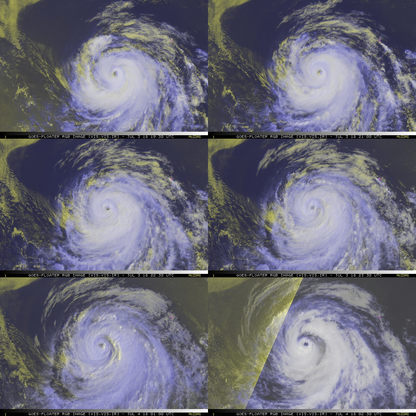
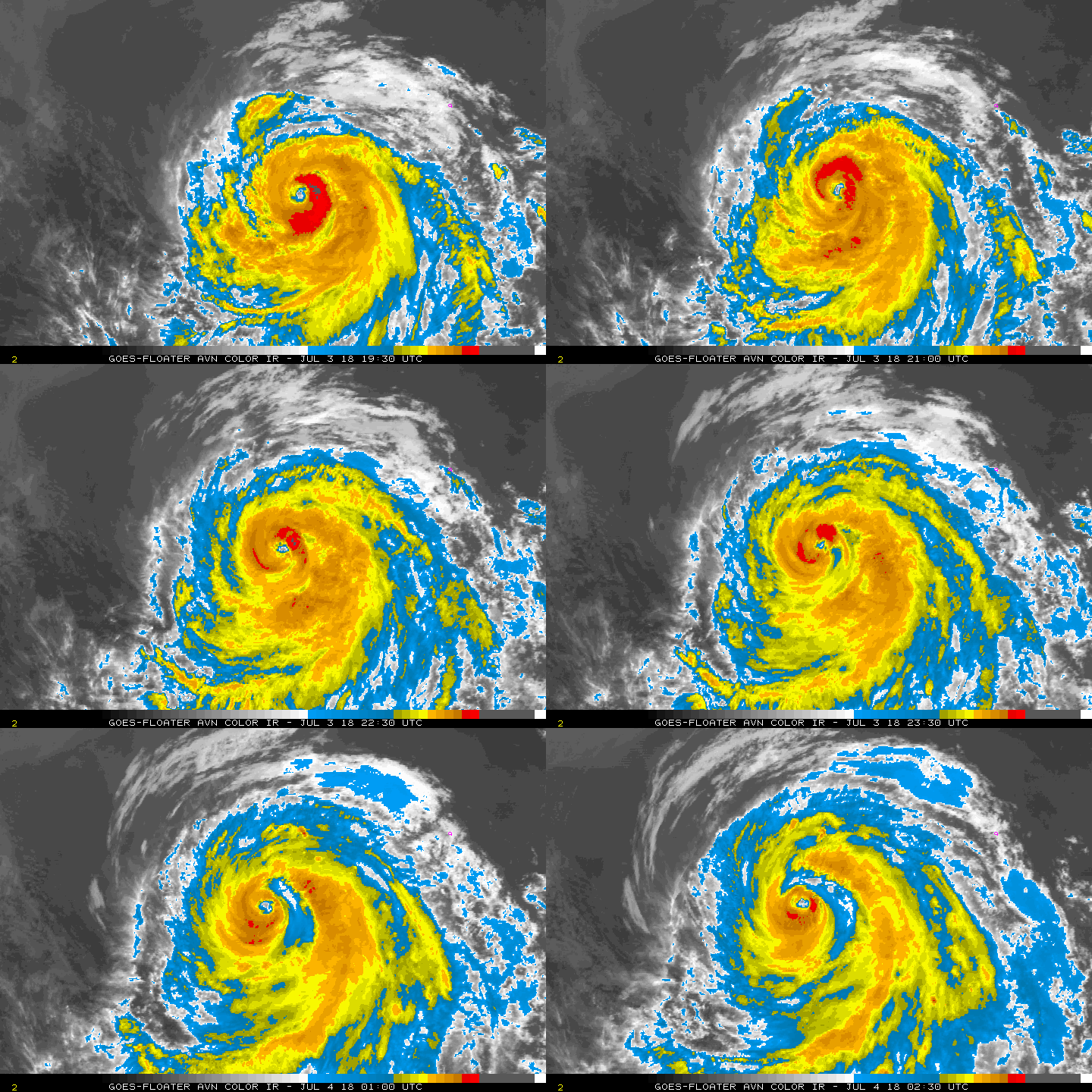
風眼開啟,強度升二級颶風,預計已經到達顛峰。
000
WTPZ42 KNHC 040233
TCDEP2

Hurricane Fabio Discussion Number  14
NWS National Hurricane Center Miami FL       EP072018
800 PM PDT Tue Jul 03 2018

The intensification trend of Fabio appears to have ended.  Several
hours ago, satellite images showed a ring of cold cloud tops
surrounding a distinct eye.  However, more recent data indicate that
the structure of Fabio has deteriorated with a pronounced dry slot
evident on the east side of the circulation.  Blending the latest
intensity estimates from TAFB, SAB, and CIMSS at the University of
Wisconsin support holding the initial wind speed at 95 kt, but this
could be a little generous.

Fabio is currently over marginally warm 27 degree C waters, but it
is headed for much cooler waters during the next several days. These
unfavorable oceanic conditions combined with a more stable airmass
and an increase in southwesterly shear should cause steady weakening
through the forecast period.  Fabio is forecast to weaken below
hurricane strength in 36 to 48 hours, and it is predicted to become
a remnant low by 96 hours.  The intensity models are in fair
agreement, and the NHC forecast lies between the HCCA and ICON
consensus aids.

The hurricane continues to move west-northwestward at 13 kt.  There
is no change to the track forecast reasoning.  Fabio is expected to
continue west-northwestward to northwestward at about the same
forward speed during the next few days while it moves on the
southwestern periphery of a mid-level ridge.  By the end of the
forecast period, when Fabio is a weak and shallow system, the
cyclone is predicted to slow down as it becomes more influenced by
the low-level flow.  The track models remain in good agreement, and
the NHC forecast lies near the middle of the guidance envelope.

FORECAST POSITIONS AND MAX WINDS

INIT  04/0300Z 16.5N 117.9W   95 KT 110 MPH
12H  04/1200Z 17.4N 119.7W   90 KT 105 MPH
24H  05/0000Z 18.9N 122.2W   80 KT  90 MPH
36H  05/1200Z 20.4N 124.7W   65 KT  75 MPH
48H  06/0000Z 22.0N 127.0W   50 KT  60 MPH
72H  07/0000Z 24.8N 131.1W   40 KT  45 MPH
96H  08/0000Z 26.7N 135.0W   30 KT  35 MPH...POST-TROP/REMNT LOW
120H  09/0000Z 28.1N 138.0W   25 KT  30 MPH...POST-TROP/REMNT LOW

$$
Forecaster Cangialosi
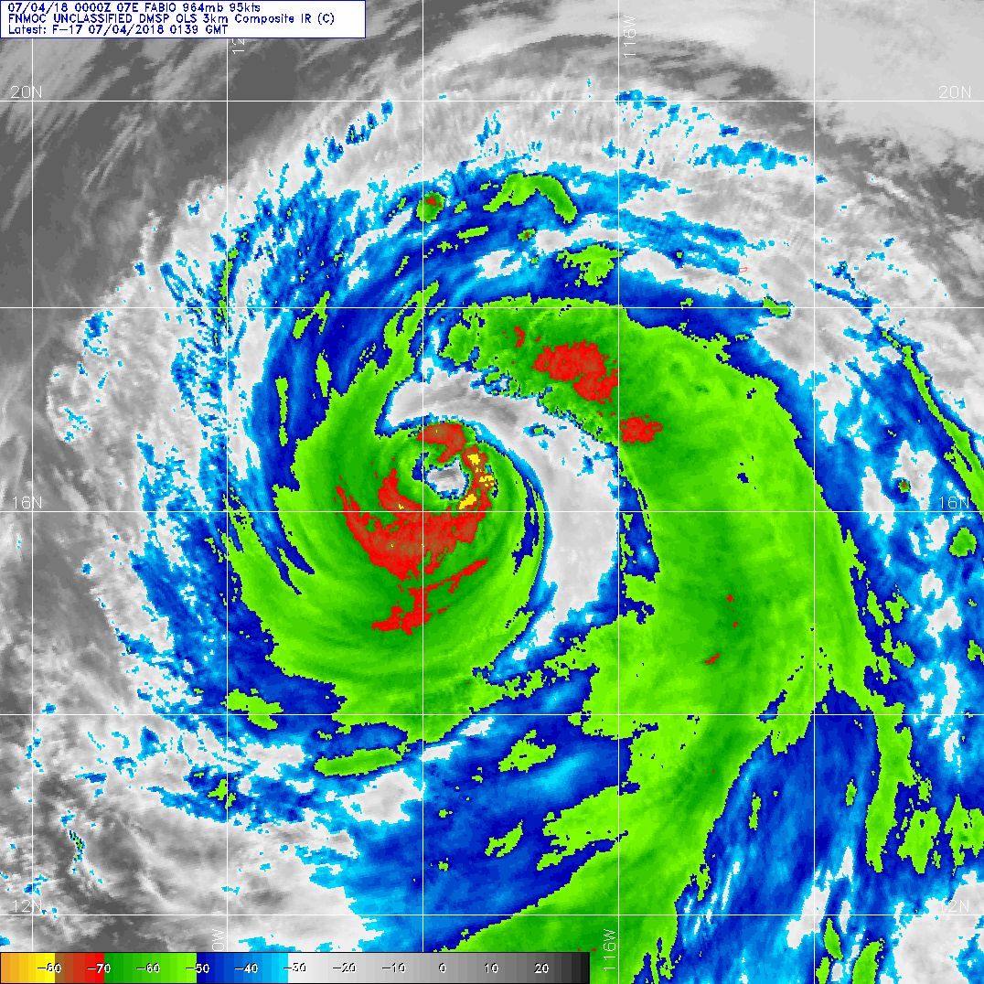
20180704.0139.f17.ir.olsircomp.07E.FABIO.x.jpg rgb-animated.gif avn-animated.gif

回復

使用道具 舉報

快速回覆
您需要登錄後才可以回帖 登錄 | 立即加入

本版積分規則

0908morakot

    主題

    帖子

    69萬

    積分

    12級[颶風Hurricane]

    Rank: 12Rank: 12Rank: 12

12級[颶風Hurricane]

發訊息

本平台僅供學術討論之用,預報應以氣象局為準

威普網站虛擬主機贊助公司

臺灣第一個天氣類型社群平台 即時天氣資訊、精準颱風動態

線上客服
FB傳送訊息
廣告行銷
精準行銷 物超所值
官方粉專
發佈 快速回復 返回頂部 返回列表