簽到天數: 3291 天 [LV.Master]伴壇終老
|
 t02436|2017-9-18 11:35
|
顯示全部樓層
瘋狂了...
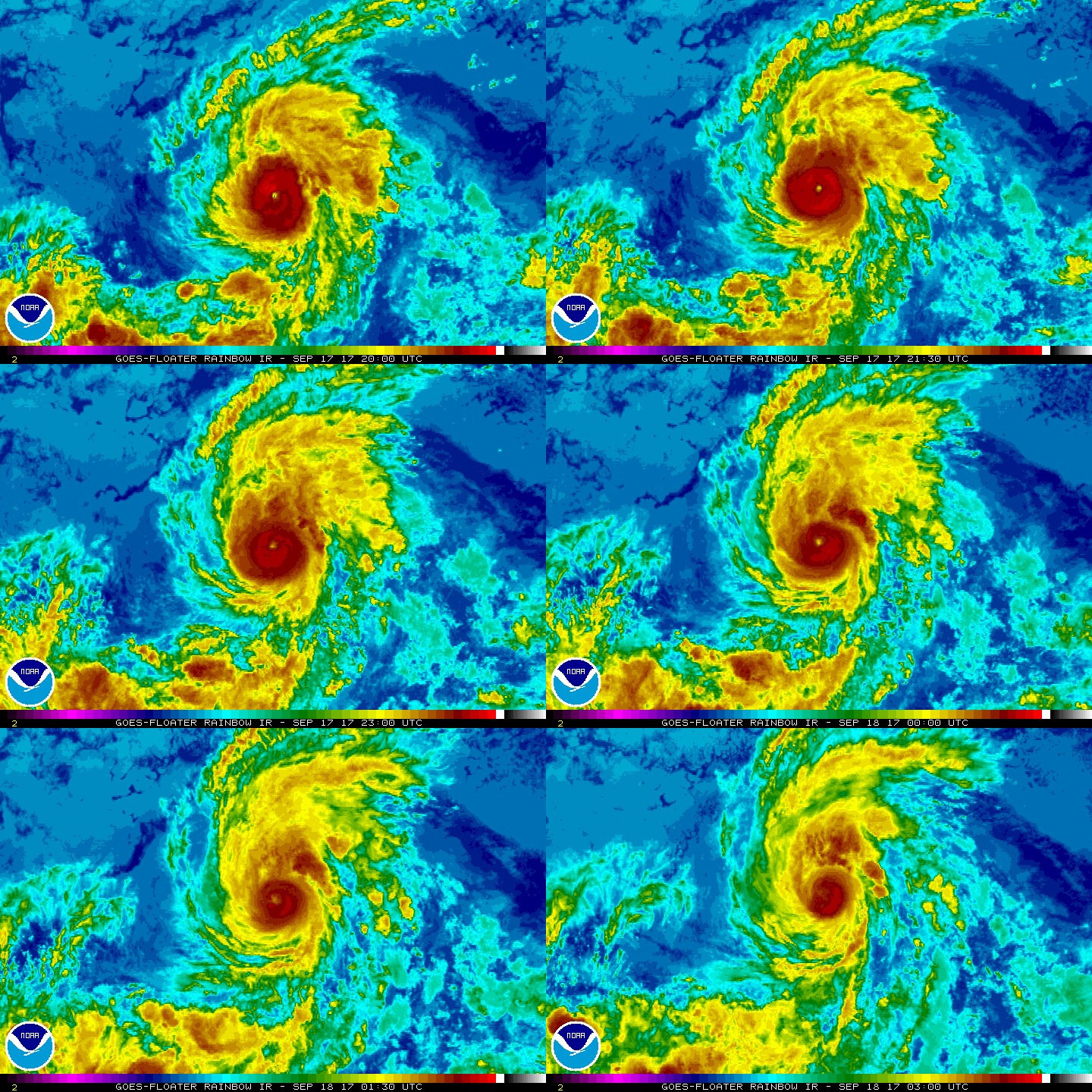
03Z評價100節,直衝MH,只不過風眼糊了,巔峰大概要過去了....
ZCZC MIATCDEP5 ALL
TTAA00 KNHC DDHHMM
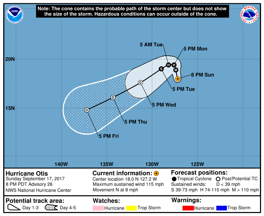
Hurricane Otis Discussion Number 26
NWS National Hurricane Center Miami FL EP152017
800 PM PDT Sun Sep 17 2017
Otis's rapid intensification rate has leveled off over the
past few hours, with the small clear eye not quite as distinct as
earlier. Still, the cloud pattern of the hurricane remains well
organized. While the 0000 UTC Dvorak estimates had subjective
values near 90 kt, a 6-hourly data-T average was 105 kt. As a blend
of these data, the initial wind speed is set to 100 kt. Otis is
moving over marginal SSTs now, so any further intensification is
expected to be slight. By tomorrow night, a combination of lower
SSTs, drier air and an increase in southerly shear is forecast to
cause a significant weakening of Otis. Almost all of the guidance
show rapid weakening by early Tuesday, and this is the solution
provided in the new NHC wind speed prediction. Global models
suggest Otis will lose organized deep convection within about 3
days, so the cyclone is forecast to degenerate into a remnant low at
that time.
Otis is moving faster to the north, now at 7 kt. The hurricane
should take a sharp westward turn in about 24 hours as it runs
into a building ridge over the eastern Pacific, then turn
west-southwest or southwest under that ridge. Very little change
was made to the previous forecast, which lies between the model
consensus and the ECMWF model.
FORECAST POSITIONS AND MAX WINDS
INIT 18/0300Z 18.0N 127.2W 100 KT 115 MPH
12H 18/1200Z 18.9N 127.4W 100 KT 115 MPH
24H 19/0000Z 19.4N 127.6W 85 KT 100 MPH
36H 19/1200Z 19.4N 128.2W 65 KT 75 MPH
48H 20/0000Z 19.0N 129.0W 45 KT 50 MPH
72H 21/0000Z 17.6N 131.3W 30 KT 35 MPH...POST-TROP/REMNT LOW
96H 22/0000Z 16.1N 134.3W 25 KT 30 MPH...POST-TROP/REMNT LOW
120H 23/0000Z 14.8N 137.2W 20 KT 25 MPH...POST-TROP/REMNT LOW
$$
Forecaster Blake
NNNN


|
|