簽到天數: 3291 天 [LV.Master]伴壇終老
|
 t02436|2017-9-9 11:19
|
顯示全部樓層
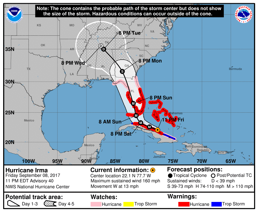
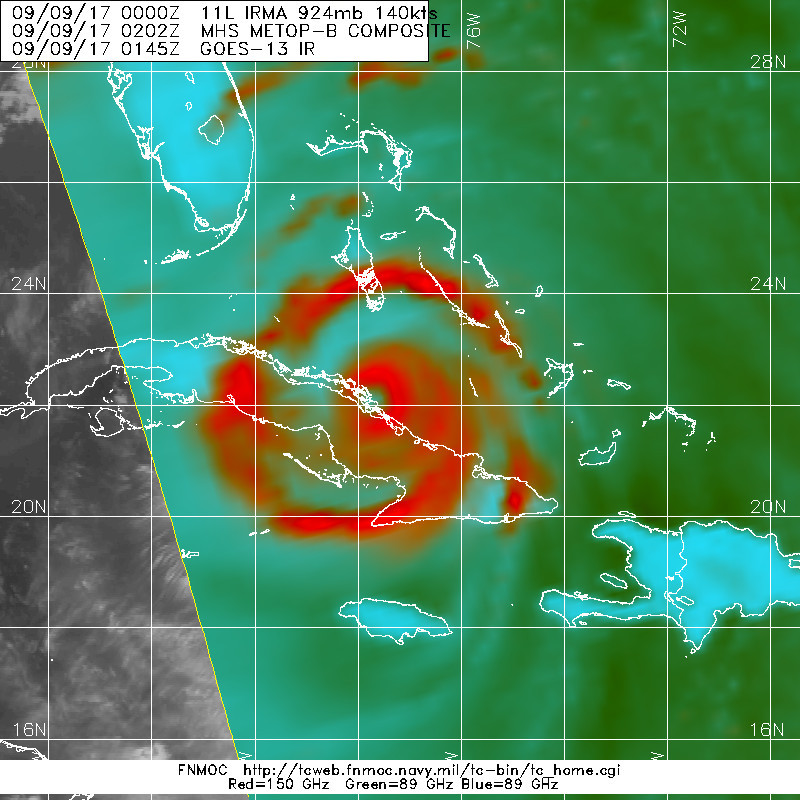
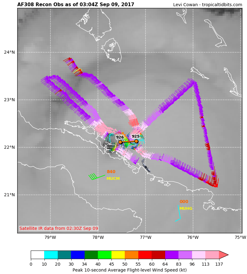
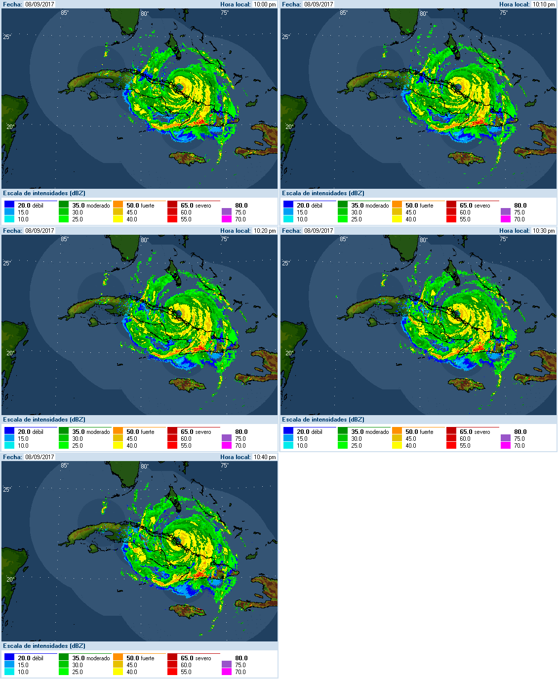
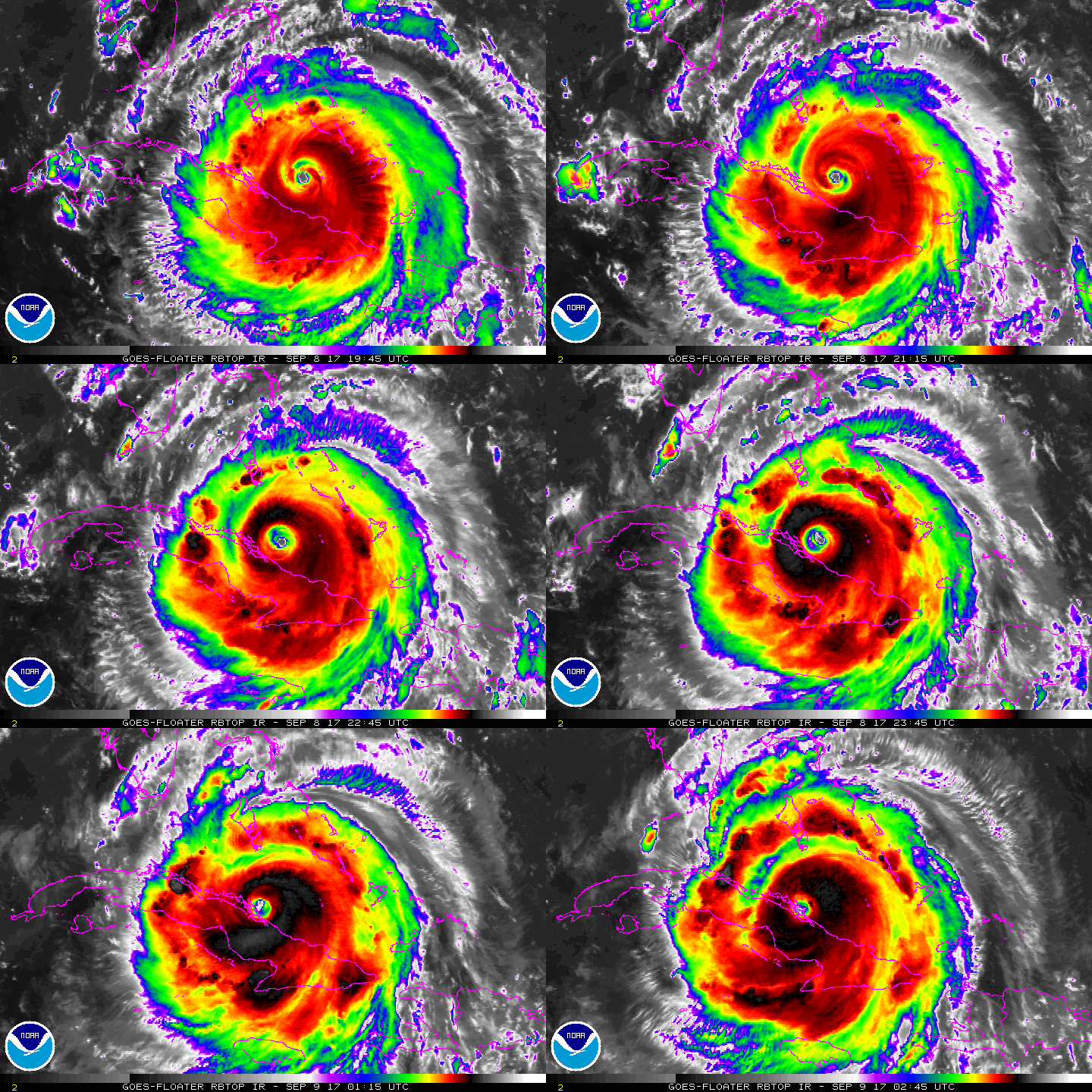
03Z報重回C5,只不過不小心走偏西太多,有半顆風眼已經進入古巴。
NHC持續認為將開始轉西北方向移動,登陸古巴與否將決定著Irma將以何種強度登陸美國...
000
WTNT41 KNHC 090259
TCDAT1
Hurricane Irma Discussion Number 40
NWS National Hurricane Center Miami FL AL112017
1100 PM EDT Fri Sep 08 2017
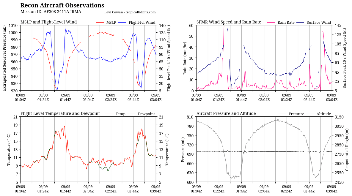
An Air Force Hurricane Hunter flight has found that Irma has
re-intensified to category 5 strength. The plane measured a
maximum flight-level wind of 154 kt and SFMR winds of 140-145 kt in
the northwestern eyewall, so the initial intensity is raised to 140
kt. The hurricane is producing very deep convection in all
quadrants around the eye, which the Air Force flight measured to be
35 n mi wide.
Apparently the ridge to the north of Irma has been stronger than
expected, and the initial motion remains westward, or 280/11 kt.
The track guidance continues to insist on Irma turning
west-northwestward soon, moving along the Cuban Keys adjacent to
the north coast of Cuba during the next 24 hours. After that time,
Irma is expected to turn sharply north-northwestward and accelerate
after 48 hours, moving parallel to the west coast of Florida and
then into Georgia. Mainly because Irma's eye has not deviated from
its westward motion, the new NHC forecast track has again shifted
slightly westward. Because of the hurricane's angle of approach to
the west coast of Florida, it is extremely difficult to pinpoint
exactly where the center might move onshore.
If the eye continues to move over the Cuban Keys and does not move
inland over the main island of Cuba, then Irma would likely not
lose much intensity during the next day or so. As we've stated
many times, fluctuations in intensity are likely during the next 36
hours due to possible and unpredictable eyewall replacement cycles.
After 36 hours, there are some indications that vertical shear may
increase over the hurricane, and a little more weakening is
anticipated at that time. Because of the concerns in the track
forecast noted above, Irma would be able to maintain a strong
intensity for a longer period of time if the center stays off the
west Florida coast. Regardless, Irma is still expected to be a
dangerous hurricane as it approaches the Florida Keys and the west
coast of Florida through 48 hours.
KEY MESSAGES:
1. Irma will continue to bring life-threatening wind, storm surge,
and rainfall hazards to portions of the Bahamas and the north coast
of Cuba, especially over the adjacent Cuban Keys, through Saturday.
2. Irma is expected to make landfall in Florida as an extremely
dangerous major hurricane, and will bring life-threatening wind
impacts to much of the state regardless of the exact track of the
center.
3. There is the danger of life-threatening storm surge inundation in
portions of central and southern Florida, including the Florida
Keys, during the next 36 hours, where a Storm Surge Warning is in
effect. The threat of significant storm surge flooding along the
southwest coast of Florida has increased, and 8 to 12 feet of
inundation above ground level is possible in this area. This is a
life-threatening situation. Everyone in these areas should take all
actions to protect life and property from rising water and follow
evacuation instructions from local officials.
4. Irma is expected to produce very heavy rain and inland flooding.
Total rain accumulations of 8 to 15 inches, with isolated amounts of
20 inches are expected over the Florida Keys and much of the Florida
peninsula through Tuesday night. Irma will likely bring periods of
heavy rain to much of the Florida Panhandle, Georgia, South
Carolina, and western North Carolina early next week, including some
mountainous areas which are more prone to flash flooding. All areas
seeing heavy rainfall from Irma will experience a risk of flooding
and flash flooding.
FORECAST POSITIONS AND MAX WINDS
INIT 09/0300Z 22.1N 77.7W 140 KT 160 MPH
12H 09/1200Z 22.6N 79.1W 140 KT 160 MPH
24H 10/0000Z 23.3N 80.6W 135 KT 155 MPH
36H 10/1200Z 24.5N 81.4W 130 KT 150 MPH
48H 11/0000Z 26.5N 81.9W 115 KT 130 MPH...INLAND
72H 12/0000Z 31.6N 83.8W 50 KT 60 MPH...INLAND
96H 13/0000Z 35.0N 87.0W 25 KT 30 MPH...INLAND
120H 14/0000Z 35.5N 87.5W 20 KT 25 MPH...POST-TROP/INLAND
$$
Forecaster Berg
|
|