簽到天數: 3291 天 [LV.Master]伴壇終老
|
 t02436|2017-8-17 11:21
|
顯示全部樓層
03Z站上90節
000
WTNT43 KNHC 170232
TCDAT3
Hurricane Gert Discussion Number 17
NWS National Hurricane Center Miami FL AL082017
1100 PM AST Wed Aug 16 2017
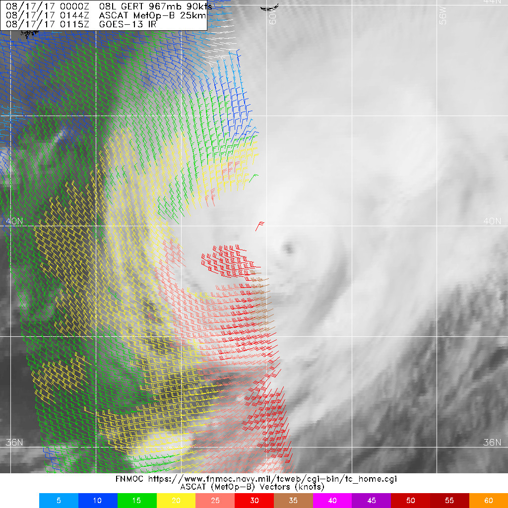
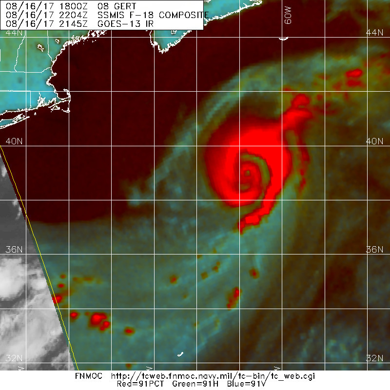
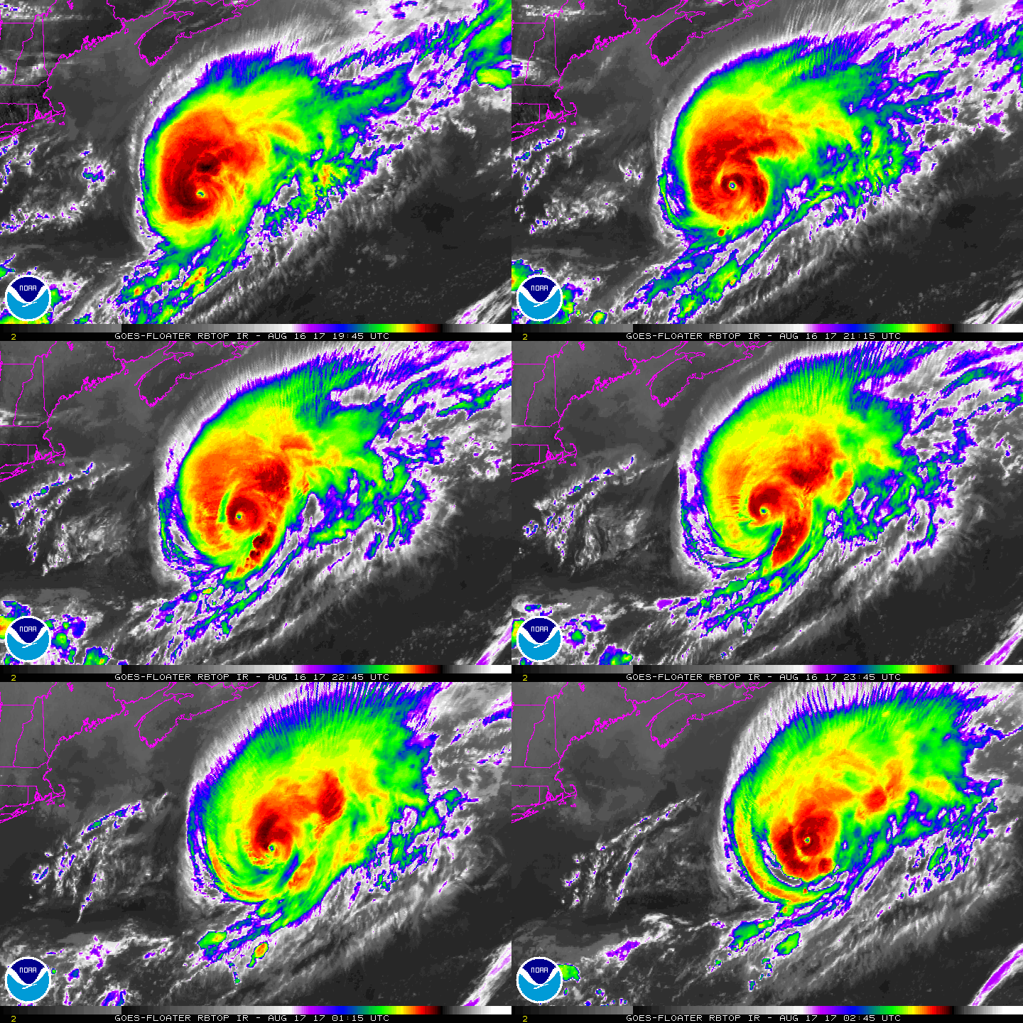
Gert has maintained an eye with very cold cloud tops mainly over
the northern and western portions of the circulation, which is
rather remarkable for a system at 40N latitude. The current
intensity is set a little higher, to 90 kt, in agreement with the
latest Dvorak estimates from TAFB and SAB. The cyclone has
continued to traverse warm waters, but very soon will encounter a
much cooler ocean to the north of the Gulf Stream. Thus, rapid
weakening is forecast, similar to the latest model consensus. In 36
hours the global model guidance depicts the system becoming embedded
in a distinct baroclinic zone, so Gert should have become an
extratropical storm by that time. The extratropical cyclone is
forecast to merge with another large low over the north Atlantic
after 72 hours.
Gert has continued to accelerate and is now moving
east-northeastward near 32 kt. A slightly faster motion is
expected on Thursday in the strong flow to the southeast of a
mid-tropospheric cyclone nearing Newfoundland. Later in the
forecast period, the post-tropical system is likely to turn
northeastward and slow down significantly while it interacts with
the other large low.
The track, intensity, and wind radii forecasts have incorporated
guidance from NOAA's Ocean Prediction Center.
Swells from Gert should continue to affect the northeast U.S. coast
and Atlantic Canada through Thursday. These swells are likely to
produce dangerous surf and rip current conditions. Please consult
products from your local weather forecast office for more
information.
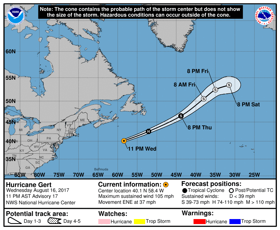
FORECAST POSITIONS AND MAX WINDS
INIT 17/0300Z 40.1N 58.4W 90 KT 105 MPH
12H 17/1200Z 42.6N 52.1W 75 KT 85 MPH
24H 18/0000Z 46.5N 43.8W 60 KT 70 MPH
36H 18/1200Z 50.5N 38.0W 50 KT 60 MPH...POST-TROP/EXTRATROP
48H 19/0000Z 52.5N 35.0W 45 KT 50 MPH...POST-TROP/EXTRATROP
72H 20/0000Z 53.5N 31.5W 40 KT 45 MPH...POST-TROP/EXTRATROP
96H 21/0000Z...DISSIPATED
$$
Forecaster Pasch


|
|