簽到天數: 3291 天 [LV.Master]伴壇終老
|
 t02436|2017-3-28 09:38
|
顯示全部樓層
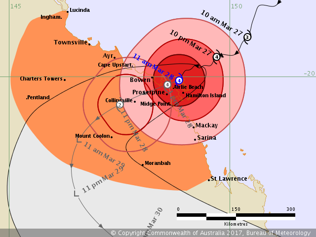
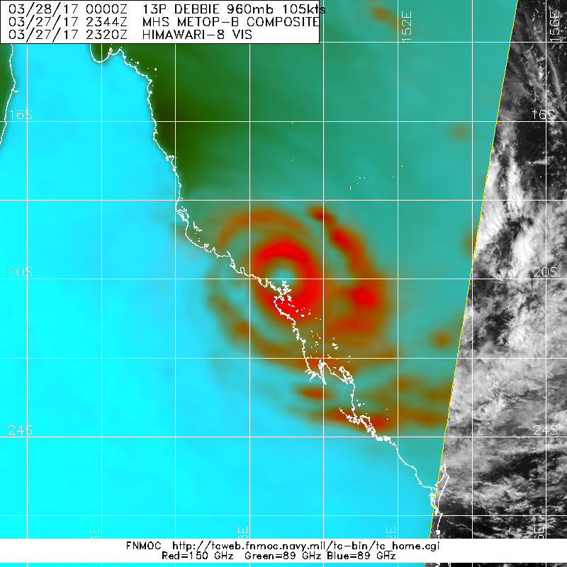
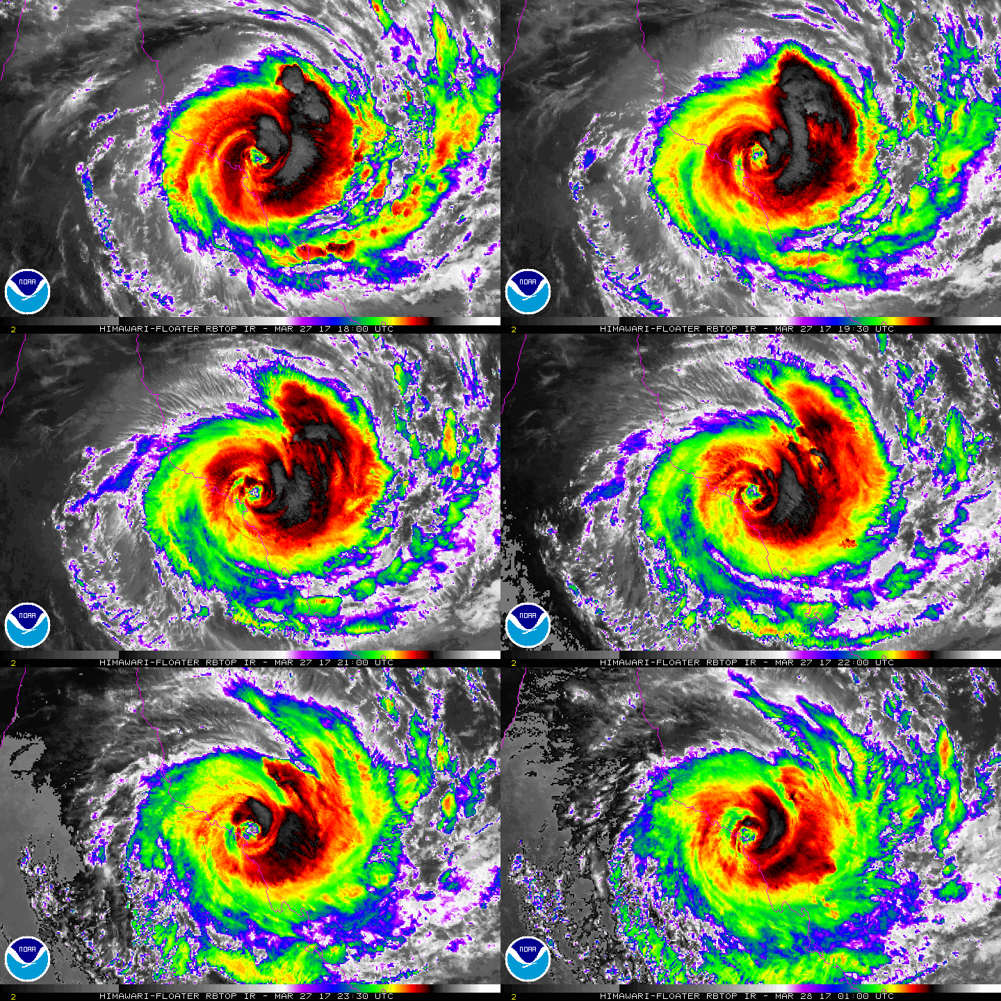
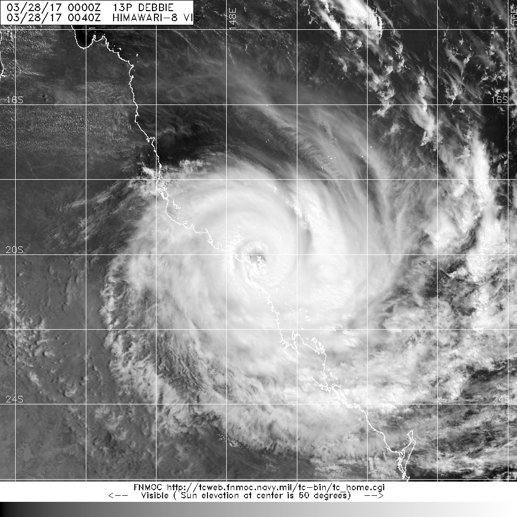
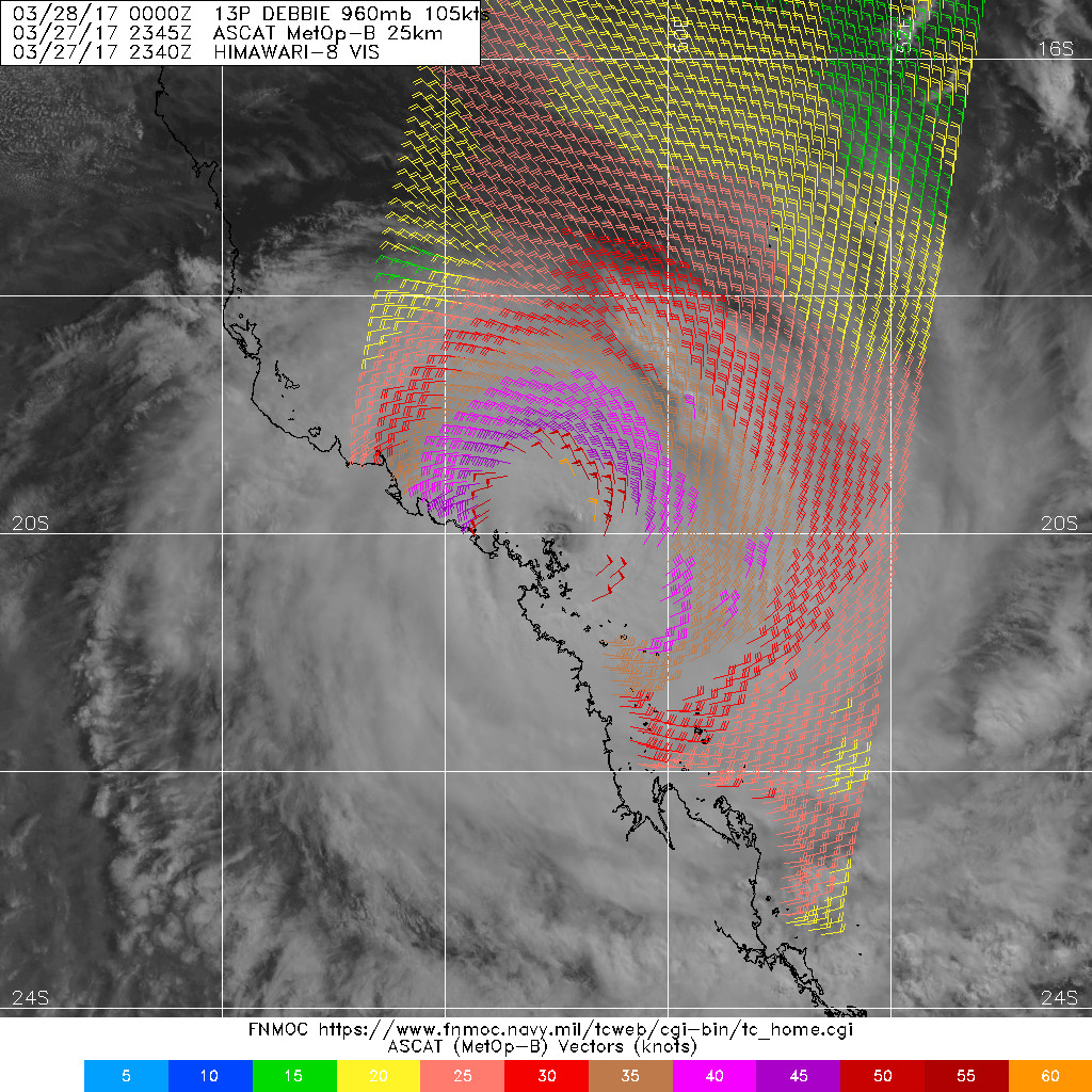
21Z強度略調至100節,眼牆已經上陸,即將登陸
IDQ20018
TROPICAL CYCLONE TECHNICAL BULLETIN: AUSTRALIA - EASTERN REGION
Issued by BRISBANE TROPICAL CYCLONE WARNING CENTRE
at: 0117 UTC 28/03/2017
Name: Severe Tropical Cyclone Debbie
Identifier: 24U
Data At: 0100 UTC
Latitude: 20.1S
Longitude: 148.8E
Location Accuracy: within 15 nm [30 km]
Movement Towards: southwest [225 deg]
Speed of Movement: 5 knots [9 km/h]
Maximum 10-Minute Wind: 100 knots [185 km/h]
Maximum 3-Second Wind Gust: 140 knots [260 km/h]
Central Pressure: 943 hPa
Radius of 34-knot winds NE quadrant: 120 nm [220 km]
Radius of 34-knot winds SE quadrant: 120 nm [220 km]
Radius of 34-knot winds SW quadrant: 105 nm [195 km]
Radius of 34-knot winds NW quadrant: 105 nm [195 km]
Radius of 48-knot winds NE quadrant: 60 nm [110 km]
Radius of 48-knot winds SE quadrant: 60 nm [110 km]
Radius of 48-knot winds SW quadrant: 45 nm [85 km]
Radius of 48-knot winds NW quadrant: 50 nm [95 km]
Radius of 64-knot winds: 35 nm [65 km]
Radius of Maximum Winds: 20 nm [35 km]
Dvorak Intensity Code: T5.5/T5.5/D1.0/24HRS
Pressure of outermost isobar: 1006 hPa
Radius of outermost closed isobar: 180 nm [335 km]
FORECAST DATA
Date/Time : Location : Loc. Accuracy: Max Wind : Central Pressure
[UTC] : degrees : nm [km]: knots[km/h]: hPa
+06: 28/0700: 20.3S 148.1E: 025 [050]: 080 [150]: 958
+12: 28/1300: 20.6S 147.5E: 040 [070]: 055 [100]: 979
+18: 28/1900: 21.0S 147.0E: 050 [095]: 040 [075]: 989
+24: 29/0100: 21.4S 146.6E: 065 [120]: 030 [060]: 996
+36: 29/1300: 22.6S 146.5E: 085 [155]: 030 [055]: 1000
+48: 30/0100: 24.0S 147.8E: 105 [190]: 025 [050]: 997
+60: 30/1300: 25.5S 150.2E: 125 [230]: 025 [050]: 999
REMARKS:
Severe tropical cyclone Debbie continues to exhibits a clear eye on satellite
and radar imagery. recent observations include a 10-minute mean wind of 103
knots at Hamilton Island Airport, and wind gusts of 262 km/h at Hamilton Island,
139 km/h at Proserpine airport and 119 km/h at Bowen. Other non-official
observations include a 247 km/h at Airlie Beach. These peak winds appeared to
coincide with the passage of an eyewall mesovortex evident in radar and visible
imagery. These observations have led to setting the current intensisty at 100
knots. Latest Dvorak analysis was based on an eye pattern with a LG surround, an
addition of 0.5 for a B surround and an OW eye, yielding a DT of 5.5. MET and
PAT were 5.5 and 5.5 respectively. The FT and CI were based on a three-hour
average DT of 5.5.
Destructive gusts now being reported from the Bowen area. Observations of gales
continue to be reported from south of Mackay; in the past few hours, wind speeds
in the lower levels sampled by the wind profiler at the Mackay racecourse have
leveled off or even decreased a little.
Significant sea level anomalies are now starting to be recorded on the DSITI
storm tide monitoring gauges at Shute Harbour, Laguna Quays and Mackay with
positive anomalies of approximately 1.0 to 1.5 metres and HAT exceedence at
Shute Harbour and Laguna Quays.
Confidence in the centre position is rated as good based on merged radar
imagery, primarily from the Bowen and Mackay radars along the Queensland east
coast.
The mid-level ridge to the south of the system has become the primary steering
influence. Mean motion has been to the west-southwest at about 4 knots [8 km/h]
during the past 12 hours; however superimposed on this track has been shorter
term variations in direction and speed associated with internal rearrangements
of the cyclone structure. The system is most likely to remain on a general slow
west-southwest track for the next 6 to 12 hours through landfall on the
Queensland coast and further inland, with a subsequent curve to the south on
Wednesday as the ridge weakens and an upper trough develops through southern
Australia. There is still high confidence in this track.
The system remains located in an area of weak vertical wind shear over sea
surface temperatures of 29 to 30 degrees Celsius. After landfall the system
should intitially weaken at a rate somewhat faster than the standard decay model
due to enhanced topography along the post-landfall track. However, as it tracks
inland and curves onto a southerly and eventually a south-southeasterly track
during Wednesday and Thursday, interaction with the upper level trough over
southern Australia may actually lead to an extra-tropical transition and
possibly a slight re-strengthening of the system.
Copyright Commonwealth of Australia
==
The next bulletin for this system will be issued by: 28/0730 UTC by Brisbane
TCWC.
|
|