簽到天數: 3291 天 [LV.Master]伴壇終老
|
 t02436|2016-7-25 11:00
|
顯示全部樓層
00Z速報評價105節,03Z正報再調升到115節,正式站上四級熱帶氣旋
000
WTPZ43 KNHC 250249
TCDEP3
HURRICANE GEORGETTE DISCUSSION NUMBER 14
NWS NATIONAL HURRICANE CENTER MIAMI FL EP082016
800 PM PDT SUN JUL 24 2016
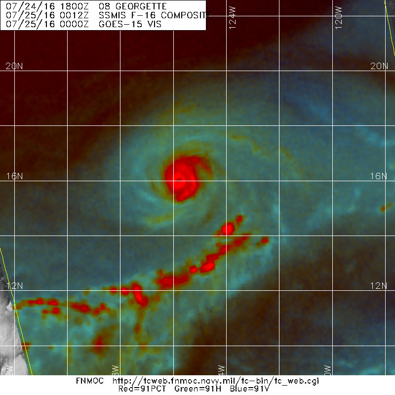
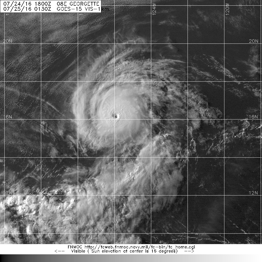
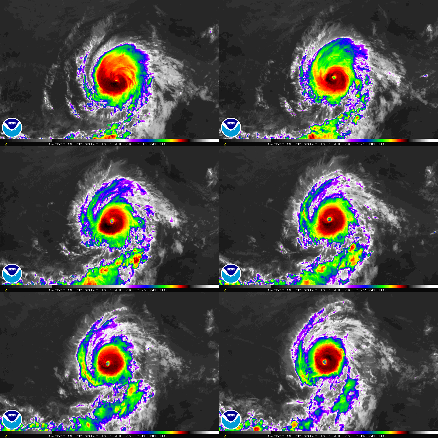
Georgette has been rapidly intensifying. The eye of the hurricane
has become much more distinct in satellite images since the previous
advisory, and the deep convection is fairly symmetric around the
center. The latest Dvorak estimates from TAFB, SAB, and CIMSS at
the University of Wisconsin support raising the initial intensity to
115 kt, making Georgette a category 4 hurricane on the Saffir-
Simpson Hurricane Wind Scale. This is an impressive 50-kt intensity
increase in the past 24 hours. Even though Georgette is a major
hurricane, scatterometer data from a few hours ago indicated that
its wind field is fairly compact.
Georgette has been taking advantage of favorable environmental
conditions of very low shear and sufficiently warm waters of about
27 deg C during its rapid intensification phase. Although the shear
is expected to remain light during the next few days, Georgette is
forecast to track over progressively cooler SSTs and it should cross
the 26 deg C isotherm in about 12 hours. Therefore, some additional
strengthening is possible overnight, but a steady weakening trend
should commence on Monday. Georgette is forecast to become a
post-tropical cyclone in 3 to 4 days when it is expected to be
embedded in a dry air mass and located over SSTs of 22-23 deg C.
The hurricane is moving northwestward at about 10 kt toward a
weakness in the subtropical ridge caused by an upper-level low. This
general heading with a decrease in forward speed is expected during
the next couple of days. After that time, a faster motion toward
the west-northwest and then west is forecast when the weakening
system becomes steered by the low-level trade wind flow. The NHC
track forecast is not too different from the previous one, and lies
close to the multi-model consensus.
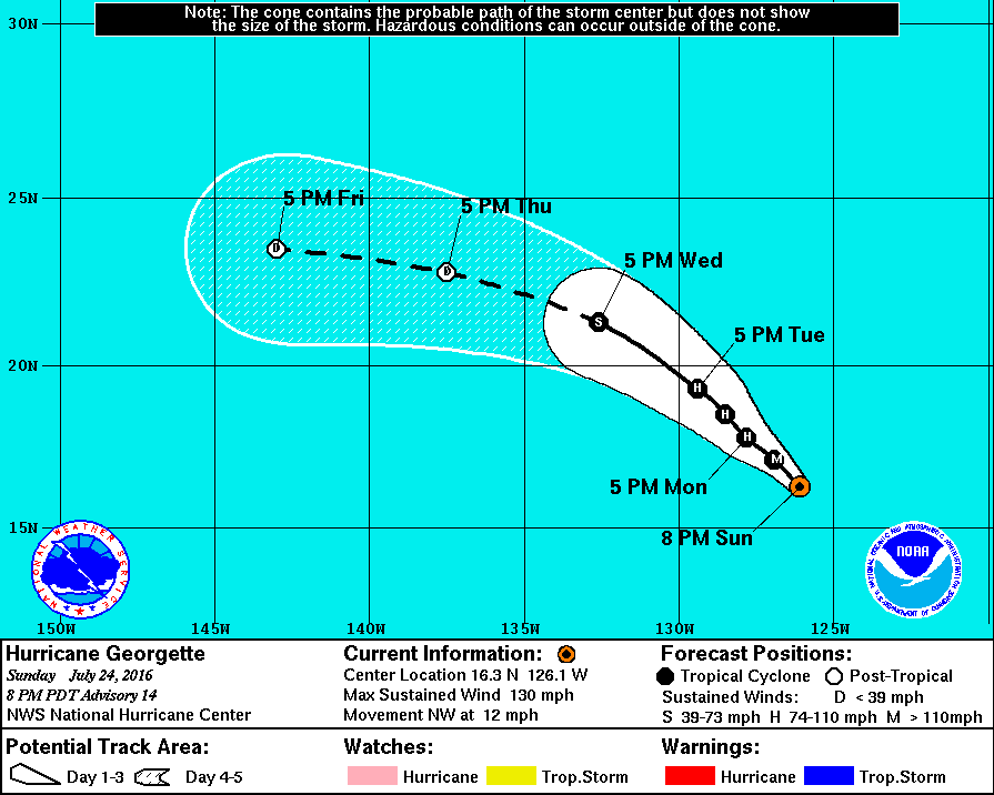
FORECAST POSITIONS AND MAX WINDS
INIT 25/0300Z 16.3N 126.1W 115 KT 130 MPH
12H 25/1200Z 17.1N 126.9W 110 KT 125 MPH
24H 26/0000Z 17.8N 127.8W 95 KT 110 MPH
36H 26/1200Z 18.5N 128.5W 80 KT 90 MPH
48H 27/0000Z 19.3N 129.4W 65 KT 75 MPH
72H 28/0000Z 21.3N 132.6W 45 KT 50 MPH
96H 29/0000Z 22.8N 137.5W 30 KT 35 MPH...POST-TROP/REMNT LOW
120H 30/0000Z 23.5N 143.0W 25 KT 30 MPH...POST-TROP/REMNT LOW
$$
Forecaster Cangialosi


|
|