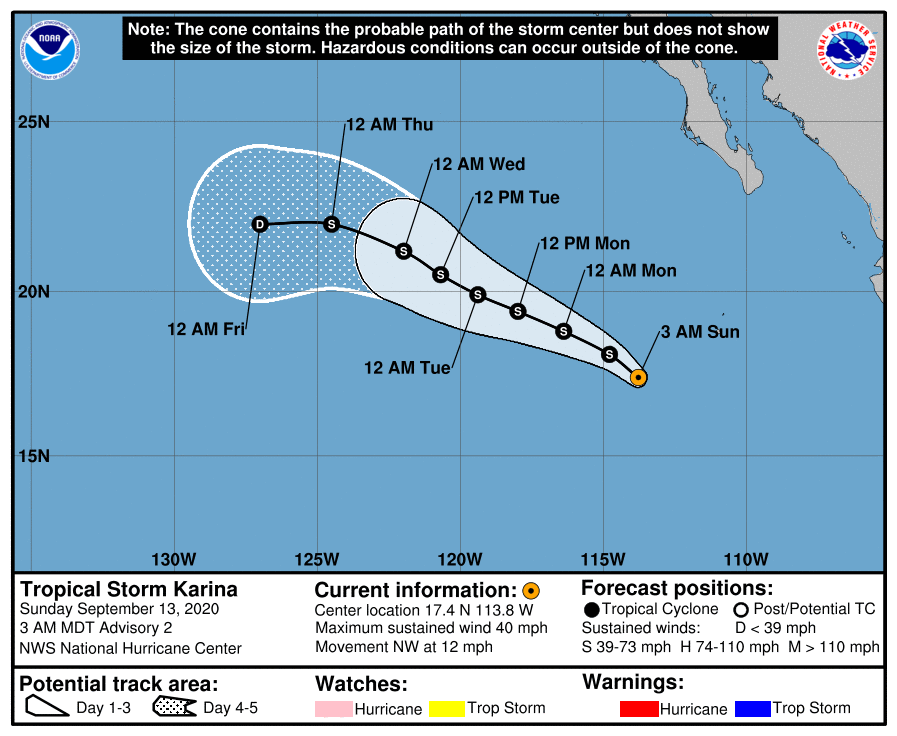
Tropical Storm Karina Discussion Number 2
NWS National Hurricane Center Miami FL EP162020
300 AM MDT Sun Sep 13 2020
Recent scatterometer data showed an area of 30-35 kt winds within
about 80 n mi of the center of Tropical Depression Sixteen-E in the
southwestern quadrant. Based on this data, along with 35-40 kt
intensity estimates from TAFB and the CIMSS satellite consensus,
the depression is upgraded to Tropical Storm Karina with an initial
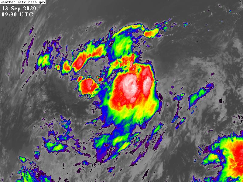
intensity of 35 kt. Satellite imagery show that the system is
still being affected by northeasterly vertical shear, with the
low-level center exposed to the northeast of the main convective
mass.
The initial motion is now 310/10. The global models forecast a
mid-level ridge to build westward to the north of Karina in a day or
two, causing the cyclone to move west- northwestward. A more
westward motion is expected near the end of the forecast period as a
weakening Karin is steered more by the low-level trade winds. The
track guidance is in fair agreement with this scenario, although
there is some spread in the forward speed, possibly due differences
in how Karina interacts with the larger ITCZ/monsoon trough
circulation, including the remnants of Invest 91E. The new forecast
track will follow the forward speed of the consensus models and has
only minor adjustments from the previous track.
The forecast track takes the center of Karin over cooler water,
with the system crossing the 25-26C isotherms in 48-72 h. Present
indications are that the shear will decrease a little before the 72
h point, so the intensity forecast calls for gradual strengthening
during that time. After 72 h, the cooler water and dry air
entrainment should cause weakening. The new intensity forecast has
some minor adjustments from the previous forecast, and it is in
best agreement with the HCCA corrected consensus model and the
Florida State Superensemble.
2. Another area of low pressure is located several hundred miles
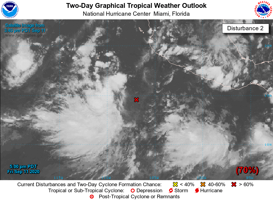
south-southwest of the coast of southwestern Mexico. This system is
producing a large area of disorganized showers and thunderstorms
well to the west of the center of the the low. Environmental
conditions appear conducive for development, and a tropical
depression is likely to form over the weekend or early next week
while the system moves west-northwestward at 10 to 15 mph away from
the coast of Mexico.
* Formation chance through 48 hours...high..70 percent.
* Formation chance through 5 days...high...80 percent.
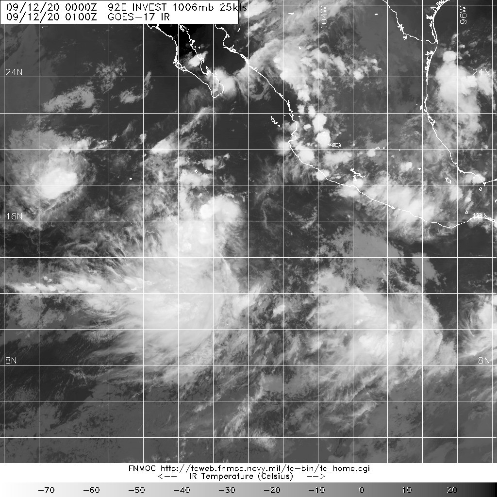
2. REMARKS: AN AREA OF CONVECTION (INVEST 92E) HAS PERSISTED NEAR
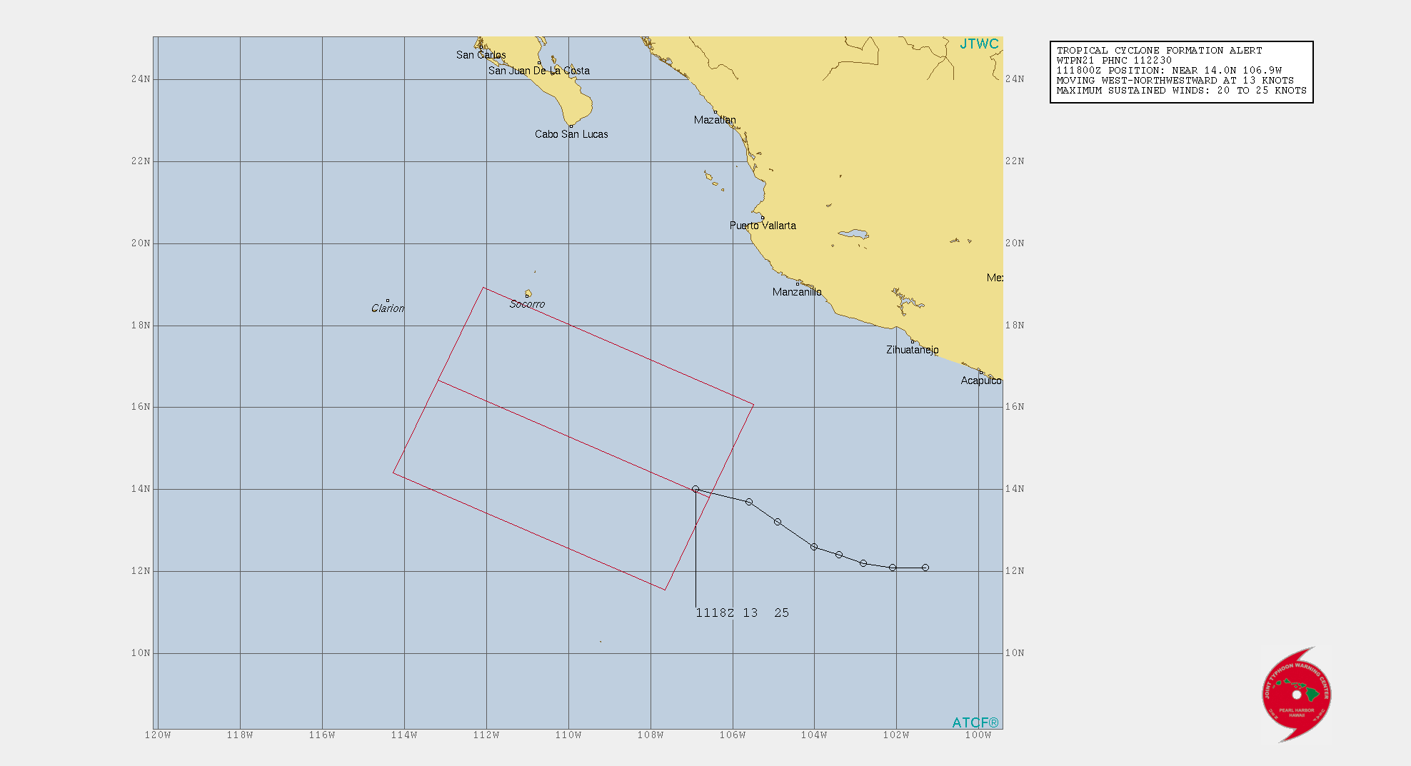
14.0N 106.9W, APPROXIMATELY 366 NM SOUTHEAST OF SOCORRO, MEXICO.
ANIMATED MULTISPECTRAL VISIBLE IMAGERY AND A 112025Z AMSR2 89GHZ
IMAGE DEPICT AN EXPOSED LOW LEVEL CIRCULATION WITH FLARING
CONVECTION IN THE WESTERN SEMICIRCLE. ENVIRONMENTAL ANALYSIS REVEALS
GOOD EQUATORWARD OUTFLOW, LOW (<15KTS) VERTICAL WIND SHEAR, AND WARM
(28-29C) SEA SURFACE TEMPERATURES. NUMERICAL MODELS ARE IN GOOD
AGREEMENT THAT INVEST 92E WILL CONTINUE TO TRACK GENERALLY
WEST-NORTHWESTWARD WHILE CONTINUING TO CONSOLIDATE OVER THE NEXT 24-
36 HOURS. MAXIMUM SUSTAINED SURFACE WINDS ARE ESTIMATED AT 20 TO 25
KNOTS. MINIMUM SEA LEVEL PRESSURE IS ESTIMATED TO BE NEAR 1007 MB.
THE POTENTIAL FOR THE DEVELOPMENT OF A SIGNIFICANT TROPICAL CYCLONE
WITHIN THE NEXT 24 HOURS IS HIGH.