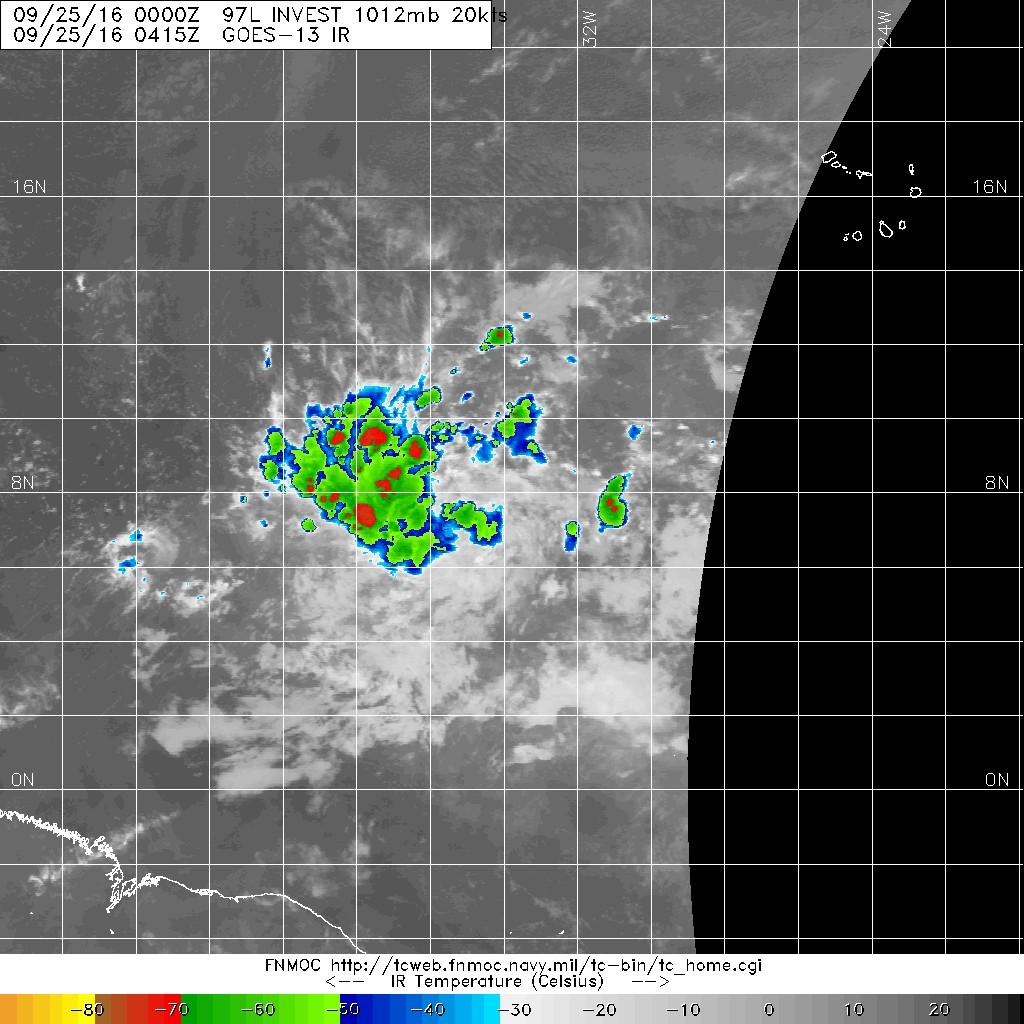
五級颶風 編號:14 L 名稱:Matthew 以上資料來自:NHC、颱風論壇整理製作
|
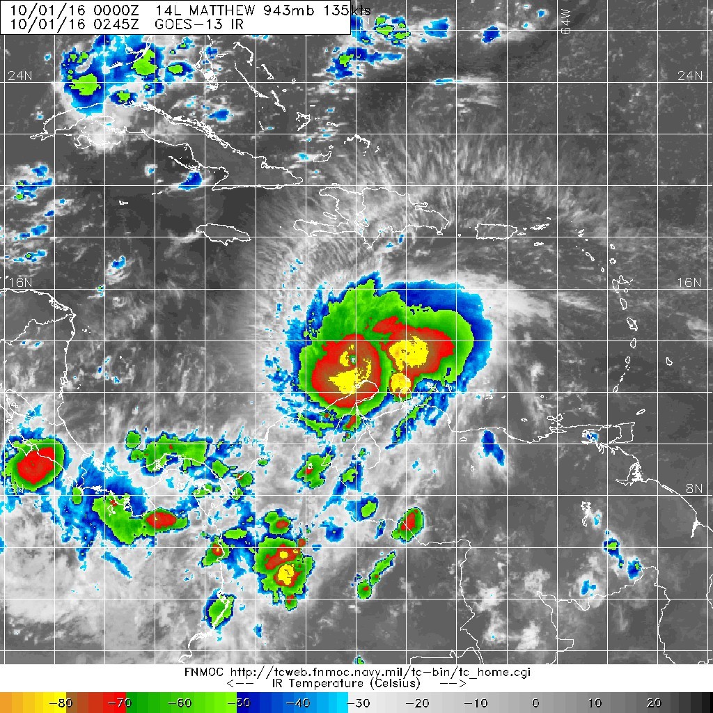
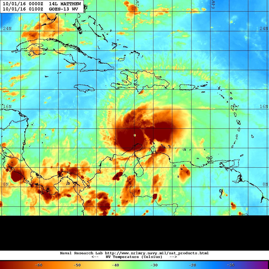
馬修颶風的巔峰 也恭喜北大西洋 , 睽回9年來唯一的Cat.5 (只贏過中太平洋. 很悲情) 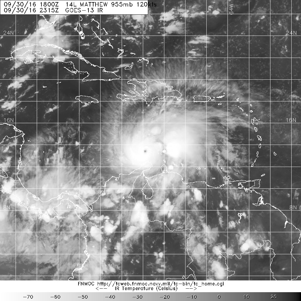
|
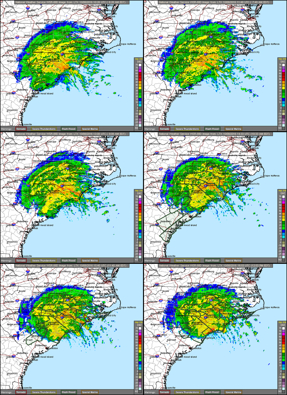
颶風馬修10月8日位處南卡羅來納州、正轉化為溫帶氣旋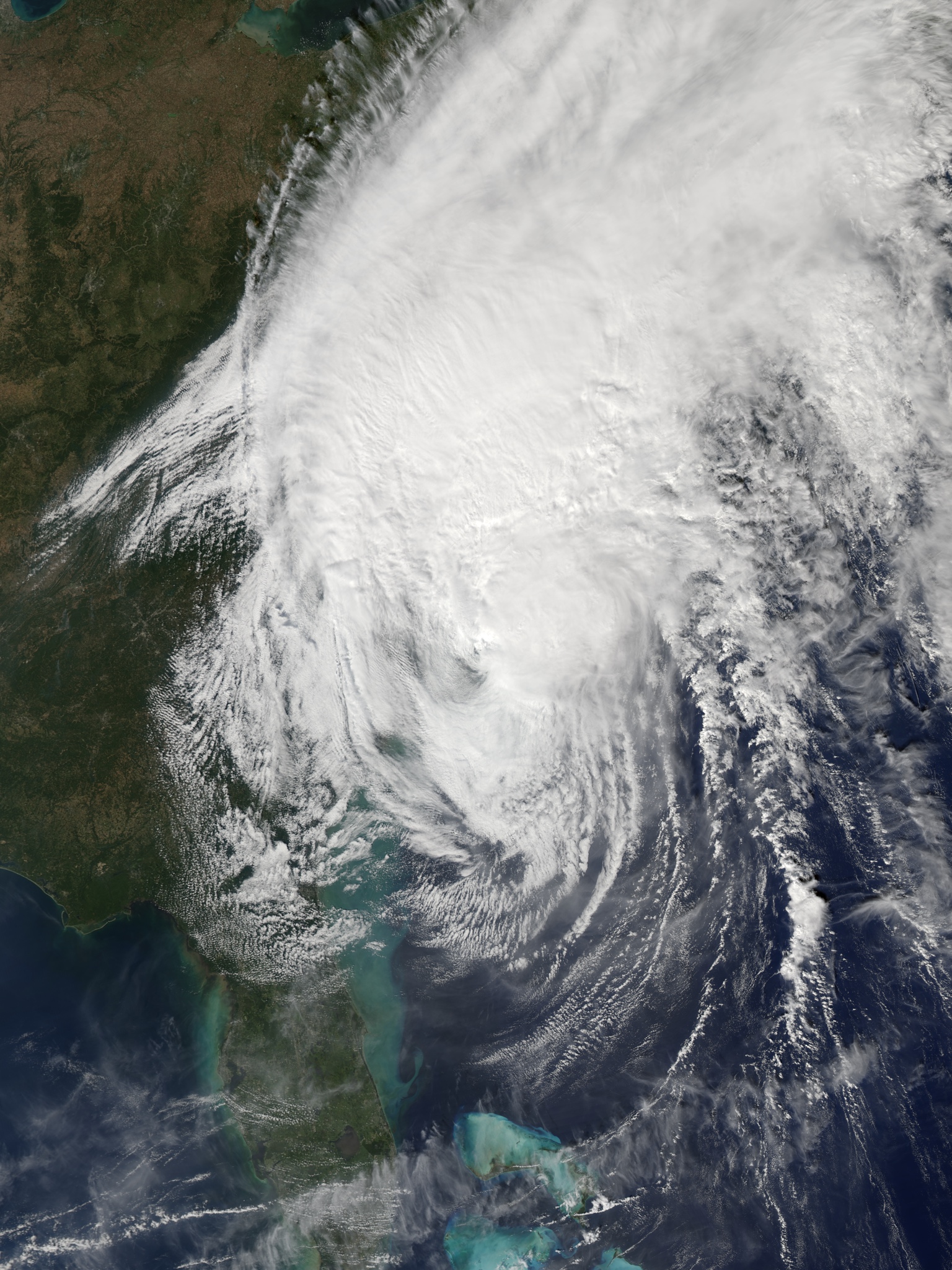
https://commons.wikimedia.org/wi ... 016-10-08_1820Z.jpg |
已經是後熱帶氣旋,但威力依舊。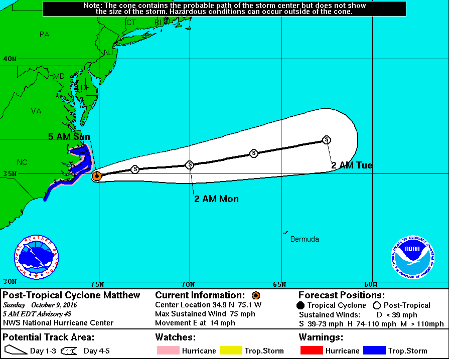
000 WTNT44 KNHC 090855 TCDAT4 POST-TROPICAL CYCLONE MATTHEW DISCUSSION NUMBER 45 NWS NATIONAL HURRICANE CENTER MIAMI FL AL142016 500 AM EDT SUN OCT 09 2016 Satellite and radar imagery indicate that Matthew has become a post-tropical cyclone, with the closest deep convection now located more than 150 nmi north and northeast of the exposed low-level center. Despite this change in structure, surface observations across eastern North Carolina and an earlier ASCAT pass indicate that strong winds persist northwest through southwest of the center. An Air Force Reserve reconnaissance mission completed earlier this morning also indicated that hurricane-force winds were occuring southwest of the center, so the initial intensity is being maintained at 65 kt for this advisory. Surface observations indicate that a cold front should overtake Matthew's center shortly, resulting in extratropical transition. The global and regional models forecast Matthew to slowly weaken over the next 48 hours, and that trend has been followed in the official intensity forecast. In the 48-72 hour time period, Matthew's circulation is expected to dissipate within the frontal system. A combination of satellite and radar imagery, aircraft data, and coastal surface observations indicate that Matthew is moving 065/12 kt. Matthew is now fully embedded within the mid-latitude westerly flow, and this deep-layer steering pattern is expected to move the cyclone east-northeastward and away from the coast of North Carolina today. An eastward motion is expected by tonight and should continue until Matthew dissipates in 48 hours or so. The new NHC track forecast is a little north of the previous track and lies close to a blend of the ECMWF, UKMET, and GFS solutions. Recent observations and the forecast strength of the band of winds over the eastern North Carolina coastal area requires maintaining the Hurricane Watch. Strong winds in the Tidewater Region of Virginia are being handled by non-tropical wind warnings. KEY MESSAGES: 1. As Matthew's structure changes, the system's strongest winds continue to shift to the west side of the circulation. The winds are expected to increase significantly over the coastal areas of eastern North Carolina during the next several hours, and during the next 6 to 12 hours there is the possibility of near-hurricane force winds over the North Carolina Outer Banks, as well as the Pamlico and Albemarle Sounds. There is also an increased threat of storm surge in these areas. Please see the Prototype Storm Surge Watch/Warning Graphic for a depiction of the areas at risk. 2. Although Matthew has become a post-tropical cyclone, NHC will continue to issue its full suite of advisory and warning products as long as the system remains a significant threat to land areas. FORECAST POSITIONS AND MAX WINDS INIT 09/0900Z 34.9N 75.1W 65 KT 75 MPH...POST-TROPICAL 12H 09/1800Z 35.2N 73.0W 60 KT 70 MPH...POST-TROP/EXTRATROP 24H 10/0600Z 35.4N 70.0W 50 KT 60 MPH...POST-TROP/EXTRATROP 36H 10/1800Z 35.9N 66.5W 40 KT 45 MPH...POST-TROP/EXTRATROP 48H 11/0600Z 36.5N 62.5W 35 KT 40 MPH...POST-TROP/EXTRATROP 72H 12/0600Z...DISSIPATED $$ Forecaster Stewart |
|
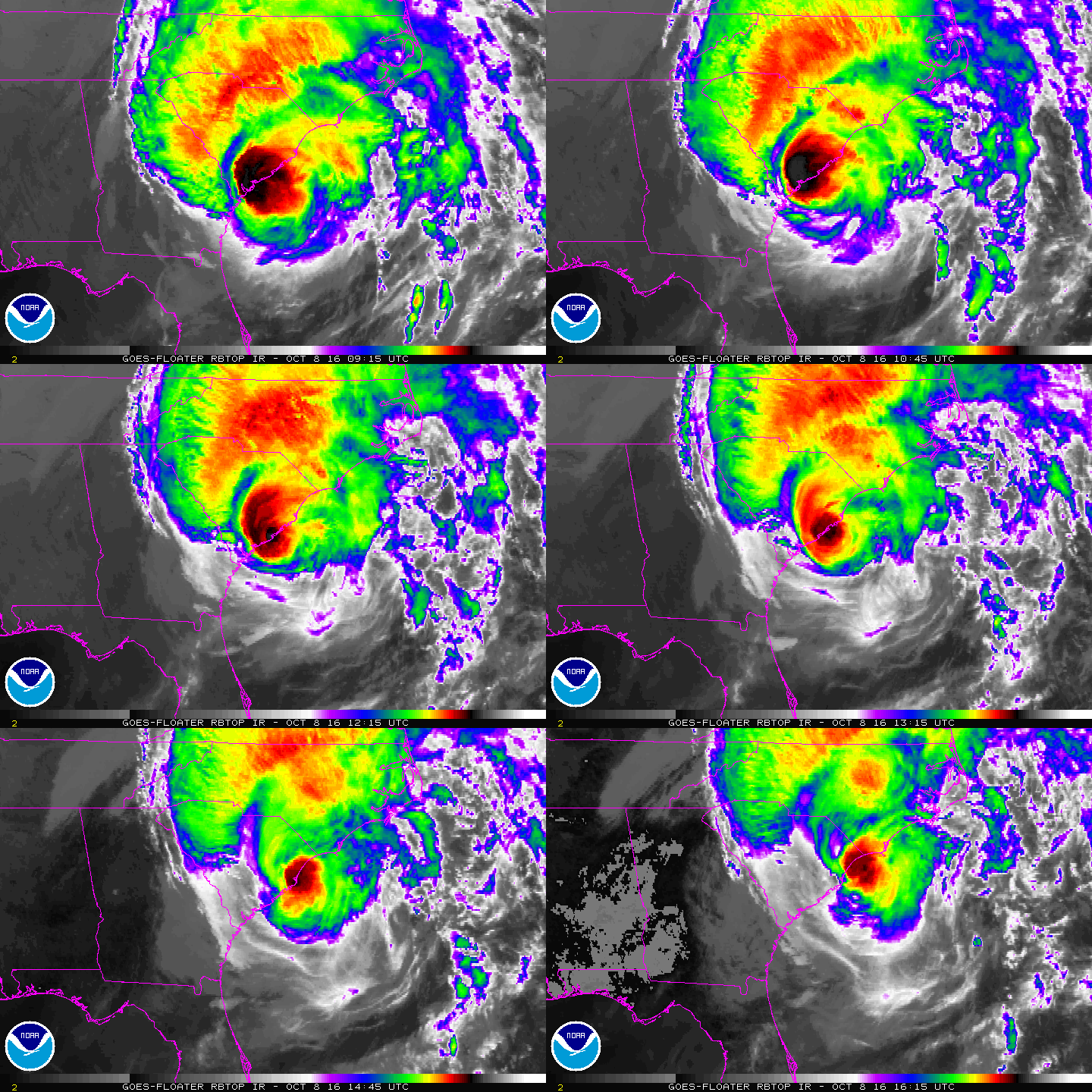
來不及轉彎就撞進去了.... 15Z登陸南卡羅來納州,評價一下子降到C1下限的65節,並認為三天後消散。 BULLETIN 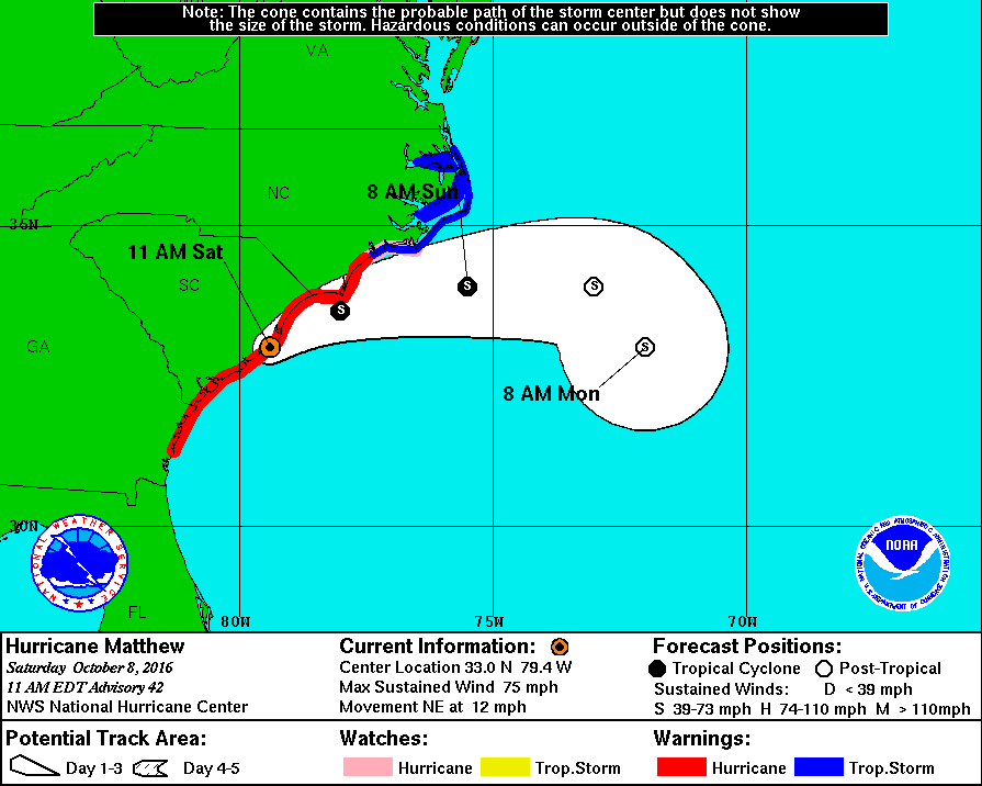
|
10月2日加勒比海的颶風馬修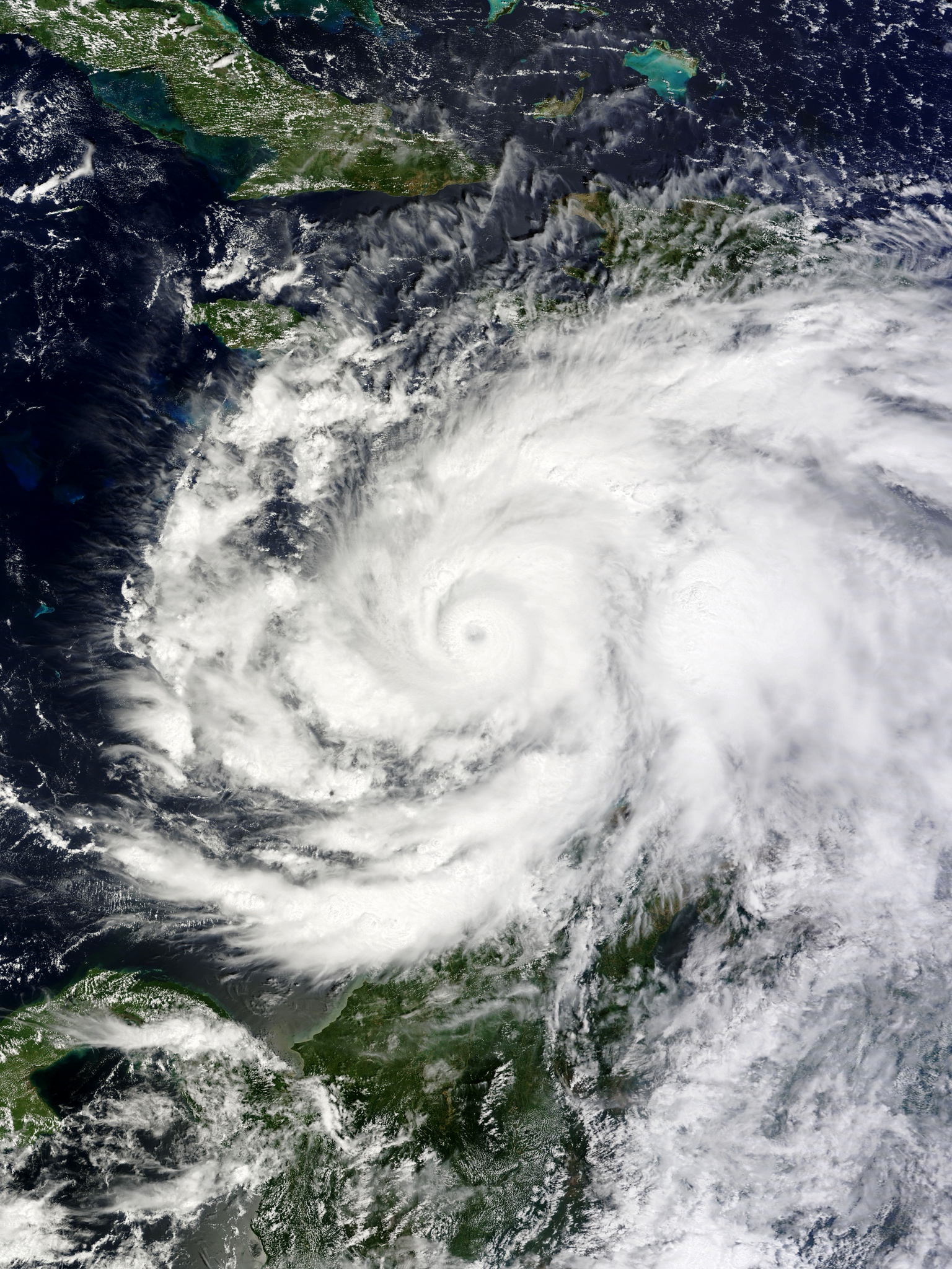
https://commons.wikimedia.org/wi ... 016-10-02_1545Z.jpg |
| CNN你要不要臉? |

|
本帖最後由 蜜露 於 2016-10-9 10:25 編輯 罹難人數最新已經增加至842人 馬修經過了海地 . 西南方城鎮這次多數房屋被毀. 空拍更令人可怕... 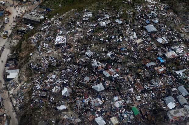
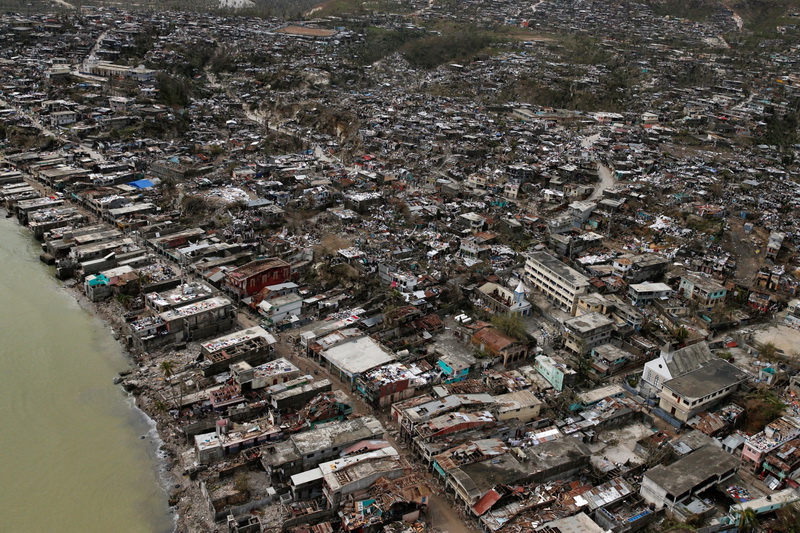
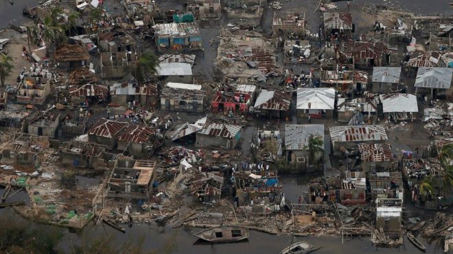
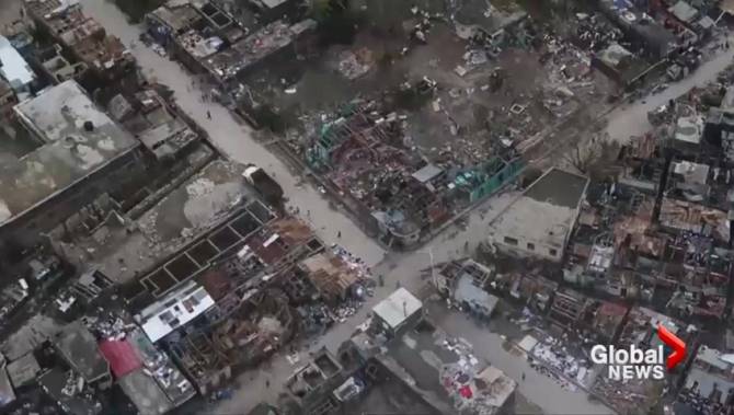


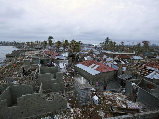

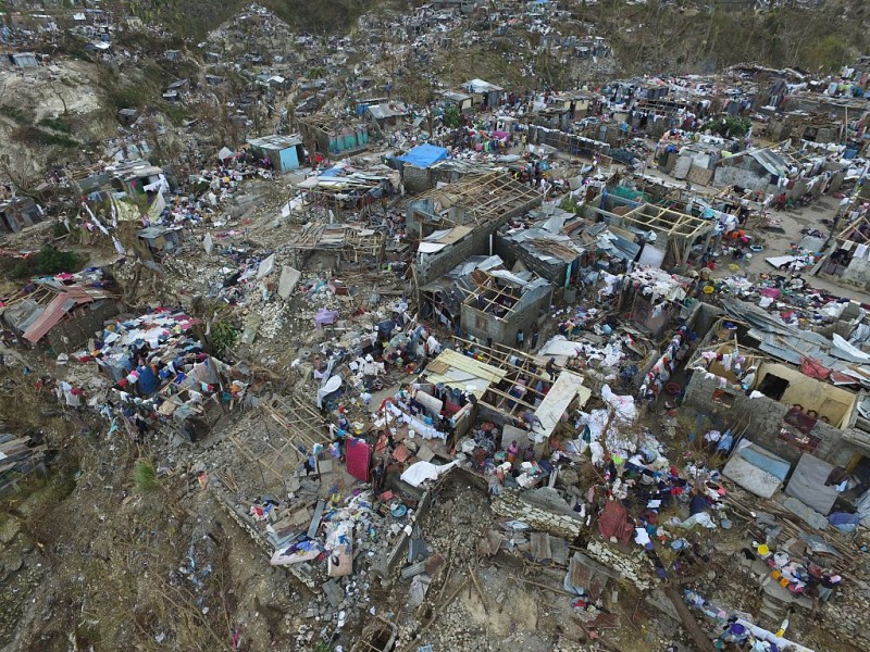
這個空拍風毀比溫斯頓還有尼伯特還要嚴重. 這裡房屋結構真的.. 海地在五年前才碰過地震. 房屋有的組合屋.還不是完整的 |