簽到天數: 4163 天 [LV.Master]伴壇終老
|
基本資料
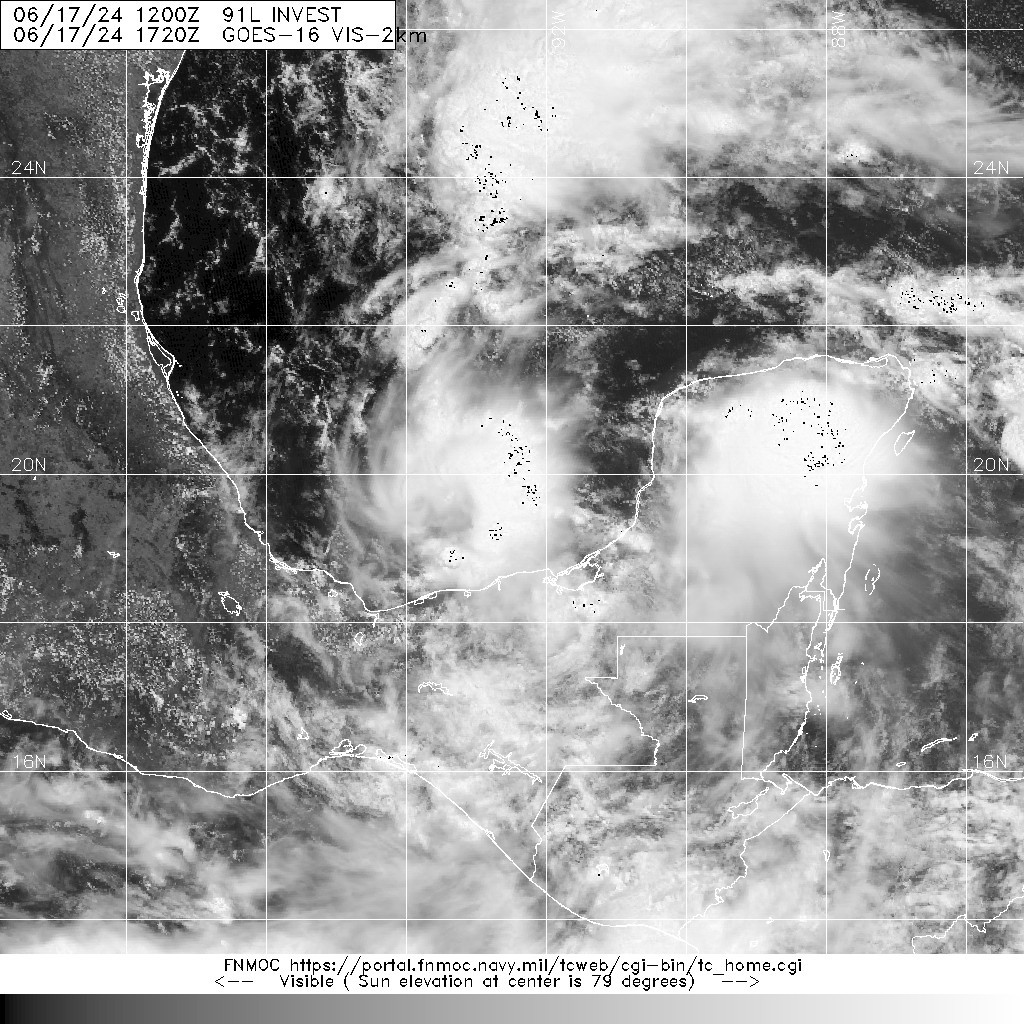
編號 :91L
擾動編號日期:2024 年 06 月 17 日 20 時
撤編日期 :2024 年 06 月 00 日 00 時
AL, 91, 2024061712, , BEST, 0, 195N, 925W, 30, 1004, D


ZCZC MIATWOAT ALL
TTAA00 KNHC DDHHMM
Tropical Weather Outlook
NWS National Hurricane Center Miami FL
200 PM EDT Mon Jun 17 2024
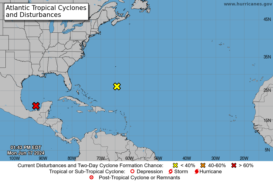
For the North Atlantic...Caribbean Sea and the Gulf of Mexico:
1. Satellite and surface observations indicate that a broad area of
low pressure is located over the Bay of Campeche with winds of
35-40 mph occurring in an area well to the northeast of the center
over the southern Gulf of Mexico. Environmental conditions appear
conducive for gradual development, and a tropical depression or
tropical storm is likely to form by midweek while the low moves
slowly west-northwestward toward the western Gulf coast.
Regardless of development, several more days of heavy rainfall are
expected across portions of southern Mexico and Central America, and
these rains are likely to cause life-threatening flooding and flash
flooding. Locally heavy rainfall is also expected to spread over
portions of Texas and Louisiana by the middle of the week. In
addition, gale warnings have been issued for portions of the Gulf of
Mexico, and more information on those warnings is available in High
Seas Forecasts issued by the National Weather Service. Interests
along the western and northwestern Gulf coasts should monitor the
progress of this system, as tropical storm watches and warnings may
be required for portions of this area later this afternoon or
tonight. An Air Force Reserve Hurricane Hunter aircraft is
currently en route to investigate the system.
* Formation chance through 48 hours...high...70 percent.
* Formation chance through 7 days...high...70 percent.
2. Southwestern Atlantic Ocean:
An area of cloudiness and thunderstorms located several hundred
miles east of the Bahamas is associated with a surface trough and
an upper-level area of low pressure. Environmental conditions
could be conducive for some development of this system during the
next few days while it moves westward or west-northwestward. The
system is forecast to approach the coast of the southeast United
States on Thursday or Friday.
* Formation chance through 48 hours...low...10 percent.
* Formation chance through 7 days...low...30 percent.
High Seas Forecasts issued by the National Weather Service
can be found under AWIPS header NFDHSFAT1, WMO header FZNT01
KWBC, and online at ocean.weather.gov/shtml/NFDHSFAT1.php
Forecaster Beven
|
評分
-
查看全部評分
|