簽到天數: 4163 天 [LV.Master]伴壇終老
|
本帖最後由 周子堯@FB 於 2024-6-13 01:16 編輯
基本資料
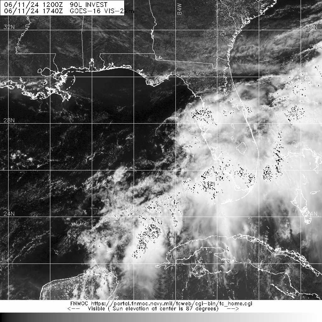
編號 :90L
擾動編號日期:2024 年 06 月 11 日 20 時
撤編日期 :2024 年 06 月 00 日 00 時
AL, 90, 2024061112, , BEST, 0, 264N, 847W, 20, 1009, DB, 34, NEQ


Tropical Weather Outlook Text EspañolTropical Weather Discussion
ZCZC MIATWOAT ALL
TTAA00 KNHC DDHHMM
Tropical Weather Outlook
NWS National Hurricane Center Miami FL
200 PM EDT Tue Jun 11 2024
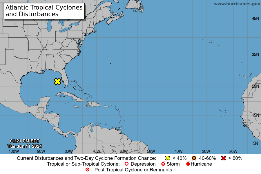
For the North Atlantic...Caribbean Sea and the Gulf of Mexico:
1. Eastern Gulf of Mexico and Offshore Southeast U.S. (AL90):
A broad area of low pressure over the eastern Gulf of Mexico is
producing a large area of disorganized showers and thunderstorms.
This system is expected to move northeastward across Florida during
the next day or so and move offshore of the U.S. Southeast coast
later this week. Environmental conditions are expected to be
generally unfavorable, although some slow development is possible
when the system is offshore of the U.S. Southeast coast. Regardless
of development, heavy rainfall is already occuring and is expected
to continue across portions of Florida during the next few days.
For more information, see products issued by the Weather Prediction
Center and local National Weather Service Forecast Offices.
* Formation chance through 48 hours...low...10 percent.
* Formation chance through 7 days...low...20 percent.
Weather Prediction Center products can be found at
www.wpc.ncep.noaa.gov and National Weather Service forecast
information can be found at www.weather.gov
Forecaster Kelly
|
評分
-
查看全部評分
|