簽到天數: 2141 天 [LV.Master]伴壇終老
|
 周子堯@FB|2023-12-5 09:44
|
顯示全部樓層
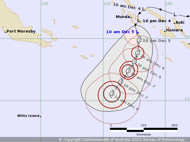
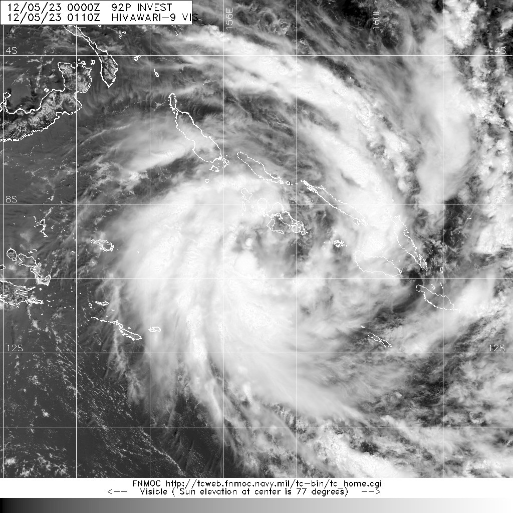
BoM升格02U,預計6小時內成旋
IDQ20065
IDQ20018TROPICAL CYCLONE TECHNICAL BULLETIN: AUSTRALIA - EASTERN REGIONIssued by AUSTRALIAN BUREAU OF METEOROLOGY TROPICAL CYCLONE WARNING CENTREat: 0059 UTC 05/12/2023Name: Tropical Low Identifier: 02UData At: 0000 UTCLatitude: 9.4SLongitude: 157.8ELocation Accuracy: within 25nm (45 km)Movement Towards: south (180 deg)Speed of Movement: 5 knots (8 km/h)Maximum 10-Minute Wind: 35 knots (65 km/h)Maximum 3-Second Wind Gust: 50 knots (95 km/h)Central Pressure: 998 hPaRadius of 34-knot winds NE quadrant: Radius of 34-knot winds SE quadrant: Radius of 34-knot winds SW quadrant: 70 nm (130 km)Radius of 34-knot winds NW quadrant: Radius of 48-knot winds NE quadrant: Radius of 48-knot winds SE quadrant: Radius of 48-knot winds SW quadrant: Radius of 48-knot winds NW quadrant: Radius of 64-knot winds: nm ( km)Radius of Maximum Winds: nm ( km)Dvorak Intensity Code: T2.5/2.5/D1.0/24HRS STT:D0.5/06HRSPressure of outermost isobar: 1006 hPaRadius of outermost closed isobar: 200 nm (370 km)FORECAST DATADate/Time : Location : Loc. Accuracy: Max Wind : Central Pressure(UTC) : degrees : nm (km): knots(km/h): hPa+06: 05/0600: 9.7S 157.7E: 040 (075): 040 (075): 994+12: 05/1200: 10.1S 157.9E: 055 (105): 045 (085): 992+18: 05/1800: 10.6S 157.9E: 065 (120): 050 (095): 989+24: 06/0000: 11.2S 157.8E: 070 (135): 055 (100): 986+36: 06/1200: 11.9S 157.5E: 075 (135): 065 (120): 978+48: 07/0000: 12.6S 157.0E: 090 (170): 080 (150): 965+60: 07/1200: 13.5S 156.4E: 105 (200): 090 (165): 956+72: 08/0000: 14.4S 155.7E: 120 (225): 090 (165): 956+96: 09/0000: 16.1S 154.7E: 150 (280): 080 (150): 964+120: 10/0000: 17.3S 153.7E: 200 (370): 070 (130): 973REMARKS:Tropical low 02U is developing in a moderately favourable environment duringthe past 12 hours, with increasing deep convection and curvature in the cloudpattern. Current position is based on microwave and animated IR satelliteimagery, with good certainty. Dvorak analysis is based on a curved band pattern with an 0.5-0.6 wrap givingDT 3.0. MET is 2.0 based on a 24 hour D- trend, however pattern T is adjustedupto 2.5. Final T and CI set at 2.5. No objective aids or scatterometryavailable. Intensity is set at 35 knots. The system is located to the southwest of an upper anticyclone, with some lowto moderate northeasterly deep layer wind shear, but not sufficient to hinderdevelopment. Development of the system will also be aided by an upper trough tothe south enhancing upper poleward outflow in the short to medium term. Assuch, further intensification is expected, with the system forecast to developinto a severe tropical cyclone late Wednesday or Thursday as it moves into thefar northeast Coral Sea. The system has been tracking slowly south under the steering of a weakmid-level ridge to the east. This influence and track is likely to continue inthe short to medium term, with the strength of the ridge fluctuating as theupper trough passes to the south during the next 24-36 hours. Once this troughhas passed, a stronger steering ridge extending from Australia may partiallycradle the system later in the week, giving the track more of a westwardcomponent. By early next week, this ridge is in turn eroded by the approach ofanother upper trough, though there is some divergence between model guidance onthe strength and timing of this feature, and consequent uncertainty in thetrack going into these longer lead times. Some guidance favours a moresoutherly track, consequently moving the system towards the Queensland coast,south of Mackay. Another credible scenario has 02U approaching the Queenslandcoast, between Cooktown and Mackay, on a westerly track as a tropical cyclonenext week. Copyright Commonwealth of Australia==The next bulletin for this system will be issued by: 05/0730 UTC. 

|
|