簽到天數: 4163 天 [LV.Master]伴壇終老
|
基本資料
編號 :92 L
擾動編號日期 :2023 年 10 月 08 日 08 時
撤編日期 :2023 年 00 月 00 日 00 時
AL, 92, 2023100800, , BEST, 0, 95N, 190W, 25, 1010, DB


Tropical Weather Outlook Text Tropical Weather Discussion
ZCZC MIATWOAT ALL
TTAA00 KNHC DDHHMM
Tropical Weather Outlook
NWS National Hurricane Center Miami FL
200 PM EDT Mon Oct 9 2023
For the North Atlantic...Caribbean Sea and the Gulf of Mexico:
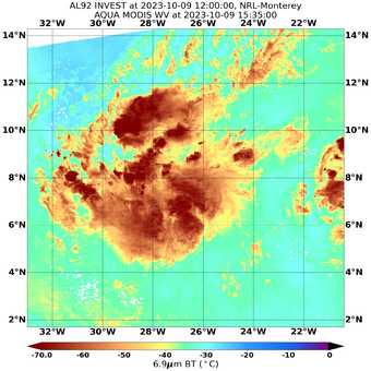
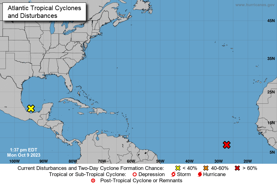
1. Eastern Tropical Atlantic (AL92):
A low-latitude tropical wave located several hundred miles
south-southwest of the Cabo Verde Islands continues to produce a
large area of showers and thunderstorms. This activity has become a
bit more concentrated this afternoon, and environmental conditions
appear conducive for additional development of this system during
the next several days. A tropical depression is likely to form in
the next couple of days while it moves west-northwestward or
northwestward across the eastern tropical Atlantic.
* Formation chance through 48 hours...high...70 percent.
* Formation chance through 7 days...high...80 percent.
2. Southwestern Gulf of Mexico:
Shower and thunderstorm activity has changed little in organization
in association with a small area of low pressure over the
southwestern Gulf of Mexico. Environmental conditions appear only
marginally favorable for some additional development while the
system moves slowly northward before the low merges with a frontal
system over the western Gulf of Mexico by midweek.
* Formation chance through 48 hours...low...20 percent.
* Formation chance through 7 days...low...20 percent.
Forecaster Papin
|
|