開啟輔助訪問
 找回密碼
 立即加入

18E.Marie 東太2020年風季第三個C4 進入中太 減弱消散

簽到天數: 1650 天

[LV.Master]伴壇終老

2020-9-28 02:11 | 顯示全部樓層
本帖最後由 周子堯@FB 於 2020-10-11 11:26 編輯

  四級颶風  
編號:18 E
名稱:Marie
153235dh8l81m3s6uqdgqd.jpg
  基本資料  
擾動編號日期:2020 09 28 01
命名日期  :2020 09 30 05
撤編日期  :2020 10 11 09
登陸地點  :

  巔峰時期資料  
近中心最強風速 :115  kt ( Cat.4 )
海平面最低氣壓 :948 百帕

  擾動編號資料  

94E.INVEST.15kts-1005mb-14N-105W
20200927.1740.goes-17.vis.2km.94E.INVEST.15kts.1005mb.14N.105W.pc.jpg


NHC:20%  


1. A small area of low pressure has formed within an elongated region
of disturbed weather, a few hundred miles south of the southwestern
coast of Mexico. This system is expected to move generally westward
for the next day or two, and it could interact with a
westward-moving tropical wave during that time. Environmental
conditions are expected to support at least gradual development
during the next several days and a tropical depression is likely to
form later this week. The system is forecast to turn
west-northwestward by mid-week and will likely continue moving in
that general direction through the end of the week.
* Formation chance through 48 hours...low...20 percent.
* Formation chance through 5 days...high...80 percent.

two_pac_2d1.png two_pac_5d1.png 以上資料來自:NHC、颱風論壇整理製作

評分

參與人數 1水氣能量 +15 +1 收起 理由
t02436 + 15 + 1

查看全部評分

回復

使用道具 舉報

簽到天數: 601 天

[LV.9]以壇為家II

霧峰追風者|2020-9-28 07:59 | 顯示全部樓層
展望提升至40%。
1. A well-defined low pressure system located a few hundred miles south
of the southwestern coast of Mexico is producing a large area of
disorganized cloudiness and thunderstorms.  The disturbance is
forecast to move generally westward for the next several days, and
environmental conditions are expected to gradually become more
conducive for a tropical depression to form around midweek.
* Formation chance through 48 hours...medium...40 percent.
* Formation chance through 5 days...high...90 percent.
two_pac_2d1.png
回復

使用道具 舉報

簽到天數: 1650 天

[LV.Master]伴壇終老

老農民版夜神月|2020-9-29 00:19 | 顯示全部樓層
NHC展望提升至70%/90%
1. A broad area of disturbed weather is located a few hundred miles
south of the southwestern coast of Mexico. Shower and thunderstorm
activity associated with a small low embedded within this area has
decreased since yesterday. However, environmental conditions are
expected to gradually become more conducive for development and a
tropical depression will likely form within the next two or three
days. The disturbance is forecast to move generally westward for the
next several days and then turn west-northwestward by the weekend.
* Formation chance through 48 hours...high...70 percent.
* Formation chance through 5 days...high...90 percent.
two_pac_2d1.png two_pac_5d1.png
94E_gefs_latest.png


回復

使用道具 舉報

簽到天數: 1650 天

[LV.Master]伴壇終老

老農民版夜神月|2020-9-29 00:33 | 顯示全部樓層
JTWC1430Z發布TCFA
WTPN21 PHNC 281430
MSGID/GENADMIN/JOINT TYPHOON WRNCEN PEARL HARBOR HI//
SUBJ/TROPICAL CYCLONE FORMATION ALERT (INVEST 94E)//
RMKS/
1. FORMATION OF A SIGNIFICANT TROPICAL CYCLONE IS POSSIBLE WITHIN
100 NM EITHER SIDE OF A LINE FROM 13.5N 104.4W TO 13.9N 107.3W
WITHIN THE NEXT 12 TO 24 HOURS. AVAILABLE DATA DOES NOT JUSTIFY
ISSUANCE OF NUMBERED TROPICAL CYCLONE WARNINGS AT THIS TIME.
WINDS IN THE AREA ARE ESTIMATED TO BE 15 TO 20 KNOTS. METSAT
IMAGERY AT 281200Z INDICATES THAT A CIRCULATION CENTER IS LOCATED
NEAR 13.6N 104.5W. THE SYSTEM IS MOVING NORTHWESTWARD AT 03
KNOTS.
2. REMARKS: AN AREA OF CONVECTION (INVEST 94E) HAS PERSISTED NEAR
13.6N 104.5W, APPROXIMATELY 480 NM SOUTHEAST OF SOCORRO, MEXICO.
ANIMATED MULTISPECTRAL SATELLITE IMAGERY AND A 281206Z SSMIS 91GHZ
IMAGE DEPICT DISORGANIZED FLARING CONVECTION OBSCURING A BROAD LOW
LEVEL CIRCULATION. ENVIRONMENTAL ANALYSIS REVEALS INVEST 94E IS
EXPERIENCING GOOD POLEWARD OUTFLOW, LOW TO MODERATE (10-20KTS)
VERTICAL WIND SHEAR, AND WARM (28-29C) SEA SURFACE TEMPERATURES.
GLOBAL MODELS ARE IN GOOD AGREEMENT THAT INVEST 94E WILL CONTINUE TO
INTENSIFY AND CONSOLIDATE AS IT TRACKS GENERALLY WESTWARD OVER THE
NEXT 24-36HRS. MAXIMUM SUSTAINED SURFACE WINDS ARE ESTIMATED AT 15
TO 20 KNOTS. MINIMUM SEA LEVEL PRESSURE IS ESTIMATED TO BE NEAR 1007
MB. THE POTENTIAL FOR THE DEVELOPMENT OF A SIGNIFICANT TROPICAL
CYCLONE WITHIN THE NEXT 24 HOURS IS HIGH.
3. THIS ALERT WILL BE REISSUED, UPGRADED TO WARNING OR CANCELLED BY
291430Z.//
NNNN

ep9420.gif 20200928.1530.goes-17.vis.2km.94E.INVEST.20kts.1007mb.13.6N.104.5W.pc.jpg
20200928.0839.gw1.89hbt.94E.INVEST.25kts.1008mb.12.6N.104.1W.95pc.jpg 20200928.0839.gw1.89pct89h89v.94E.INVEST.25kts.1008mb.12.6N.104.1W.95pc.jpg
回復

使用道具 舉報

簽到天數: 1650 天

[LV.Master]伴壇終老

老農民版夜神月|2020-9-29 17:00 | 顯示全部樓層
NHC09Z升格TD18E,初報上望85KT
430
WTPZ43 KNHC 290843
TCDEP3

Tropical Depression Eighteen-E Discussion Number   1
NWS National Hurricane Center Miami FL       EP182020
300 AM MDT Tue Sep 29 2020

A burst of deep convection that developed near the center of the
area of low pressure well southwest of the southwestern coast of
Mexico during the evening has persisted overnight.  Microwave
imagery and a 0444 UTC ASCAT-C overpass indicated that the center
of the low re-formed within the area of deep convection and with
the overall increase in the organization of the system, advisories
are being initiated on the eighteen tropical depression of the 2020
eastern Pacific hurricane season.  The scatterometer data revealed
peak winds of around 30 kt, and that is used as the advisory
intensity.  

The depression is located over warm water and within an area of
light to moderate northeasterly shear, and these conditions are
expected to allow for steady strengthening over the next few days.  
Although the SHIPS model guidance only shows a peak intensity
of 65-70 kt in 72-84 hours, the SHIPS rapid intensification index
indicates a 50 percent chance of a 65 kt increase in intensity over
the next 72 hours. In addition, the global models significantly
deepen the system over the next few days. On the basis of the
SHIP RI information and the global models, the NHC intensity
forecast is above the IVCN intensity consensus close to the more
aggressive HWRF and HCCA models.  Late in the period, decreasing
SSTs and increasing vertical wind shear should result in weakening.

Given the recent re-formation of the center, the initial motion
estimate is a highly uncertain 275/9 kt. A deep-layer ridge
centered over the southwestern United States is expected to steer
the cyclone westward to west-northwestward during the next several
days.  By the end of the forecast period, the cyclone will be
approaching the southwestern portion of the ridge allowing it to
turn northwesterly.  Although there some model differences in
the predicted forward speed of the depression, the models are in
good agreement on the overall track forecast scenario.  To account
for these forward speed differences, the NHC forecast is near the
middle of the guidance envelope close to the various consensus
aids.


FORECAST POSITIONS AND MAX WINDS

INIT  29/0900Z 13.2N 107.6W   30 KT  35 MPH
12H  29/1800Z 13.5N 109.0W   35 KT  40 MPH
24H  30/0600Z 14.2N 111.2W   45 KT  50 MPH
36H  30/1800Z 14.6N 114.3W   55 KT  65 MPH
48H  01/0600Z 14.8N 117.3W   65 KT  75 MPH
60H  01/1800Z 15.3N 119.9W   75 KT  85 MPH
72H  02/0600Z 16.2N 122.3W   85 KT 100 MPH
96H  03/0600Z 18.3N 126.2W   80 KT  90 MPH
120H  04/0600Z 20.5N 129.2W   60 KT  70 MPH

084459_5day_cone_with_line_and_wind.png 20200929.0600.goes-17.ir.94E.INVEST.25kts.1006mb.13.6N.105.9W.100pc.jpg
20200929.0440.gpm.89hbt.94E.INVEST.25kts.1006mb.13.6N.105.9W.045pc.jpg 20200929.0440.gpm.89pct89h89v.94E.INVEST.25kts.1006mb.13.6N.105.9W.045pc.jpg
回復

使用道具 舉報

簽到天數: 1650 天

[LV.Master]伴壇終老

老農民版夜神月|2020-9-30 05:02 | 顯示全部樓層
21Z升格TS,命名Marie,NHC上調上望至MH,100KT
680
WTPZ43 KNHC 292033
TCDEP3

Tropical Storm Marie Discussion Number   3
NWS National Hurricane Center Miami FL       EP182020
300 PM MDT Tue Sep 29 2020

A WindSat microwave image from earlier this morning indicated that
the tropical cyclone's low-level circulation was becoming better
defined, with perhaps the formative stage of a cyan ring seen in the
37-GHz channel.  Visible images also show the center tucked just
beneath recent bursts of deep convection, and Dvorak estimates have
risen to T2.0 and T2.5 from TAFB and SAB, respectively.  These data,
along with ambiguity analyses of recent ASCAT-B and -C scatterometer
passes, indicate the depression has strengthened to Tropical Storm
Marie with maximum winds of 35 kt.

Marie's future track is probably the most straightforward part of
the forecast.  A mid-tropospheric high anchored over the
southwestern United States is steering Marie westward with an
initial motion of 275/10 kt.  This high will remain the main driver,
forcing the cyclone westward or west-northwestward for the next 3
days.  By days 4 and 5, Marie is likely to reach a break in the
ridge and should slow down a bit and turn toward the northwest.
There are no notable outliers among the track guidance, and the
small spread among the models yields higher-than-normal confidence
in the track forecast.  The new NHC forecast is very similar to the
previous prediction, and is close to the TVCE and HCCA consensus
aids.

The intensity forecast is a little more challenging, but mostly
because a good proportion of the guidance suggests that Marie will
intensify significantly during the next few days.  Relatively low
deep-layer shear, warm ocean waters, and favorable upper-level
divergence all favor strengthening, and several of the various
SHIPS Rapid Intensification thresholds are several times higher
than their climatological means.  In addition, all of the dynamical
models, the consensus aids, and the GFS-based SHIPS model bring
Marie to hurricane strength within 24 hours.  Given these signals,
the NHC intensity forecast has been raised from the previous one
and lies near or just below the intensity consensus in order to
maintain some continuity.  But given what is shown by some of the
better-performing intensity models, I would not be surprised if
subsequent forecasts show a faster rate of intensification or
a higher peak intensity.  Weakening is expected by days 4 and 5 due
to cooler waters and increasing southwesterly shear.

Marie's 12-ft sea radii are larger than would be expected for a
small, just-developing tropical storm due to a large fetch of
southerly swell originating from the Southern Hemisphere.


FORECAST POSITIONS AND MAX WINDS

INIT  29/2100Z 13.6N 109.5W   35 KT  40 MPH
12H  30/0600Z 13.9N 111.6W   45 KT  50 MPH
24H  30/1800Z 14.6N 114.5W   60 KT  70 MPH
36H  01/0600Z 14.9N 117.5W   75 KT  85 MPH
48H  01/1800Z 15.3N 120.3W   90 KT 105 MPH
60H  02/0600Z 16.0N 122.7W  100 KT 115 MPH
72H  02/1800Z 17.2N 124.9W  100 KT 115 MPH
96H  03/1800Z 19.6N 128.5W   85 KT 100 MPH
120H  04/1800Z 21.4N 131.6W   60 KT  70 MPH

$$
Forecaster Berg
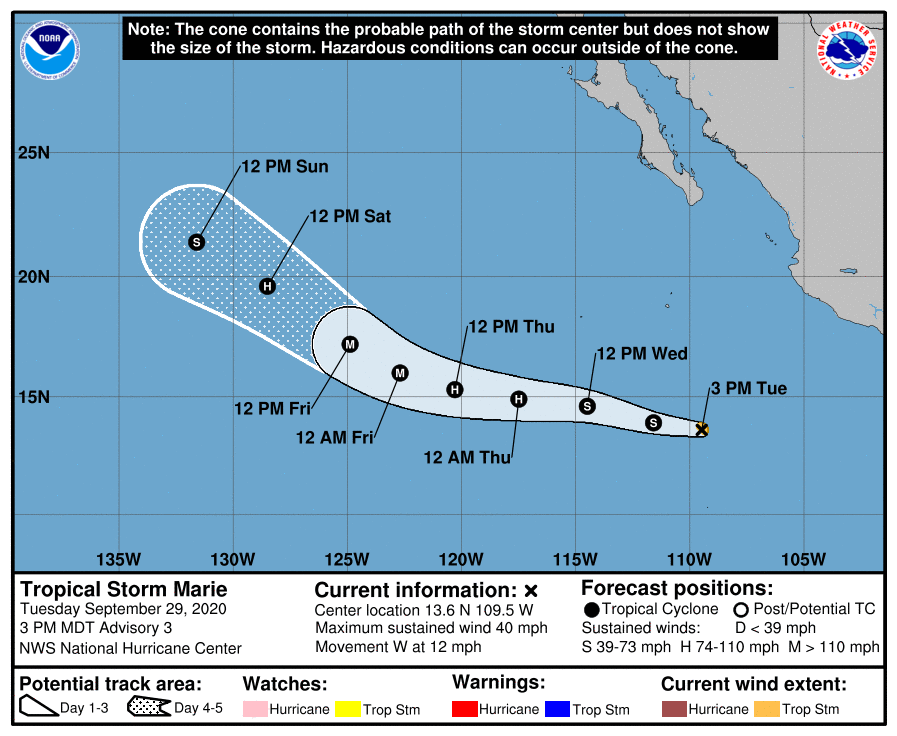
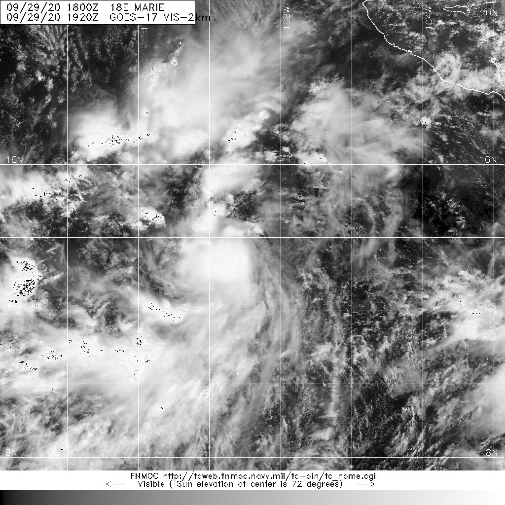
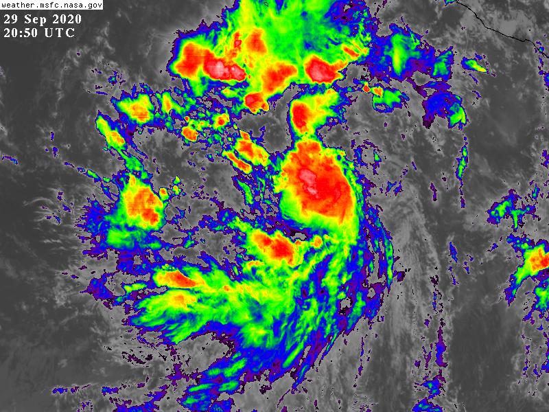
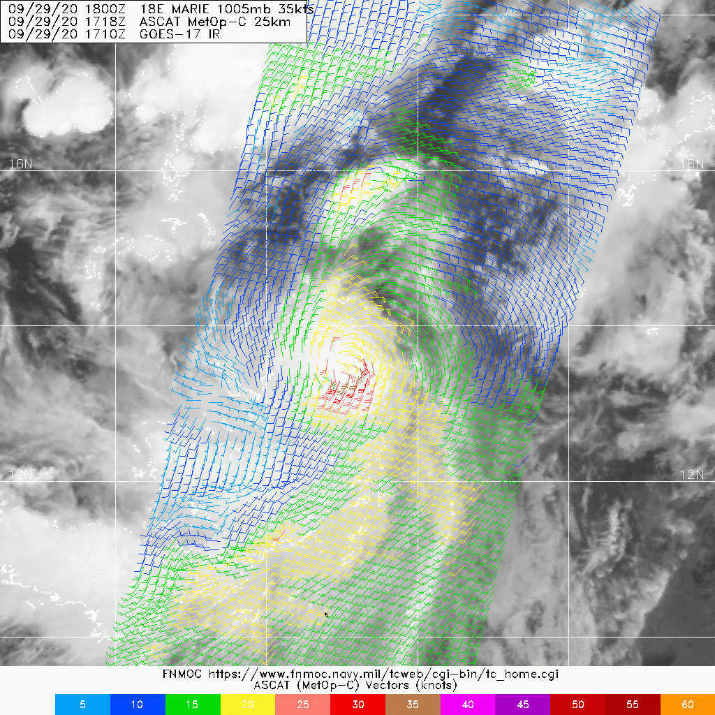
203448_5day_cone_no_line_and_wind.png 20200929.1920.goes-17.vis.2km.18E.MARIE.35kts.1005mb.13.6N.108.8W.pc.jpg
GOES20502020273EWKui3.jpg LATEST (27).jpg
回復

使用道具 舉報

簽到天數: 1650 天

[LV.Master]伴壇終老

老農民版夜神月|2020-10-1 00:24 | 顯示全部樓層
NHC新報預測將於24H內達C2,36H內達MH,並持續上調上望至C4
FORECAST POSITIONS AND MAX WINDS

INIT  30/1500Z 14.2N 113.8W   55 KT  65 MPH
12H  01/0000Z 14.3N 116.1W   65 KT  75 MPH
24H  01/1200Z 14.5N 118.9W   85 KT 100 MPH
36H  02/0000Z 15.1N 121.5W  100 KT 115 MPH
48H  02/1200Z 15.9N 123.9W  110 KT 125 MPH
60H  03/0000Z 16.9N 125.9W  115 KT 130 MPH
72H  03/1200Z 18.0N 127.6W  100 KT 115 MPH
96H  04/1200Z 19.8N 130.7W   75 KT  85 MPH
120H  05/1200Z 21.1N 133.4W   55 KT  65 MPH
20200930.1550.goes-17.vis.2km.18E.MARIE.50kts.1000mb.14.1N.113W.pc.jpg 20200930.1417.f17.91h.18E.MARIE.50kts.1000mb.14.1N.113W.100pc.jpg
20200930.1417.f17.91pct91h91v.18E.MARIE.50kts.1000mb.14.1N.113W.100pc.jpg 144509_5day_cone_no_line_and_wind.png
GOES16002020274a6Bz9y.jpg


回復

使用道具 舉報

簽到天數: 1650 天

[LV.Master]伴壇終老

老農民版夜神月|2020-10-1 23:15 | 顯示全部樓層
快速增強中。15Z定強C2,90KT.NHC看好24H後發展達巔峰,120KT
000
WTPZ43 KNHC 011437
TCDEP3

Hurricane Marie Discussion Number  10
NWS National Hurricane Center Miami FL       EP182020
800 AM PDT Thu Oct 01 2020

Marie has continued to become better organized this morning.  An
AMSR image from just after 09Z showed a closed mid-level eyewall,
and conventional satellite imagery shows an increasingly symmetric
cloud pattern with very cold cloud tops, colder than -80C, around
the center.  The current intensity estimate is set at 90 kt in
agreement with Dvorak classifications from both TAFB and SAB.   
Marie is moving over SSTs warmer than 28 deg C and in a moist,
low-shear atmospheric environment.  The SHIPS guidance still shows
a significant probability of rapid intensification through tonight,
so Marie is likely to become a major hurricane quite soon.  The
official forecast is a little above the latest corrected model
consensus.  In a couple of days, the hurricane should be crossing
the SST gradient and encountering cooler waters, so a weakening
trend is anticipated to be underway within 48 hours.

The estimated initial motion is west-northwestward, or 285/15 kt.  
For the next couple of days, Marie should continue to move along
the southern periphery of a mid-tropospheric ridge associated with
a high pressure system centered over California.  A slight turn to
the right with some deceleration is expected during the forecast
period due to a weakness in the ridge near 130W longitude.  By the
end of the period, Marie is likely to turn toward the northwest
while it moves through this weakness.  The official track forecast
lies very close to the latest multi-model consensus, TVCE,
prediction.


FORECAST POSITIONS AND MAX WINDS

INIT  01/1500Z 15.2N 119.5W   90 KT 105 MPH
12H  02/0000Z 15.9N 121.7W  110 KT 125 MPH
24H  02/1200Z 16.8N 124.1W  120 KT 140 MPH
36H  03/0000Z 17.8N 126.2W  120 KT 140 MPH
48H  03/1200Z 18.8N 127.9W  105 KT 120 MPH
60H  04/0000Z 19.6N 129.3W   90 KT 105 MPH
72H  04/1200Z 20.4N 130.7W   75 KT  85 MPH
96H  05/1200Z 21.7N 133.7W   60 KT  70 MPH
120H  06/1200Z 23.8N 136.2W   40 KT  45 MPH

$$
Forecaster Pasch
20201001.1309.f18.91hw.18E.MARIE.90kts.973mb.15.1N.119.1W.070pc.jpg 20201001.1309.f18.91h.18E.MARIE.90kts.973mb.15.1N.119.1W.070pc.jpg
20201001.1309.f18.91pct91h91v.18E.MARIE.90kts.973mb.15.1N.119.1W.070pc.jpg GOES15002020275peLwrh.jpg
回復

使用道具 舉報

123下一頁
快速回覆
您需要登錄後才可以回帖 登錄 | 立即加入

本版積分規則

本平台僅供學術討論之用,預報應以氣象局為準

威普網站虛擬主機贊助公司

臺灣第一個天氣類型社群平台 即時天氣資訊、精準颱風動態

線上客服
FB傳送訊息
廣告行銷
精準行銷 物超所值
官方粉專
發佈 快速回復 返回頂部 返回列表