簽到天數: 3291 天 [LV.Master]伴壇終老
|
 t02436|2016-9-13 00:11
|
顯示全部樓層
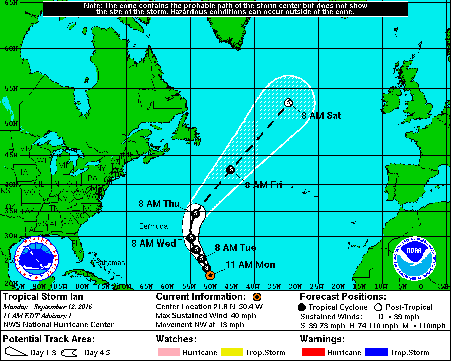
NHC 15Z命名Ian
000
WTNT45 KNHC 121443
TCDAT5
TROPICAL STORM IAN DISCUSSION NUMBER 1
NWS NATIONAL HURRICANE CENTER MIAMI FL AL102016
1100 AM AST MON SEP 12 2016
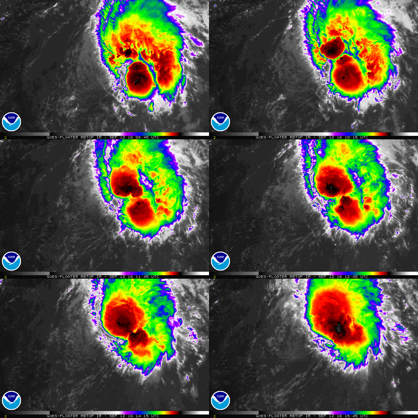
Visible satellite images and a recent ASCAT overpass show
that the low pressure system over the central Atlantic has now
acquired a well-defined low-level circulation. The scatterometer
data showed tropical-storm-force winds over the northern semicircle
of the circulation, and the advisory intensity is set to 35 kt.
Ian is not a well organized storm, with the low-level center
exposed and displaced about 70 n mi to the southwest of the main
area of deep convection. This is due to the effect of about 20 kt
of vertical shear over the system, and this strong shear is
predicted to persist for at least the next day or so. In 36 to 48
hours, the shear is forecast to relax somewhat, so some slow
intensification could begin by tomorrow night. The official
intensity forecast is a little above the model consensus. In 120
hours, or sooner, the system should become embedded within a
frontal zone over north Atlantic and lose tropical characteristics.
Ian is moving northwestward, with initial motion estimated to be
about 320/11 kt. The storm is currently moving through a break in
the subtropical ridge. In the next few days, a 500 mb trough
approaching from the west should cause Ian to turn northward and
then north-northeastward while accelerating. The official forecast
track leans toward the ECMWF solution, but is also not far from the
latest dynamical model consensus.
FORECAST POSITIONS AND MAX WINDS
INIT 12/1500Z 21.8N 50.4W 35 KT 40 MPH
12H 13/0000Z 23.4N 51.2W 35 KT 40 MPH
24H 13/1200Z 25.4N 52.4W 35 KT 40 MPH
36H 14/0000Z 27.3N 53.6W 40 KT 45 MPH
48H 14/1200Z 29.7N 54.8W 45 KT 50 MPH
72H 15/1200Z 34.5N 53.8W 50 KT 60 MPH
96H 16/1200Z 42.5N 45.5W 50 KT 60 MPH
120H 17/1200Z 53.0N 32.0W 50 KT 60 MPH...POST-TROP/EXTRATROP
$$
Forecaster Pasch


|
|