簽到天數: 3291 天 [LV.Master]伴壇終老
|
 t02436|2016-8-28 22:46
|
顯示全部樓層
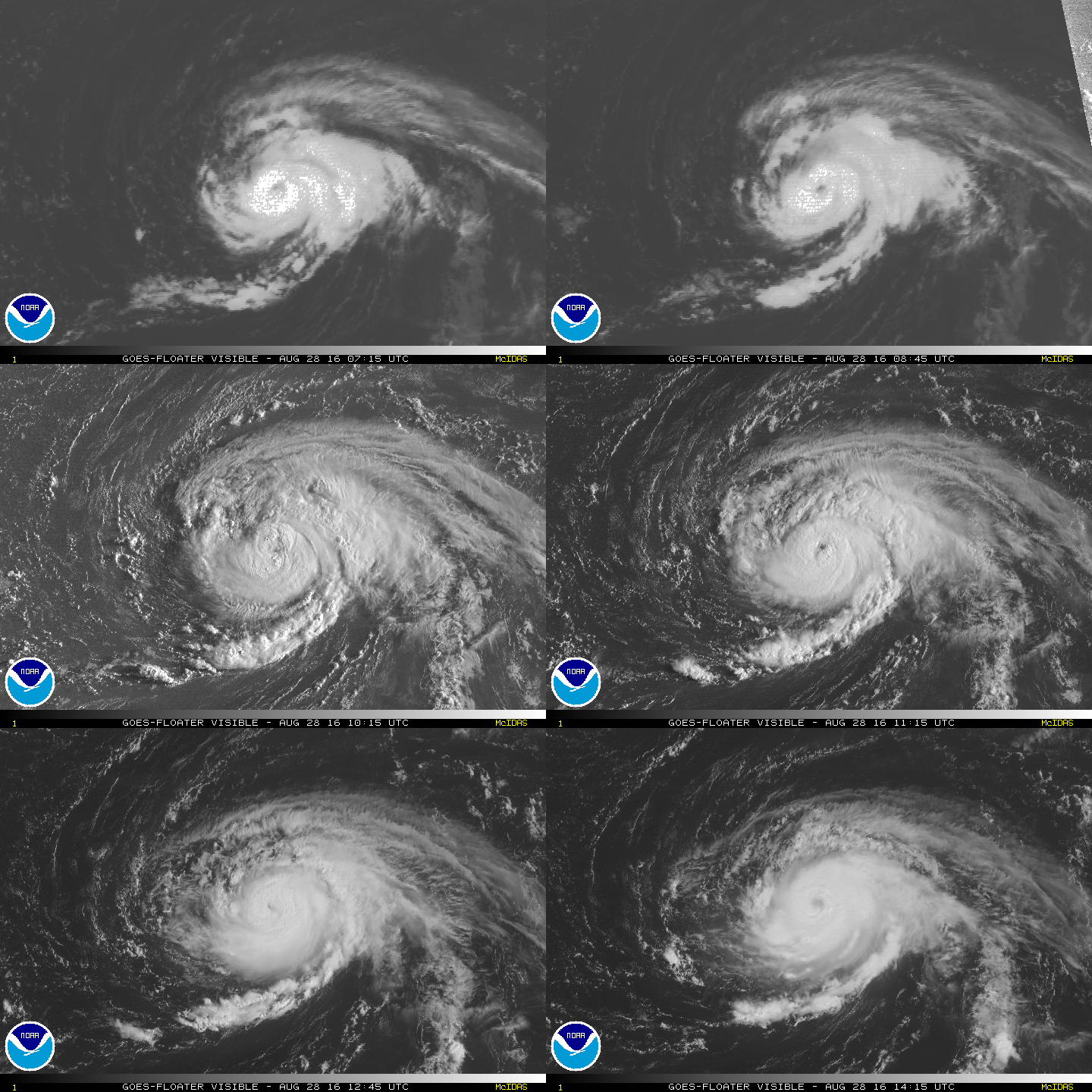
高層風眼終於開出來了,但還是模糊模糊
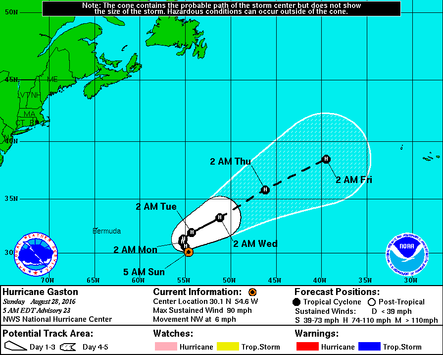
NHC 15Z正報維持速報評價90節,即將抵達轉向點。
000
WTNT42 KNHC 281436
TCDAT2
HURRICANE GASTON DISCUSSION NUMBER 24
NWS NATIONAL HURRICANE CENTER MIAMI FL AL072016
1100 AM AST SUN AUG 28 2016
The eye was fairly distinct a few hours ago, but recently it has
become slightly cloud-filled and the inner-core convection has
become less symmetrical. The current intensity is set at 90 kt,
in agreement with a Dvorak estimate from TAFB and objective ADT
values from UW-CIMSS. Assuming the slight degradation of the inner
core structure to be temporary, a little more strengthening is
expected within the next 12 to 24 hours. Gaston should remain in a
low to moderate vertical wind shear environment for the next
couple of days, which would allow the hurricane to more or less
maintain its intensity through 36-48 hours. By 72 hours and beyond,
increasing westerly shear should induce weakening. The official
intensity forecast is close to the multi-model consensus IVCN.
Steering currents are weak, and the initial motion is a
northwestward drift or 320/4 kt. Gaston's motion is being
partially blocked by a narrow subtropical ridge, and this scenario
should continue for the next day or so. The hurricane is expected
to gradually work its way through the ridge and, in 24 to 48 hours,
begin to move northeastward and east-northeastward as it enters the
mid-latitude westerlies. The official forecast is close to a
consensus of the ECMWF and GFS solutions.
FORECAST POSITIONS AND MAX WINDS
INIT 28/1500Z 30.5N 54.8W 90 KT 105 MPH
12H 29/0000Z 30.8N 55.3W 95 KT 110 MPH
24H 29/1200Z 31.2N 55.6W 95 KT 110 MPH
36H 30/0000Z 31.6N 55.1W 90 KT 105 MPH
48H 30/1200Z 32.4N 53.7W 90 KT 105 MPH
72H 31/1200Z 34.3N 49.4W 80 KT 90 MPH
96H 01/1200Z 36.5N 44.0W 75 KT 85 MPH
120H 02/1200Z 38.5N 36.5W 70 KT 80 MPH
$$
Forecaster Pasch


|
|