開啟輔助訪問
 找回密碼
 立即加入

20P.Trevor 登陸約克角半島後於卡灣重整 二顛登陸北領地

簽到天數: 868 天

[LV.10]以壇為家III

jrchang5|2019-3-18 15:27 | 顯示全部樓層
本帖最後由 jrchang5 於 2019-3-18 15:33 編輯

BoM 18/06Z升格為澳式C2,預測19日下午至晚間將以澳式C3強度登陸約克角半島。
IDQ20018
TROPICAL CYCLONE TECHNICAL BULLETIN: AUSTRALIA - EASTERN REGION
Issued by BRISBANE TROPICAL CYCLONE WARNING CENTRE
at: 0724 UTC 18/03/2019
Name: Tropical Cyclone Trevor
Identifier: 20U
Data At: 0600 UTC
Latitude: 12.5S
Longitude: 145.3E
Location Accuracy: within 15 nm [30 km]
Movement Towards: west southwest [251 deg]
Speed of Movement: 3 knots [6 km/h]
Maximum 10-Minute Wind: 50 knots [95 km/h]
Maximum 3-Second Wind Gust: 70 knots [130 km/h]
Central Pressure: 990 hPa
Radius of 34-knot winds NE quadrant: 90 nm [165 km]
Radius of 34-knot winds SE quadrant: 90 nm [165 km]
Radius of 34-knot winds SW quadrant: 70 nm [130 km]
Radius of 34-knot winds NW quadrant: 70 nm [130 km]
Radius of 48-knot winds NE quadrant: 20 nm [35 km]
Radius of 48-knot winds SE quadrant: 20 nm [35 km]
Radius of 48-knot winds SW quadrant: 20 nm [35 km]
Radius of 48-knot winds NW quadrant: 20 nm [35 km]
Radius of 64-knot winds:
Radius of Maximum Winds: 15 nm [30 km]
Dvorak Intensity Code: T3.5/3.5/D1.5/24HRS STT:D0.5/06HRS
Pressure of outermost isobar: 1008 hPa
Radius of outermost closed isobar: 120 nm [220 km]
FORECAST DATA
Date/Time    : Location    : Loc. Accuracy: Max Wind   : Central Pressure
[UTC]        : degrees     :      nm  [km]: knots[km/h]: hPa
+06:  18/1200: 12.6S 145.0E:     035 [070]:  055  [100]:  987
+12:  18/1800: 12.7S 144.7E:     050 [090]:  065  [120]:  983
+18:  19/0000: 12.9S 144.3E:     060 [115]:  070  [130]:  980
+24:  19/0600: 13.0S 143.8E:     075 [135]:  080  [150]:  980
+36:  19/1800: 13.1S 142.8E:     095 [175]:  040  [075]:  997
+48:  20/0600: 13.1S 141.9E:     115 [210]:  030  [055]: 1002
+60:  20/1800: 12.9S 141.2E:     135 [245]:  030  [055]: 1002
+72:  21/0600: 13.0S 140.7E:     150 [280]:  040  [075]:  996
+96:  22/0600: 13.9S 139.1E:     195 [365]:  065  [120]:  980
+120: 23/0600: 15.5S 136.5E:     285 [525]:  085  [155]:  964
REMARKS:
Tropical Cyclone Trevor has continued to become organised with several deep
convective bands wrapping around the centre in the last 6 hours. Latest
satellite images show deep convection now covering the centre with a possible
CDO developing.

Position is good based on enhanced animated rapid scan VIS imagery and hint of
the a circulation centre appearing on Weipa radar.

Dvorak analysis is based on a tightest curved band wrapping 0.8 yielding a
DT=3.5. MET agrees with development at 1.5 rate per day. ADT is near 3.0 and
SATCON estimate is 60 knots [1-minute average].

The cyclone continues to be steered by a weakening mid-level ridge to the east,
while a stronger middle level ridge is now building across the main land to the
south. This will maintain a dominant east to northeast steering over the system.

Overall synoptic environment has remained very favourable in the last 24 hours,
enabling Trevor to rapidly develop from a T2.0 to a T3.5. Given the favourable
conditions into the convective diurnal cycle [overnight], further
intensification is expected.

At this rate, Trevor could reach a high end category 3 cyclone before it crosses
the coast on Tuesday evening. There is a risk of further intensification to a
category 4 even, if the cyclone moves slower than its forecast speed.

Trevor is expected to weaken to a low or a marginal category 1 system as it
crosses the Peninsula and into the Gulf of Carpentaria during Wednesday. The
conditions for redevelopment in the Gulf of Carpentaria are similar to that of
the east coast. Hence, Trevor is expected to redevelop or intensify quickly as
it moves over water towards the southwestward.

Copyright Commonwealth of Australia
==
The next bulletin for this system will be issued by: 18/1330 UTC by Brisbane
TCWC.
IDQ20023

Australian Government Bureau of Meteorology
Queensland
Tropical Cyclone Warning Centre

Media: The Standard Emergency Warning Signal should NOT be used with this warning.

TOP PRIORITY FOR IMMEDIATE BROADCAST
TROPICAL CYCLONE ADVICE NUMBER 9
Issued at 4:53 pm EST on Monday 18 March 2019

Headline:
Tropical Cyclone Trevor is rapidly intensifying and expected be a category 3 cyclone tomorrow morning.A Cyclone Watch has been extended to the western Peninsula coast.

Areas Affected:
Warning Zone
Orford Ness to Cooktown.

Watch Zone
Cape York to Pormpuraaw.

Cancelled Zone
Cooktown to Cape Tribulation and Orford Ness to Cape York.

Details of Tropical Cyclone Trevor at 4:00 pm AEST:
Intensity: Category 2, sustained winds near the centre of 95 kilometres per hour with wind gusts to 130 kilometres per hour.

Location: within 30 kilometres of 12.5 degrees South 145.3 degrees East, estimated to be 220 kilometres east of Lockhart River and 370 kilometres east of Weipa.

Movement: west southwest at 6 kilometres per hour.

Tropical Cyclone Trevor continues to move slowly towards the eastern Cape York Peninsula coast. It is expected to intensify to a category 3 before crossing the coast near Lockhart River on Tuesday evening. Tropical Cyclone Trevor may weaken as it crosses the northern Peninsula during Tuesday night before entering the Gulf of Carpentaria later on Wednesday, where it will reintensify into a tropical cyclone.

Hazards:
GALES, with gusts in excess of 90 km/h, are expected to develop between Cape Grenville and Cooktown tonight. These GALES may extend north to Orford Ness during Tuesday, if the cyclone takes a more northerly track.

DESTRUCTIVE WINDS, with gusts in excess of 125 km/h are possible between Cape Grenville and Coen from Tuesday afternoon as the cyclone approaches the coast.

The VERY DESTRUCTIVE CORE of Tropical Cyclone Trevor, with extreme gusts up to 205 km/h may occur near the centre as the cyclone makes landfall on Tuesday evening.

GALES are expected to extend inland over the Peninsula on Tuesday night as the cyclone moves inland. GALES may develop along the western Peninsula coast between Thursday Island and Pormpuraaw during Wednesday as Trevor reintensifies in the Gulf of Caprentaria.

ABNORMALLY HIGH TIDES are expected on Tuesday and Wednesday's morning high tides for far northeast Queensland coast, north of Port Douglas.

As the cyclone crosses the coast, a storm tide is expected between Orford Ness and Cape Flattery. Large waves may produce minor flooding along the foreshore. People living in these areas are likely to be affected by flooding and should take measures to protect their property as much as possible and be prepared to help their neighbours.

HEAVY RAINFALL, which may lead to flash flooding, is forecast to develop across far north Queensland over the next few days. A Flood Watch has been issued for catchments north of Cairns to Kowanyama.

Recommended Action:
People between Orford Ness and Cooktown, including Lockhart River and Coen, should immediately commence or continue preparations, especially securing boats and property, using available daylight hours.

People between Cape York and Pormpuraaw on western Peninsula, should consider what action they will need to take if the cyclone threat increases, and listen to the next advice at 8pm AEST.

- Information is available from your local government.

- For cyclone preparedness and safety advice, visit Queensland's Disaster Management Services website (www.disaster.qld.gov.au).

- For emergency assistance call the Queensland State Emergency Service (SES) on 132 500 (for assistance with storm damage, rising flood water, fallen trees on buildings or roof damage).

Next Advice:
The next advice will be issued by 8:00 pm AEST Monday 18 March.

This warning is also available through TV and Radio Broadcasts; the Bureau's website at www.bom.gov.au or call 1300 659 212. The Bureau and the State Emergency Service would appreciate this warning being broadcast regularly.

IDQ65001 (1).png 20190318.0650.himawari-8.vis.20P.TREVOR.50kts.985mb.12.3S.145E.100pc.jpg rgb_lalo-animated.gif rb_lalo-animated (1).gif


回復

使用道具 舉報

簽到天數: 1650 天

[LV.Master]伴壇終老

老農民版夜神月|2019-3-18 03:28 | 顯示全部樓層
本帖最後由 老農民版夜神月 於 2019-3-18 15:31 編輯

目前由於BoM也恰巧同一時間升格
因此可見圖上給予20P的仍是暫時命名Twenty
稍後應即會改為BoM給予的國際通用命名Trevor
20190317.1850.himawari-8.ircolor.20P.TWENTY.35kts.996mb.13.1S.146.3E.100pc.jpg 20190317.1733.f15.vis.olsvisnghtcomp.20P.TWENTY.x.jpg


回復

使用道具 舉報

簽到天數: 868 天

[LV.10]以壇為家III

jrchang5|2019-3-18 03:21 | 顯示全部樓層
本帖最後由 jrchang5 於 2019-3-18 03:29 編輯
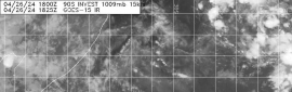
BoM 17/18Z升格命名首報
IDQ20018
TROPICAL CYCLONE TECHNICAL BULLETIN: AUSTRALIA - EASTERN REGION
Issued by BRISBANE TROPICAL CYCLONE WARNING CENTRE
at: 1906 UTC 17/03/2019
Name: Tropical Cyclone Trevor
Identifier: 20U
Data At: 1800 UTC
Latitude: 12.4S
Longitude: 146.1E
Location Accuracy: within 40 nm [75 km]
Movement Towards: west southwest [248 deg]
Speed of Movement: 5 knots [10 km/h]
Maximum 10-Minute Wind: 35 knots [65 km/h]
Maximum 3-Second Wind Gust: 50 knots [95 km/h]
Central Pressure: 995 hPa
Radius of 34-knot winds NE quadrant: 40 nm [75 km]
Radius of 34-knot winds SE quadrant: 40 nm [75 km]
Radius of 34-knot winds SW quadrant: 60 nm [110 km]
Radius of 34-knot winds NW quadrant: 40 nm [75 km]
Radius of 48-knot winds NE quadrant:   
Radius of 48-knot winds SE quadrant:   
Radius of 48-knot winds SW quadrant:   
Radius of 48-knot winds NW quadrant:   
Radius of 64-knot winds:
Radius of Maximum Winds: 25 nm [45 km]
Dvorak Intensity Code: T3.0/3.0/D1.5/24HRS STT:D0.5/06HRS
Pressure of outermost isobar: 1008 hPa
Radius of outermost closed isobar: 140 nm [260 km]
FORECAST DATA
Date/Time    : Location    : Loc. Accuracy: Max Wind   : Central Pressure
[UTC]        : degrees     :      nm  [km]: knots[km/h]: hPa
+06:  18/0000: 12.7S 145.6E:     050 [095]:  040  [075]:  994
+12:  18/0600: 12.7S 145.3E:     065 [120]:  045  [085]:  992
+18:  18/1200: 12.7S 144.9E:     075 [145]:  050  [095]:  990
+24:  18/1800: 12.9S 144.6E:     090 [165]:  055  [100]:  987
+36:  19/0600: 13.1S 143.7E:     110 [200]:  060  [110]:  984
+48:  19/1800: 13.3S 142.6E:     130 [235]:  035  [065]: 1000
+60:  20/0600: 13.2S 141.6E:     150 [275]:  030  [055]: 1002
+72:  20/1800: 12.9S 140.9E:     165 [310]:  030  [055]: 1002
+96:  21/1800: 13.4S 139.8E:     210 [390]:  045  [085]:  994
+120: 22/1800: 14.8S 137.8E:     300 [555]:  060  [110]:  985
REMARKS:
Tropical low 20U [now tropical cyclone Trevor] has continued to develop during
the past 6 hours, and now exhibits a central dense overcast with a cold comma
and peripheral banding. Position fair based on recent microwave passes and
extrapolation.

Dvorak analysis is based on a curved band pattern with an average 0.6 to 0.7
wrap over the past three hours. DT is 3.0. MET is 2.5 based on a 24 hour D
trend. PT is 3.0 based on the improved cloud structure. Final T is 3.0. ADT
guidance suggests FT 2.8 with Vmax [1 minute] 41 knots. Intensity is analysed at
35 knots [10 minute mean].

The system will continue to be steered WSW by a weak mid-level ridge to the east
in the short term. In the medium term, a new ridge will build under the system
and steer it more westward. NWP guidance is reasonably consistent on this
prognosis.

Vertical wind shear is low along the projected track, with the subtropical jet
well to the south. SSTs are favourable and upper outflow is reasonably good to
the south. Development at the standard rate is forecast which would see the
system reach at least category 2 before making landfall on the eastern Cape York
Peninsula coast late on Tuesday, though a crossing at category 3 cannot be ruled
out.

In the longer term, the system is likely to move into the Gulf of Carpentaria
around mid-week. Conditions for development are expected to remain favourable
and the system is likely to redevelop into a tropical cyclone in the Gulf.

Copyright Commonwealth of Australia
==
The next bulletin for this system will be issued by: 18/0130 UTC by Brisbane
TCWC.
IDQ20023

Australian Government Bureau of Meteorology
Queensland
Tropical Cyclone Warning Centre

Media: The Standard Emergency Warning Signal should NOT be used with this warning.

TOP PRIORITY FOR IMMEDIATE BROADCAST
TROPICAL CYCLONE ADVICE NUMBER 5
Issued at 4:46 am EST on Monday 18 March 2019

Headline:
Tropical cyclone Trevor has formed in the northern Coral Sea.

Areas Affected:
Warning Zone
Cape Grenville to Cape Flattery, including Coen and Lockhart River.

Watch Zone
Cape York to Cape Grenville and Cape Flattery to Cape Tribulation (including Cooktown), including adjacent inland areas.

Cancelled Zone
None.

Details of Tropical Cyclone Trevor at 4:00 am AEST:
Intensity: Category 1, sustained winds near the centre of 65 kilometres per hour with wind gusts to 95 kilometres per hour.

Location: within 75 kilometres of 12.4 degrees South 146.1 degrees East, estimated to be 305 kilometres east of Lockhart River and 500 kilometres north of Cairns.

Movement: west southwest at 10 kilometres per hour.

Tropical cyclone Trevor, category 1, has formed in the northern Coral Sea east of Cape York Peninsula.

Tropical cyclone Trevor is expected to move in a west-southwest direction towards the Cape York Peninsula coast. It is expected to continue intensifying, and should reach category 2 before crossing the eastern Cape York Peninsula coast later on Tuesday.

Hazards:
GALES, with gusts in excess of 90 km/h, are expected to develop between Cape Grenville and Cape Flattery on Monday night. These GALES may extend north to the Torres Strait Islands and south to Cape Tribulation, including Cooktown, on Tuesday.

DESTRUCTIVE WINDS, with gusts in excess of 125 km/h, may occur as the centre of the cyclone makes landfall on the eastern Cape York Peninsula coast later on Tuesday.

As the cyclone crosses the coast, ABNORMALLY HIGH TIDES are expected about the far north Queensland coast. Large waves are likely along the beachfront.

HEAVY RAINFALL, which may lead to flash flooding, is forecast to develop across far north Queensland over the next few days.

Recommended Action:
People between Cape Grenville and Cape Flattery, including Lockhart River and Coen, should immediately commence or continue preparations, especially securing boats and property, using available daylight hours.

People elsewhere between the Torres Strait Islands and Cape Tribulation, including Cooktown should consider what action they will need to take if the cyclone threat increases, and listen to the next advice at 8am AEST.

- Information is available from your local government.

- For cyclone preparedness and safety advice, visit Queensland's Disaster Management Services website (www.disaster.qld.gov.au).

- For emergency assistance call the Queensland State Emergency Service (SES) on 132 500 (for assistance with storm damage, rising flood water, fallen trees on buildings or roof damage).

Next Advice:
The next advice will be issued by 8:00 am AEST Monday 18 March.

This warning is also available through TV and Radio Broadcasts; the Bureau's website at www.bom.gov.au or call 1300 659 212. The Bureau and the State Emergency Service would appreciate this warning being broadcast regularly.
IDQ65001.png vis_lalo-animated.gif rb_lalo-animated.gif

回復

使用道具 舉報

簽到天數: 1650 天

[LV.Master]伴壇終老

老農民版夜神月|2019-3-18 02:56 | 顯示全部樓層
經過多日的整合發展
1718Z,JTWC升格20P
20P INVEST 190317 1800 13.1S 146.3E SHEM 35 996
TPPS10 PGTW 171816

A. TROPICAL DISTURBANCE 92P (NE OF QUEENSLAND)

B. 17/1730Z

C. 13.13S

D. 146.41E

E. FIVE/HMWRI8

F. T2.5/2.5 STT: D0.5/03HRS

G. IR/EIR

H. REMARKS: 38A/PBO SBC/ANMTN. CNTVTN WRAPS .40 ON LOG10 SPIRAL
YIELDING DT OF 2.5. MET AND PT AGREE. DBO DT.

I. ADDITIONAL POSITIONS: NONE


DARLOW


vis018-lalo.gif 20190317.1810.himawari-8.ir.92P.INVEST.30kts.1004mb.12.6S.146.7E.100pc.jpg
20190317.1810.himawari-8.irbd.92P.INVEST.30kts.1004mb.12.6S.146.7E.100pc.jpg 20190317.1620.Aqua.wv.modwv.INVEST.1KM.jpg
92P_gefs_latest.png 92P_tracks_latest.png


回復

使用道具 舉報

簽到天數: 601 天

[LV.9]以壇為家II

霧峰追風者|2019-3-18 02:53 | 顯示全部樓層
本帖最後由 霧峰追風者 於 2019-3-18 03:10 編輯

BoM 18Z命名“Trevor”,逐漸增強,將直襲約克角半島。
IDQ20018
TROPICAL CYCLONE TECHNICAL BULLETIN: AUSTRALIA - EASTERN REGION
Issued by BRISBANE TROPICAL CYCLONE WARNING CENTRE
at: 1906 UTC 17/03/2019
Name: Tropical Cyclone Trevor
Identifier: 20U
Data At: 1800 UTC
Latitude: 12.4S
Longitude: 146.1E
Location Accuracy: within 40 nm [75 km]
Movement Towards: west southwest [248 deg]
Speed of Movement: 5 knots [10 km/h]
Maximum 10-Minute Wind: 35 knots [65 km/h]
Maximum 3-Second Wind Gust: 50 knots [95 km/h]
Central Pressure: 995 hPa
Radius of 34-knot winds NE quadrant: 40 nm [75 km]
Radius of 34-knot winds SE quadrant: 40 nm [75 km]
Radius of 34-knot winds SW quadrant: 60 nm [110 km]
Radius of 34-knot winds NW quadrant: 40 nm [75 km]
Radius of 48-knot winds NE quadrant:   
Radius of 48-knot winds SE quadrant:   
Radius of 48-knot winds SW quadrant:   
Radius of 48-knot winds NW quadrant:   
Radius of 64-knot winds:
Radius of Maximum Winds: 25 nm [45 km]
Dvorak Intensity Code: T3.0/3.0/D1.5/24HRS STT:D0.5/06HRS
Pressure of outermost isobar: 1008 hPa
Radius of outermost closed isobar: 140 nm [260 km]
FORECAST DATA
Date/Time    : Location    : Loc. Accuracy: Max Wind   : Central Pressure
[UTC]        : degrees     :      nm  [km]: knots[km/h]: hPa
+06:  18/0000: 12.7S 145.6E:     050 [095]:  040  [075]:  994
+12:  18/0600: 12.7S 145.3E:     065 [120]:  045  [085]:  992
+18:  18/1200: 12.7S 144.9E:     075 [145]:  050  [095]:  990
+24:  18/1800: 12.9S 144.6E:     090 [165]:  055  [100]:  987
+36:  19/0600: 13.1S 143.7E:     110 [200]:  060  [110]:  984
+48:  19/1800: 13.3S 142.6E:     130 [235]:  035  [065]: 1000
+60:  20/0600: 13.2S 141.6E:     150 [275]:  030  [055]: 1002
+72:  20/1800: 12.9S 140.9E:     165 [310]:  030  [055]: 1002
+96:  21/1800: 13.4S 139.8E:     210 [390]:  045  [085]:  994
+120: 22/1800: 14.8S 137.8E:     300 [555]:  060  [110]:  985
REMARKS:
Tropical low 20U [now tropical cyclone Trevor] has continued to develop during
the past 6 hours, and now exhibits a central dense overcast with a cold comma
and peripheral banding. Position fair based on recent microwave passes and
extrapolation.

Dvorak analysis is based on a curved band pattern with an average 0.6 to 0.7
wrap over the past three hours. DT is 3.0. MET is 2.5 based on a 24 hour D
trend. PT is 3.0 based on the improved cloud structure. Final T is 3.0. ADT
guidance suggests FT 2.8 with Vmax [1 minute] 41 knots. Intensity is analysed at
35 knots [10 minute mean].

The system will continue to be steered WSW by a weak mid-level ridge to the east
in the short term. In the medium term, a new ridge will build under the system
and steer it more westward. NWP guidance is reasonably consistent on this
prognosis.

Vertical wind shear is low along the projected track, with the subtropical jet
well to the south. SSTs are favourable and upper outflow is reasonably good to
the south. Development at the standard rate is forecast which would see the
system reach at least category 2 before making landfall on the eastern Cape York
Peninsula coast late on Tuesday, though a crossing at category 3 cannot be ruled
out.

In the longer term, the system is likely to move into the Gulf of Carpentaria
around mid-week. Conditions for development are expected to remain favourable
and the system is likely to redevelop into a tropical cyclone in the Gulf.

Copyright Commonwealth of Australia
==
The next bulletin for this system will be issued by: 18/0130 UTC by Brisbane
TCWC.

回復

使用道具 舉報

簽到天數: 868 天

[LV.10]以壇為家III

jrchang5|2019-3-17 09:18 | 顯示全部樓層
本帖最後由 jrchang5 於 2019-3-17 09:58 編輯

BoM判定17/00Z仍為熱帶低壓並編號20U,在約克角半島以東緩慢向西南西移動,有機會在18日升格命名,並將於19日以澳式C2強度在該半島東岸登陸。

IDQ20018
TROPICAL CYCLONE TECHNICAL BULLETIN: AUSTRALIA - EASTERN REGION
Issued by BRISBANE TROPICAL CYCLONE WARNING CENTRE
at: 0145 UTC 17/03/2019
Name: Tropical Low  
Identifier: 20U
Data At: 0000 UTC
Latitude: 10.5S
Longitude: 146.9E
Location Accuracy: within 30 nm [55 km]
Movement Towards: south southwest [206 deg]
Speed of Movement: 2 knots [4 km/h]
Maximum 10-Minute Wind: 25 knots [45 km/h]
Maximum 3-Second Wind Gust: 45 knots [85 km/h]
Central Pressure: 1000 hPa
Radius of 34-knot winds NE quadrant: 40 nm [75 km]
Radius of 34-knot winds SE quadrant:   
Radius of 34-knot winds SW quadrant:   
Radius of 34-knot winds NW quadrant:   
Radius of 48-knot winds NE quadrant:   
Radius of 48-knot winds SE quadrant:   
Radius of 48-knot winds SW quadrant:   
Radius of 48-knot winds NW quadrant:   
Radius of 64-knot winds:
Radius of Maximum Winds:   
Dvorak Intensity Code: T2.0/2.0/W0.5/24HRS
Pressure of outermost isobar: 1008 hPa
Radius of outermost closed isobar: 300 nm [555 km]
FORECAST DATA
Date/Time    : Location    : Loc. Accuracy: Max Wind   : Central Pressure
[UTC]        : degrees     :      nm  [km]: knots[km/h]: hPa
+06:  17/0600: 10.8S 146.7E:     040 [080]:  030  [055]: 1000
+12:  17/1200: 11.1S 146.5E:     055 [100]:  030  [055]: 1000
+18:  17/1800: 11.5S 146.1E:     065 [125]:  030  [055]: 1001
+24:  18/0000: 11.7S 145.5E:     080 [145]:  030  [055]: 1001
+36:  18/1200: 11.7S 144.9E:     100 [180]:  035  [065]:  997
+48:  19/0000: 12.2S 144.2E:     120 [220]:  045  [085]:  992
+60:  19/1200: 12.3S 143.2E:     140 [255]:  050  [095]:  989
+72:  20/0000: 12.5S 142.2E:     180 [335]:  030  [055]: 1001
+96:  21/0000: 12.7S 141.6E:     200 [370]:  030  [055]: 1000
+120: 22/0000: 13.5S 141.0E:     200 [370]:  045  [085]:  991
REMARKS:
A Tropical Low is located to the south of the PNG mainland. Centre location is
fair based on VIS and microwave animation. This has been confirmed by the latest
ASCAT pass. A small deep convective blob near centre gives a DT=1.5 with deeper
convection located in a band further to the northwest. Current Intensity is
based on MET=2.0=PT.

The ASCAT pass shows a decent low level cross equatorial flow feeding into the
low with gales located near centre in the NE quadrant. The low is located in a
low vertical wind shear zone under an upper high with good upper level outflow
to the west and south, aided by an upper cut-off low moving eastwards in the far
south. Sea surface temperatures in the northwest Coral Sea are around 30
degrees.

The low is showing reasonably good organisation but missing deep convection near
centre at present. However, the favourable environment will lead to the low
developing into a tropical cyclone in the next 24 hours. Further intensification
to category 2 is possible.

The low is likely to be steered by the weak mid-level ridge located to its east
in the short term and then by a stronger ridge building over Australia as the
cut-off low in the far south moves away. Overall, a west-southwest movement
would be favoured throughout its life-time. On this path, the cyclone would
cross the Cape York Peninsula coast and weaken due to land effects during early
week.

Given the favourable conditions persisting in the longer term, there is a good
chance that the cyclone may redevelop once it moves into the southern Gulf of
Carpentaria by mid to late week.

Copyright Commonwealth of Australia
==
The next bulletin for this system will be issued by: 17/0730 UTC by Brisbane
TCWC.

IDQ20023

Australian Government Bureau of Meteorology
Queensland
Tropical Cyclone Warning Centre

Media: The Standard Emergency Warning Signal should NOT be used with this warning.

PRIORITY
TROPICAL CYCLONE ADVICE NUMBER 1
Issued at 10:37 am EST on Sunday 17 March 2019

Headline:
High chance of tropical cyclone formation in the northwest Coral Sea on Monday

Areas Affected:
Warning Zone
None.

Watch Zone
Torres Strait Islands to Cape Flattery.

Cancelled Zone
None.

Details of Tropical Low at 10:00 am AEST:
Intensity: Tropical Low, sustained winds near the centre of 45 kilometres per hour with wind gusts to 85 kilometres per hour.

Location: within 55 kilometres of 10.5 degrees South 146.9 degrees East, estimated to be 465 kilometres east northeast of Lockhart River and 730 kilometres north of Cairns.

Movement: slow moving.

The tropical low is expected to continue tracking in a general westwards direction towards the far north Queensland coast over the next couple of days. At this stage, the system is rated a high chance of forming into a tropical cyclone on Monday and is forecast to reach category 2 intensity prior to moving onto the far north Queensland coast late on Tuesday or during Wednesday.

Hazards:
GALES, with gusts in excess of 90 km/h, may develop between the Torres Strait Islands and Cape Flattery on Tuesday. DESTRUCTIVE WINDS, with gusts in excess of 125 km/h, may occur about a small stretch of the far north Queensland coast if the system reaches category 2 intensity prior to moving onto the coast late on Tuesday or during Wednesday.

As the cyclone crosses the coast late on Tuesday or during Wednesday, ABNORMALLY HIGH TIDES are expected about the far north Queensland coast. Large waves are likely along the beachfront.

HEAVY RAINFALL, which may lead to flash flooding, is forecast to develop across far north Queensland over the next few days.

Recommended Action:
People between the Torres Strait Islands and Cape Flattery should consider what action they will need to take if the cyclone threat increases.

- Information is available from your local government

- For cyclone preparedness and safety advice, visit Queensland's Disaster Management Services website (www.disaster.qld.gov.au)

- For emergency assistance call the Queensland State Emergency Service (SES) on 132 500 (for assistance with storm damage, rising flood water, fallen trees on buildings or roof damage).

Next Advice:
The next advice will be issued by 5:00 pm AEST Sunday 17 March.

This warning is also available through TV and Radio Broadcasts; the Bureau's website at www.bom.gov.au or call 1300 659 212. The Bureau and the State Emergency Service would appreciate this warning being broadcast regularly.
IDQ20008
SECURITE

HIGH SEAS WEATHER WARNING FOR METAREA 10 ISSUED BY THE
AUSTRALIAN BUREAU OF METEOROLOGY TROPICAL CYCLONE WARNING CENTRE BRISBANE
AT 0110UTC 17 MARCH 2019

GALE WARNING FOR NORTH EASTERN AREA

SITUATION
At 0000 UTC a Tropical Low was centred within 30 nautical miles of
latitude ten decimal five south (10.5S)
longitude one hundred and forty six decimal nine east (146.9E)
Recent movement : slow moving
Maximum winds   : 25 knots
Central pressure: 1000 hPa

AREA AFFECTED
Within 40 nautical miles in NE quadrant

FORECAST
Maximum winds to 25 knots near the centre increasing to 30 knots by 0000 UTC 18
March.

Winds above 34 knots within 40 nautical miles in NE quadrant with rough to very
rough seas and moderate swell.

REMARKS
All ships in the area please send weather reports every three hours. Regular
weather observing ships use normal channels. Other ships please use either
email to marwxqld@bom.gov.au or fax to +61732200221 or satellite using SAC1241
through Land Earth Station Burum 312 [or 212 as appropriate] via Perth.

Next warning will be issued by 0700 UTC 17 March 2019.

WEATHER BRISBANE

IDQ65001.png 20190317.0020.himawari-8.vis.92P.INVEST.30kts.1000mb.10.7S.146.7E.100pc.jpg 92P_gefs_latest.png esrl.eps.ecmb.hit.loop.92P.2019.2019031612.gif


回復

使用道具 舉報

簽到天數: 601 天

[LV.9]以壇為家II

霧峰追風者|2019-3-15 22:22 | 顯示全部樓層
目前在巴布亞新新幾內亞責任區裡,BoM 旋風展望有機會在該區命名。
Tropical Cyclone Outlook for Coral Sea
Issued at 2:30 pm EST on Friday 15 March 2019
for the period until midnight EST Monday 18 March 2019.

Existing Cyclones in the Eastern Region:
Nil.

Potential Cyclones:

At 2pm AEST Friday, a developing tropical low was located east of Papua New Guinea. This low is expected to develop further and may develop into a tropical cyclone in the Papua New Guinea area of responsibility today or over the weekend.

This system is expected to drift southwest over the weekend. It may enter northern parts of the Eastern Region early next week as a tropical cyclone or developing tropical low.


Likelihood of a tropical cyclone in the Eastern Region on:
Saturday:Very low
Sunday:Moderate
Monday:Moderate
IDQ20008
SECURITE
CANCELLATION

HIGH SEAS WEATHER WARNING FOR METAREA 10 ISSUED BY THE
AUSTRALIAN BUREAU OF METEOROLOGY TROPICAL CYCLONE WARNING CENTRE BRISBANE
AT 1258UTC 15 MARCH 2019

GALE WARNING FOR NORTH EASTERN AREA

SITUATION
At 1200 UTC a Tropical Low was centred within 30 nautical miles of
latitude eight decimal eight south (8.8S)
longitude one hundred and fifty decimal five east (150.5E)
Recent movement : southwest at 4 knots
Maximum winds   : 30 knots
Central pressure: 999 hPa
The low is no longer expected to develop into a tropical cyclone within 24
hours.

AREA AFFECTED
Nil

FORECAST
Gales are no longer expected within 24 hours.

No further warnings will be issued unless the system intensifies.

WEATHER BRISBANE


回復

使用道具 舉報

簽到天數: 1650 天

[LV.Master]伴壇終老

老農民版夜神月|2019-3-15 10:39 | 顯示全部樓層
本帖最後由 老農民版夜神月 於 2019-3-15 10:48 編輯

15/0130JTWC發布TCFA
WTPS21 PGTW 150130
MSGID/GENADMIN/JOINT TYPHOON WRNCEN PEARL HARBOR HI//
SUBJ/TROPICAL CYCLONE FORMATION ALERT (INVEST 92P)//
RMKS/
1. FORMATION OF A SIGNIFICANT TROPICAL CYCLONE IS POSSIBLE WITHIN
160 NM EITHER SIDE OF A LINE FROM 8.2S 151.0E TO 15.1S 148.3E
WITHIN THE NEXT 12 TO 24 HOURS. AVAILABLE DATA DOES NOT JUSTIFY
ISSUANCE OF NUMBERED TROPICAL CYCLONE WARNINGS AT THIS TIME.
WINDS IN THE AREA ARE ESTIMATED TO BE 28 TO 33 KNOTS. METSAT
IMAGERY AT 150000Z INDICATES THAT A CIRCULATION CENTER IS LOCATED
NEAR 8.6S 151.0E. THE SYSTEM IS MOVING SOUTH-SOUTHEASTWARD AT 03
KNOTS.
2. REMARKS: THE AREA OF CONVECTION (INVEST 92P) PREVIOUSLY LOCATED
NEAR 8.1S 150.9E, IS NOW LOCATED NEAR 8.6S 151.0E APPROXIMATELY 236
NM EAST-NORTHEAST OF PORT MORESBY, PAPUA NEW GUINEA. ANIMATED
MULTISPECTRAL SATELLITE IMAGERY AND A 142304Z MHS METOP-B 89GHZ
IMAGE DEPICT A CONSOLIDATING LOW LEVEL CIRCULATION CENTER (LLCC)
WITH DEEP CONVECTION BUILDING OVER THE CENTER. A 142306Z METOP-B
ASCAT PASS REVEALS A DEFINED CIRCULATION WITH 25 KT WINDS WRAPPED
AROUND THE CENTER AND STRONGER WINDS WRAPPING IN FROM THE SOUTHWEST.
UPPER LEVEL ANALYSIS DEPICTS INVEST 92P BORDERING AN AREA OF LOW TO
MODERATE (10-25 KNOT) VERTICAL WIND SHEAR, WITH EXCELLENT POLEWARD
DIFFLUENCE ALOFT.  WARM SEA SURFACE TEMPERATURES (29-30 CELSIUS) IN
THE SOLOMON SEA SUPPORT FUTURE DEVELOPMENT. GLOBAL MODELS ARE IN
GOOD AGREEMENT THAT 92P WILL GRADUALLY DEVELOP TO TROPICAL CYCLONE
STRENGTH WITH IN THE NEXT 24-36 HOURS AS IT TRACKS SOUTHWARD, WITH
POSSIBLE LAND INTERFERENCE FROM NEARBY ISLANDS AND THE PAPUAN
PENINSULA. MAXIMUM SUSTAINED SURFACE WINDS ARE ESTIMATED AT 28 TO 33
KNOTS. MINIMUM SEA LEVEL PRESSURE IS ESTIMATED TO BE NEAR 998 MB.
THE POTENTIAL FOR THE DEVELOPMENT OF A SIGNIFICANT TROPICAL CYCLONE
WITHIN THE NEXT 24 HOURS IS HIGH.
3. THIS ALERT WILL BE REISSUED, UPGRADED TO WARNING OR CANCELLED BY
160130Z.
//
NNNN
sh9219.gif 5abf3901213fb80e32a099cf38d12f2eb938940f.jpg
93aac3cec3fdfc03ba3ceaa0da3f8794a4c22633.jpg


回復

使用道具 舉報

快速回覆
您需要登錄後才可以回帖 登錄 | 立即加入

本版積分規則

本平台僅供學術討論之用,預報應以氣象局為準

威普網站虛擬主機贊助公司

臺灣第一個天氣類型社群平台 即時天氣資訊、精準颱風動態

線上客服
FB傳送訊息
廣告行銷
精準行銷 物超所值
官方粉專
發佈 快速回復 返回頂部 返回列表