開啟輔助訪問
 找回密碼
 立即加入

20P.Trevor 登陸約克角半島後於卡灣重整 二顛登陸北領地

簽到天數: 601 天

[LV.9]以壇為家II

霧峰追風者|2019-3-20 22:04 | 顯示全部樓層
本帖最後由 霧峰追風者 於 2019-3-20 22:07 編輯

目前移動速度滯留飄移中,受到陸地影響,強度已減弱到35kt,預計明天上半天才會進入卡灣,強度重整上望澳式C4。
IDQ20018
TROPICAL CYCLONE TECHNICAL BULLETIN: AUSTRALIA - EASTERN REGION
Issued by BRISBANE TROPICAL CYCLONE WARNING CENTRE
at: 0654 UTC 20/03/2019
Name: Tropical Cyclone Trevor
Identifier: 20U
Data At: 0600 UTC
Latitude: 13.0S
Longitude: 141.9E
Location Accuracy: within 15 nm [30 km]
Movement Towards: west northwest [297 deg]
Speed of Movement: 2 knots [4 km/h]
Maximum 10-Minute Wind: 35 knots [65 km/h]
Maximum 3-Second Wind Gust: 50 knots [95 km/h]
Central Pressure: 998 hPa
Radius of 34-knot winds NE quadrant: 25 nm [45 km]
Radius of 34-knot winds SE quadrant: 25 nm [45 km]
Radius of 34-knot winds SW quadrant: 30 nm [55 km]
Radius of 34-knot winds NW quadrant: 30 nm [55 km]
Radius of 48-knot winds NE quadrant:   
Radius of 48-knot winds SE quadrant:   
Radius of 48-knot winds SW quadrant:   
Radius of 48-knot winds NW quadrant:   
Radius of 64-knot winds:
Radius of Maximum Winds: 10 nm [20 km]
Dvorak Intensity Code: n/a
Pressure of outermost isobar: 1006 hPa
Radius of outermost closed isobar: 130 nm [240 km]
FORECAST DATA
Date/Time    : Location    : Loc. Accuracy: Max Wind   : Central Pressure
[UTC]        : degrees     :      nm  [km]: knots[km/h]: hPa
+06:  20/1200: 13.0S 141.7E:     030 [060]:  045  [085]:  990
+12:  20/1800: 12.9S 141.4E:     045 [080]:  050  [095]:  985
+18:  21/0000: 12.9S 141.1E:     055 [105]:  060  [110]:  980
+24:  21/0600: 12.9S 140.8E:     070 [130]:  070  [130]:  974
+36:  21/1800: 13.3S 140.0E:     090 [165]:  085  [155]:  963
+48:  22/0600: 13.8S 138.9E:     110 [200]:  095  [170]:  954
+60:  22/1800: 14.4S 137.5E:     130 [235]:  095  [175]:  948
+72:  23/0600: 15.3S 135.9E:     145 [270]:  095  [175]:  964
+96:  24/0600: 18.0S 133.5E:     190 [355]:  030  [055]: 1002
+120: 25/0600: 20.7S 133.9E:     280 [515]:  030  [050]: 1002
REMARKS:
Tropical cyclone Trevor remains a marginal category 1 cyclone, located just over
land near Arukun on the western side of Cape York Peninsula. The centre was
located with high confidence using Weipa radar and hi-resolution visible
satellite imagery. Satellite and radar imagery shows that deeper convection is
starting to re-develop on the northern side of the circulation centre.

The atmospheric environment remains extremely favourable for re-intensification
as tropical cyclone Trevor moves offshore this evening, with low vertical wind
shear and SSTs around 30-31C. Rapid re-intensification is therefore considered
likely. NWP models are in agreement of a much larger and intense system
developing once it pushes further west over central Gulf of Carpentaria waters.

A short wave upper trough is pushing across southern Queensland, hence the slow
movement of the cyclone in the short term, but as a stronger sub-tropical ridge
develops over the interior of the Australian continent tomorrow, the cyclone
should start to develop a more steady west-southwestwards track.

A land impact as a severe tropical cyclone appears highly likely later in the
week or weekend on the Northern Territory side of the Gulf of Carpentaria.

Copyright Commonwealth of Australia
==
The next bulletin for this system will be issued by: 20/1330 UTC by Darwin TCWC.
IDD65001.png rgb_lalo-animated (1).gif rbtop_lalo-animated.gif
回復

使用道具 舉報

簽到天數: 601 天

[LV.9]以壇為家II

霧峰追風者|2019-3-20 01:44 | 顯示全部樓層
本帖最後由 霧峰追風者 於 2019-3-20 01:53 編輯

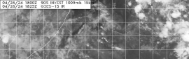
目前通過約克角半島中,BoM強度減弱為澳式C2,JTWC也略微減弱至C2,預計明天進入卡灣將再整合,上望澳式C4。
IDQ20018
TROPICAL CYCLONE TECHNICAL BULLETIN: AUSTRALIA - EASTERN REGION
Issued by BRISBANE TROPICAL CYCLONE WARNING CENTRE
at: 1429 UTC 19/03/2019
Name: Severe Tropical Cyclone Trevor
Identifier: 20U
Data At: 1200 UTC
Latitude: 12.9S
Longitude: 143.3E
Location Accuracy: within 10 nm [20 km]
Movement Towards: west [278 deg]
Speed of Movement: 4 knots [7 km/h]
Maximum 10-Minute Wind: 70 knots [130 km/h]
Maximum 3-Second Wind Gust: 100 knots [185 km/h]
Central Pressure: 969 hPa
Radius of 34-knot winds NE quadrant: 50 nm [95 km]
Radius of 34-knot winds SE quadrant: 60 nm [110 km]
Radius of 34-knot winds SW quadrant: 40 nm [75 km]
Radius of 34-knot winds NW quadrant: 30 nm [55 km]
Radius of 48-knot winds NE quadrant: 25 nm [45 km]
Radius of 48-knot winds SE quadrant: 30 nm [55 km]
Radius of 48-knot winds SW quadrant: 20 nm [35 km]
Radius of 48-knot winds NW quadrant: 20 nm [35 km]
Radius of 64-knot winds SE quadrant: 15 nm [30 km]
Radius of 64-knot winds SW quadrant: 15 nm [30 km]
Radius of Maximum Winds: 10 nm [15 km]
Dvorak Intensity Code: T4.5/5.0/D1.0/24HRS  STT:W0.5/3HRS
Pressure of outermost isobar: 1002 hPa
Radius of outermost closed isobar: 120 nm [220 km]
FORECAST DATA
Date/Time    : Location    : Loc. Accuracy: Max Wind   : Central Pressure
[UTC]        : degrees     :      nm  [km]: knots[km/h]: hPa
+06:  19/1800: 13.0S 142.9E:     020 [040]:  050  [090]:  986
+12:  20/0000: 13.0S 142.5E:     035 [065]:  040  [075]:  991
+18:  20/0600: 13.1S 142.1E:     045 [085]:  040  [075]:  990
+24:  20/1200: 13.0S 141.8E:     060 [110]:  045  [085]:  986
+36:  21/0000: 13.0S 141.2E:     080 [145]:  060  [110]:  977
+48:  21/1200: 13.1S 140.6E:     100 [180]:  080  [145]:  963
+60:  22/0000: 13.6S 139.6E:     120 [220]:  085  [155]:  957
+72:  22/1200: 14.1S 138.2E:     135 [255]:  095  [170]:  950
+96:  23/1200: 15.9S 135.0E:     180 [335]:  055  [100]:  982
+120: 24/1200: 18.8S 133.2E:     270 [500]:  030  [055]:  998
REMARKS:
Severe tropical cyclone Trevor crossed the coast earlier this evening just south
of Lockhart River as a strong category 3 system, and remains slow moving in the
area as a slightly weaker category 3 system. Trevor has begun weakening, with
the eye filling in on recent Weipa radar and satellite imagery.

The cyclone has been slow moving as it crossed the coast, and the community at
Lockhart River [approximately 17 km north of the centre] has experienced the
northern eye wall with damaging to destructive winds for over six hours. The
automatic weather station at Lockhart River recorded peak gusts to 74 knots [137
km/h], although the winds have been offshore and subject to terrain effects.
MSLP dropped to 974.8 hPa.

Dvorak analysis will cease to be applicable with the centre over land, however
from recent images: FT=4.5/CI=5.0 based on time-averaged embedded centre with LG
surround, as the eye is now very transient. Objective aids are also unavailable
now that the system is over land. Intensity of 70 kt is based on standard inland
decay rates supported by peripheral observations.

Surface winds will continue to weaken considerably until the cyclone emerges
into the Gulf of Carpentaria later Wednesday. NWP models are generally
consistent with fairly rapid re-intensification as well as a transition into a
much larger, very intense system once it begins moving over water, with the
environment remaining favourable over the Gulf for the coming days.

The cyclone has been steered by a weak mid-level ridge to the south, which
should persist with slight  strengthening of this later in the week steering the
system to the west-southwest over the Gulf. A land impact appears highly likely
as a severe TC later in the week or weekend on the NT side of the Gulf of
Carpentaria.

Copyright Commonwealth of Australia
==
The next bulletin for this system will be issued by: 19/1930 UTC by Brisbane
TCWC.

IDQ65001.png Screenshot_2019-03-20-01-38-57_com.android.chrome_1553017154501.jpg
sh202019.20190319142820.gif 20190319.1720.himawari-8.ir.20P.TREVOR.90kts.962mb.12.9S.143.3E.100pc.jpg rgb_lalo-animated (1).gif rbtop_lalo-animated (1).gif
回復

使用道具 舉報

簽到天數: 868 天

[LV.10]以壇為家III

jrchang5|2019-3-19 16:18 | 顯示全部樓層
本帖最後由 jrchang5 於 2019-3-19 16:40 編輯

依最新的雷達降水回波圖,風眼於19/07Z左右正在登陸約克角半島。BoM判定06Z登陸前近中心最大風速達85kts,中心氣壓967hpa。預測進入卡灣重新發展後,巔峰強度上望澳式C4。
IDQ20018
TROPICAL CYCLONE TECHNICAL BULLETIN: AUSTRALIA - EASTERN REGION
Issued by BRISBANE TROPICAL CYCLONE WARNING CENTRE
at: 0707 UTC 19/03/2019
Name: Severe Tropical Cyclone Trevor
Identifier: 20U
Data At: 0600 UTC
Latitude: 13.0S
Longitude: 143.6E
Location Accuracy: within 10 nm [20 km]
Movement Towards: west [264 deg]
Speed of Movement: 5 knots [9 km/h]
Maximum 10-Minute Wind: 85 knots [155 km/h]
Maximum 3-Second Wind Gust: 120 knots [220 km/h]
Central Pressure: 967 hPa
Radius of 34-knot winds NE quadrant: 50 nm [95 km]
Radius of 34-knot winds SE quadrant: 60 nm [110 km]
Radius of 34-knot winds SW quadrant: 40 nm [75 km]
Radius of 34-knot winds NW quadrant: 30 nm [55 km]
Radius of 48-knot winds NE quadrant: 25 nm [45 km]
Radius of 48-knot winds SE quadrant: 30 nm [55 km]
Radius of 48-knot winds SW quadrant: 20 nm [35 km]
Radius of 48-knot winds NW quadrant: 20 nm [35 km]
Radius of 64-knot winds: 15 nm [30 km]
Radius of Maximum Winds: 15 nm [30 km]
Dvorak Intensity Code: T5.0/5.0/D1.5/24HRS STT:S0.0/06HRS
Pressure of outermost isobar: 1000 hPa
Radius of outermost closed isobar: 100 nm [185 km]
FORECAST DATA
Date/Time    : Location    : Loc. Accuracy: Max Wind   : Central Pressure
[UTC]        : degrees     :      nm  [km]: knots[km/h]: hPa
+06:  19/1200: 13.0S 143.1E:     020 [040]:  065  [120]:  977
+12:  19/1800: 13.1S 142.6E:     035 [065]:  045  [085]:  986
+18:  20/0000: 13.1S 142.1E:     045 [085]:  040  [070]:  992
+24:  20/0600: 13.1S 141.7E:     060 [110]:  040  [075]:  994
+36:  20/1800: 13.0S 141.0E:     080 [145]:  055  [100]:  982
+48:  21/0600: 13.1S 140.4E:     100 [180]:  075  [135]:  968
+60:  21/1800: 13.3S 139.6E:     120 [220]:  085  [155]:  960
+72:  22/0600: 13.9S 138.4E:     135 [255]:  090  [165]:  952
+96:  23/0600: 15.5S 135.0E:     180 [335]:  075  [140]:  970
+120: 24/0600: 18.0S 132.6E:     270 [500]:  030  [055]: 1000
REMARKS:
Severe tropical cyclone Trevor is making landfall on the far north Qld coast
near Lockhart River. The circulation developed rapidly in the last 36h, then
temporarily weakened earlier today when the eye filled in, but in the few hours
prior to landfall it has experienced a burst in deep convection indicating
renewed intensification.

Intensity of 85 kn based on Dvorak analysis: FT/CI=5.0 based on time averaged
embedded centre and eye pattern though some fluctuations in DT numbers in the
past six hours. ADT estimates have risen sharply to CI=5.3, and hence SATCON has
responded with intensity at 90kn [corrected to 10 min. mean].

Aside from land influences, the current environment is favourable for
intensification over water: low wind shear; highly diffluent upper level winds
with strong  poleward outflow in particular and high low-mid level moisture.
Following landfall, surface winds should weaken considerably until it emerges
into the Gulf of Carpentaria later Wednesday. NWP models are generally
consistent with intensification as well as a transition into a much larger, very
intense system.

The cyclone has been steered by a weak mid-level ridge to the south which should
persist with slight strengthening of this later in the week steering the system
to the west-southwest over the Gulf. A land impact appears highly likely as a
severe TC later in the week or weekend on the NT side of the Gulf of
Carpentaria.

Copyright Commonwealth of Australia
==
The next bulletin for this system will be issued by: 19/1330 UTC by Brisbane
TCWC.
IDQ65001.png IDR782.gif
另JTWC判定06Z登陸前近中心最大風速升至100kts,中心氣壓954hpa。
20P TREVOR
As of 06:00 UTC Mar 19, 2019:

Location: 13.0°S 143.7°E
Maximum Winds: 100 kt
Minimum Central Pressure: 954 mb
sh202019.20190319080839.gif 20190319.0720.himawari-8.vis.20P.TREVOR.100kts.954mb.13S.143.7E.100pc.jpg rgb_lalo-animated.gif rbtop_lalo-animated.gif

回復

使用道具 舉報

簽到天數: 868 天

[LV.10]以壇為家III

jrchang5|2019-3-19 10:12 | 顯示全部樓層
BoM判定19/00Z近中心最大風速續升至80kts,中心氣壓964hpa。
由最新的雷達降水回波圖,可看出Trevor已發展出雙眼牆,強度已近第一次巔峰。
IDQ20018
TROPICAL CYCLONE TECHNICAL BULLETIN: AUSTRALIA - EASTERN REGION
Issued by BRISBANE TROPICAL CYCLONE WARNING CENTRE
at: 0118 UTC 19/03/2019
Name: Severe Tropical Cyclone Trevor
Identifier: 20U
Data At: 0000 UTC
Latitude: 13.0S
Longitude: 144.1E
Location Accuracy: within 10 nm [20 km]
Movement Towards: west southwest [252 deg]
Speed of Movement: 5 knots [9 km/h]
Maximum 10-Minute Wind: 80 knots [150 km/h]
Maximum 3-Second Wind Gust: 110 knots [205 km/h]
Central Pressure: 964 hPa
Radius of 34-knot winds NE quadrant: 75 nm [140 km]
Radius of 34-knot winds SE quadrant: 75 nm [140 km]
Radius of 34-knot winds SW quadrant: 60 nm [110 km]
Radius of 34-knot winds NW quadrant: 60 nm [110 km]
Radius of 48-knot winds NE quadrant: 30 nm [55 km]
Radius of 48-knot winds SE quadrant: 30 nm [55 km]
Radius of 48-knot winds SW quadrant: 30 nm [55 km]
Radius of 48-knot winds NW quadrant: 30 nm [55 km]
Radius of 64-knot winds: 20 nm [35 km]
Radius of Maximum Winds: 10 nm [20 km]
Dvorak Intensity Code: T5.0/5.0/D1.5/24HRS STT: S0.0/06HRS
Pressure of outermost isobar: 1004 hPa
Radius of outermost closed isobar: 140 nm [260 km]
FORECAST DATA
Date/Time    : Location    : Loc. Accuracy: Max Wind   : Central Pressure
[UTC]        : degrees     :      nm  [km]: knots[km/h]: hPa
+06:  19/0600: 13.1S 143.5E:     020 [040]:  085  [155]:  959
+12:  19/1200: 13.1S 143.0E:     035 [065]:  060  [110]:  980
+18:  19/1800: 13.2S 142.5E:     045 [085]:  045  [085]:  990
+24:  20/0000: 13.2S 142.1E:     060 [110]:  040  [075]:  993
+36:  20/1200: 13.1S 141.2E:     080 [145]:  045  [085]:  990
+48:  21/0000: 13.1S 140.6E:     100 [180]:  065  [120]:  975
+60:  21/1200: 13.2S 140.0E:     120 [220]:  080  [150]:  963
+72:  22/0000: 13.6S 139.0E:     135 [255]:  090  [165]:  954
+96:  23/0000: 15.1S 135.9E:     180 [335]:  100  [185]:  946
+120: 24/0000: 17.3S 132.8E:     270 [500]:  030  [055]:  999
REMARKS:
Severe tropical cyclone Trevor has developed rapidly in the past 24 hours,
developing an eye overnight. However, recent imagery shows slight warming of
cloud tops and a double eye wall appearance on microwave and Weipa radar may
indicate that intensification of the compact inner eye [RMW - 10 nautical miles
or less]. has been arrested.

Intensity of 80 kn based on Dvorak analysis: FT/CI=5.0 based on an eye pattern:
LG surround with an DG eye  [DT 5.0 but has fluctuated over the past 6 hours].
ADT estimates have risen sharply to CI=5.3, though this latest info has yet to
be ingested to SATCON which is still at 72kn [corrected to 10 min. mean].

Landfall is expected in the next six hours. Aside from land influences, the
current environment is favourable for further intensification: low wind shear;
highly diffluent upper level winds with strong  poleward outflow in particular
and high low-mid level moisture. Further intensification to a category 4 [90+kn]
at landfall is possible but is dependent upon the how the inner core responds.

Following landfall, surface winds should weaken considerably but once the
circulation moves into the Gulf,  a period of rapid intensification is highly
likely. NWP models are consistent with this as well as a transition into a much
larger, very intense system.

The cyclone has been steered by a weakening mid-level ridge to the east. A
stronger middle level ridge is now building across the mainland to the south
which is expected to become the dominant steering mechanism and accelerate the
system to the west-southwest over the Gulf. A land impact appears highly likely
as a severe TC later in the week or weekend on the NT side of the Gulf of
Carpentaria.

Copyright Commonwealth of Australia
==
The next bulletin for this system will be issued by: 19/0730 UTC by Brisbane
TCWC.
IDQ65001.png IDR782.gif 20190319.0110.himawari-8.vis.20P.TREVOR.95kts.952mb.13S.144.1E.100pc.jpg vis_lalo-animated.gif rb_lalo-animated.gif


回復

使用道具 舉報

簽到天數: 601 天

[LV.9]以壇為家II

霧峰追風者|2019-3-19 03:26 | 顯示全部樓層
本帖最後由 霧峰追風者 於 2019-3-19 03:57 編輯
老農民版夜神月 發表於 2019-3-19 02:40
JTWC官方T值分析已達5.0

上面有說過EC對於熱帶氣旋的強度預測向來是比較少在畫大餅的

分析出T5.0,JTWC 18Z強度直升"二級颶風"( 90kts )。 sh202019.20190318193832.gif 20190318.1850.himawari-8.ir.20P.TREVOR.90kts.956mb.12.9S.144.6E.100pc.jpg 20190318.1731.f16.ir.olsircomp.20P.TREVOR.x.jpg

回復

使用道具 舉報

簽到天數: 601 天

[LV.9]以壇為家II

霧峰追風者|2019-3-19 03:04 | 顯示全部樓層
本帖最後由 霧峰追風者 於 2019-3-19 03:10 編輯

BoM 風眼隱現,18Z強度升澳式C3,即將登陸。
IDQ20018
TROPICAL CYCLONE TECHNICAL BULLETIN: AUSTRALIA - EASTERN REGION
Issued by BRISBANE TROPICAL CYCLONE WARNING CENTRE
at: 1904 UTC 18/03/2019
Name: Severe Tropical Cyclone Trevor
Identifier: 20U
Data At: 1800 UTC
Latitude: 12.9S
Longitude: 144.6E
Location Accuracy: within 10 nm [20 km]
Movement Towards: west southwest [240 deg]
Speed of Movement: 4 knots [7 km/h]
Maximum 10-Minute Wind: 65 knots [120 km/h]
Maximum 3-Second Wind Gust: 90 knots [165 km/h]
Central Pressure: 975 hPa
Radius of 34-knot winds NE quadrant: 75 nm [140 km]
Radius of 34-knot winds SE quadrant: 75 nm [140 km]
Radius of 34-knot winds SW quadrant: 60 nm [110 km]
Radius of 34-knot winds NW quadrant: 60 nm [110 km]
Radius of 48-knot winds NE quadrant: 25 nm [45 km]
Radius of 48-knot winds SE quadrant: 25 nm [45 km]
Radius of 48-knot winds SW quadrant: 25 nm [45 km]
Radius of 48-knot winds NW quadrant: 25 nm [45 km]
Radius of 64-knot winds:
Radius of Maximum Winds: 10 nm [20 km]
Dvorak Intensity Code: T4.5/4.5/D1.5/24HRS STT:D1.0/06HRS
Pressure of outermost isobar: 1004 hPa
Radius of outermost closed isobar: 90 nm [165 km]
FORECAST DATA
Date/Time    : Location    : Loc. Accuracy: Max Wind   : Central Pressure
[UTC]        : degrees     :      nm  [km]: knots[km/h]: hPa
+06:  19/0000: 13.1S 144.2E:     020 [040]:  075  [140]:  968
+12:  19/0600: 13.2S 143.6E:     035 [065]:  080  [150]:  964
+18:  19/1200: 13.2S 143.0E:     045 [085]:  060  [110]:  980
+24:  19/1800: 13.1S 142.5E:     060 [110]:  045  [085]:  990
+36:  20/0600: 13.1S 141.6E:     080 [145]:  030  [055]:  998
+48:  20/1800: 12.9S 140.9E:     100 [180]:  030  [055]:  998
+60:  21/0600: 12.9S 140.3E:     120 [220]:  040  [075]:  993
+72:  21/1800: 13.2S 139.4E:     135 [255]:  060  [110]:  980
+96:  22/1800: 14.4S 136.7E:     180 [335]:  080  [150]:  965
+120: 23/1800: 16.5S 133.7E:     270 [500]:  035  [065]:  996
REMARKS:
Severe tropical cyclone Trevor continues to develop, with an eye evident on IR
imagery for the past several hours. Radar and recent microwave imagery depict a
very compact inner convective core [RMW - 10 nautical miles or less]. Position
is good based on Weipa radar and satellite and microwave imagery.

Dvorak analysis is based on an eye pattern: B surround with an LG eye and W
ring. This yields DT 5.0 and has been consistent over the past few hours. MET is
4.5 based on a 24 hour D+ trend. PT is also 4.5. Final T based on DT due to
confidence in the pattern, however limited to 4.5 by Dvorak constraints. CMSS
and NESDIS ADT estimates are both 59 knots [one minute mean] but have not yet
shifted to using an eye pattern. Recent SATCON is 75 knots, biased upwards by
ATMS and SSMIS estimates of 88 knots, with other member estimates being lower.
Intensity is analysed at 65 knots [10 minute mean].

The cyclone has been steered by a weakening mid-level ridge to the east. A
stronger middle-level ridge is now building across the mainland to the south
which is expected to become the dominant steering mechanism and accelerate the
system to the west-southwest.

The current environment is excellent for further intensification. Deep-layer
shear is low at 5 to 10 knots. Upper-level winds are highly diffluent with good
poleward outflow in particular. This is reflected in high percentages in the
SHIPS RI guidance. With roughly 12 hours until forecast landfall, further
intensification to high category 3 is forecast, however more rapid
intensification leading to a category 4 landfall cannot be ruled out.

Trevor is expected to weaken to a tropical low or a marginal category 1 system
as it crosses the Peninsula into the Gulf of Carpentaria during Wednesday.
Forecast conditions remain excellent for redevelopment in the Gulf and Trevor is
expected to redevelop and intensify quickly there. NWP models transition Trevor
into a much larger, very intense system. At this stage expect redevelopment to
at least a high-end category 3 system in the Gulf, possibly / probably higher.

Copyright Commonwealth of Australia
==
The next bulletin for this system will be issued by: 19/0130 UTC by Brisbane
TCWC.

IDQ65001.png
rgb-animated (1).gif bd_lalo-animated.gif

回復

使用道具 舉報

簽到天數: 1650 天

[LV.Master]伴壇終老

老農民版夜神月|2019-3-19 02:40 | 顯示全部樓層
本帖最後由 老農民版夜神月 於 2019-3-19 02:45 編輯

JTWC官方T值分析已達5.0
TPPS10 PGTW 181816

A. TROPICAL CYCLONE 20P (TREVOR)

B. 18/1750Z

C. 12.86S

D. 144.57E

E. THREE/HMWRI8

F.
T5.0/5.0/D2.5/24HRS  STT: D0.5/03HRS

G. IR/EIR


H. REMARKS: 09A/PBO RAGGED EYE/ANMTN. MG EYE SURROUNDED BY W
YIELDS AN E# AND DT (NO EYE ADJUSTMENT W) OF 6.0. MET 4.0. PT
5.0. DBO PT. EYE DIAMETER 12NM.


I. ADDITIONAL POSITIONS: NONE


   DAVIS

上面有說過EC對於熱帶氣旋的強度預測向來是比較少在畫大餅的
所以要出現915以下的中心最低氣壓預測其實不太容易
印象中去年西北太平洋的6個C5,7個猛烈
也只有山竹在兩三日前被預報出低於915百怕的巔峰中心氣壓

也因此這次的20P的巔峰強度會如何,確實值得觀察
20190318.1550.himawari-8.ircolor.20P.TREVOR.55kts.982mb.12.6S.144.9E.100pc.jpg 20190318.1550.himawari-8.ir.20P.TREVOR.55kts.982mb.12.6S.144.9E.100pc.jpg
LATEST0.jpg LATEST.jpg


回復

使用道具 舉報

簽到天數: 1650 天

[LV.Master]伴壇終老

老農民版夜神月|2019-3-19 01:29 | 顯示全部樓層
本帖最後由 老農民版夜神月 於 2019-3-19 02:19 編輯

EC數值主觀預測20P巔峰最低氣壓913,這個氣壓數字預測其實對於EC來說並不常見
79_90766_aa76bfbe2c776d3.png
GFS也預測氣壓降至908,同樣看好20P登陸澳洲前的強度爆發
79_87039_102d23aeff180ce.png
GFS主觀數值氣旋強度雖然常常發抽,但這次對於20P倒跟EC不謀而合

下圖為EC系級的路徑預測,大概的西行登澳方向已大致底定
79_90766_f59d5a6a85afa06.png
接下來最需要觀察的是是否有如數值預測的一般在登陸前大爆發
目前的環境看來是支持的(如下圖)
但是環境好歸好
強度能否反映出來還是要看系統的造化
s_wpac_cdas1.png 2019SH20_OHCNFCST_201903181200.gif
wgmssht.019gif.gif

回復

使用道具 舉報

快速回覆
您需要登錄後才可以回帖 登錄 | 立即加入

本版積分規則

本平台僅供學術討論之用,預報應以氣象局為準

威普網站虛擬主機贊助公司

臺灣第一個天氣類型社群平台 即時天氣資訊、精準颱風動態

線上客服
FB傳送訊息
廣告行銷
精準行銷 物超所值
官方粉專
發佈 快速回復 返回頂部 返回列表