簽到天數: 1650 天 [LV.Master]伴壇終老
|
 老農民版夜神月|2021-11-23 01:46
|
顯示全部樓層
老農民版夜神月|2021-11-23 01:46
|
顯示全部樓層
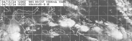
BoM,JTWC12Z均定強40節
IDW27600
TROPICAL CYCLONE TECHNICAL BULLETIN: AUSTRALIA - WESTERN REGION
Issued by AUSTRALIAN BUREAU OF METEOROLOGY TROPICAL CYCLONE WARNING CENTRE
at: 1304 UTC 22/11/2021
Name: Tropical Cyclone Paddy
Identifier: 02U
Data At: 1200 UTC
Latitude: 13.5S
Longitude: 108.1E
Location Accuracy: within 45 nm [85 km]
Movement Towards: south [171 deg]
Speed of Movement: 3 knots [6 km/h]
Maximum 10-Minute Wind: 40 knots [75 km/h]
Maximum 3-Second Wind Gust: 55 knots [100 km/h]
Central Pressure: 995 hPa
Radius of 34-knot winds NE quadrant:
Radius of 34-knot winds SE quadrant: 90 nm [165 km]
Radius of 34-knot winds SW quadrant: 70 nm [130 km]
Radius of 34-knot winds NW quadrant: 70 nm [130 km]
Radius of 48-knot winds NE quadrant:
Radius of 48-knot winds SE quadrant:
Radius of 48-knot winds SW quadrant:
Radius of 48-knot winds NW quadrant:
Radius of 64-knot winds:
Radius of Maximum Winds: 30 nm [55 km]
Dvorak Intensity Code: T3.0/3.0/D1.0/24HRS STT:S0.0/06HRS
Pressure of outermost isobar: 1007 hPa
Radius of outermost closed isobar: 120 nm [220 km]
FORECAST DATA
Date/Time : Location : Loc. Accuracy: Max Wind : Central Pressure
[UTC] : degrees : nm [km]: knots[km/h]: hPa
+06: 22/1800: 13.7S 108.0E: 060 [115]: 045 [085]: 992
+12: 23/0000: 13.9S 107.8E: 070 [130]: 045 [085]: 992
+18: 23/0600: 14.0S 107.6E: 080 [145]: 040 [075]: 995
+24: 23/1200: 14.0S 107.5E: 080 [145]: 035 [065]: 998
+36: 24/0000: 14.0S 107.2E: 080 [150]: 035 [065]: 998
+48: 24/1200: 13.8S 106.5E: 105 [195]: 030 [055]: 1001
+60: 25/0000: 13.5S 105.7E: 130 [235]: 030 [055]: 1001
+72: 25/1200: 13.2S 104.8E: 160 [295]: 025 [045]: 1004
+96: 26/1200: 12.9S 102.9E: 220 [405]: 025 [045]: 1004
+120: 27/1200: 12.1S 101.5E: 210 [385]: 020 [035]: 1006
REMARKS:
Position determined from animated IR imagery. Earlier scatterometer passes
indicated gales wrapping around the southern and western side of the system and
deep convection continues within those quadrants.
Paddy [02U] is a smaller than average system that responded quickly to
favourable conditions overnight, however the system intensity has now plateaued
over the last 6-12 hours.
Dvorak assessment is based on an initial classification of T1.0 at 00Z on
21/11/2021. At 0000Z on 22/11/2021 FT is constrained to 2.5, although the
operational intensity estimate at that time was equivalent to T3.0 based on
scatterometer passes. At 1200UTC a wrap of 0.7 on EIR yields DT 3.0. While the
organisation of the system has improved over the last 24 hours there is less
deep convection near the system centre, thus MET is 2.5 based on a D- trend, PAT
is 3.0. FT and CI remain at 3.0.
SSTs remain above 28C, with broadly low shear and favourable upper divergence
poleward of the system due to a mid-latitude trough. However as the trough moves
further east a ridge to the south is strengthening and as a small system the
intensity may fluctuate due to local variations in conditions.
Paddy is expected to move slowly south over the next 24 hours and intensify only
moderately. Beyond 24 hours the influence of the ridge to the south will
increase. Paddy is expected to commence a more westward track and weaken as dry
air wraps around the system and easterly wind shear increases. NWP is generally
consistent with the forecast movement of Paddy, though intensity varies and
fluctuations are unlikely to be adequately represented.
Copyright Commonwealth of Australia
==
The next bulletin for this system will be issued by: 22/1930 UTC.
WDXS31 PGTW 221500
MSGID/GENADMIN/JOINT TYPHOON WRNCEN PEARL HARBOR HI//
SUBJ/PROGNOSTIC REASONING FOR TROPICAL CYCLONE 01S (PADDY) WARNING
NR 002//
RMKS/
1. FOR METEOROLOGISTS.
2. 6 HOUR SUMMARY AND ANALYSIS.
SUMMARY:
INITIAL POSITION: 13.7S 108.1E
INITIAL INTENSITY: 40 KTS
GEOGRAPHIC REFERENCE: 237 NM SOUTHEAST OF CHRISTMAS ISLAND,
AUSTRALIA
MOVEMENT PAST 6 HOURS: SOUTH-SOUTHWESTWARD AT 04 KTS
SIGNIFICANT WAVE HEIGHT: 13 FEET
SATELLITE ANALYSIS, INITIAL POSITION AND INTENSITY DISCUSSION:
ANIMATED MULTISPECTRAL SATELLITE IMAGERY (MSI) DEPICTS AN AREA OF
DEEP, FLARING CONVECTION LOCATED TO THE SOUTHEAST AN ASSESSED LOW
LEVEL CIRCULATION CENTER (LLCC). A 221106Z SSMIS 91GHZ IMAGE SHOWS
THE AFOREMENTIONED FLARING CONVECTION ALONG WITH FRAGMENTED BANDING
WRAPPING INTO THE LLCC. TC PADDY IS A FAIRLY COMPACT SYSTEM AND IS
LOCATED IN A FAVORABLE ENVIRONMENT WITH GOOD POLEWARD OUTFLOW
ALOFT, LOW (5-10 KTS) VERTICAL WIND SHEAR (VWS), AND WARM (28-29 C)
SEA SURFACE TEMPERATURES (SST). THE INITIAL POSITION IS PLACED WITH
HIGH CONFIDENCE BASED ON THE SSMIS PASS AND MULTIPLE AGENCY FIXES.
THE INITIAL INTENSITY OF 40 KTS IS SET WITH MEDIUM CONFIDENCE
AVERAGED BETWEEN MULTIPLE AGENCY DVORAK ESTIMATES.
INITIAL WIND RADII BASIS: PERSISTENCE.
CURRENT STEERING MECHANISM: SUBTROPICAL RIDGE (STR) LOCATED TO THE
SOUTH.
AGENCY DVORAK AND AUTOMATED FIXES:
PGTW: T1.5 - 25 KTS
APRF: T3.0 - 45 KTS
CIMSS ADT: 35 KTS AT 221140Z
FORECASTER ASSESSMENT OF CURRENT ENVIRONMENT: FAVORABLE
VWS: 10-15 KTS
SST: 28-29 CELSIUS
OUTFLOW: MODERATE POLEWARD
ANALYSIS CONFIDENCE:
INITIAL POSITION: HIGH
INITIAL INTENSITY: MEDIUM
INITIAL WIND RADII: MEDIUM
3. FORECAST REASONING.
SIGNIFICANT FORECAST CHANGES: THERE ARE NO SIGNIFICANT CHANGES TO
THE FORECAST FROM THE PREVIOUS WARNING.
FORECAST DISCUSSION: TC PADDY HAS TRACKED SOUTHWARD OVER THE PAST 6
HOURS. BY TAU 12, THE SYSTEM WILL TURN SOUTHWESTWARD AS THE STR
BUILDS IN FROM THE SOUTH. BY TAU 24, TC PADDY WILL MAKE ITS TURN
WESTWARD AND WILL START TO EXPERIENCE DRY AIR BEING INTRODUCED FROM
THE SOUTHWEST, CONTRIBUTING TO A WEAKENED INTENSITY OF 35 KTS. BY
TAU 36, THE SYSTEM WILL TAKE A SLIGHT JOG TO THE WEST-NORTHWEST AS
HIGH PRESSURE TO SOUTH WILL CONTINUE TO BUILD. DURING THIS TIME, TC
PADDY WILL BEGIN TO ENCOUNTER AN AREA OF INCREASED VWS, FURTHER
CONTRIBUTING TO ITS DEMISE. CONDITIONS WILL CONTINUE TO BECOME MORE
UNFAVORABLE THROUGHOUT THE REMAINDER OF THE FORECAST TRACK. FULL
DISSIPATION IS EXPECTED BY TAU 72.
MODEL DISCUSSION: THE JTWC TRACK IS PLACED WITH MEDIUM CONFIDENCE
FAVORING THE GFS AND ECMWF SOLUTIONS. THE UKMET TRACK SHOOTS OFF TO
THE WEST-NORTHWEST AT TAU 36, AND TURNS DUE NORTH AFTERWARDS. DUE
TO ITS ERRATIC NATURE, UKMET WAS DISREGARDED FOR THIS FORECAST.
NAVGEM IS ANOTHER OUTLIER SHOWING A MORE SOUTHERLY TRACK, FOLLOWED
BY A GRADUAL TURN TO THE SOUTHWEST. AS A RESULT, THE JTWC TRACK IS
PLACED SLIGHTLY TO THE RIGHT OF THE MODEL CONSENSUS (CONW). THE
JTWC INTENSITY FORECAST IS SET WITH MEDIUM CONFIDENCE, AGREEING
WITH MODEL CONSENSUS (ICNW).
FORECAST CONFIDENCE:
TRACK 0 - 72 HR: MEDIUM
INTENSITY 0 - 72 HR: MEDIUM//
NNNN
.gif")
.png")


|
|


 提升卡
提升卡 千斤頂
千斤頂


.png")

.gif")


.png")
.gif")

.jpg")