簽到天數: 3198 天 [LV.Master]伴壇終老
|
 king111807|2021-10-27 15:47
|
顯示全部樓層
king111807|2021-10-27 15:47
|
顯示全部樓層
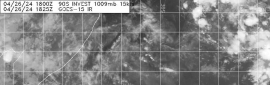
NHC展望降至10%
1. A deep, non-tropical low pressure system with storm-force winds is
located less than 100 miles east-southeast of Cape Cod,
Massachusetts. The extratropical low is expected to meander off of
the mid-Atlantic and northeastern U.S. coasts today, bringing rain
and wind impacts to portions of those areas. Thereafter, the low is
expected to move eastward away from the United States, and it could
acquire some subtropical characteristics while it moves eastward or
southeastward over the warmer waters of the central Atlantic through
this weekend. For more information on this system, including storm
warnings, see products issued by your local National Weather Service
office and High Seas Forecasts issued by the National Weather
Service.
* Formation chance through 48 hours...low...10 percent.
* Formation chance through 5 days...medium...40 percent. 
|
|


.png")
.png")
.png")

.png")


.png")
.png")

.png")
.png")
.png")