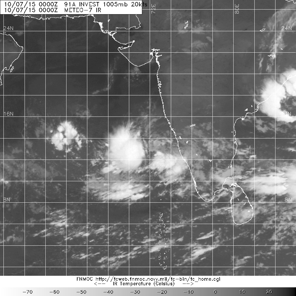
本帖最後由 0908morakot 於 2015-10-13 11:13 編輯 深低壓 編號:ARB 03 ( 03 A ) 名稱:無 基本資料 擾動編號日期:2015 年 10 月 07 日 08 時 JTWC升格日期 ...
|
JTWC 06Z直接發出FW.... IMD 06Z降格低壓,不再看好命名 ** WTIN20 DEMS 110711 *** 風力明顯不足.... |
JTWC 00Z直接降到25節,並推翻先前評價,只留下兩報35節,預測兩天後重回TS。03A THREE 151010 1800 15.5N 69.6E IO 30 1000 一夜過後對流慘不忍睹,看來命名這件事又充滿變數了... |
IMD 06Z升格深低壓,預測18Z加強為氣旋風暴。SPECIAL TROPICAL WEATHER OUTLOOK JTWC 06Z預測將有可能以熱帶風暴下限強度登陸阿曼。 |
|
JTWC 18Z評價35節並升格03A,巔峰上望45節,後期將在阿拉伯海減弱消散。 |
|
IMD在中午升格低壓區並編號ARB03 目前預測48小時內將會增強到深低壓 Time of issue: 1400 hours IST Dated: 09.10.2015 Bulletin No.: ARB03/2015/03 Sub: Depression over eastcentral Arabian Sea. The depression over eastcentral Arabian Sea remained practically stationary for the past 6 hours and lay centred at 1130 hours IST of today, the 9th October, 2015 near latitude 14.00 N and longitude 70.30 E, about 410 km west-southwest of Goa and 630 km south-southwest of Mumbai. It would move initially north-northwestwards slowly and intensify into a deep depression during next 48 hrs. Under its influence, rainfall at many places with isolated heavy falls would occur over coastal Karnataka and Kerala during next 24 hours and over Konkan and Goa during subsequent 24 hrs. Strong wind speed reaching 30-40 kmph gusting to 50 kmph would prevail along and off Konkan, Goa and Karnataka coasts during next 48 hrs and along and off Kerala coast and Lakshadweep area during next 24 hrs. Sea condition would be rough. Fishermen are advised not to venture into deep sea along and off Karnataka,Konkan and Goa coasts during next 48 hrs and Kerala coast and Lakshadweep area during next 24 hrs. The next bulletin will be issued at 2030hrs IST of today, the 9th October, 2015 ** WTIN20 DEMS 090340 *** 對流集中在系統西側,仍有待整合。 |
|
本帖最後由 alu 於 2015-10-8 18:26 編輯 看了一年多北印度洋的颶風,發覺北印度洋的颶風大多是在近岸形成的颶風,好像比較少像西太都是遠洋形成容易造成重大災害,而北印度洋近岸形成的颶風之所以造成重大災害是缺乏公共建設的緣故這是和西太比較不一樣的地方 |