開啟輔助訪問
 找回密碼
 立即加入

11P.Kimi 逐漸減弱

查看數: 12809 評論數: 9 收藏 0切换到帖子模式
    組圖打開中,請稍候......
發佈時間: 2021-1-16 06:26

正文摘要:

  二級熱帶氣旋   編號:11 P 名稱:Kimi 以上資料來自:BoM、JTWC、颱風論壇整理製作

dom 發表於 2021-1-18 21:16
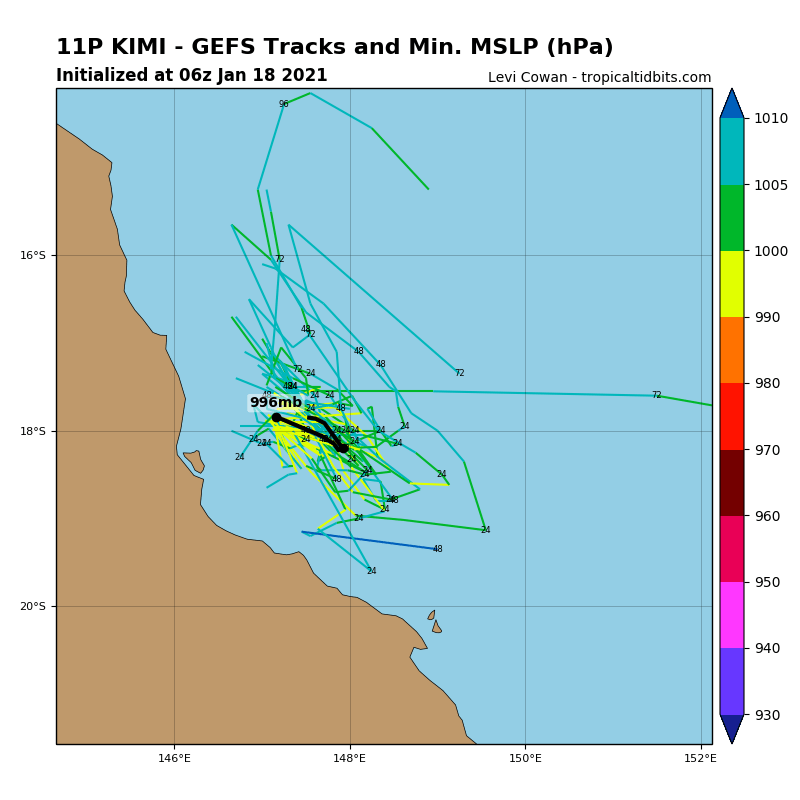
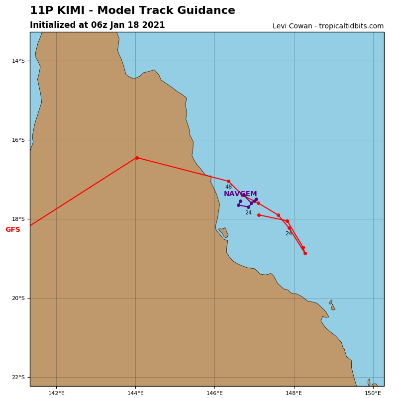
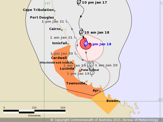
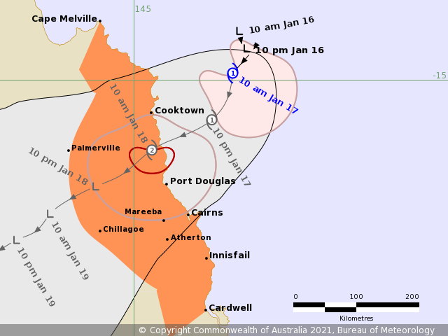
BoM降格澳式C1,預料轉為採取西北方向移動並逐漸減弱
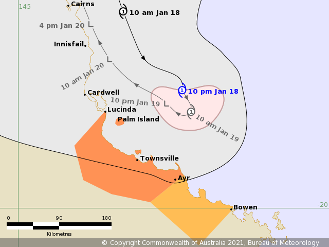
The forecast path shown above is the Bureau's best estimate of the cyclone's future movement and intensity. There is always some uncertainty associated with tropical cyclone forecasting and the grey zone indicates the range of likely tracks of the cyclone centre.
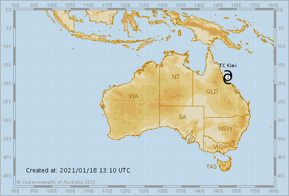
Due to the uncertainty in the future movement, the indicated winds will almost certainly extend to regions outside the rings on this map. The extent of the warning and watch zones reflects this.

This product is designed for land-based communities; mariners should read the coastal waters and high seas warnings.


Headline:

Tropical cyclone Kimi is weakening off the north Queensland coast. Significant impacts on the coast are becoming less likely.


Areas affected:

Warning zone: Lucinda to Ayr, including Townsville.

Watch zone: Ayr to Bowen.

Cancelled zones: Innisfail to Lucinda.


Details of Tropical Cyclone Kimi at 10:00 pm AEST:

Intensity: category 1, sustained winds near the centre of 75 kilometres per hour with wind gusts to 100 kilometres per hour.
Location: within 35 kilometres of 18.2 degrees South, 147.5 degrees East , 230 kilometres southeast of Cairns and 140 kilometres north northeast of Townsville .
Movement: southeast at 12 kilometres per hour .

Tropical cyclone Kimi is expected to drift towards the south-southeast tonight and become slow moving early on Tuesday, off the coast between Hinchinbrook Island and Townsville.

The cyclone has displayed a weakening trend over the past few hours, and it is expected to weaken further during Tuesday. In the longer term, the remnants of the system are expected to begin tracking back towards the north-northwest as a weak tropical low.

A coastal crossing as a tropical cyclone is becoming UNLIKELY.


Hazards:

DESTRUCTIVE WINDS are no longer expected about coastal and island areas.

GALES with gusts to 120km/h remain possible about coastal and island communities between Lucinda and Ayr tonight and Tuesday morning if the cyclone tracks further to the south. Gales may also extend southwards to Bowen later on Tuesday if the system can persist as a tropical cyclone into Tuesday afternoon, although this is becoming less likely.

HEAVY RAINFALL with the potential to produce flash flooding and major river flooding may affect coastal areas between Innisfail and Bowen on Tuesday. A Flood Watch is current for this area; refer to that product for more detail.

ABNORMALLY HIGH TIDES are likely on Tuesday as the cyclone gets closer to the coast, however the sea level should not exceed the highest tide of the year. Large waves are likely along the beachfront.


Recommended Action:

People between Lucinda and Ayr, including Palm Island and Townsville, should immediately commence or continue preparations, especially securing boats and property.

People between Ayr and Bowen, should consider what action they will need to take if the cyclone threat increases.

- For cyclone preparedness and safety advice, visit Queensland's Disaster Management Services website (www.disaster.qld.gov.au)

- If you choose to take shelter away from your home, stay COVID-19 safe and pack a mask and hand sanitiser (if you have them).

- For emergency assistance call the Queensland State Emergency Service (SES) on 132 500 (for assistance with storm damage, rising flood water, fallen trees on buildings or roof damage).
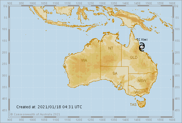
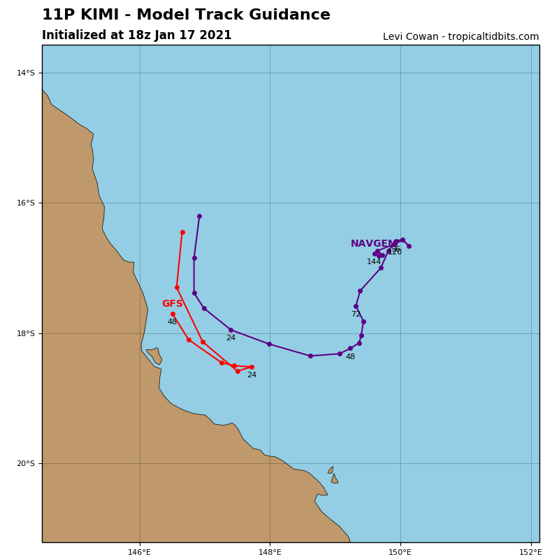
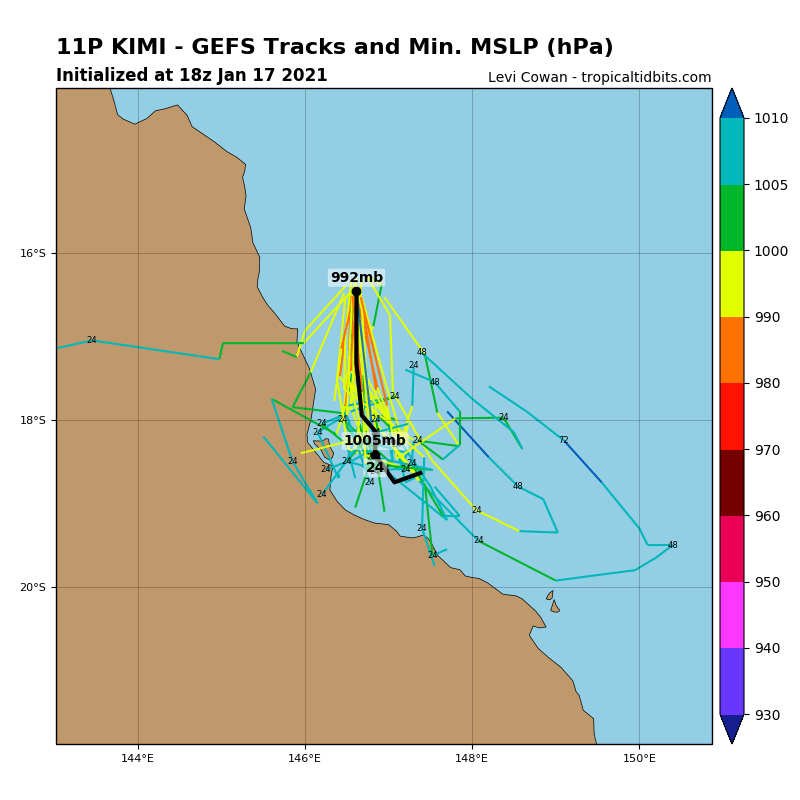
IDA00041.png IDQ65001.png 11P_gefs_latest.png 11P_tracks_latest.png
dom 發表於 2021-1-18 12:39
BoM升格澳式C2
The forecast path shown above is the Bureau's best estimate of the cyclone's future movement and intensity. There is always some uncertainty associated with tropical cyclone forecasting and the grey zone indicates the range of likely tracks of the cyclone centre.
Due to the uncertainty in the future movement, the indicated winds will almost certainly extend to regions outside the rings on this map. The extent of the warning and watch zones reflects this.

This product is designed for land-based communities; mariners should read the coastal waters and high seas warnings.


Headline:

Kimi intensifies to category 2 as it moves south. Cyclone Watch declared to Bowen.


Areas affected:

Warning zone: Innisfail to Ayr, inluding Lucinda, Palm Island and Townsville.

Watch zone: Ayr to Bowen.

Cancelled zones: Port Douglas to Innisfail.


Details of Tropical Cyclone Kimi at 1:00 pm AEST:

Intensity: category 2, sustained winds near the centre of 95 kilometres per hour with wind gusts to 130 kilometres per hour.
Location: within 20 kilometres of 17.5 degrees South, 146.8 degrees East , 130 kilometres east southeast of Cairns and 195 kilometres north of Townsville .
Movement: south southeast at 15 kilometres per hour .

Tropical cyclone Kimi has intensified to a category 2 cyclone. It is currently moving south-southeast and is likely to continue this movement through tonight, but is now expected to slow and stall off the coast between Hinchinbook Island and Townsville on Tuesday while beginning to weaken.

However, considerable uncertainty remains with the future movement of the system, and a category 2 coastal crossing between Hinchinbrook Island and Townsville tonight or on Tuesday REMAINS POSSIBLE.


Hazards:

DESTRUCTIVE WINDS with gusts to 150 km/h may develop about coastal and island areas between Hinchinbrook Island and Ayr overnight tonight or on Tuesday, depending on the movement of the cyclone.

GALES with gusts to 120km/h are likely about coastal and island communities between Innisfail and Ayr tonight and Tuesday. Gales may also extend southwards to Bowen later on Tuesday depending on the movement of the cyclone.

HEAVY RAINFALL with the potential to produce flash flooding and major river flooding expected to affect coastal and adjacent inland areas between Innisfail and Bowen tonight and on Tuesday. A Flood Watch is current for this area; refer to that product for more detail.

ABNORMALLY HIGH TIDES are likely today as Tuesday as the cyclone gets closer to the coast, however the sea level should not exceed the highest tide of the year. Large waves are likely along the beachfront.


Recommended Action:

People between Innisfail and Ayr, including Lucinda, Palm Island and Townsville should immediately commence or continue preparations, especially securing boats and property.

People between Ayr and Bowen should consider what action they will need to take if the cyclone threat increases.

- For cyclone preparedness and safety advice, visit Queensland's Disaster Management Services website (www.disaster.qld.gov.au)

- If you choose to take shelter away from your home, stay COVID-19 safe and pack a mask and hand sanitiser (if you have them).

- For emergency assistance call the Queensland State Emergency Service (SES) on 132 500 (for assistance with storm damage, rising flood water, fallen trees on buildings or roof damage).
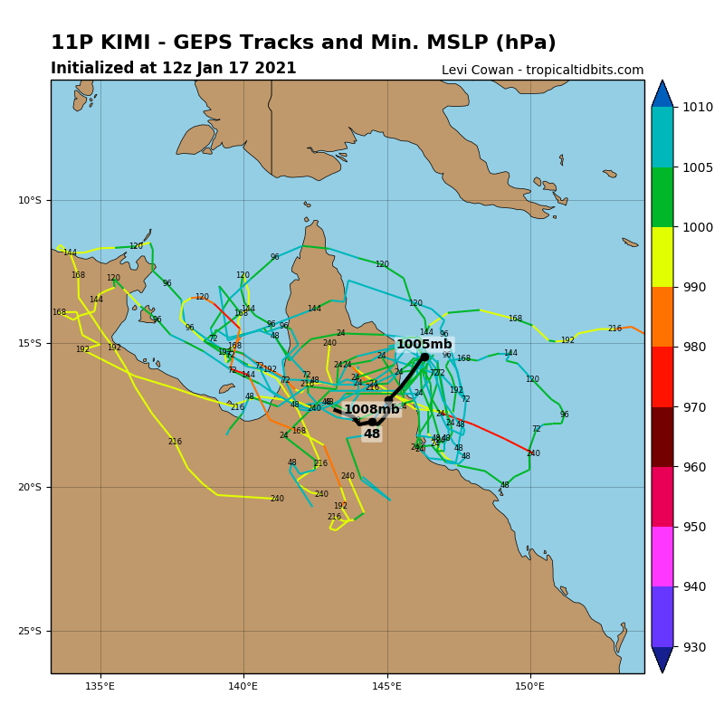
IDA00041.png IDQ65001.png 11P_tracks_latest.png 11P_gefs_latest.png 11P_geps_latest.png
dom 發表於 2021-1-17 10:21
本帖最後由 dom 於 2021-1-17 10:54 編輯

BoM命名Kimi,預測24小時內登陸
FLASH TROPICAL CYCLONE ADVICE NUMBER 1
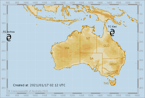
Issued at 12:11 pm EST on Sunday 17 January 2021
Headline:
Tropical cyclone Kimi has formed northeast of Cooktown.

Areas Affected:
Warning Zone
Cape Melville to Cardwell, extending inland to Palmerville and Chillagoe, including Cooktown, Port Douglas, Cairns, and Innisfail.

Watch Zone
None.

Cancelled Zone
None.

Details of Tropical Cyclone Kimi at 10:00 am AEST:
Intensity: Category 1, sustained winds near the centre of 65 kilometres per hour with wind gusts to 95 kilometres per hour.

Location: within 45 kilometres of 14.9 degrees South 146.4 degrees East, estimated to be 140 kilometres east northeast of Cooktown and 235 kilometres north northeast of Cairns.

Movement: southwest at 9 kilometres per hour.

Tropical cyclone Kimi has formed in the northwest Coral Sea northeast of Cooktown. The cyclone is expected to move to the southwest and cross the north tropical coast between Cape Flattery and Port Douglas on Monday morning. It may reach category 2 before crossing.

Hazards:
DESTRUCTIVE WINDS with gusts to 130 km/h may develop about coastal and island areas between Cape Flattery and Cairns from early Monday morning as the cyclone approaches.

GALES with gusts to 120km/h may develop about coastal and island areas between Cape Melville and Cardwell from Sunday evening. These GALES may extend inland to Palmerville and Chillagoe on Monday as the cyclone moves inland.

HEAVY RAINFALL is forecast to develop about coastal and adjacent inland areas between Cape Flattery and Cardwell from Sunday afternoon. A Flood Watch is current for this area; refer to that product for more detail.

ABNORMALLY HIGH TIDES are likely on Sunday night and Monday as the cyclone approaches, however they are unlikely to exceed the highest tide of the year.

Recommended Action:
People between Cape Melville and Cardwell should immediately commence preparations, especially securing boats and property using available daylight hours.

- For cyclone preparedness and safety advice, visit Queensland's Disaster Management Services website (www.disaster.qld.gov.au)

- If you choose to take shelter away from your home, stay COVID-19 safe and pack a mask and hand sanitiser (if you have them).

- For emergency assistance call the Queensland State Emergency Service (SES) on 132 500 (for assistance with storm damage, rising flood water, fallen trees on buildings or roof damage).

IDA00041.png IDQ65001.png
dom 發表於 2021-1-17 09:28
本帖最後由 dom 於 2021-1-17 10:53 編輯

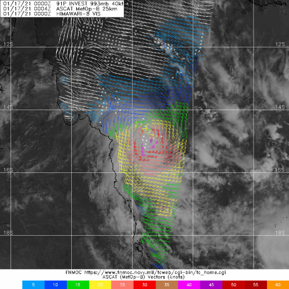
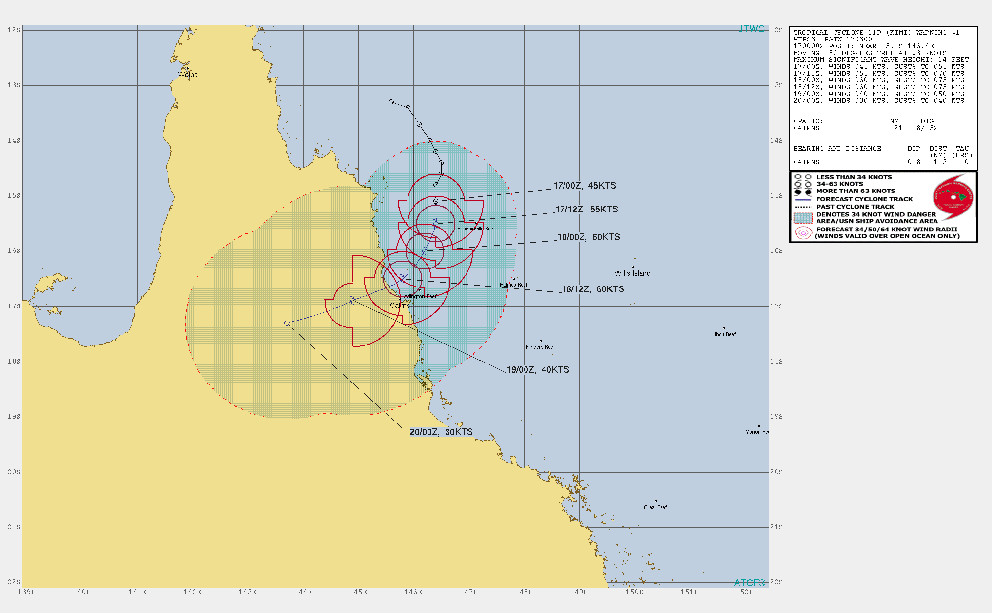
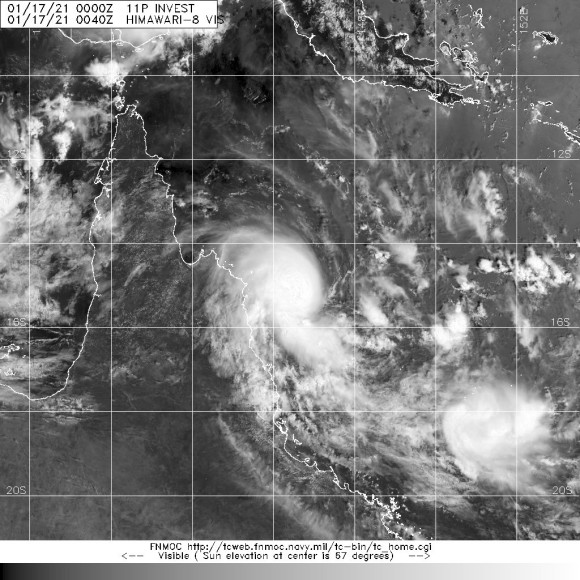
JTWC升格11P,定強45節
11P ELEVEN 210117 0000 15.1S 146.4E SHEM 45 996
efd98c5494eef01f7114f482f7fe9925bd317dcf.jpg 02d4b2b7d0a20cf416ef129861094b36adaf99d4.jpg 68ac828ba61ea8d39ada9b43800a304e241f5857.jpg.gif

本平台僅供學術討論之用,預報應以氣象局為準

威普網站虛擬主機贊助公司

臺灣第一個天氣類型社群平台 即時天氣資訊、精準颱風動態

線上客服
FB傳送訊息
廣告行銷
精準行銷 物超所值
官方粉專
發佈 快速回復 返回頂部 返回列表