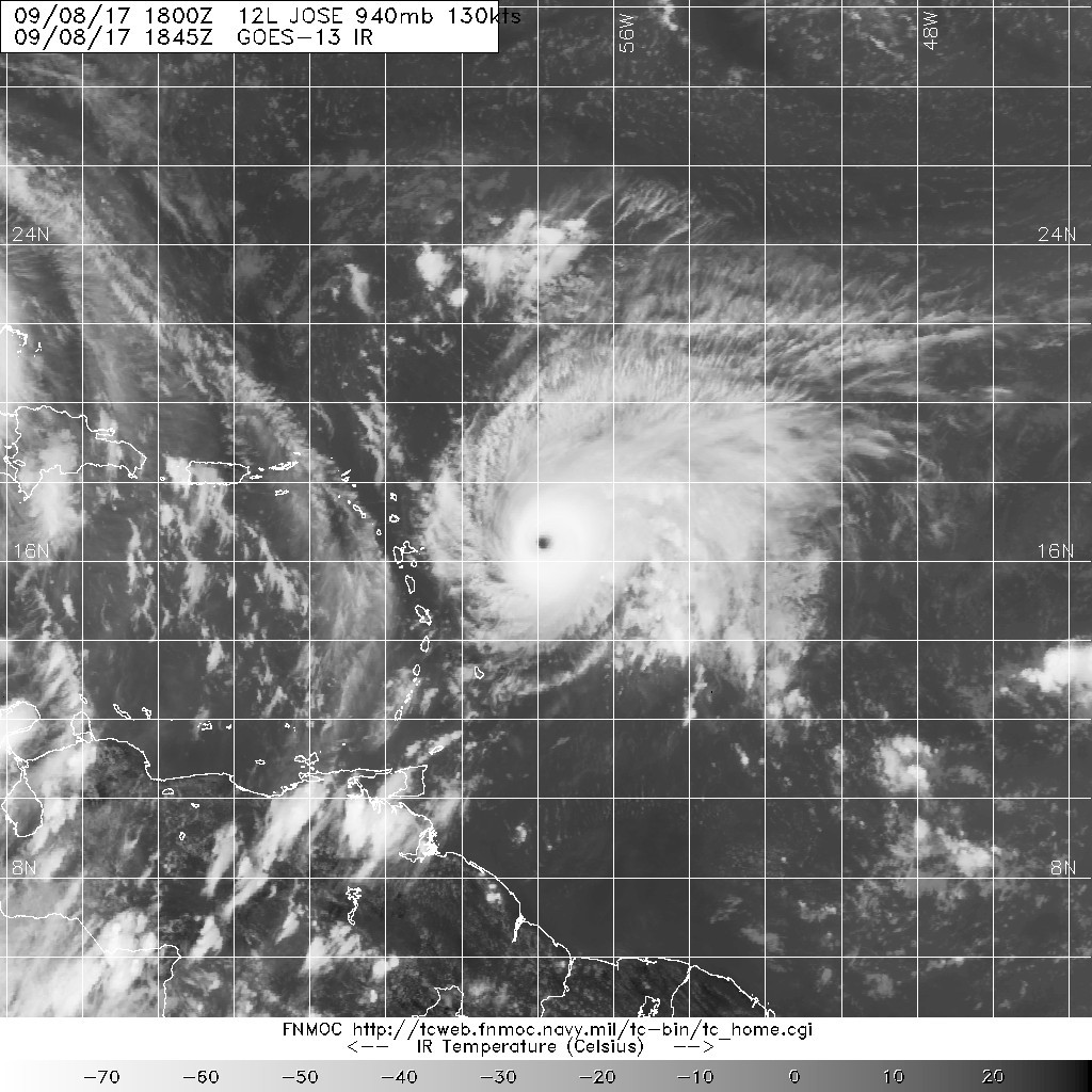
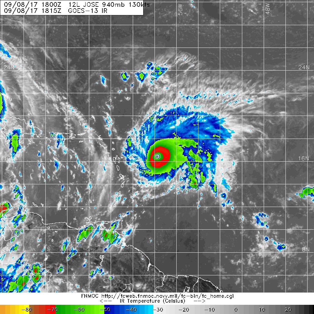
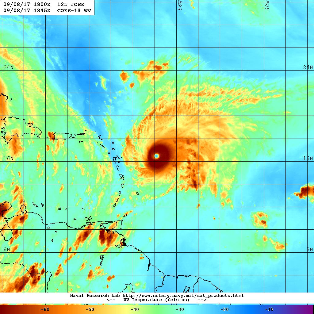
荷西的巔峰 , 有點像梅莎+南卡一顛峰. |
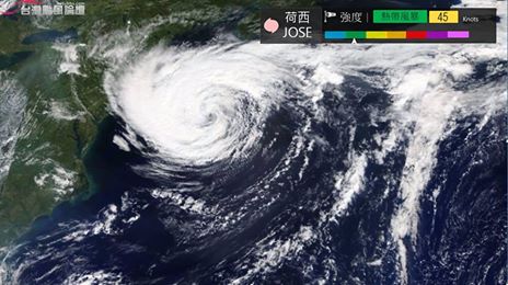
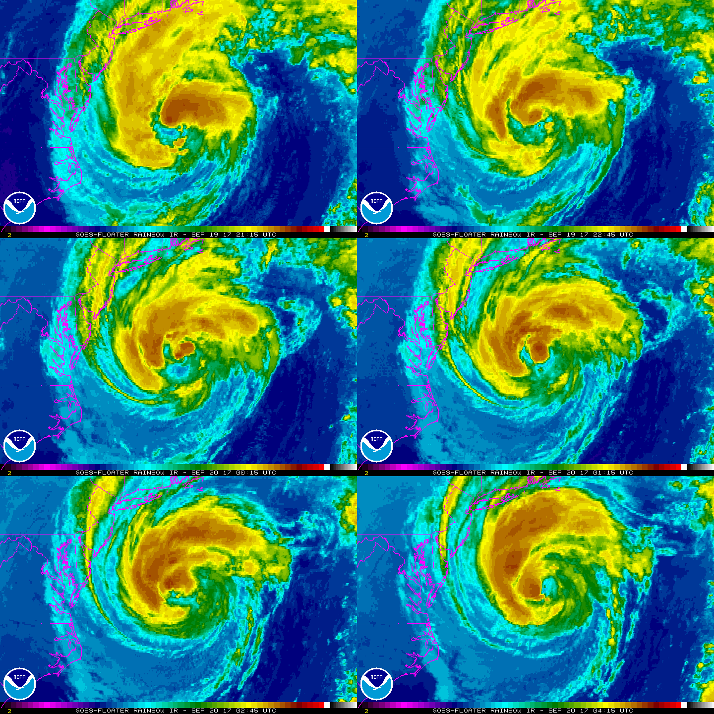
【飄忽不定的老颶風】 美國東方海面的颶風荷西(JOSE),生成至今已經邁入第17日,算是蠻長壽的颶風。 而在過去的2天中,荷西路徑忽左忽右飄忽不定,目前將再次轉往東方前進並逐漸減弱,預估對美國東岸影響程度有限。 圖資來源:NASA |
|
轉化為後熱帶氣旋 持續慢慢飄當中 已經活超過16天了 也是個挺長壽的颶風 000 WTNT42 KNHC 220250 TCDAT2 Post-Tropical Cyclone Jose Discussion Number 67 NWS National Hurricane Center Miami FL AL122017 1100 PM AST Thu Sep 21 2017 The center of Jose has lacked deep convection for at least the past 12 hours. The cyclone now has the structure of an extratropical cyclone, with rain persisting in a shield that is displaced well to the west and northwest of the center. Based on this, Jose has been declared post-tropical. Surface observations from extreme southeast New England during the past 3 hours indicate that tropical storm conditions are persisting along the coast, and the tropical storm warnings in those locations remain in place. The National Hurricane Center will continue to issue advisories on Jose until the threat of tropical storm conditions along the coast has subsided. The initial intensity has been held at 45 kt, based on a recent ASCAT pass that showed several 40-45 kt wind vectors in the NW quadrant. No change has been made to the intensity forecast, and Jose is still expected to gradually spin down over the cold waters of the North Atlantic for the next 3 days. Most of the global models still show the remnant low dissipating within 96 h. Jose remains stuck in weak steering flow and has continued to drift slowly westward. Very little change has been made to the track forecast, and all of the global models show that the cyclone will continue to meander off the New England coast until it eventually dissipates around day 4. The NHC forecast remains close to the various track consensus aids. Based on data from the aforementioned ASCAT pass, the wind radii were extended in the NW and NE quadrants. However this wind appears to be primarily occuring offshore, to the east of Cape Cod. KEY MESSAGES: 1. Tropical-storm-force winds, especially in gusts, are occuring within the tropical storm warning area. These conditions are expected to continue through tonight. 2. Minor coastal flooding is possible along portions of the coast of southern New England during the next few days. Please see products issued by local National Weather Service forecast offices. 3. Swells generated by Jose are affecting Bermuda and much of the U.S. east coast, and will likely cause dangerous surf and rip current conditions for the next couple of days in these areas. FORECAST POSITIONS AND MAX WINDS INIT 22/0300Z 39.5N 68.4W 45 KT 50 MPH...POST-TROPICAL 12H 22/1200Z 39.6N 68.7W 40 KT 45 MPH...POST-TROPICAL 24H 23/0000Z 39.5N 69.0W 40 KT 45 MPH...POST-TROPICAL 36H 23/1200Z 39.3N 68.5W 35 KT 40 MPH...POST-TROPICAL 48H 24/0000Z 39.1N 67.3W 30 KT 35 MPH...POST-TROP/REMNT LOW 72H 25/0000Z 38.8N 66.5W 25 KT 30 MPH...POST-TROP/REMNT LOW 96H 26/0000Z...DISSIPATED $$ Forecaster Zelinsky 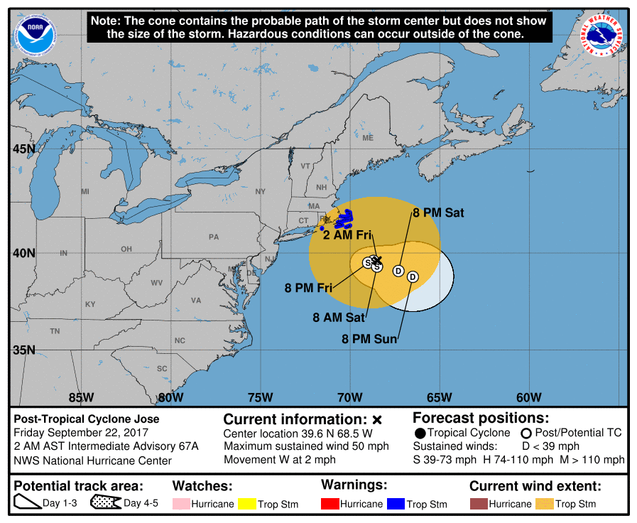
|
命名第15天,根據飛機實測及德法分析已經不再支持颶風強度,只不過後期將會在Maria北上後有互旋的可能,在北緯25度轉一圈還不滿足,打算在北緯40度再來一次XDZCZC MIATCDAT2 ALL 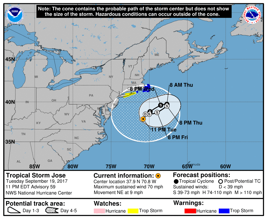
|
補個巔峰報文Hurricane Jose Discussion Number 15 |