簽到天數: 3280 天 [LV.Master]伴壇終老
|
 t02436|2015-8-25 12:03
|
顯示全部樓層
t02436|2015-8-25 12:03
|
顯示全部樓層
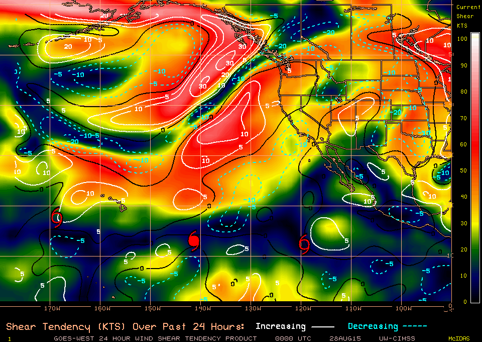
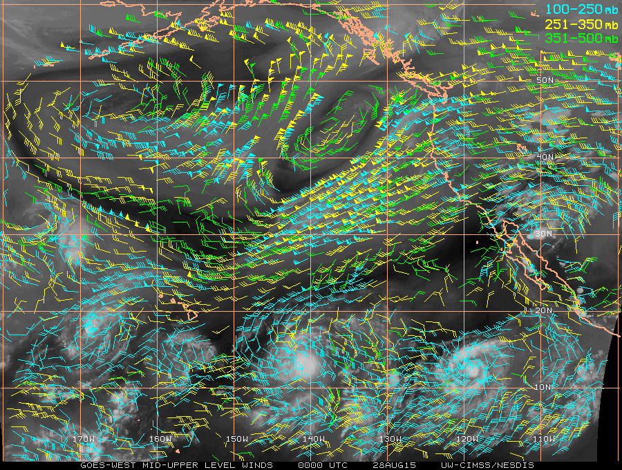
NHC稍早升格12E
巔峰上望60節
預測後期將移向夏威夷群島附近
000
WTPZ42 KNHC 250243
TCDEP2
TROPICAL DEPRESSION TWELVE-E DISCUSSION NUMBER 1
NWS NATIONAL HURRICANE CENTER MIAMI FL EP122015
800 PM PDT MON AUG 24 2015
Conventional satellite imagery shows deep convection associated with
the area of low pressure located well southwest of the southern tip
of Baja California has become better organized and increased in
coverage since yesterday. Additionally, an 1852 UTC ASCAT-B
scatterometer overpass indicated that the surface circulation has
become sufficiently well defined. Accordingly, advisories are being
initiated on the twelfth tropical depression of the 2015 eastern
Pacific hurricane season. Dvorak intensity estimates support an
initial intensity of 30 kt. The cyclone is expected to traverse
warm sea surface temperatures and move within a marginally conducive
thermodynamic environment during the entire forecast period,
resulting in only gradual intensification. Around day 4, the
large-scale guidance and the SHIPS model show increasing
southwesterly shear which should induce a weakening trend and this
is also reflected in the official forecast.
The initial motion is estimated to be at 270/3 kt. A low- to
mid-level ridge extending westward to the north of the cyclone
from northern Mexico should influence a generally westward motion
during the next couple of days. Beyond the 48 hour period, global
and hurricane models indicate a deep-layer trough weakening the
ridge to the northeast of the Hawaiian Islands causing the
depression to turn toward the west-northwest and continuing in this
direction through day 5. The NHC forecast is based on a blend of
the GFEX (GFS/ECMWF) and the TVCX multi-model consensus.
FORECAST POSITIONS AND MAX WINDS
INIT 25/0300Z 13.1N 130.9W 30 KT 35 MPH
12H 25/1200Z 13.0N 131.4W 35 KT 40 MPH
24H 26/0000Z 12.8N 132.4W 40 KT 45 MPH
36H 26/1200Z 12.8N 133.7W 45 KT 50 MPH
48H 27/0000Z 13.2N 135.4W 50 KT 60 MPH
72H 28/0000Z 15.0N 139.4W 60 KT 70 MPH
96H 29/0000Z 16.6N 143.3W 60 KT 70 MPH
120H 30/0000Z 17.8N 146.5W 55 KT 65 MPH
$$
Forecaster Roberts
|
本帖子中包含更多資源
您需要 登錄 才可以下載或查看,沒有賬號?立即加入
x
|