開啟輔助訪問
 找回密碼
 立即加入

12U(18S) 澳洲陸上氣旋 轉化溫氣

查看數: 19472 評論數: 16 收藏 0切换到帖子模式
    組圖打開中,請稍候......
發佈時間: 2021-1-29 07:56

正文摘要:

基本資料   編號    :18 S 擾動編號日期:2021 年 01 月 29 日 07 時 撤編日期  :2021 年 02 月 06 日 20 時 98S.INVEST.15kts-1004mb-16.1S-125.7E

老農民版夜神月 發表於 2021-2-6 16:09
雖然目前仍未撤編
但JTWC判定已於05/06Z轉化為副熱帶氣旋,再於05/12Z轉化為溫帶氣旋
SH, 18, 2021020500,   , BEST,   0, 250S, 1123E,  35,  996, TS,
SH, 18, 2021020506, , BEST, 0, 249S, 1119E, 35, 992, SS,
SH, 18, 2021020512, , BEST, 0, 248S, 1123E, 35, 991, EX,

20210206.0730.himawari-8.vis.18S.EIGHTEEN.35kts.996mb.27.1S.113.3E.100pc.jpg 20210206.0636.gw1.89pct89h89v.18S.EIGHTEEN.35kts.996mb.27.1S.113.3E.70pc.jpg

20210206.0636.gw1.89hbt.18S.EIGHTEEN.35kts.996mb.27.1S.113.3E.70pc.jpg ir_lalo-animated (4).gif
dom 發表於 2021-2-5 11:18
JTWC發佈Final Warning
MSGID/GENADMIN/JOINT TYPHOON WRNCEN PEARL HARBOR HI//
SUBJ/TROPICAL CYCLONE 18S (EIGHTEEN) WARNING NR 019//
RMKS/
1. TROPICAL CYCLONE 18S (EIGHTEEN) WARNING NR 019   
   01 ACTIVE TROPICAL CYCLONE IN SOUTHIO
   MAX SUSTAINED WINDS BASED ON ONE-MINUTE AVERAGE
   WIND RADII VALID OVER OPEN WATER ONLY
    ---
   WARNING POSITION:
   050000Z --- NEAR 25.1S 112.3E
     MOVEMENT PAST SIX HOURS - 245 DEGREES AT 08 KTS
     POSITION ACCURATE TO WITHIN 025 NM
     POSITION BASED ON CENTER LOCATED BY SATELLITE
   PRESENT WIND DISTRIBUTION:
   MAX SUSTAINED WINDS - 035 KT, GUSTS 045 KT
   WIND RADII VALID OVER OPEN WATER ONLY
   BECOMING SUBTROPICAL
   RADIUS OF 034 KT WINDS - 015 NM NORTHEAST QUADRANT
                            010 NM SOUTHEAST QUADRANT
                            055 NM SOUTHWEST QUADRANT
                            045 NM NORTHWEST QUADRANT
   REPEAT POSIT: 25.1S 112.3E
    ---
   FORECASTS:
   12 HRS, VALID AT:
   051200Z --- 25.8S 112.0E
   MAX SUSTAINED WINDS - 035 KT, GUSTS 045 KT
   WIND RADII VALID OVER OPEN WATER ONLY
   SUBTROPICAL
   RADIUS OF 034 KT WINDS - 010 NM NORTHEAST QUADRANT
                            080 NM SOUTHEAST QUADRANT
                            060 NM SOUTHWEST QUADRANT
                            020 NM NORTHWEST QUADRANT
    ---
REMARKS:
050300Z POSITION NEAR 25.3S 112.2E.
05FEB21. TROPICAL CYCLONE (TC) 18S (EIGHTEEN), LOCATED APPROXIMATELY
195 NM SOUTH-SOUTHWEST OF LEARMONTH, AUSTRALIA, HAS TRACKED WEST-
SOUTHWESTWARD AT 08 KNOTS OVER THE PAST SIX HOURS. ANIMATED
MULTISPECTRAL SATELLITE IMAGERY (MSI) DEPICTS AN EXPOSED LOW LEVEL
CIRCULATION CENTER (LLCC) WHICH SUPPORTS THE INITIAL POSITION WITH
GOOD CONFIDENCE. THE LIMITED REMAINING CONVECTION SOUTH OF THE LLCC
CONTINUES TO WARM AS THE SYSTEM TAKES ON SUBTROPICAL FEATURES.
ANALYSIS INDICATES UNFAVORABLE CONDITIONS FOR TROPICAL DEVELOPMENT
WITH HIGH (20-25 KNOTS) WIND SHEAR (VWS), LIMITED SPEED DIVERGENCE
FROM THE WESTERLIES OFFSET TO THE SOUTH, AND MARGINAL SST VALUES (25-
26C). TC 18S WILL CONTINUE SOUTHWARD AS A STR BUILDS EAST OF THE
SYSTEM OVER WESTERN AUSTRALIA. DUE TO THE SOUTHWARD TRACK, THE SYSTEM
WILL MOVE UNDER THE SUBTROPICAL WESTERLIES WITH INCREASING VWS (30-45
KNOTS). TC 18S IS EXPECTED TO FULL TRANSITION INTO A SUBTROPICAL
CYCLONE AS IT TRACKS POLEWARD UNDER OVER COOLING SEAS. NUMERICAL MODEL
TRACK GUIDANCE IS IN GOOD AGREEMENT LENDING HIGH CONFIDENCE TO THE
JTWC FORECAST TRACK, WHICH IS POSITIONED NEAR THE MULTI-MODEL
CONSENSUS. THIS IS THE FINAL WARNING ON THIS SYSTEM BY THE JOINT
TYPHOON WRNCEN PEARL HARBOR HI. THE SYSTEM WILL BE CLOSELY MONITORED
FOR SIGNS OF REGENERATION. MAXIMUM SIGNIFICANT WAVE HEIGHT AT 050000Z
IS 15 FEET.//
NNNN
sh1821.gif
老農民版夜神月 發表於 2021-2-5 03:05
本帖最後由 老農民版夜神月 於 2021-2-5 05:28 編輯

經歷漫漫長陸,行遍大山大河,方才踏入大海
卻也隨即便將快速南移,移向極為惡劣的環境中,轉化,踏向一生的盡頭

sh1821.gif 20210204.1746.gw1.89pct89h89v.18S.EIGHTEEN.35kts.996mb.24.8S.113.1E.97pc.jpg
ir_lalo-animated.gif avn_lalo-animated.gif
老農民版夜神月 發表於 2021-2-4 17:56
本帖最後由 老農民版夜神月 於 2021-2-5 02:26 編輯

JTWC06Z終於給了TS(前一次給出的TS已經在Best中被取消),定強35KT,並預測已達巔峰
SH, 18, 2021020400,   , BEST,   0, 243S, 1143E,  30,  993, TD,   0,    ,    0,    0,    0,    0, 1001,  150,  30,   0,   0,   S,   0,    ,   0,   0,   EIGHTEEN, M,
SH, 18, 2021020406,   , BEST,   0, 244S, 1137E,  35,  996, TS,  34, NEQ,   30,   30,   60,   45, 1001,  150,  25,   0,   0,   S,   0,    ,   0,   0,   EIGHTEEN, M,

sh1821.gif 20210204.0920.himawari-8.vis.18S.EIGHTEEN.35kts.996mb.24.4S.113.7E.100pc.jpg
20210204.0851.f16.91pct91h91v.18S.EIGHTEEN.35kts.996mb.24.4S.113.7E.090pc.jpg rbtop_lalo-animated (1).gif
老農民版夜神月 發表於 2021-2-4 09:45
終於即將出海,目前對流有萎掉的跡象,配合上BoM這幾天的預報
BoM要升格澳式C1並命名看來是不用指望了,就看JTWC會不會如他們所預報的出海後立即升格TS IDW60280 (7).png 20210204.0100.himawari-8.vis.18S.EIGHTEEN.30kts.993mb.24.3S.114.3E.100pc.jpg
AE5616DA650C496CF518221FCE78C450.jpg 18S_gefs_latest (1).png

老農民版夜神月 發表於 2021-2-3 02:54
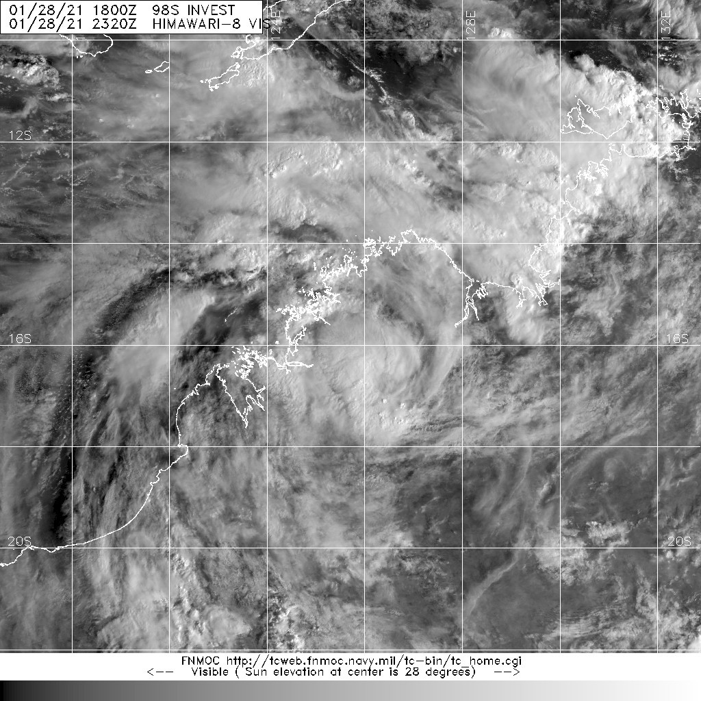
本帖最後由 老農民版夜神月 於 2021-2-3 04:00 編輯

從BoM最新的展望上看來要獲名的機率偏低,僅於周四稍微高點,為Low,其餘周三及周五都是Very Low

但同時JTWC依然上望能於周五(05/12Z)達45KT
Tropical low (12U) as located over the western Pilbara, about 150 kilometres south southeast of Onslow at 2pm WST Tuesday 2 February and has started to move south southwest in the last 6 hours. It is likely to continue moving south southwest over night before taking a more westward track on Wednesday, remaining over land where it is unlikely to be a tropical cyclone. While it still may move offshore on Thursday or Friday, it is likely to be as a tropical low as it has been over land for longer and moves into a more unfavourable environment.

Although 12U is not likely to be a tropical cyclone, heavy rainfall would still be expected, and gusty winds possible about coastal parts as it tracks west across the west Pilbara.

From late in the week the system is forecast to begin tracking to the south offshore from the west coast, from which time there is an increasing level of uncertainty around the impacts it may cause to western parts of the State.

Likelihood of this system being a tropical cyclone in the Western Region on:
Wednesday:
Very Low
Thursday:
Low
Friday:
Very Low

IDW60280.png sh1821.gif
18S_gefs_latest.png
20210202.1820.himawari-8.ir.18S.EIGHTEEN.30kts.998mb.24.2S.114.5E.100pc.jpg 20210202.1758.gw1.89pct89h89v.18S.EIGHTEEN.30kts.998mb.24.2S.114.5E.71pc.jpg
老農民版夜神月 發表於 2021-2-2 16:07
由於最新報預測中72H內將不會成旋,BoM對12U(18S)中止發報
IDW27600
TROPICAL CYCLONE TECHNICAL BULLETIN: AUSTRALIA - WESTERN REGION
Issued by AUSTRALIAN BUREAU OF METEOROLOGY TROPICAL CYCLONE WARNING CENTRE
at: 0706 UTC 02/02/2021
Name: Tropical Low  
Identifier: 12U
Data At: 0600 UTC
Latitude: 22.8S
Longitude: 115.8E
Location Accuracy: within 15 nm [30 km]
Movement Towards: south southwest [199 deg]
Speed of Movement: 8 knots [15 km/h]
Maximum 10-Minute Wind: 25 knots [45 km/h]
Maximum 3-Second Wind Gust: 45 knots [85 km/h]
Central Pressure: 992 hPa
Radius of 34-knot winds NE quadrant:   
Radius of 34-knot winds SE quadrant:   
Radius of 34-knot winds SW quadrant:   
Radius of 34-knot winds NW quadrant:   
Radius of 48-knot winds NE quadrant:   
Radius of 48-knot winds SE quadrant:   
Radius of 48-knot winds SW quadrant:   
Radius of 48-knot winds NW quadrant:   
Radius of 64-knot winds:
Radius of Maximum Winds:   
Dvorak Intensity Code: N/A overland
Pressure of outermost isobar: 998 hPa
Radius of outermost closed isobar: 120 nm [220 km]
FORECAST DATA
Date/Time    : Location    : Loc. Accuracy: Max Wind   : Central Pressure
[UTC]        : degrees     :      nm  [km]: knots[km/h]: hPa
+06:  02/1200: 23.4S 115.4E:     030 [060]:  025  [045]:  992
+12:  02/1800: 23.8S 115.0E:     045 [080]:  025  [045]:  992
+18:  03/0000: 24.0S 114.7E:     050 [095]:  025  [045]:  992
+24:  03/0600: 24.1S 114.5E:     060 [110]:  025  [045]:  992
+36:  03/1800: 24.1S 114.0E:     070 [130]:  025  [045]:  992
+48:  04/0600: 24.1S 113.6E:     090 [165]:  025  [045]:  992
+60:  04/1800: 24.0S 113.2E:     105 [190]:  030  [055]:  992
+72:  05/0600: 24.1S 112.6E:     115 [215]:  030  [055]:  992
+96:  06/0600: 26.8S 112.5E:     150 [280]:  035  [065]:  992
+120: 07/0600: 30.8S 113.8E:     180 [330]:  035  [065]:  992
REMARKS:
Tropical low 12U remains easily identifiable over land by vis imagery and by
radar [Dampier and Exmouth]. Deep convection remains vigorous near the centre
and the system is still being fuelled by moist inflow from off the Pilbara coast
in a low shear environment.

However, the system is now tracking to the south southwest which makes it more
likely to remain inland for longer. As the steering ridge weakens to the south
as a result of a mid-latitude trough, the system will slow down overnight and
during Wednesday and Thursday delaying the movement offshore until Thursday and
slightly further south where SSTs are a little cooler [<27C].

As a result, it is now not likely to develop into a tropical cyclone although a
strong low level ridge to the southwest will assist in enhancing SE flow to the
southwest of the system from Friday. By this time it will commence a southerly
track down the west coast.  

Heavy rainfall is likely on the southern side of the system as it moves south so
how much rain over land is heavily dependent upon the track.


Copyright Commonwealth of Australia
==
There will be no further bulletins for this system
IDW60280 (6).png 18S_gefs_latest.png

本平台僅供學術討論之用,預報應以氣象局為準

威普網站虛擬主機贊助公司

臺灣第一個天氣類型社群平台 即時天氣資訊、精準颱風動態

線上客服
FB傳送訊息
廣告行銷
精準行銷 物超所值
官方粉專
發佈 快速回復 返回頂部 返回列表